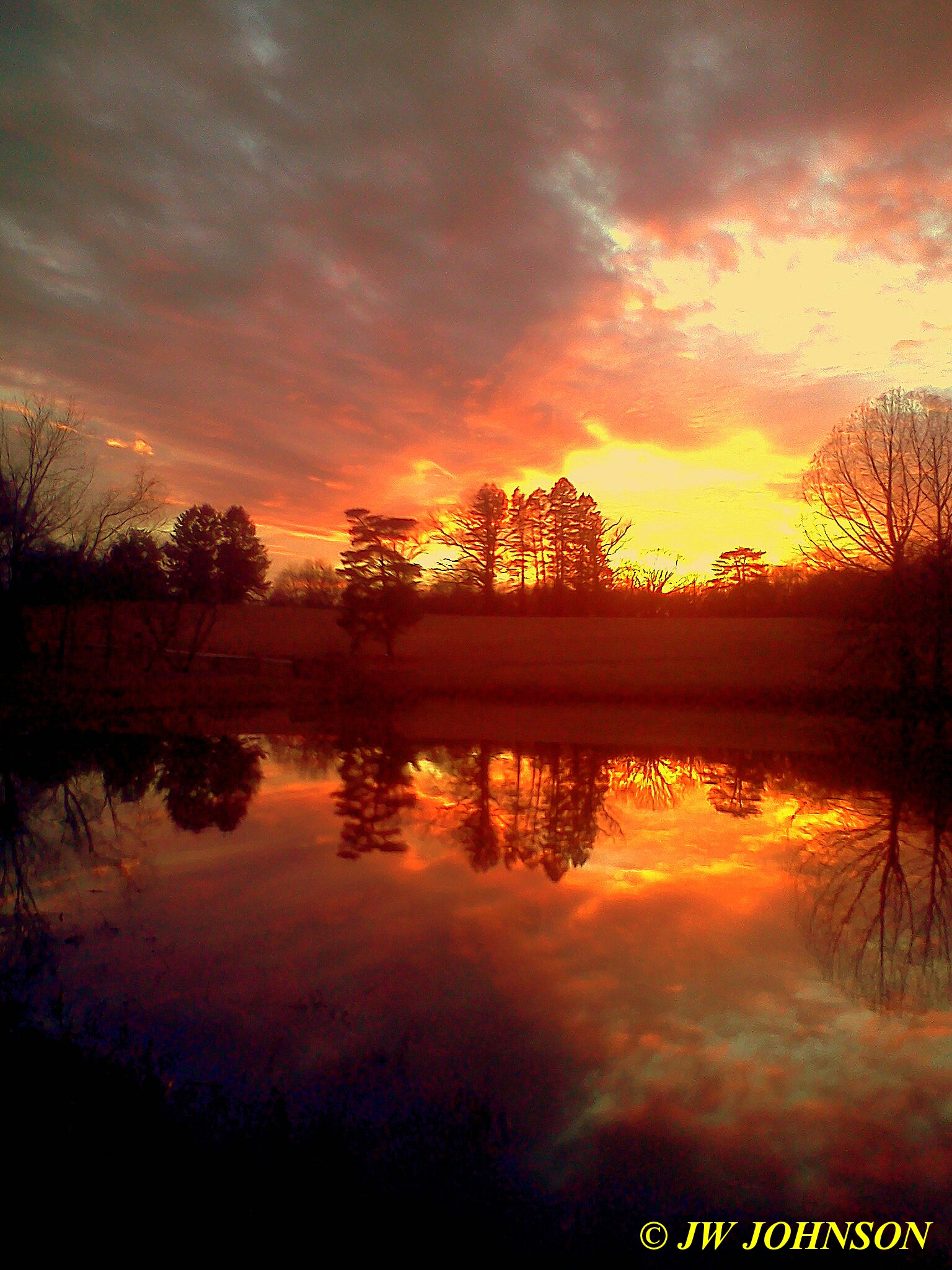
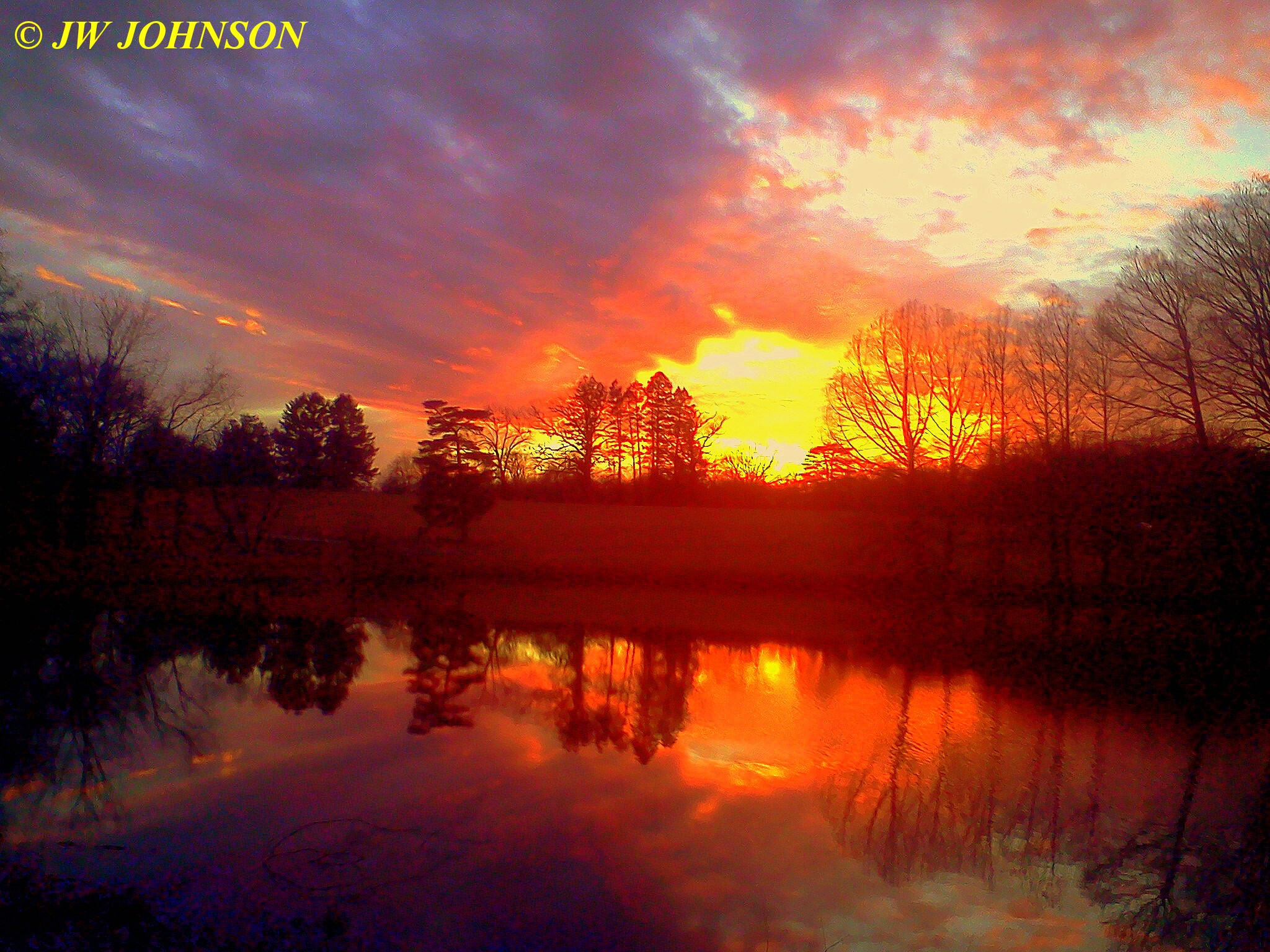
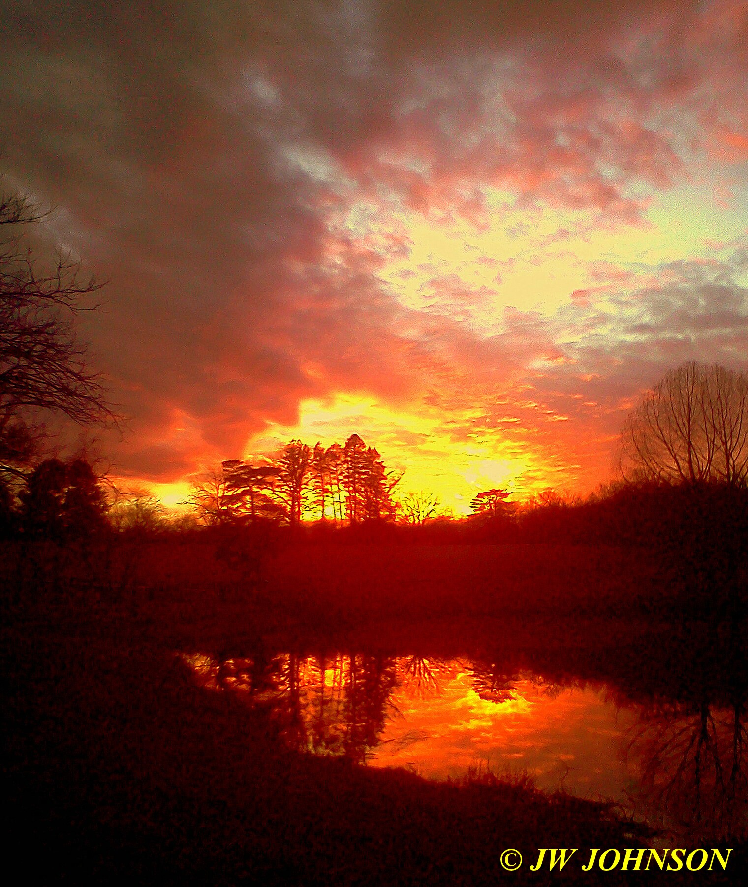
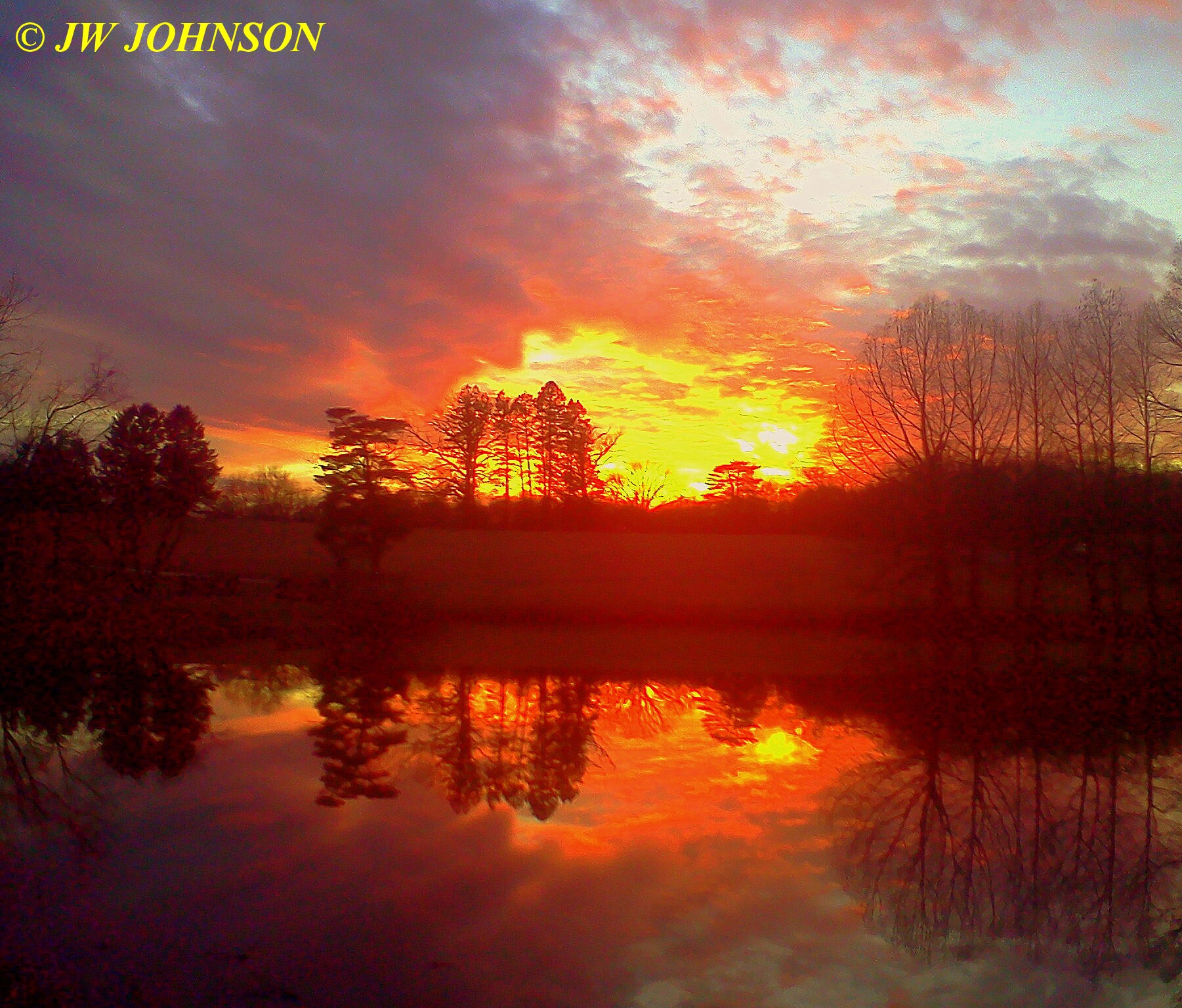
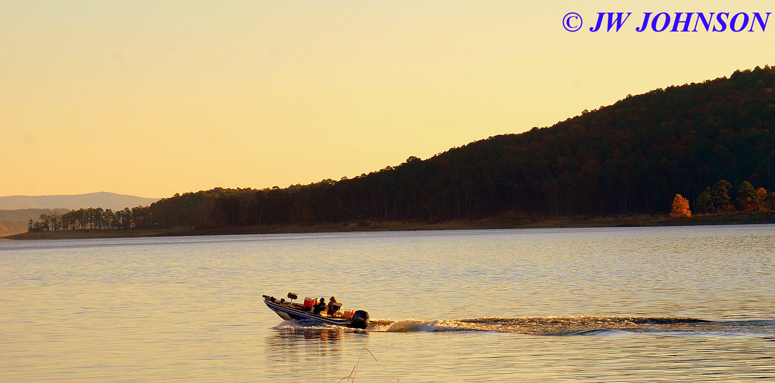
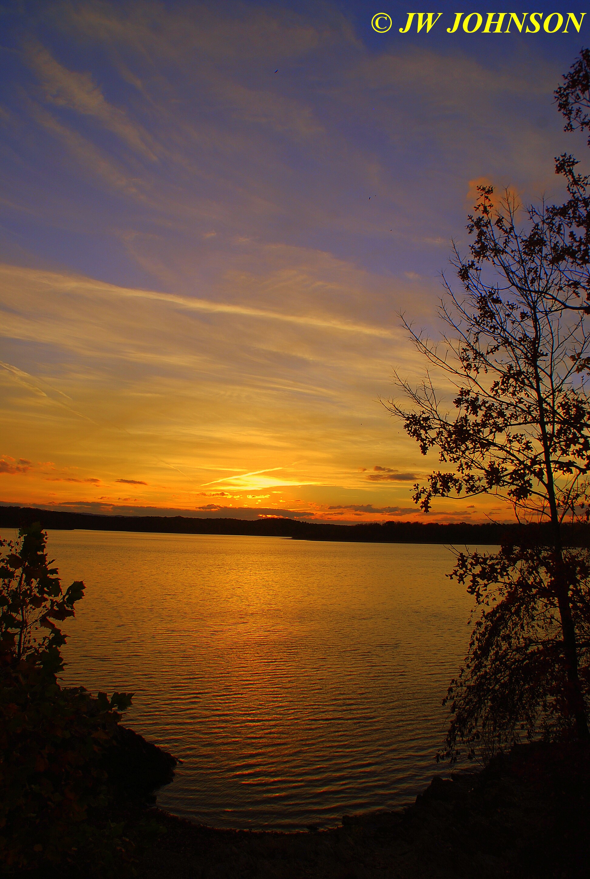
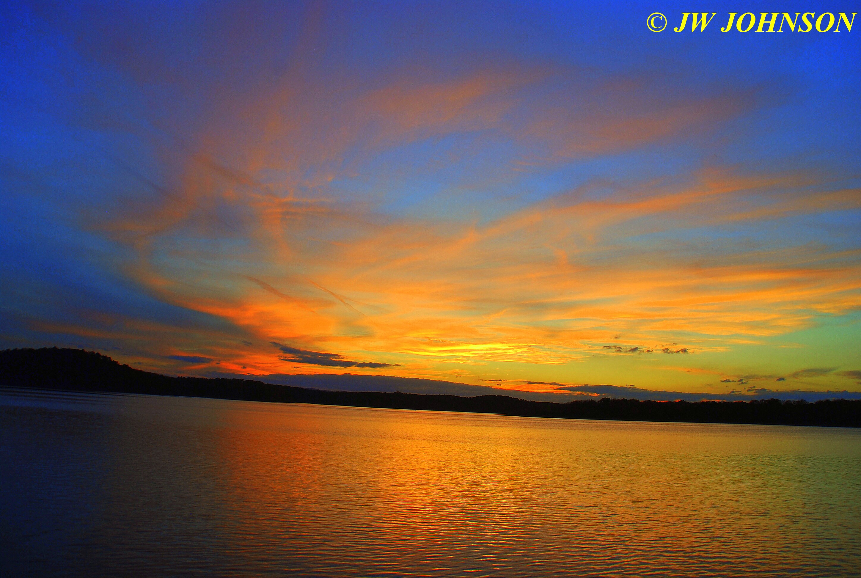
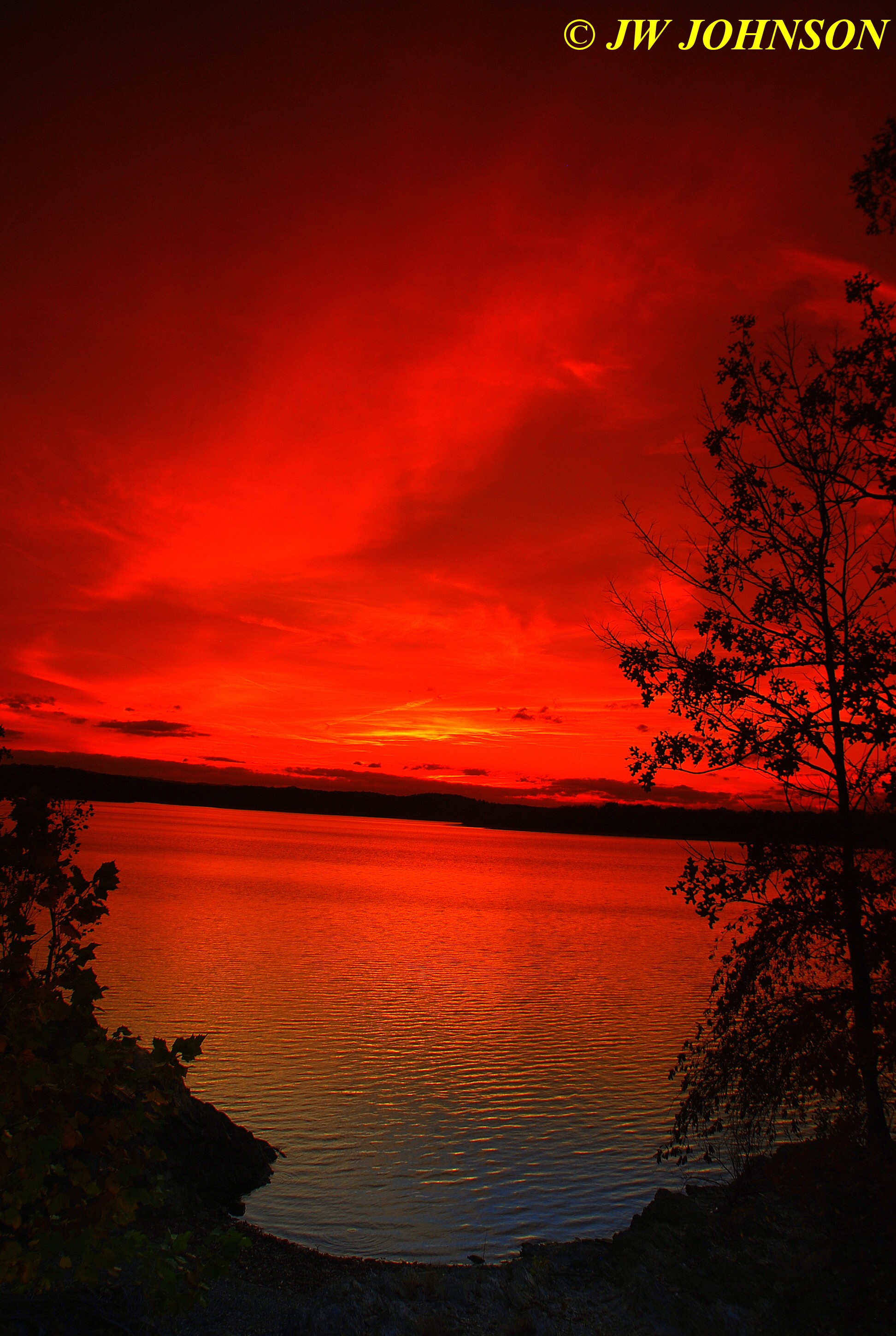
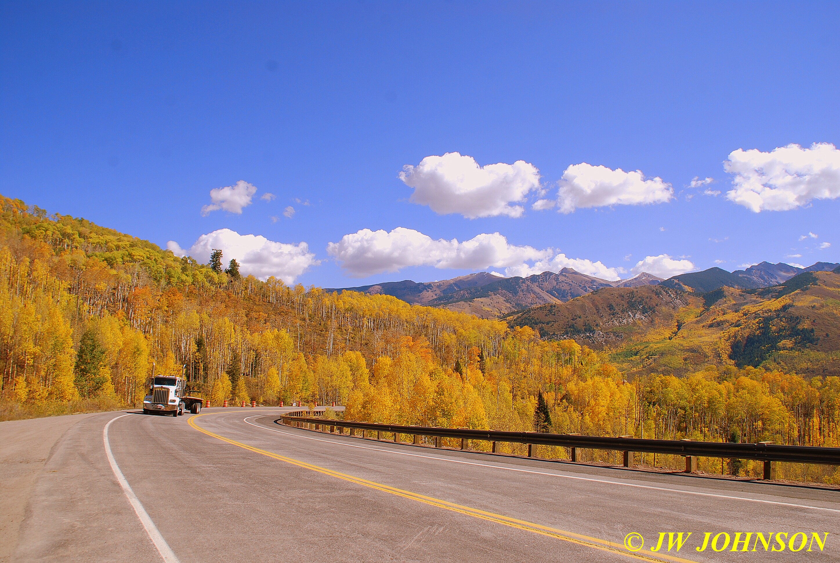
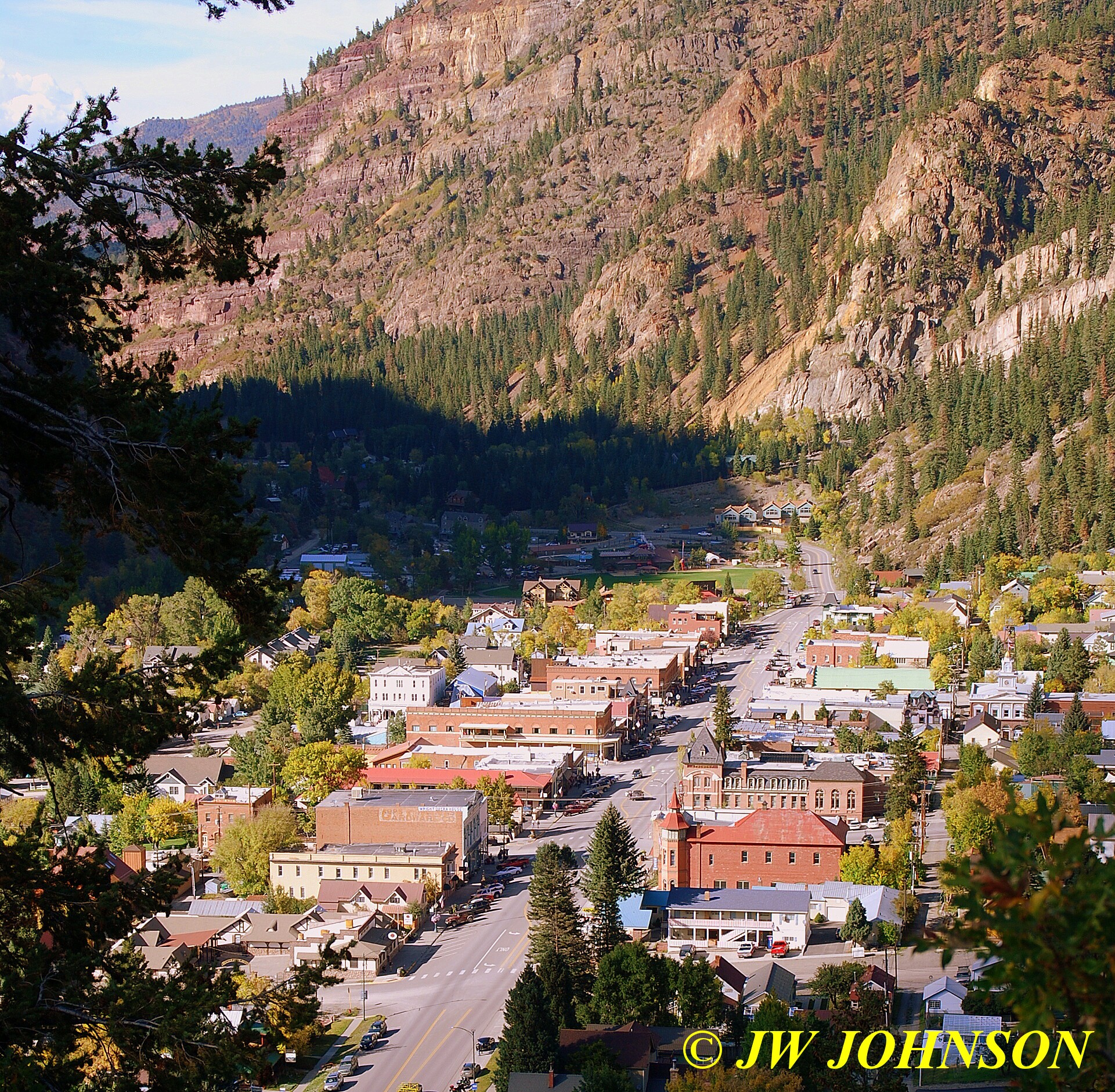
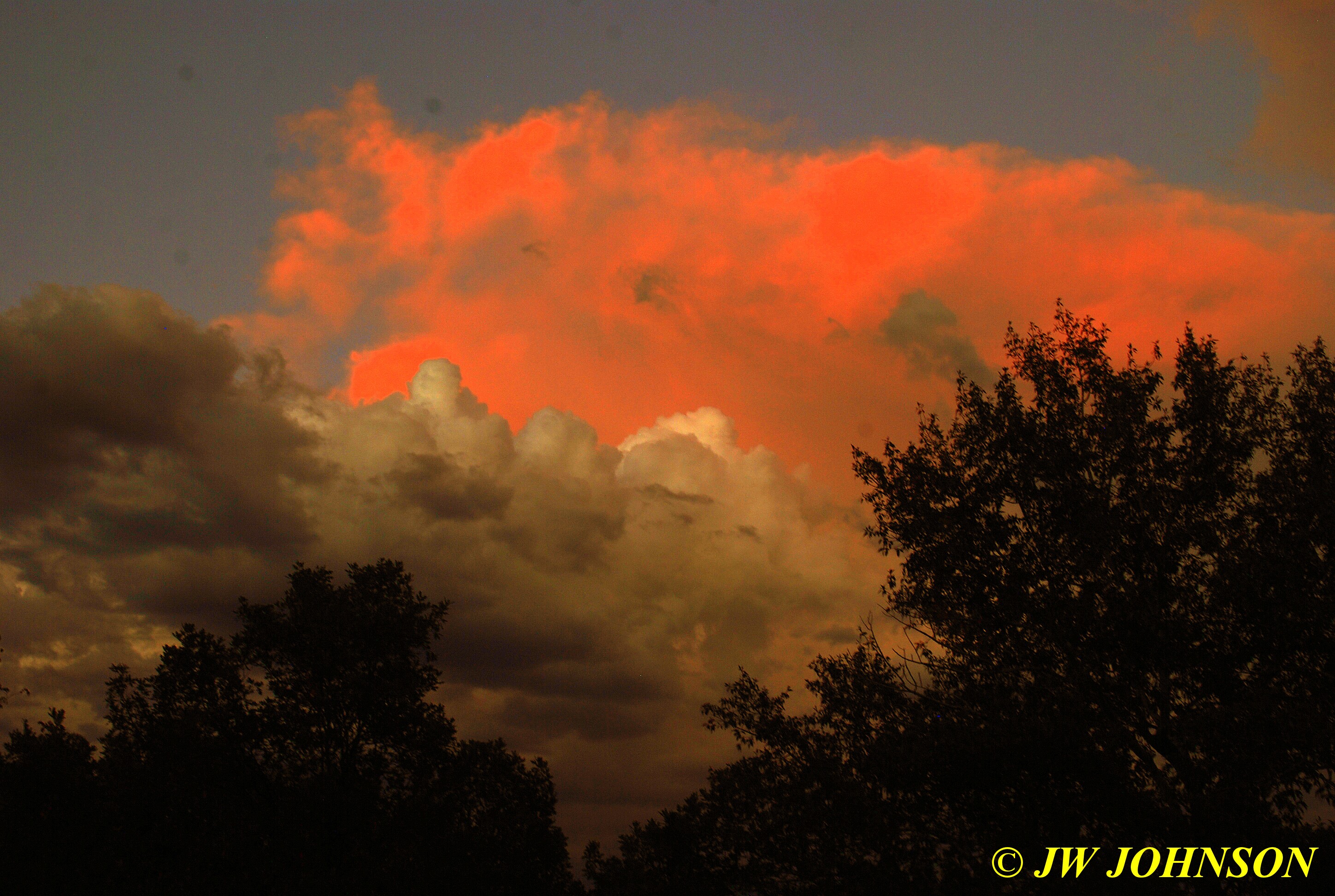
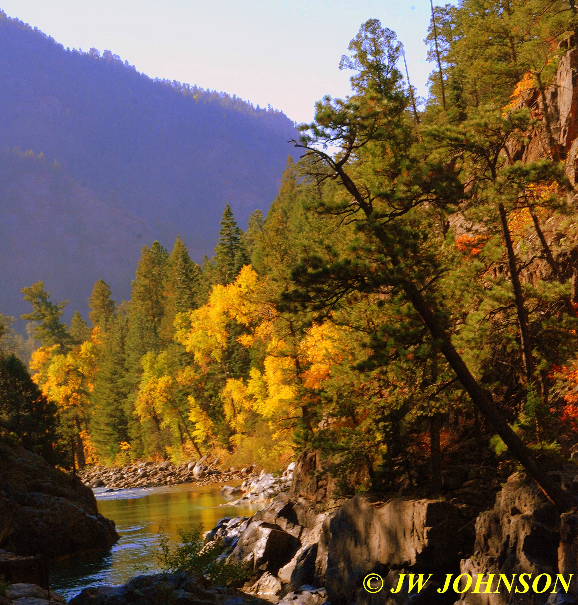
I was able to capture some pretty late fall sunsets in the past few weeks….here in Downtown Steelville early December…


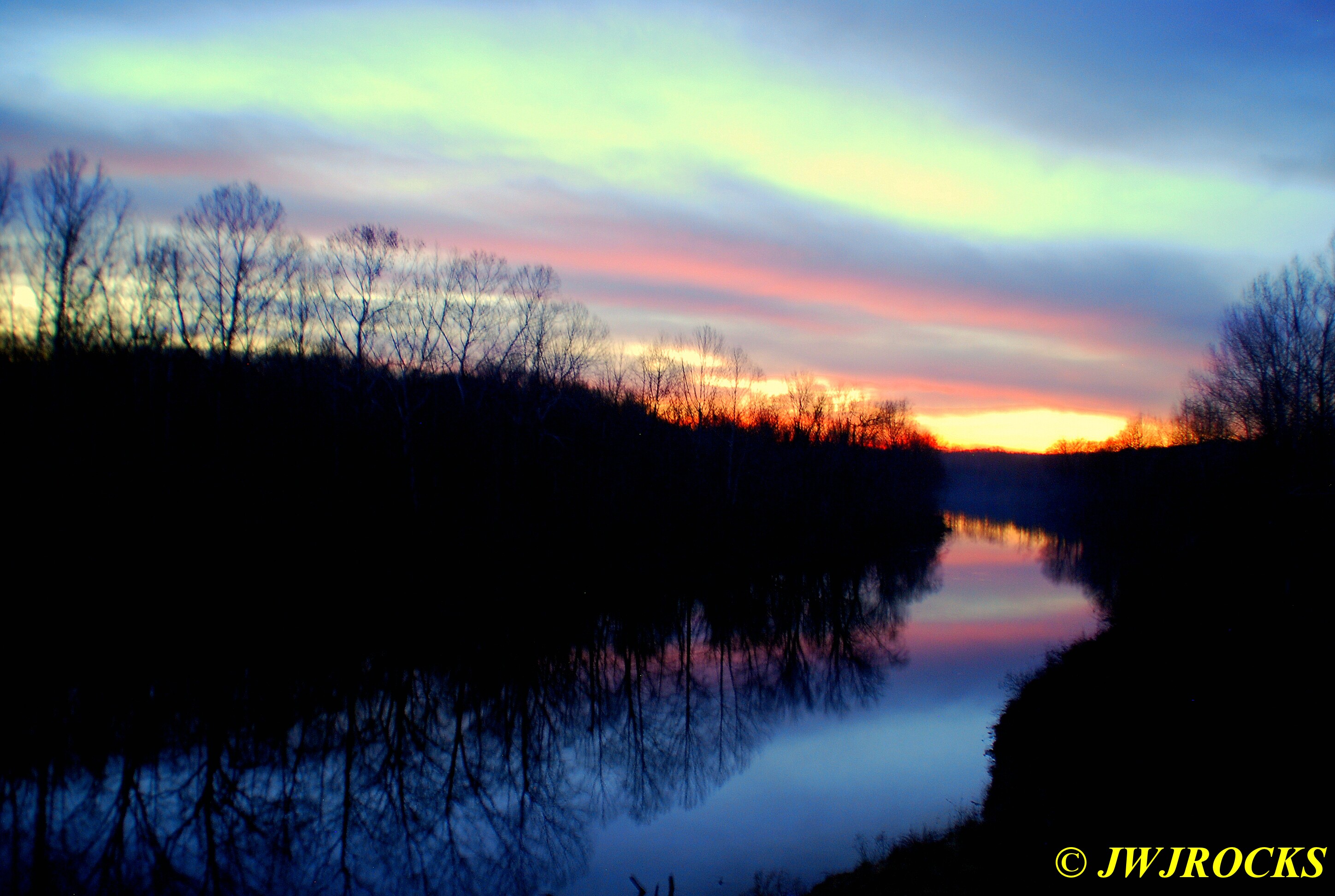
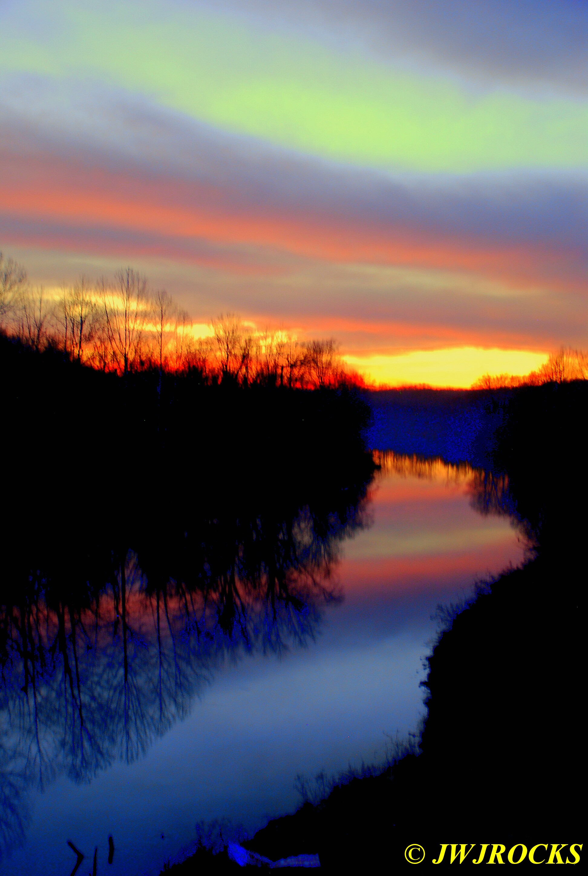
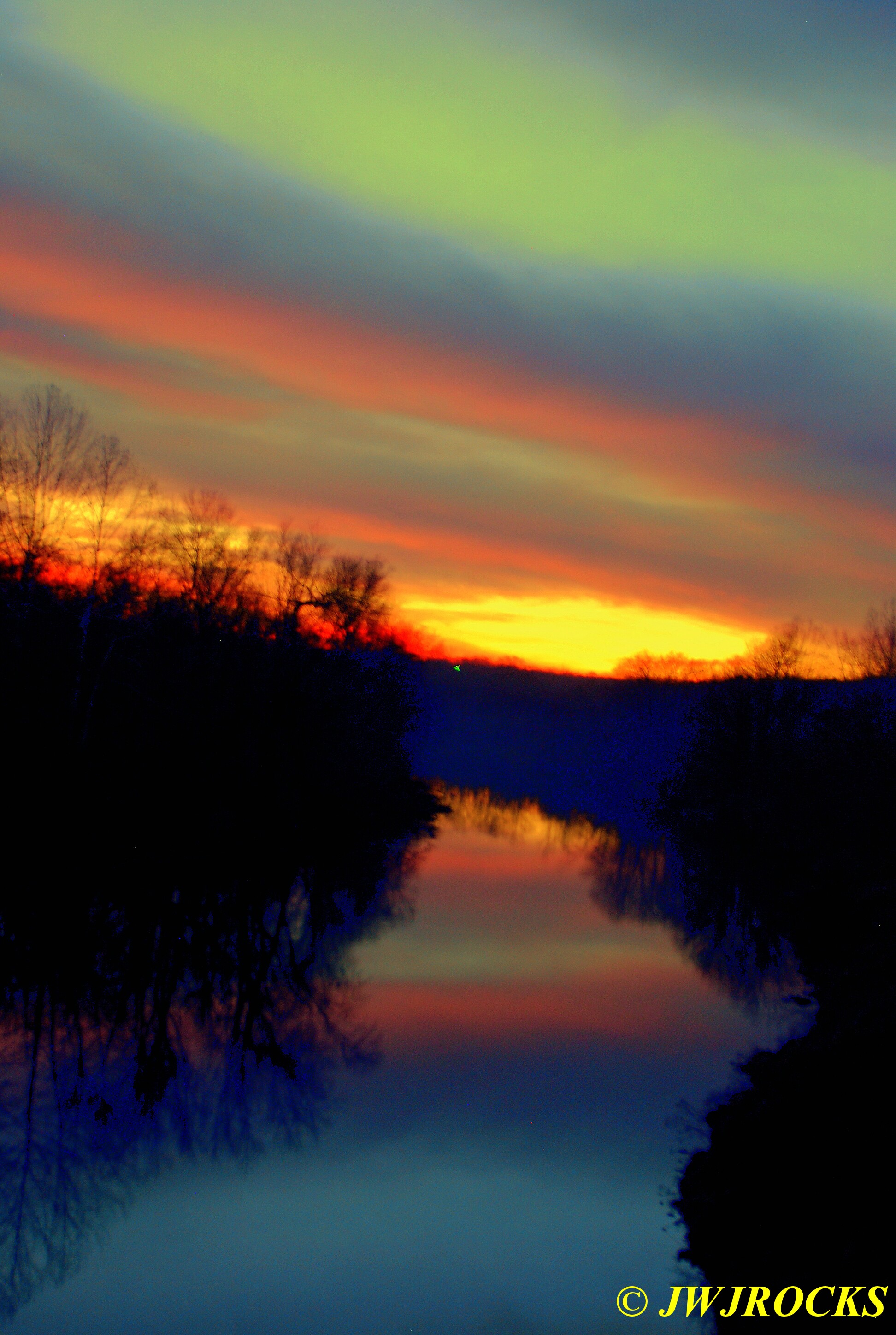
…and the Meramac River just north of Steelville….

…and downtown Cuba with the water tower too….

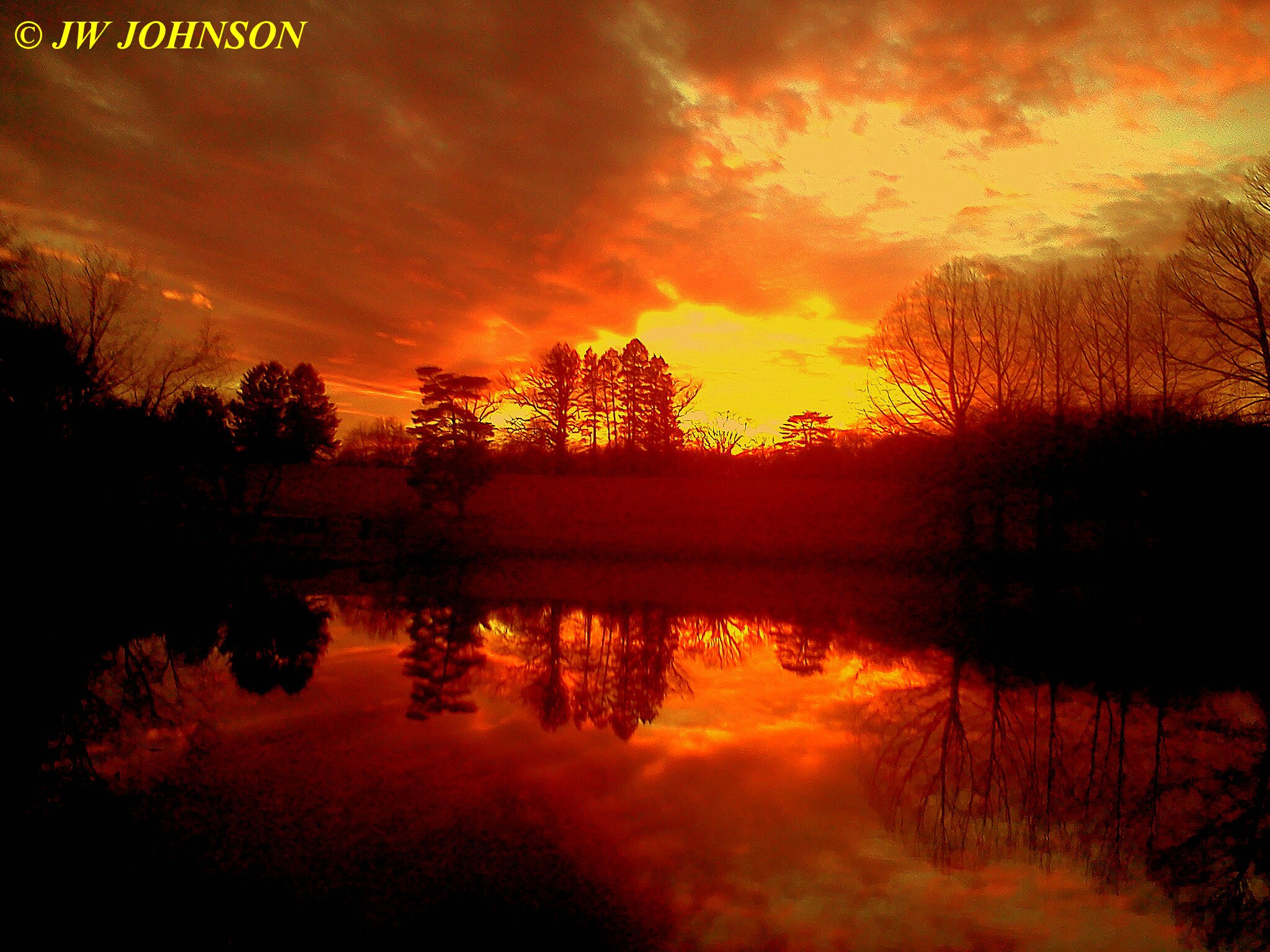
I was able to capture some pretty late fall sunsets in the past few weeks….here in Downtown Steelville early December…
…and the Meramac River just north of Steelville….
…and downtown Cuba with the water tower too….
Back in August, Ray Roth, one of my rockhunting friends from New Orleans, contacted me and asked me when I was going down to Arkansas for some quartz crystals. I told him I would be heading down there the second week of November and would have at least a couple of days free to dig quartz crystals. I usually have some photo work down there as well, but wanted to set two days aside for crystal collecting and set my vacation time up this year for just that. Ray said he would meet me down there and we stayed in touch through September and October by email.
He contacted me a couple of weeks ago, end of October and asked me about lodging options in the Mount Ida area, he was thinking about staying at the Crystal Inn once again, having stayed there before. I told him I would be staying at Mountain Harbor Resort, on Lake Ouachita, which was about five miles east of Crystal Inn and right on the lake. I mainly stay there because its one of the most dog friendly places to stay at, very scenic and pretty, and one of the few places I have found that has very friendly staff that are responsive to your needs. I have stayed at this place in the spring and fall both, one of the nicest places to stay at. Ray asked for their website and I emailed it to him…he checked into it and decided to stay there as well, told me they gave him a great rate on a room that he couldnt pass up. Their fall rates are much better because its their off season…and he was going to stay with them for about a week so they gave him a good deal. Their guestrooms are very nice…one or two king size beds and a sofa sleeper, fridge and freezer, coffee maker, patio with chairs and lake view, nice big backyard, and very pretty walk in shower with ceramic tile walls and glass doors. http://www.mountainharborresort.com is their website if anyone would want to check them out, very dog friendly place.
I usually stay in a log cabin when there, and made reservations for one back in August when I talked to Ray….thinking a few friends would visit with me while there and I would need the extra room…then found out the first two nights I wouldnt need the extra room. I mentioned that to the gals at the Lodge and they made me such a sweet deal, I just stayed in the cabin the whole time there. We were so busy during the day anyway, I didnt even notice no one else was there with me besides Missy, my border collie.
Ray arrived there on Tuesday, November 6th, the day before I did and the gals at the Lodge made him feel right at home. I took off Tuesday from my work, to get my packing finished for my trip the next morning, and to pack some goodies for Ray from Missouri and Kentucky both. I took him some fresh found druse and some purple fluorite from Marion, Kentucky, as well. Missy and I rose early the next morning, and after picking up my Mom, we headed west toward Joplin, where we would pick up Hwy 71 and head south to Fort Smith, Arkansas, our first stop. We made good time driving down there, nice sunny day and as we crossed the Boston Mountains on Hwy 71, we noticed quite a bit of color remaining in the trees in the mountain valleys…usually a good sign it will be colorful further south.
We soon arrived in Fort Smith, where I stopped off at my Uncle Harley and Aunt Dorcas` house, to drop my mom off…this is one of her younger brothers and he had already left for the family farm at Waldron to go deer hunting with more of our family members…Mom stays in Fort Smith and goes shopping with the gals til Sunday when we all meet at the farm for a reunion and dinner before heading home. I stayed and had a small lunch with Aunt Dorcas and Mom, and then filled the gas tank and headed south on 71 once again, passing through Waldron myself on the way to Lake Ouachita. Waldron is where my Mom and Dad were both born and raised, and where we used to go for Christmas when I was young and growing up…to visit my grandparents on their dairy farm…. I really cherish those memories…helping milk cows, feeding the calves….playing in the hayloft of Grandpa`s old barn…and I really miss my grandparents…my Grandpa lived to 90 yoa…milked cows til he was 65 yoa. Grandpa wasnt one to sit around and do nothing in retirement though…so he went to work for the US Forest Service there as a carpenter, helping them build fishing docks and pavilions and picnic tables, and also helped them fight forest fires in that area…..and then retired himself 25 years later, and died soon after from a rare blood cancer, caused by moldy hay of all things. I remember his supervisor at his funeral service, came up to me and told me that my Grandpa was something else when it came to hard work…she was amazed at his strength and work habit one day when she left him with the truck and radio on a forest fire, and she took a crew of younger men up the mountainside to rake a fireline…she said about halfway up that mountain, they all came to a staggering halt…out of breath and about to drop…trying to recover and gather some strength to continue up that steep hill..when all of a sudden here came your Grandfather raking a line right on past them and up that hill moving at a steady pace and he wasnt breathing hard nor had he broken a sweat !! Needless to say, I dont think she ever doubted him again after that.
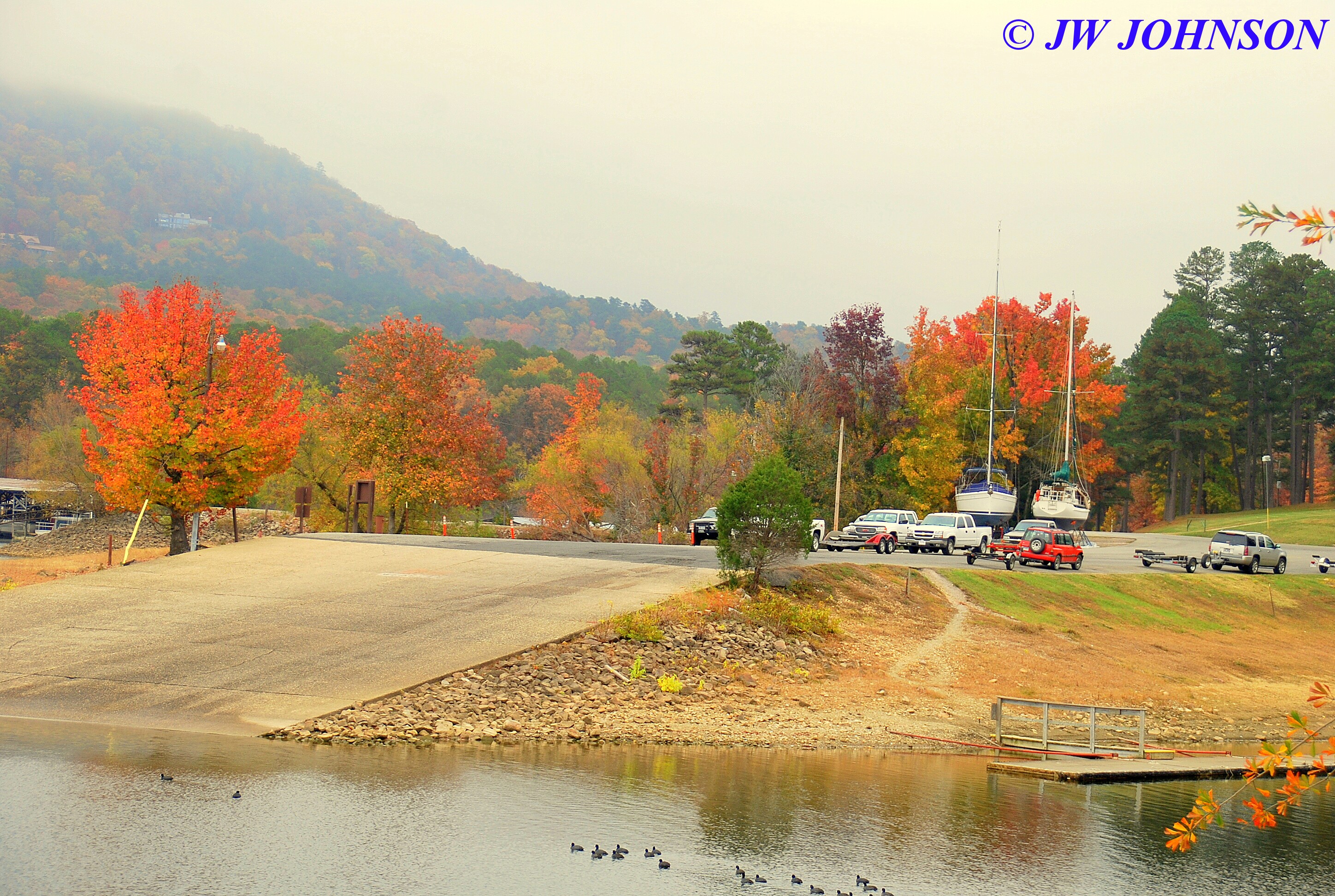
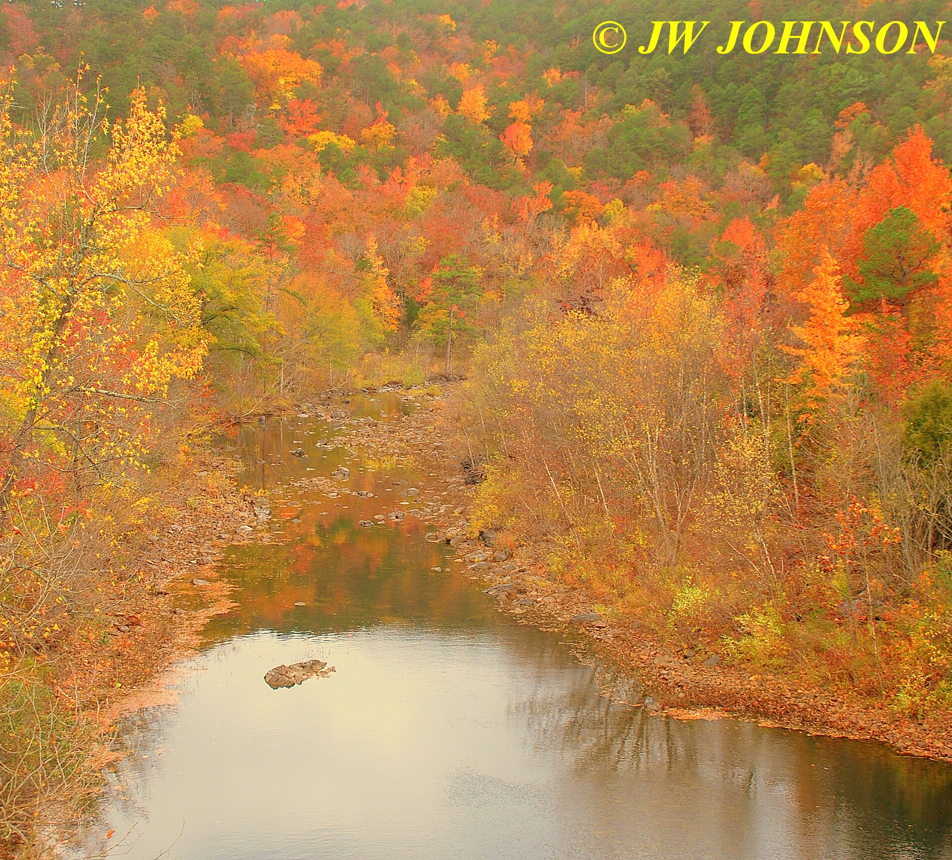
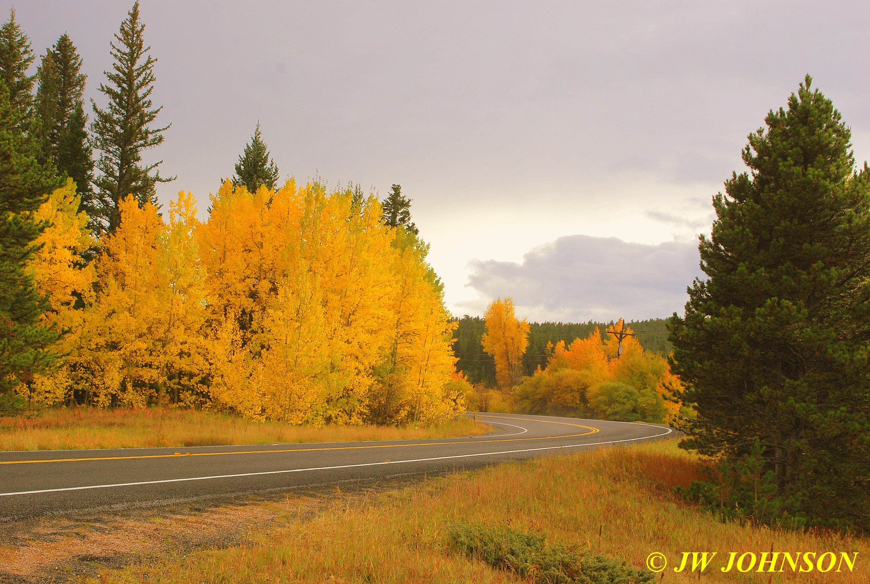
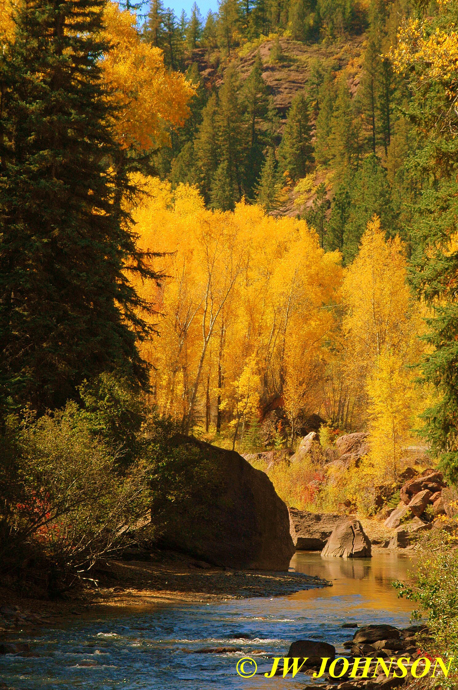
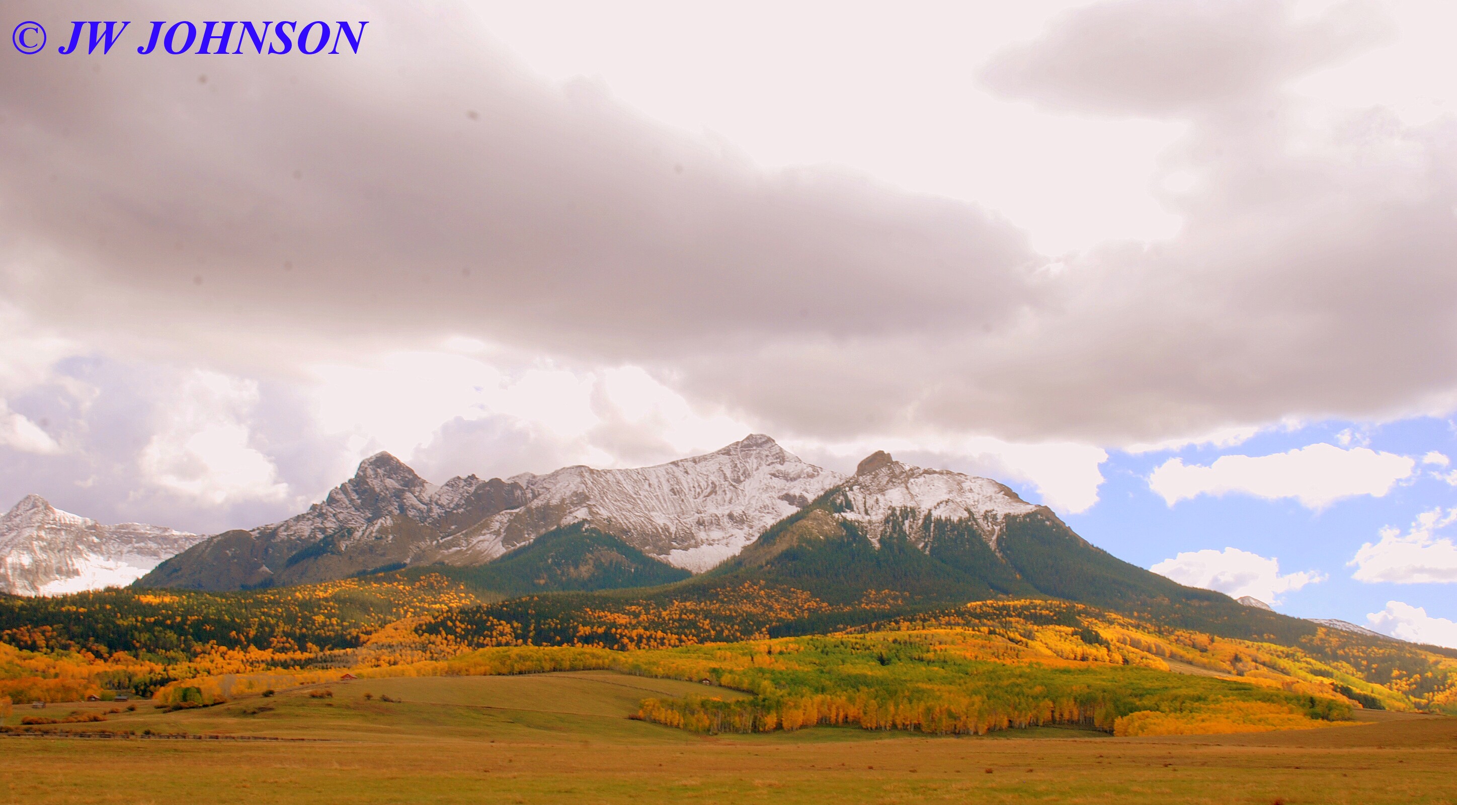
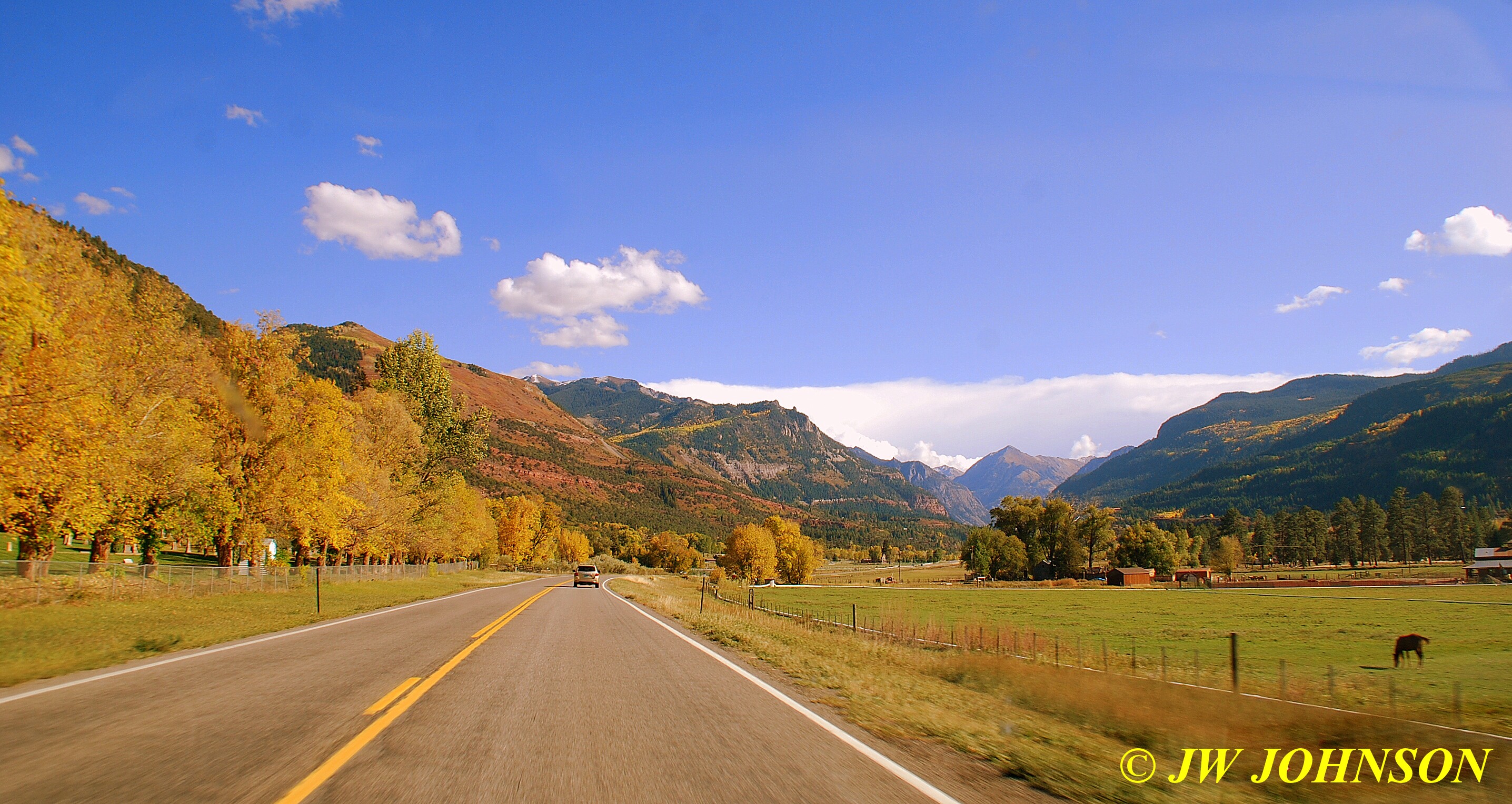
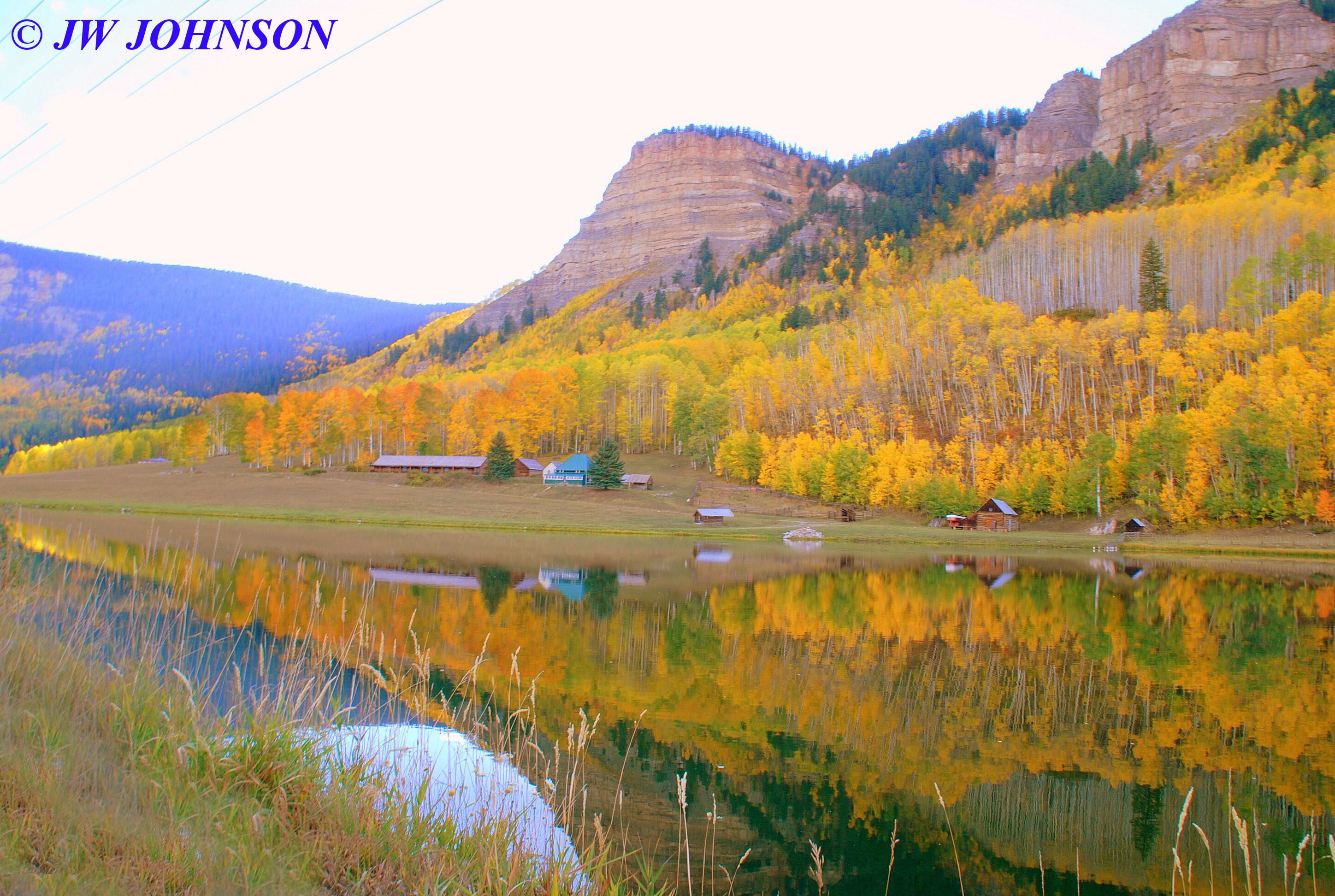
I drove on toward Mount Ida from Waldron, stopping off briefly near Y City to photograph the fall color on the Fourche La Fave River….

This is one of my favorite stops because the color along the river is simply beautiful…on both sides of the highway bridge…

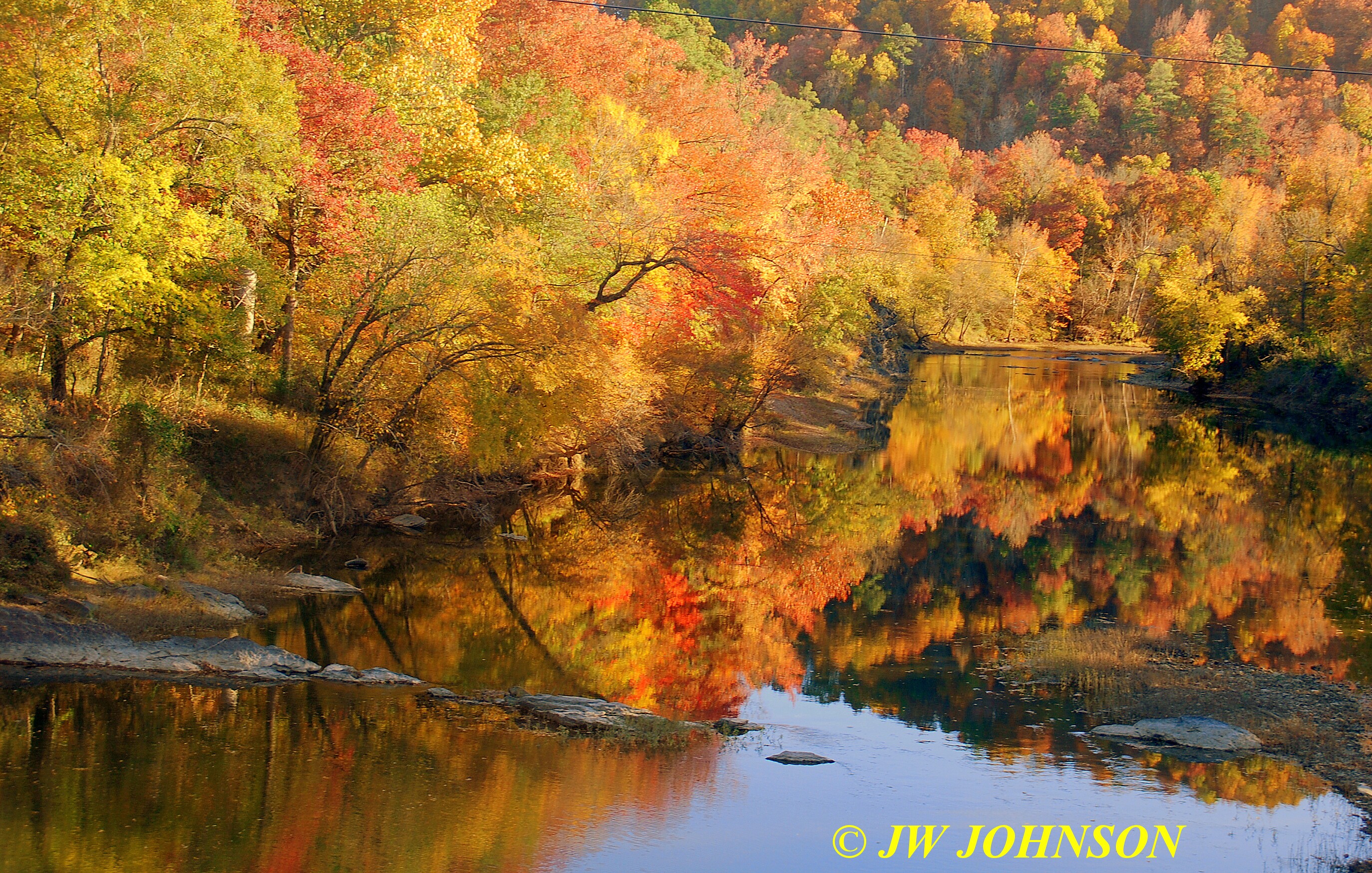
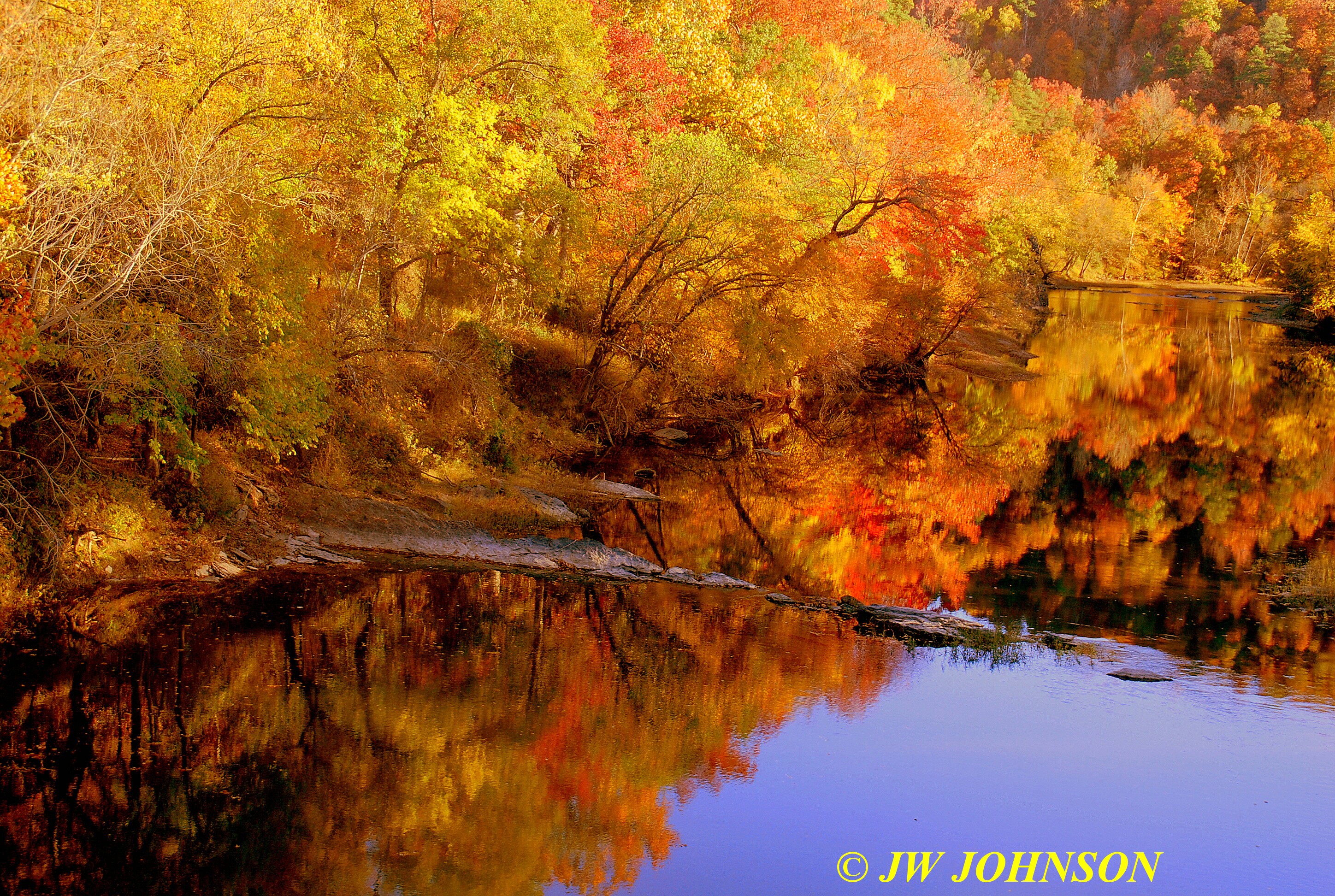
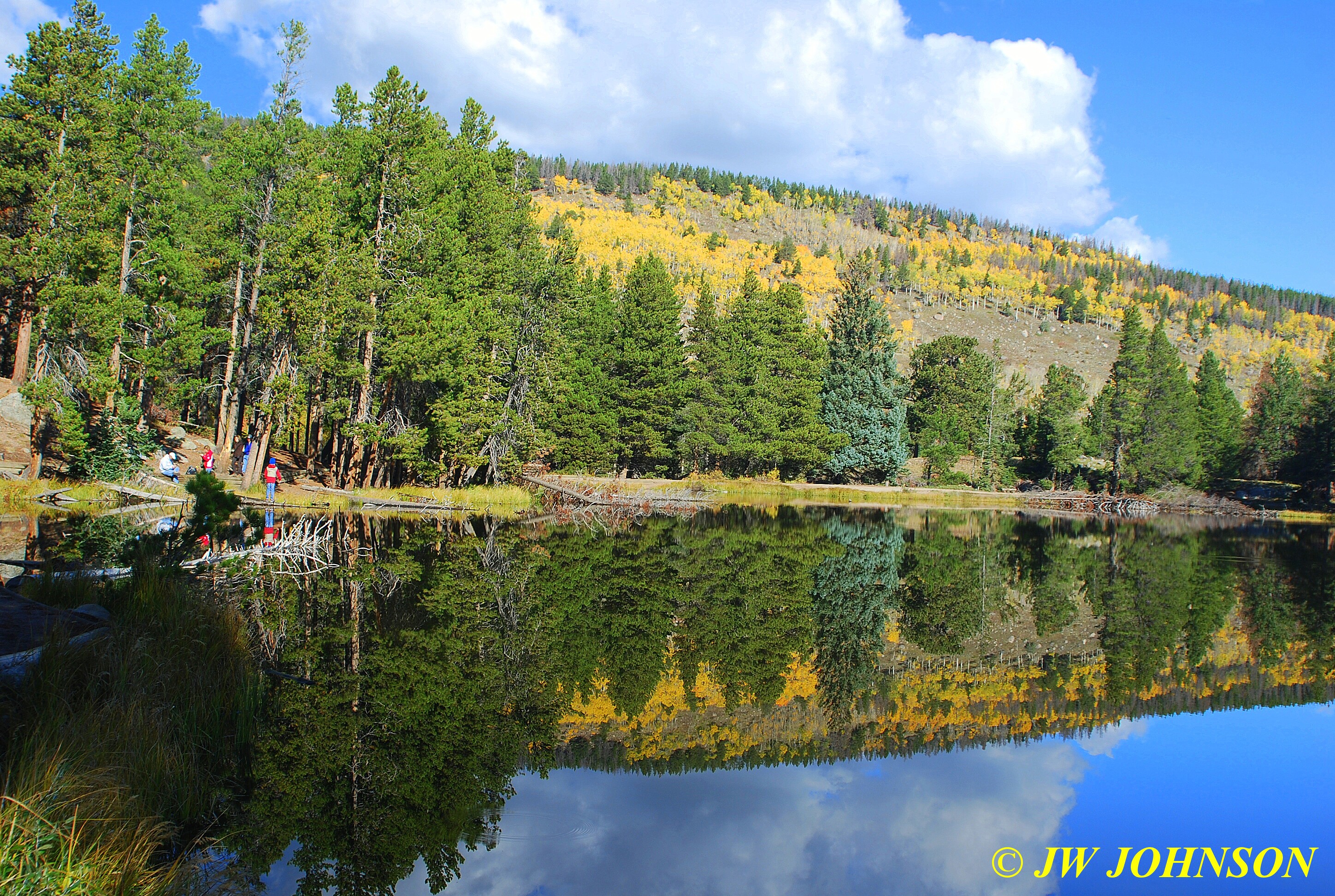
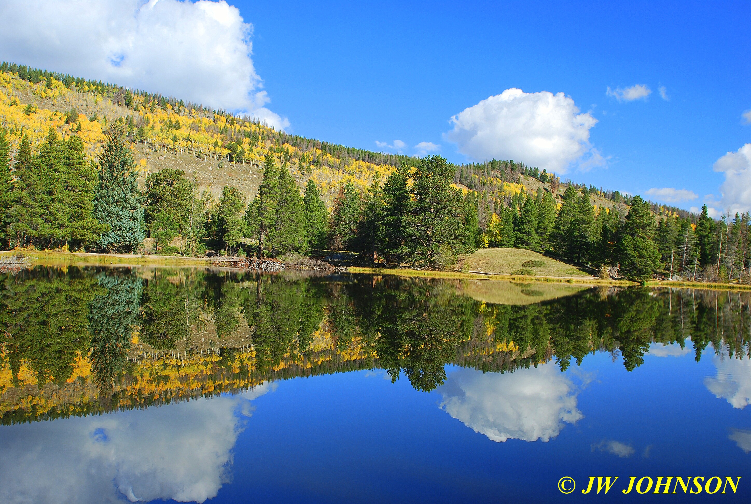
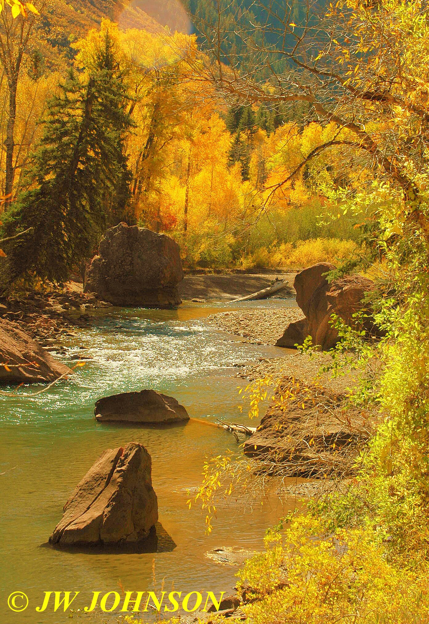
I stopped just south of the river to check on a small waterfall in the area of the old store there…but apparently the river was down far enough that the waterfalls were not even running this year…so we turned east on Hwy 270 and continued toward Mount Ida. As I dropped off the mountain east of Pencil Bluff, I crossed the Ouachita River a few miles west of Mount Ida and had to stop and walk back to the bridge with my camera…
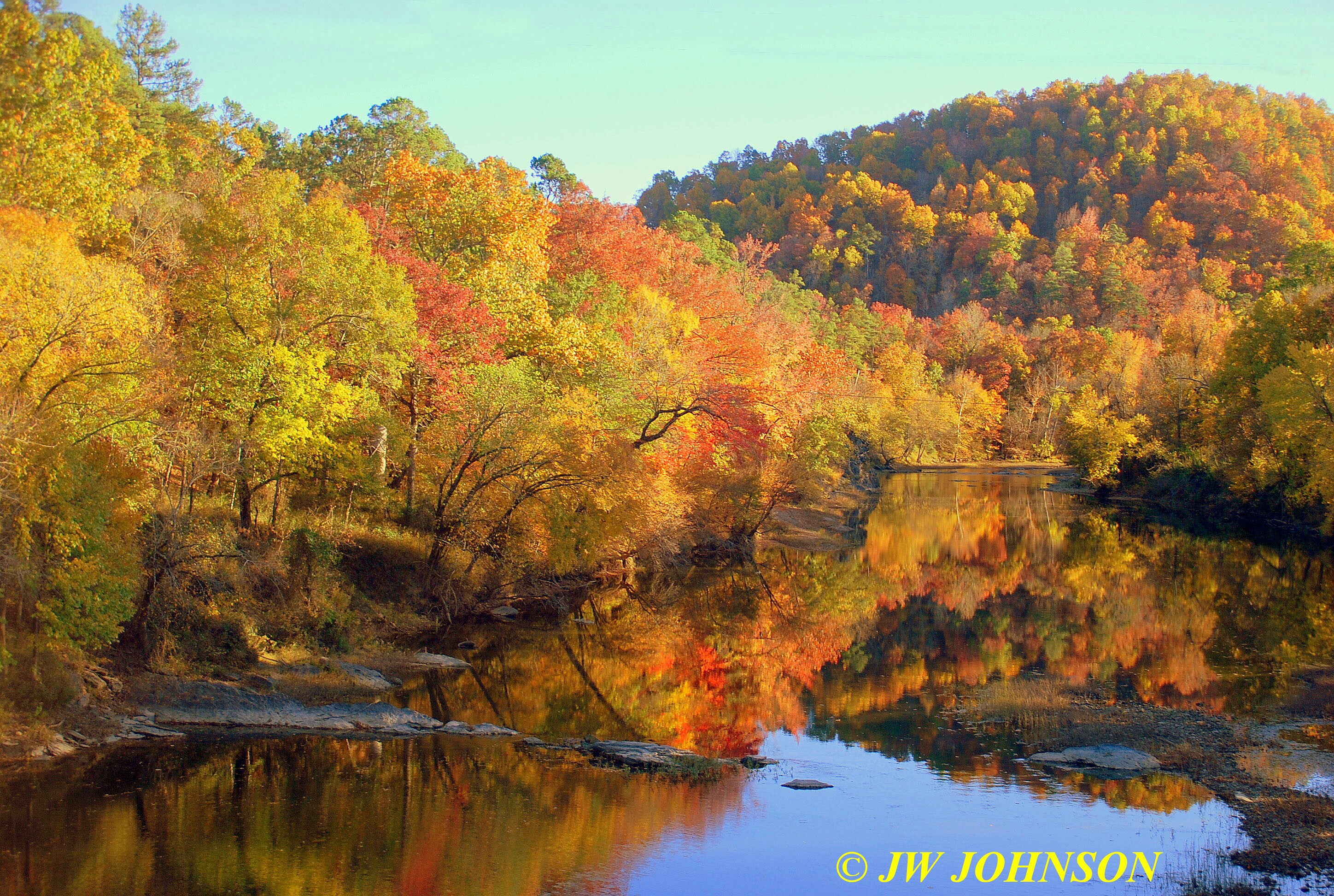
…it was absolutely gorgeous color on the east bank…and then I took a good look at the reflections in the water and in the distance the color on the trees on the hillside was fantastic too !!

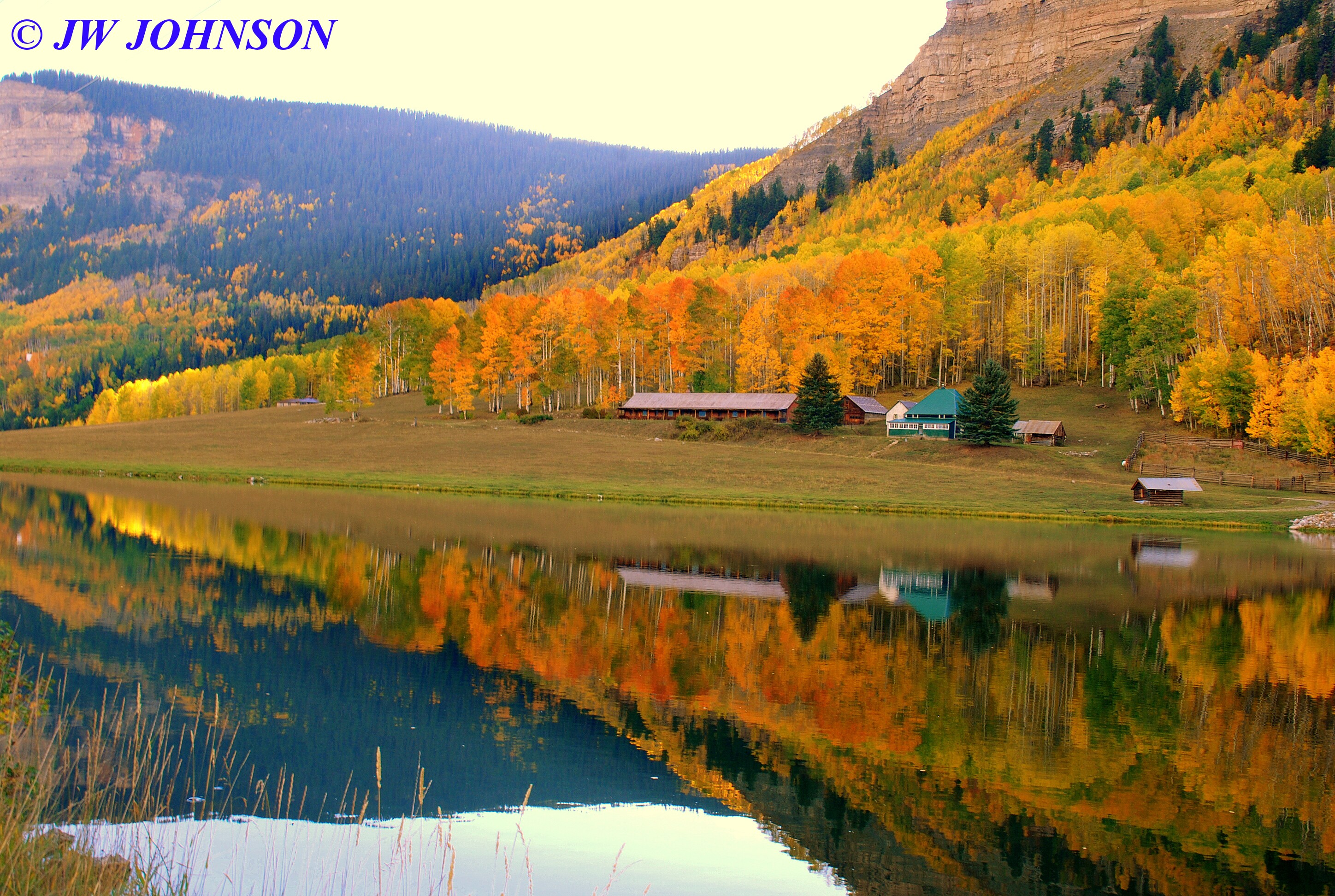
I had planned to stop at Bob`s Food City there and pick up some milk for my cereal and some Blue Bell Ice Cream, but decided I would get it on Thursday instead. We continued on to Mountain Harbor and arrived around 4 pm. After checking in with Pati and Luann at the Lodge, I stopped off at Ray`s room and gave him his care package…six flats of goodies…we sat on my truck tailgate and he looked over the fluorite and was happy with what I brought him to add to his collection. He showed me a large package of frozen gumbo that he had cooked and brought to me…while I have never tasted it to my knowledge, my Dad LOVES it as does my Supervisor at work. I had him hold on to it while I was there. Missy and I headed over to the cabin to get settled in….

…and then headed back to the Lodge restaurant for supper with Ray. That`s another great feature of the resort…they have an excellent restaurant with great food and service, plus a nice view of the lake, as the restaurant sits up on a hill overlooking a large expanse of water there. I had been looking forward to their hand breaded chicken fingers and steamed veggies, with some of their homemade potato salad…and boy do they know how to brew some good sweet tea, too.
After a good supper, I checked my email and found a reply from an area mine owner regarding a visit at their mine on Thursday morning. I had contacted a buddy of mine, a quartz dealer who resides nearby, a few days earlier and asked for area mine information. Mike had told me that the only mine that was actually digging and open to the public in the area at this time, was Sweet Surrender Mine, north of Mt Ida near Story, on the north side of Lake Ouachita. I had heard of it but had never been there before. He knew the owner and suggested we go there and dig, maybe even talk to Randy the owner and see if we could work a deal with him on getting into a pocket. He told me that a fellow that he sent there two weeks prior, was able to get into a pocket that Randy found with the track hoe, and removed several buckets of crystals nice enough to wrap up. I told Ray and we decided to go there the next morning and see what we could find.
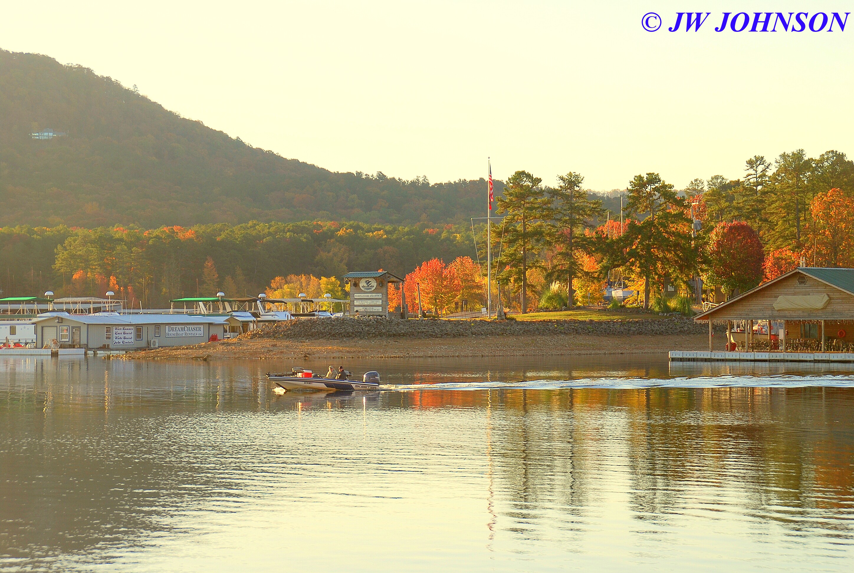
Missy and I woke up at sunrise and got a good hike in, walking the north lakeshore as the sun was coming up, this view of the main marina right off our cabin`s back deck…

..we then walked around the lakeshore toward the north marina….

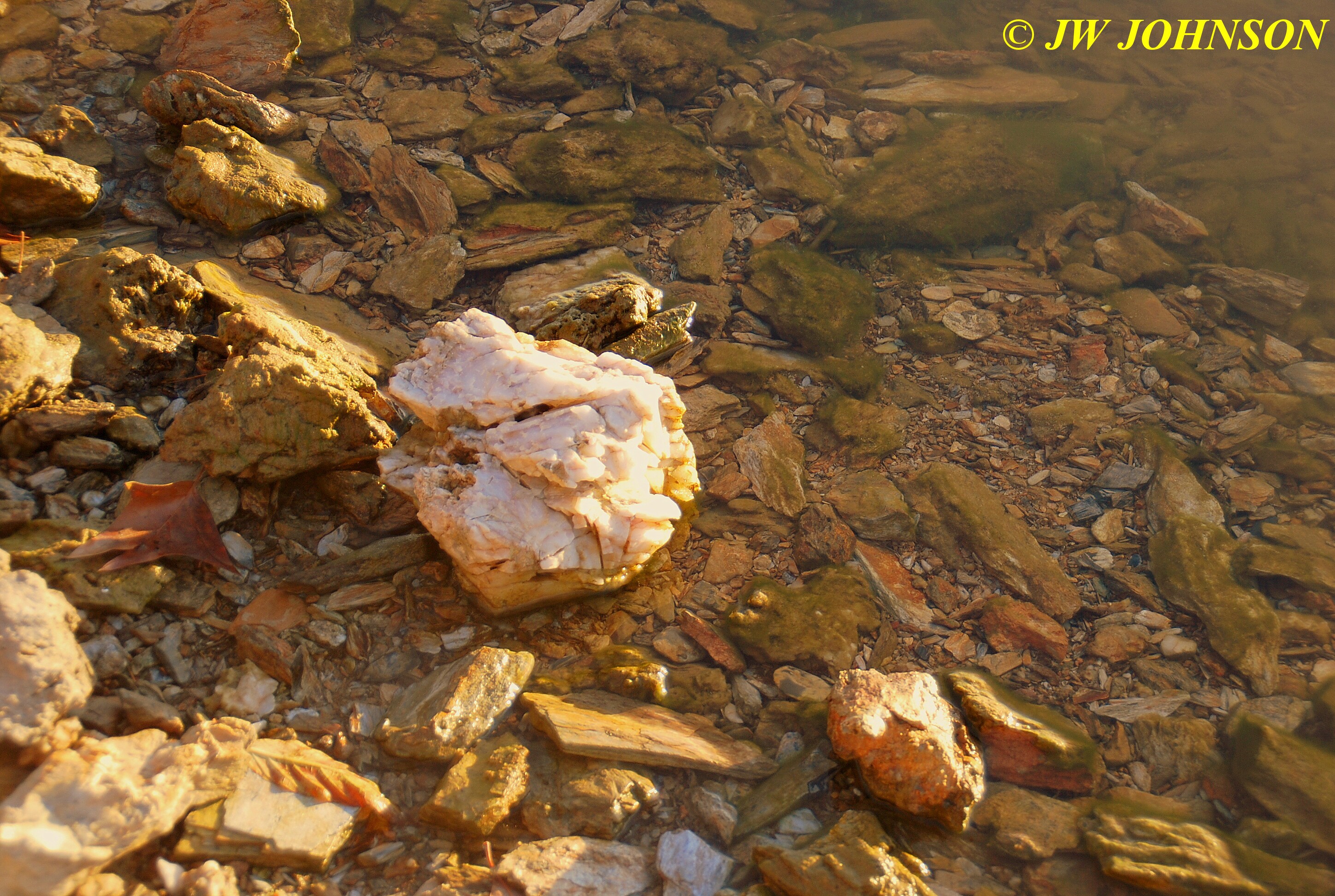
…..I was looking for quartz veins in the shale, to see if there were any crystals or just massive quartz….
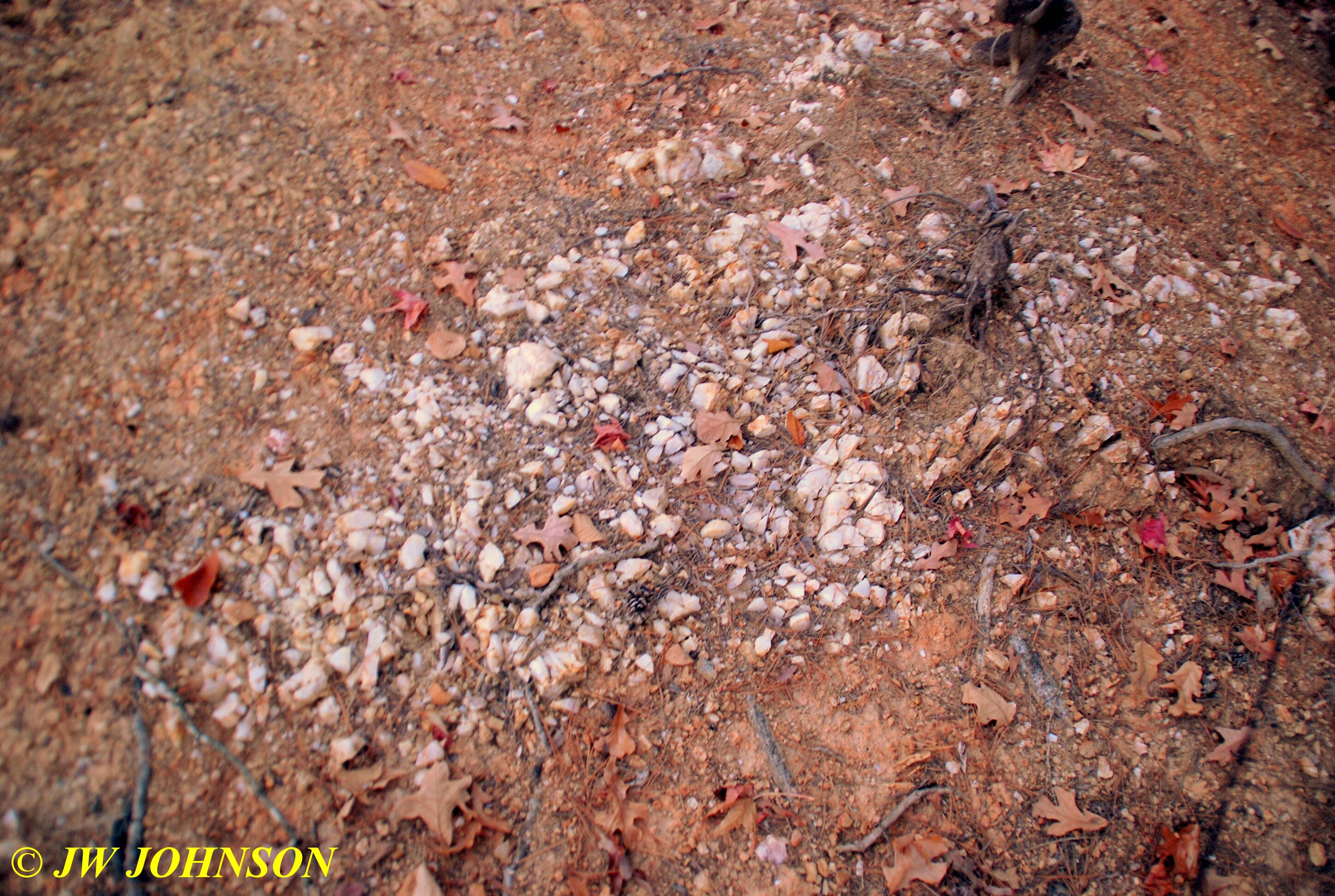
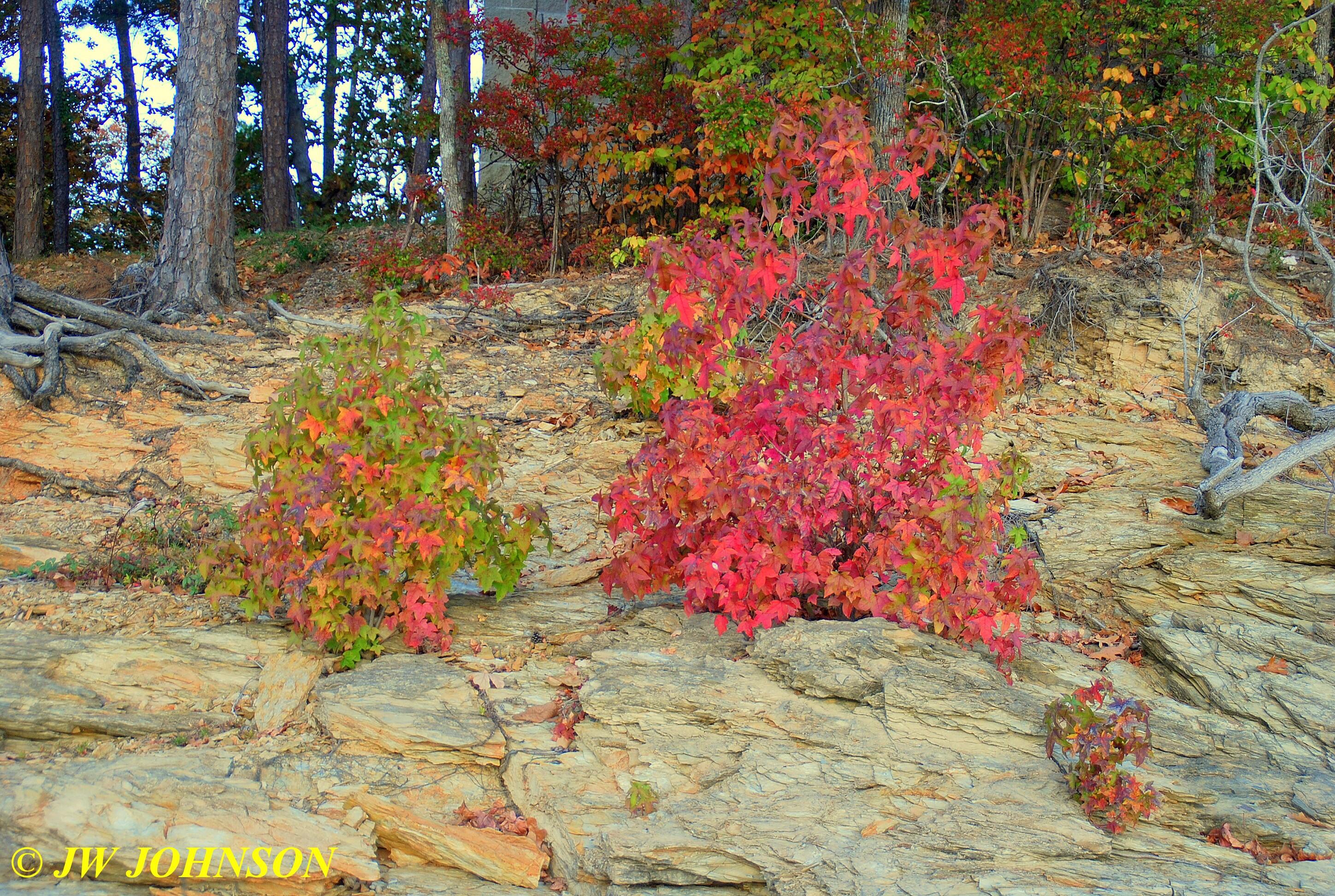
..most of the lakeshore was made up of a shale shelf that stairstepped down to the water`s edge…this one shows two nice maple shrubs cloaked in fall colors….
…and occasionally we would come across chunks of massive quartz laying on the beach, in a manner of speaking, and sometimes in the edge of the water….
…and then we walked on around to the north marina via the lakeshore, here you see a couple more of the cabins on the lake…

…we then watched a couple of guys heading out of the harbor toward open water to get some fishing in….
…in the upper left hand corner of the photo above you`ll notice a house near the top of the mountain…its referred to as a glass house…I met the residents on my May trip there and photographed it the previous fall season there.
When the fishermen hit the open water, they really opened up the boat and took off…
…as we got over to the north marina, we hit a stretch of shale that looked pretty and shapely…looked like it would make nice stepping stones….

At this point, we reached the end of the road that our cabin was located on so we started back to it…passing Cabin 18 up as we walked back…I stayed in it a few years back for a couple of nights, its the most popular cabin they had back then, its the closest one to the water….

After a quick breakfast of Arizona Green Tea and a few cookies, Missy and I met up with Ray at the Lodge and then headed to Mount Ida…I needed to stop at the bank`s atm and then we drove north on Hwy 27 toward Story to do some quartz crystal digging at an area mine…

we were there til around 3 pm…for a more extensive look at the quartz crystal digging we did down there, check out my rockhunting blog site…
http://jwjrocks.com
We headed back to Mt Ida, stopping off at Bob`s Food City and picking up some milk and ice cream, and then returned to the Lodge for supper. We decided to go to Miller Mountain Mine the next morning and see what we could find there…I have been there several times and NEVER had a bad day there…plus they have reasonably priced baskets of crystals some of which come from a variety of mines in the area, but I have always had good luck pulling some really good material from the baskets I have purchased there.
After yet another good supper at the Lodge, we retired for the night and prepared for a better day of quartz crystal collecting. For whatever reason, which I havent figured out yet, I again rose early the next morning…and Missy and I took off for another hike…thinking I`m supposed to be on vacation so shouldnt I be sleeping in later ?? This time Missy and I hiked over to the west side of the lake where we normally shoot sunsets from, the north point…this time though the sunrise this morning was putting on a good display and making me think it was sunset instead….


Looking the other way, to the east though, the sky was rather cloudy a few minutes later as we walked around to the campground side of things…
…there is a campground on the very north point of Harbor North side of Mountain Harbor, operated by the Corps of Engineers and closed this time of year…another shale lakeshore with some good color there…

…we then hiked down to the water`s edge facing south and photographed the reflections of the north side marina and boats….


…I looked at the clock on my phone and it seemed we needed to head back and get some breakfast down before we met up with Ray again, so I turned and shot the campground across the bay….
After cleaning up and getting some breakfast down, we met Ray at the Lodge and after checking email, we headed to Miller Mountain Mine via the backroads…Ray told me when we finally arrived there, that he was all turned around and didnt know how to get back to the resort from there now…told him by avoiding the drive through Hot Springs we had probably saved about 30 minutes driving time going the backway. We stopped at the entrance rock shop to visit with Caretakers Faith and Bill for a bit…Bill was down at the mine so Ray and I talked to Faith who caught us up on the past year there, and some scuttlebut for the other area mines…
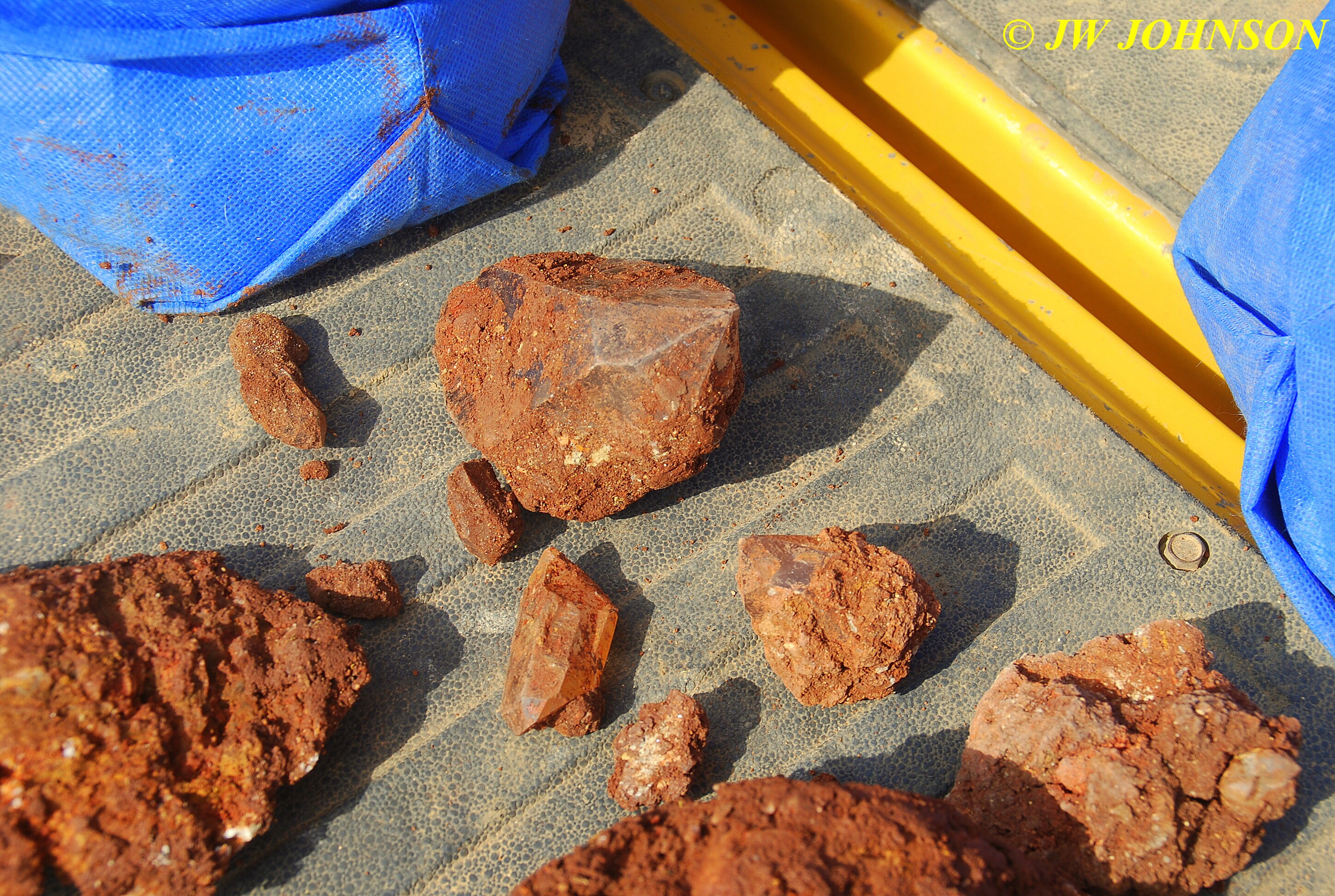
…this is a great place to do some fee digging for quartz crystals…only ten dollars a person and even less in a group of seven or more…keep all you find and can dig from daylight to dark here. Today we found a lot of smokey quartz crystals and Ray even dug into a pocket of golden healer clusters, this one the first one he found there...

…and here are some I found, including a big point at the top center of the photo below….
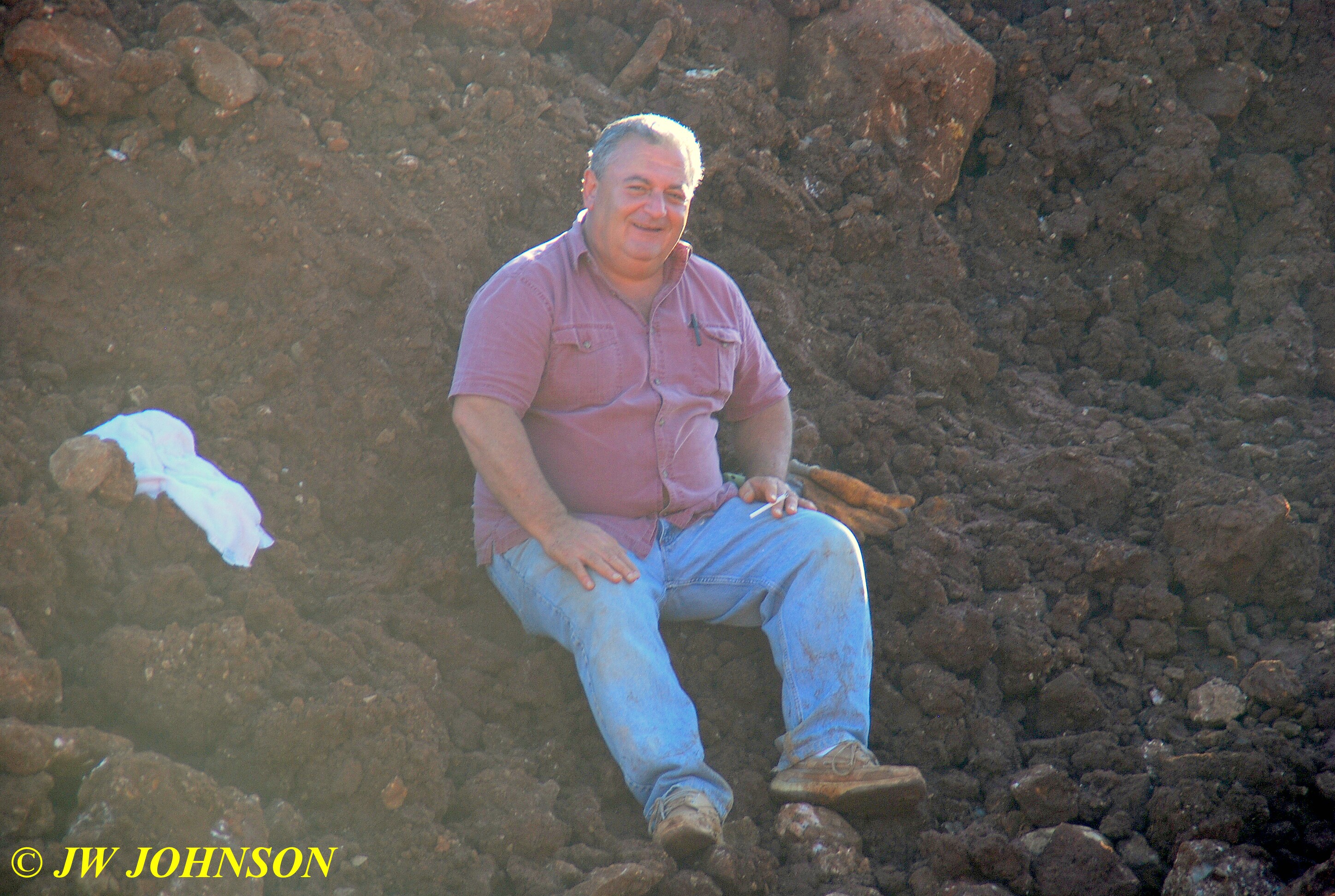
…and here is Ray taking a break from digging at Miller Mountain Mine….
We stopped off at Colton`s Steakhouse on the way back for a good steak and fixins…I contacted one of my models, Scott, who was just leaving his workplace and he met us at the steakhouse. Scott visited with us over dinner and then took off for home as we headed west to the resort. After checking my emails once again, Missy and I headed back to the cabin for the night. We had decided to try Judy`s Crystals the next day and dig at Fisher Mountain Mine, which is located south of the Mt Ida Airport. Ray didnt sleep well that night and called early to ask for a few extra hours of rest. I had no problem with that at all, getting another hour of rest myself, and then getting our walk in around the resort.
We walked down to the wood bridge on the Harbor North Road and shot the sailboats over at one of the Marina`s, looking toward the area of the Lodge...
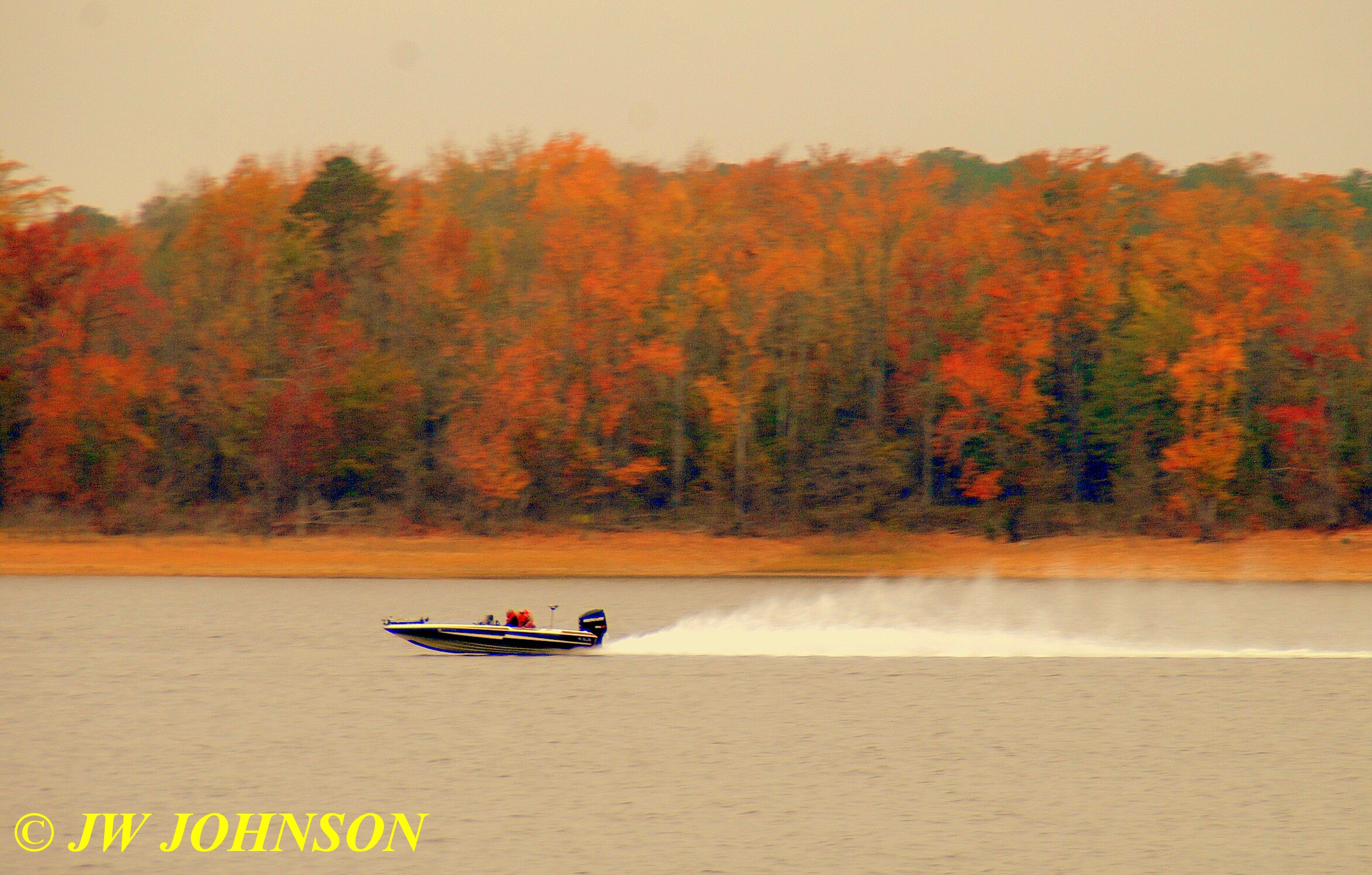
…then heard a speedboat coming down the lake behind us, so turned around and snapped these guys speeding along against a wall of colorful fall foliage on the far shore….
…breezed by one of the newer family cabins on our way to the Lodge area…

…and then drove up to the Lodge area to see the big fireboat the resort has tied up at the main marina behind the seasonal Subway Restaurant….

…a retired Coast Guard Cutter that was actually purchased for the resort by a private donor in the area. I actually had the pleasure of touring it back in May when it was very warm both inside the cabin and holds as well as outside…the front machine gun had been replaced by a water deck gun, pretty neat investment for the entire lake area. I turned around and looked back to the east toward the boat launch site and saw some beautiful fall color as well as a couple of sailboats drydocked and sitting up high….
Missy and I headed back to the cabin to get in some breakfast and tv time while waiting for Ray`s phone call that he was ready to go to Fisher Mtn Mine. By noon, Missy and I were driving to Judy`s Crystals to meet Ray there…. arriving a bit early, I met and visited with Judy and her friends, and walked around the displays to see what Judy had for sale outside the rock shop…finding some pretty quartz clusters and alot of colorful slag glass, for the most part. Ray pulled up soon after and we made our arrangements with Judy to drive on up to Fisher Mtn Mine and see what we could dig up.
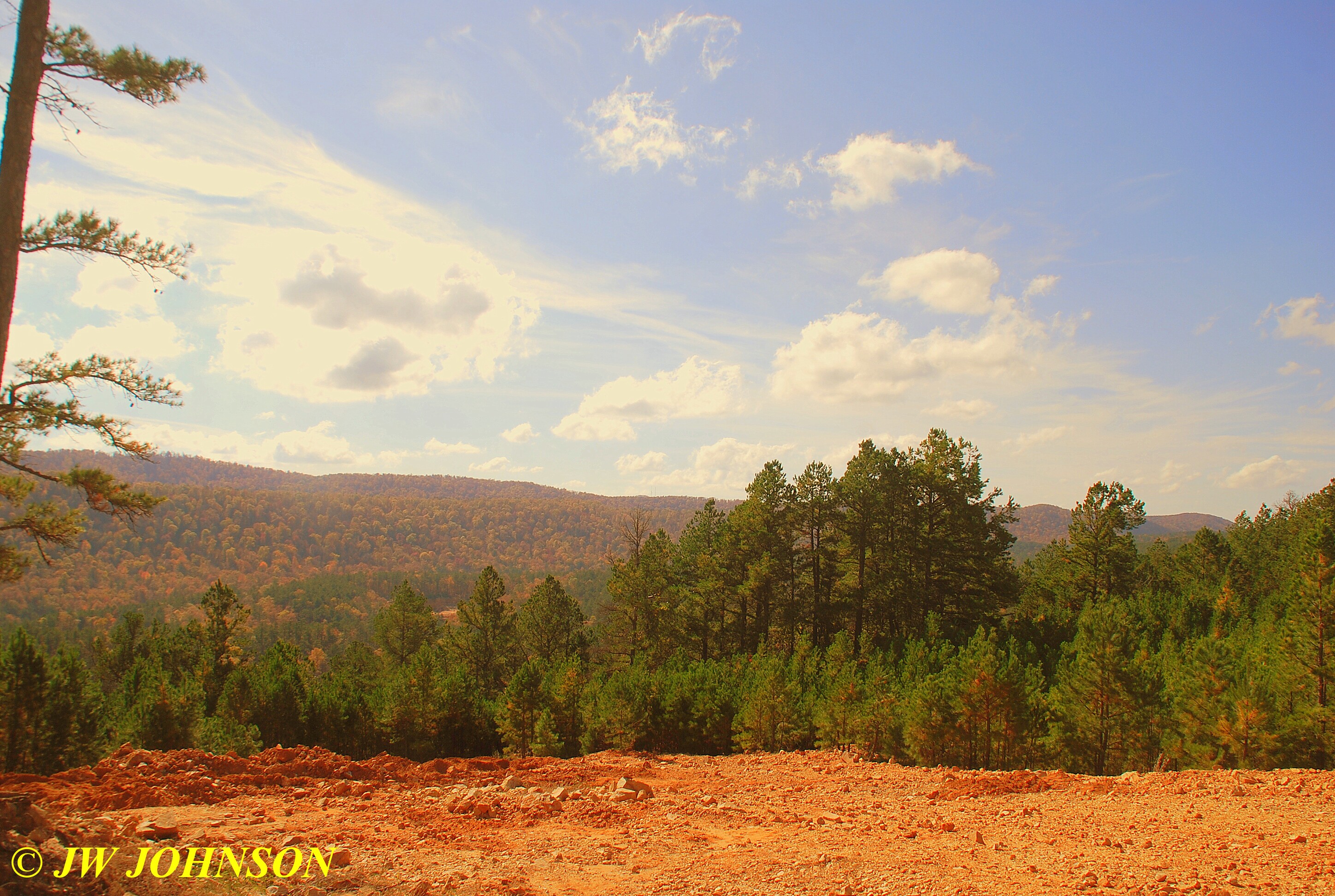
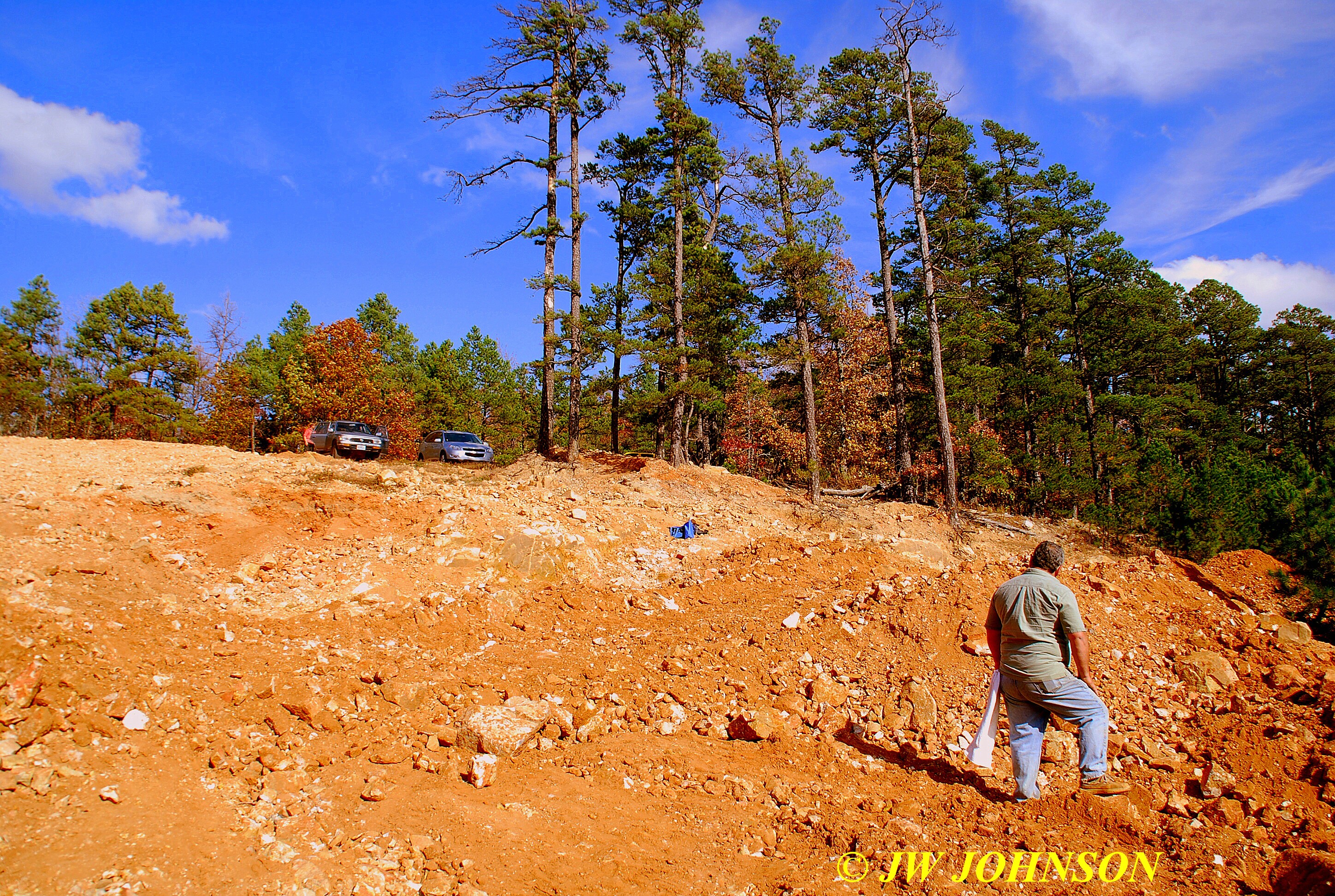
The Fisher Mtn Mine has alot of history associated with it…..it`s Ocus Stanley`s original mine….he is the guy that got the quartz crystal hunting craze started in the area….the mine sits on top of Fisher Mtn about two miles south of the Mt Ida airport, easily spotted on Google Earth Maps off Logan Gap Road before it intersects with Owley Road. For those of you that know Judy, she suffered a stroke about five weeks ago and is now hobbling around on crutches and recovering from it. She seems to be doing pretty well now, her only complaint that she hadnt been to the mine in six weeks. Ron Coleman also has an old mine up there, accessed by the same road, closed to the public by a very heavy steel gate.
This is the road that ascends much of the mountain to the mine, after passing through a very heavy steel gate off Logan Gap Road…a very pretty and scenic drive up I might add, this time of the year….

We ascended three times and leveled off three times in the mile and a half drive from the gate to the mine clearing…with a few scenic views of the mountains and valleys as we went…I had been told this might be a rough road, but as I pleasantly discovered, the lane was a thick carpet of oak leaves and pine needles under making for a soft ride instead with just an occasional rough spot along the way.
This was the view from the top of the mountain, when we arrived a few minutes later….
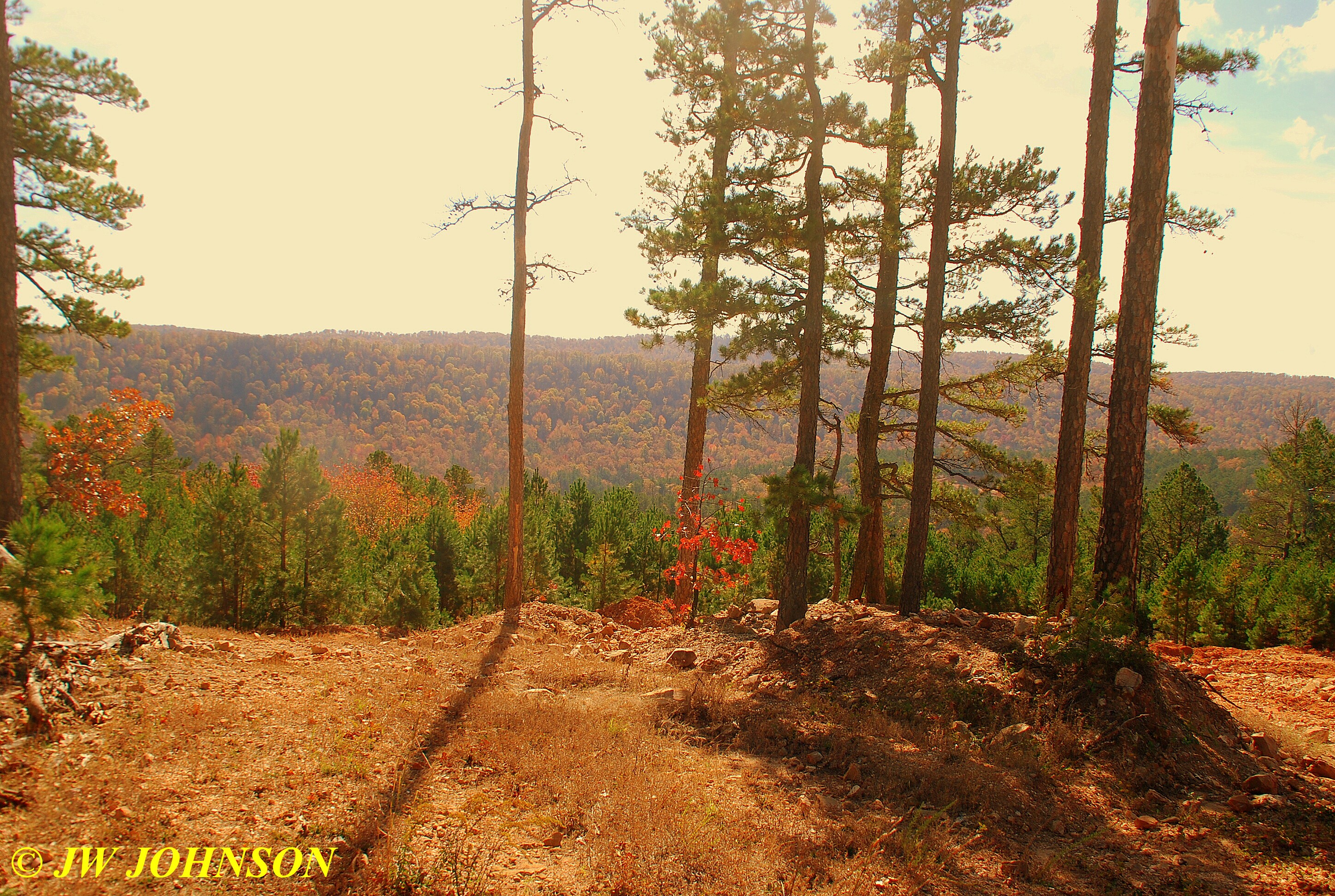
The view from up there was extraordinary…you could see to the south for miles and the color up there was pretty nice as well for a region without much rainfall since September, spotty but nice…

We returned to the resort after descending down the mountain and relocking the heavy steel gate and returning the key to Judy`s Crystals Shop, just in time for a pretty sunset over the lake…

… I told Ray as we pulled into the Lodge parking lot that it looked like a nice sunset was forming up and I would meet him at the restaurant in thirty minutes…wanted to photograph the sunset since there hadnt been a pretty one while there, til this evening. here is what I saw and shot the next twenty minutes…


…had a good supper of hand breaded chicken fingers once again, with the homemade potato salad…they really believe in feeding you there at the Lodge restaurant…then went back to the cabin to finish as much of the blue bell moo-lenia ice cream as I could. Missy and I got up about 7 Sunday morning, got a short hike and run in before packing the truck for the drive home, and before it started raining…the skies were dark when we finally stepped outside the cabin to take hike around the shore again…there was an extensive cold front coming in from the west, part of the Brutus Storm that had pounded the northwest with heavy snows earlier in the week, but the forecasters had said the storms and rain showers would hold off til noon at least…guess they were wrong again. We headed up to the Lodge to check out and check my email once again…and while there I updated the McRocks board too. Ray came down to send us off and gave me a big frozen chunk of gumbo to take back with me, and said, ” lets do this again sometime ” ![]() He wasnt leaving til Monday or Tuesday and said he would let me know that he made it home safe and sound, his drive is about as long as mine, eight hours.
He wasnt leaving til Monday or Tuesday and said he would let me know that he made it home safe and sound, his drive is about as long as mine, eight hours.
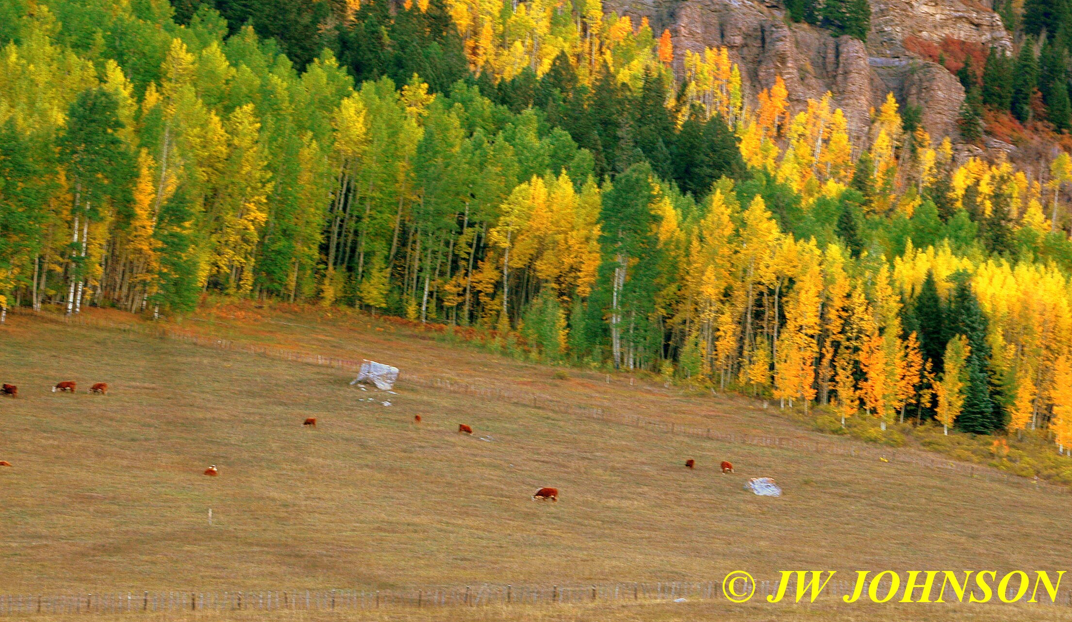
Missy and I headed up Hwy 270 toward Waldron, where we would stop for dinner and a family reunion at the family farm. As we approached Y City on 270, I came across some beautiful maple trees…….

…and some with cattle nearby in the fields….
…it was raining pretty hard when we came across this scenery just east of Y City….


…I drove maybe a quarter of a mile and crossed the Fourche La Fave River again, and parked on the bridge, because the fall color down by that river was just stunning this year…the first photo looking upstream…


…and then downstream….which is just around the corner and above those waterfalls I photographed Kyle in a couple of years ago.
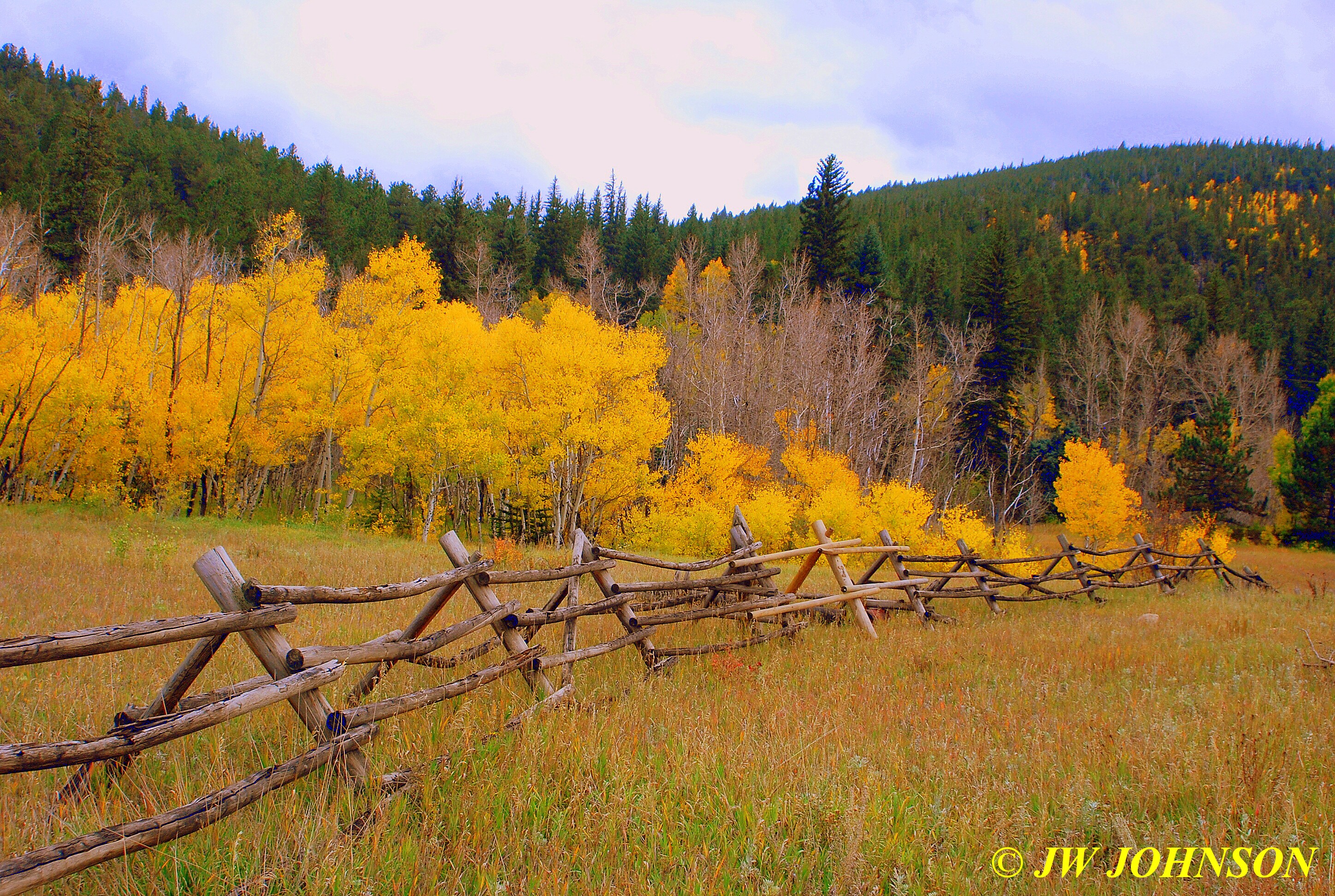
…from here its an easy drive through cattle farms to Waldron…I decided I would shorten it a bit and take Ross Creek Road in to the farm from Hwy 71…it takes me through some scenic farmlands and passes by an old farm where one of my uncles used to live…it was now raining again and the wind the night before had knocked several colorful leaves to the ground and they coated the roadway in areas as well…


…the road today was a much smoother drive than I remember it being many years ago when my parents drove down it on one of our annual visits down there to see everyone…maybe the leaves and the rain had helped to smooth down the rough areas I remembered. Pretty soon, my grandpa`s old dairy farm came into view….

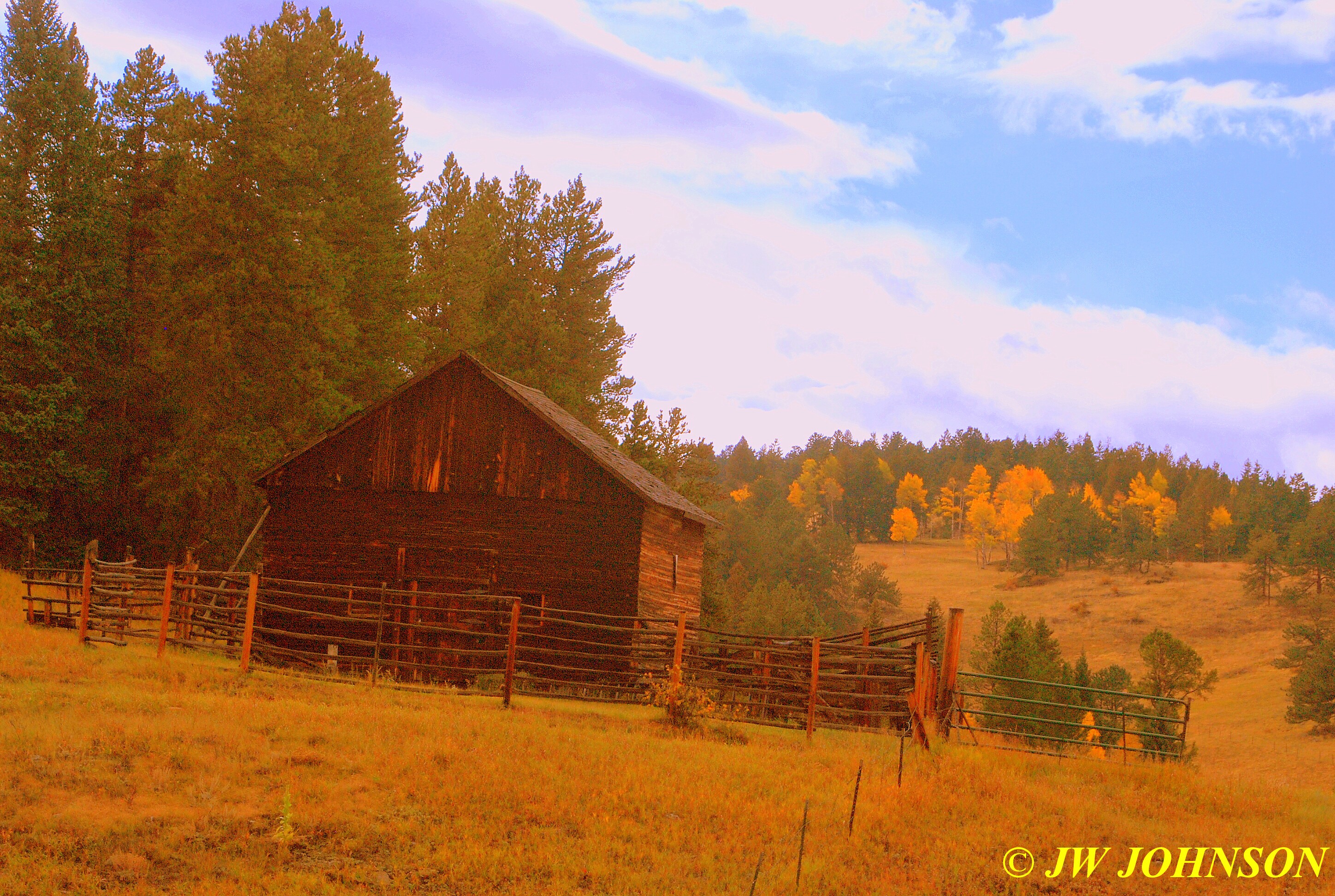
…I still call it Grandpa`s farm, even though it`s now taken care of by my Uncle Joe and Aunt Billie Jean, who lovingly restored the house and added a two car garage and a pretty white ranch fence encircling the house and garage…the old hay barn sits up behind the house at the end of the driveway and my Uncle Harley takes care of it and some acreage there as well…
…you can see the pine tree forest up above the house on the far mountainside too…a farm of many fond and cherished memories during my childhood years and continues to be for many of us still today.
I could see some activity up by the barn as I started up toward the house, I met some of my second cousins riding toward me on their four wheelers in their hunting gear…Jansen had a doe stretched out across the front of his atv…he had shot it just prior to my arrival and was the only one so far to have harvested a deer. I pulled up and parked in the field just beyond the campers and let Missy out to stretch her legs before the rains started up again. As I was visiting with several of my relatives at the campers behind the house, the rain started to fall once again, so I put Missy back in the truck to stay dry and shortly after, Mom arrived with my Aunt Dorcas and Cousin Sherry. Soon after that, several of us cousins went for a ride on the four wheelers…in the rain and through some of the mudholes to one of the other nearby farms, to see a new deerstand, and then headed back to the barn before we were completely soaked by the steady showers.
It was obvious, we were going to be eating our Sunday dinner, prepared by family and friends, in the garage and the campers, as the rain had only intensified by the time it was time to eat. After prayer, we formed a line and started filling our plates, ribs and beef brisket the two main courses cooked by my Uncle Joe and friends, and several side dishes and desserts available, as well as two large pans of homemade breadrolls cooked each year by Nadene, dear family friends from down the road….who with her husband James, also operated a dairy farm as my grandparents did, for many years. I filled my plate for the long drive home and made sure to get two of those delicious rolls she makes. After a bit more fellowship with relatives and a good meal, Mom, Missy, and I headed home in the steady rain. We finally ran out of the rain around Rogers and then hit it again east of Springfield, the last thirty miles the rain coming down hard. It was a good trip again, but we were definitely glad to be home, safely and soundly.
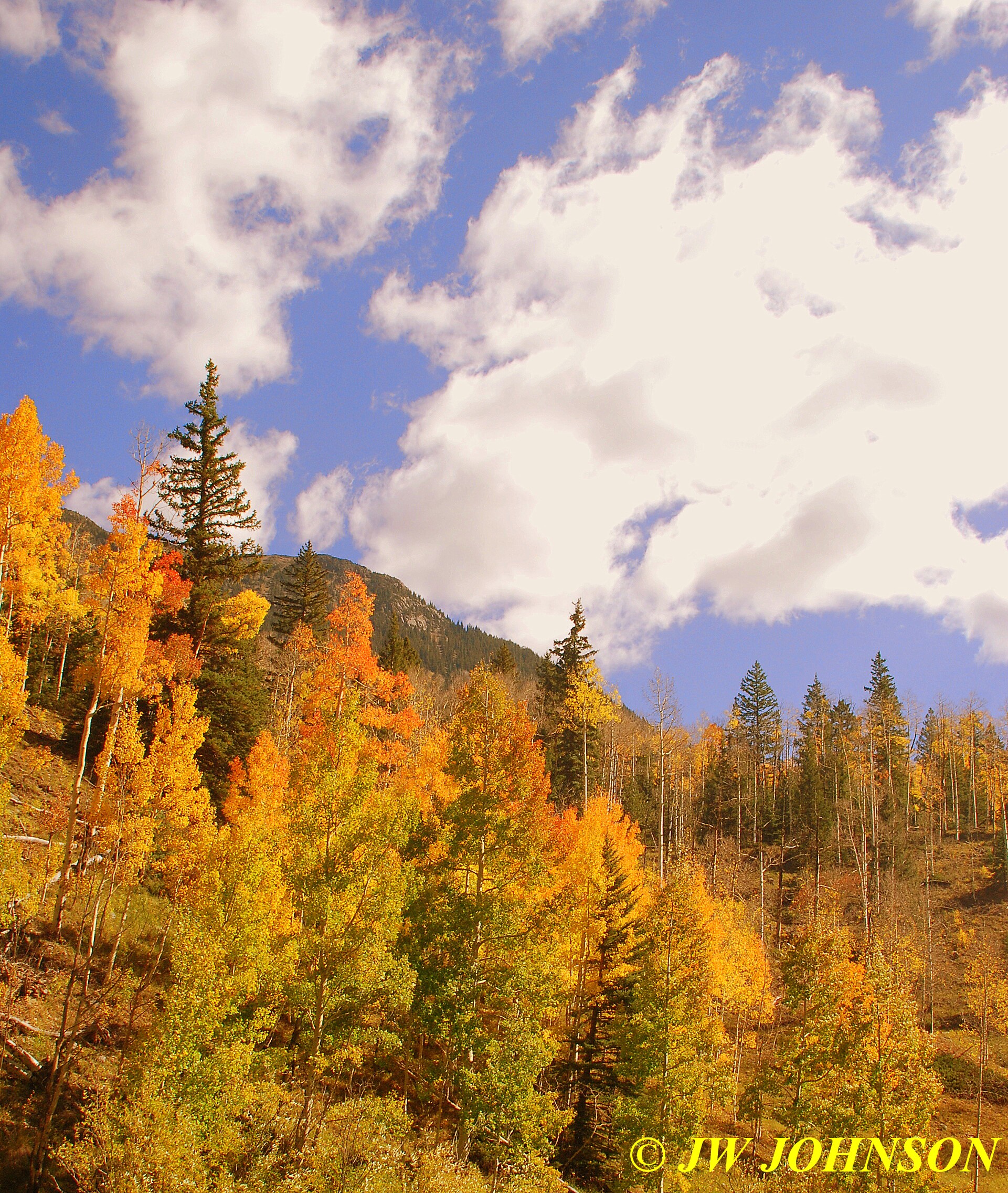
Mom and I were talking earlier this summer and she mentioned how she and Dad would love to go out to Colorado this fall and see some color, but they dont like making the long drives anymore. I told her I had the last weekend in September off and could do the driving for them if they were seriously considering it. I had planned to take off and attend the rock and gem show in Joplin that weekend, but would much rather return to Colorado instead. We started planning the trip in August…they wanted to ride the steam train from Durango to Silverton once again…the last time we rode it was forty five years ago and I dont recall much of that trip due to my age at the time. I started checking with friends in Colorado who said the last weekend in September was the optimum color viewing weekend for the aspens, and when we went to the Durango train website, it turned out to be the weekend for the Fall Photographers Special Train too. We went ahead and booked the train tickets in August, and as it turned out, it was a good thing we did. I started researching the Forest Service site for places to see north of Interstate 70, since most of my time out there in years past, had been spent south of 70, and I soon had a list of places to go see, including Rocky Mtn National Park…which was on my Dad`s list of places to see as well. I checked the mileage between places on mapquest during the slow times at work and looked at places of lodging as well as dining places. Mom decided we should take her Trailblazer since it would be more comfy than my truck or Dad`s truck, and she said Missy would have more room as well. After plotting out a couple of routes to take, she started booking hotel rooms along the main route we decided on. She emailed me at work and said a few of the hotels she booked had asked if I wanted a room with a bed for Missy as well as one for me…it was nice to see there were hotels out there that were truly concerned about the welfare of your pets. Alot of times these days, we find hotels listed on various sites that claim to be pet friendly, and then on further checking, you find out they truly wont allow pets or they charge high fees if you stay there with your pet.
I picked up a newer lens and a few filters, a newer polarizing filter and a sunset filter, and some hiking boots as well, mainly for the train ride as we would be disembarking from the train quite a few times to photograph the train in runby`s. I wasnt sure what the terrain would be like along the route, specially up the canyon, and wanted to be prepared for anything.
We decided to leave mid morning on Wednesday the 26th and drive about halfway across Kansas before stopping for the night in Salina. I was afraid we would be driving through storms, as the weather forecasts were calling for storms and rain showers from Colorado eastward, but as it was we only passed through a few short showers. I was pleasantly surprised to find that the state of Kansas had increased their speed limit on I-70 to 75 mph, which is the normal speed limit across many of the western states including Colorado. We stopped for the night at the Super 8 hotel and had a good supper at the Iron Skillet Restaurant across the road, which came highly recommended by the hotel staff. The rooms at the hotel were very nice and tastefully furnished, looked better than the hotel website, and the staff was very nice and accomodating as well. The food at the restaurant was just as good as the hotel staff had told us it would be.
We rose early on Thursday morning and found a heavy fog waiting on us out on the interstate. Dad decided to drive a few hours in it, and didnt like it at all…..the intense concentration on the road due to the fog, wore him out and hurt his eyes…he was also concerned that a deer could jump out in front of us and there would be little reaction time. Dad and I switched places when we fueled up and we entered Colorado about mid morning, which is about when the fog finally lifted completely. I was showing Mom and Dad how the terrain changes subtly as you enter Colorado on the east side…how it still resembles western Kansas, and even Missouri`s rolling hills somewhat…I never felt like I was in Colorado til I turned back to the west on the interstate and could see the mountains on the west side of Denver. Around the Limon area we started seeing deer occasionally laying down in the alfalfa fields on the east side of the interstate…they were quite small in size, possibly due to the drought conditions and less food for them to find and eat.
We had made arrangements to stop and meet up with my cousin Cindy Dill Fox, and her husband Kent, at the only Cracker Barrel Restaurant in Denver, for lunch, so we turned north on Interstate 25 and arrived there just ahead of them. Mom and Dad went inside to freshen up and I was walking Missy on her leash when they arrived. I gave Cindy a big hug and then retrieved the care package I put together for their daughter Emmie, who is an aspiring rockhound. Took her some Missouri druse, Kentucky fluorite, and Arkansas quartz for her collection. She and Cindy will be traveling here soon and I told her I would take them druse collecting here.
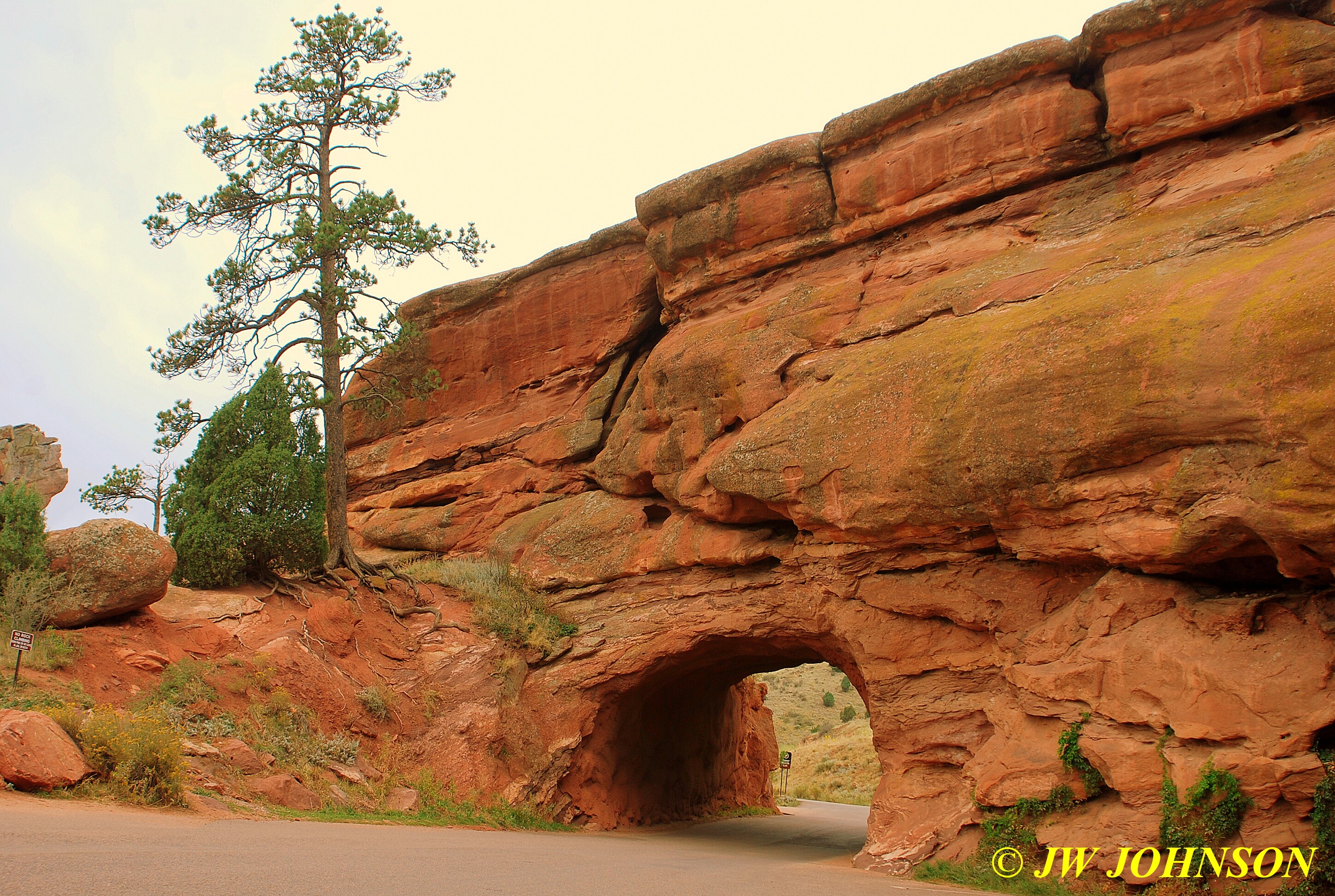
After a good lunch and visit with Cindy and Kent, we drove down to see Red Rocks Park, on the west side of Denver and south of 70, just west of 470 near the small town of Morrison. This is a beautiful park that sits nestled in amongst some very large red rocks….
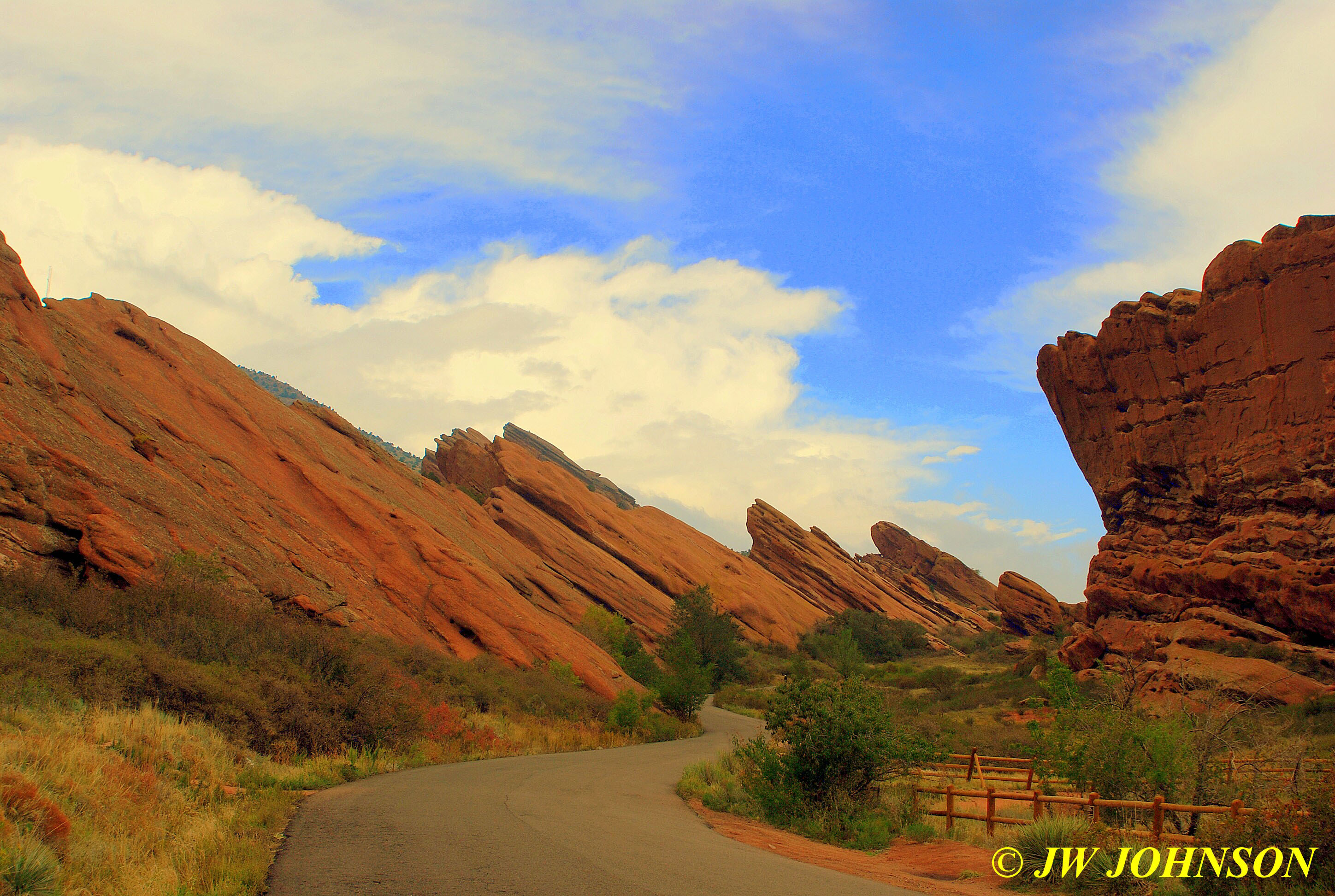
…and you can normally drive into it from the north side on Alameda Parkway, however after turning off 470 onto Alameda, we soon discovered the road shut down and had to continue south on 470 to the turnoff to Morrison…. after driving through the small town, we turned right and entered from the south side. After that we just followed the signs and drove up between the two ridges of beautiful BIG rocks….

…and continued up the hill, cautiously moving around a pair of bicyclists pedaling up the hill, watching hikers traversing the easy slopes and trails around the immense sloped sandstone rocks, til we reached the very top…..
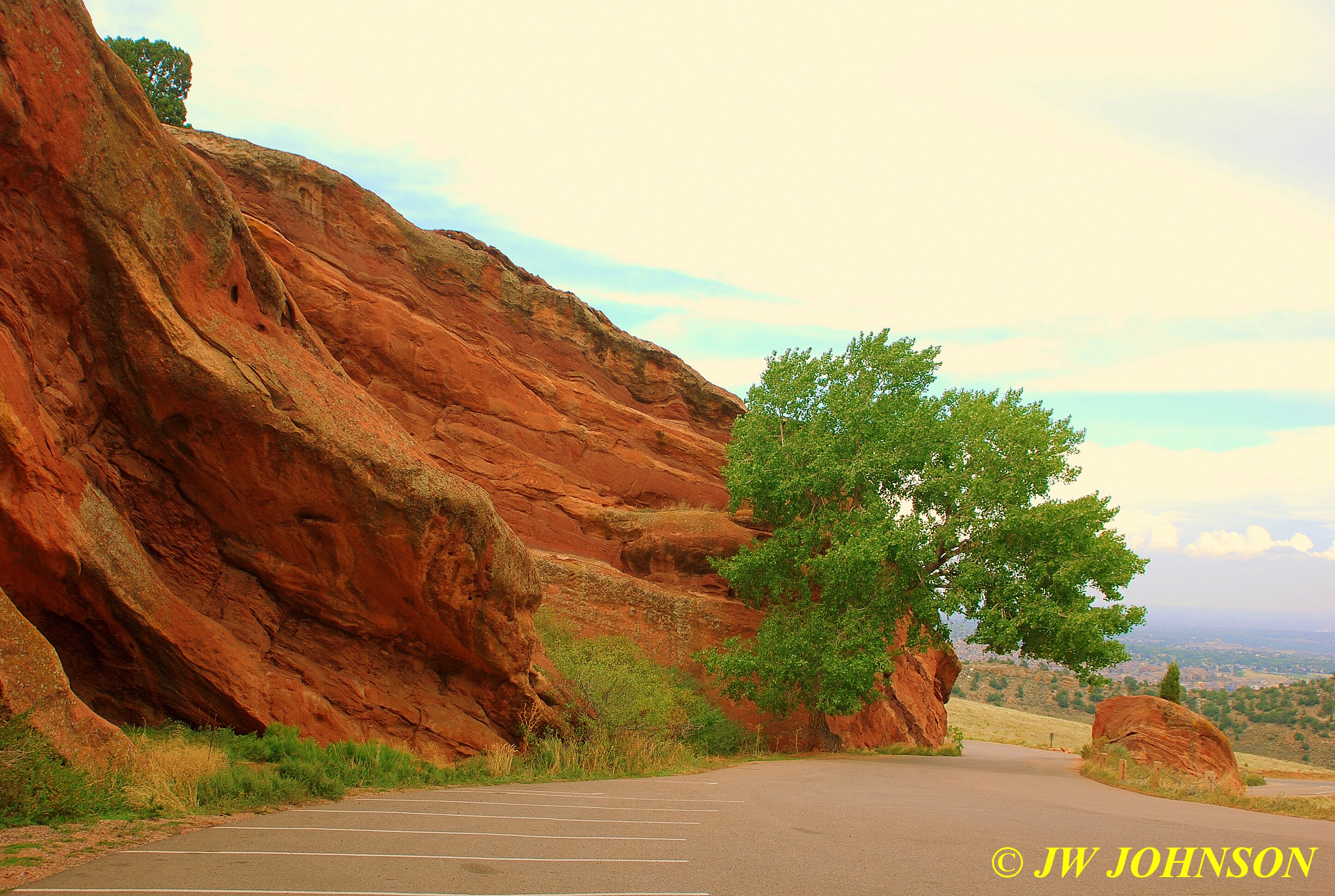
where the rear entrance was located for the ampitheatre, that was cut into the rocks many years ago….
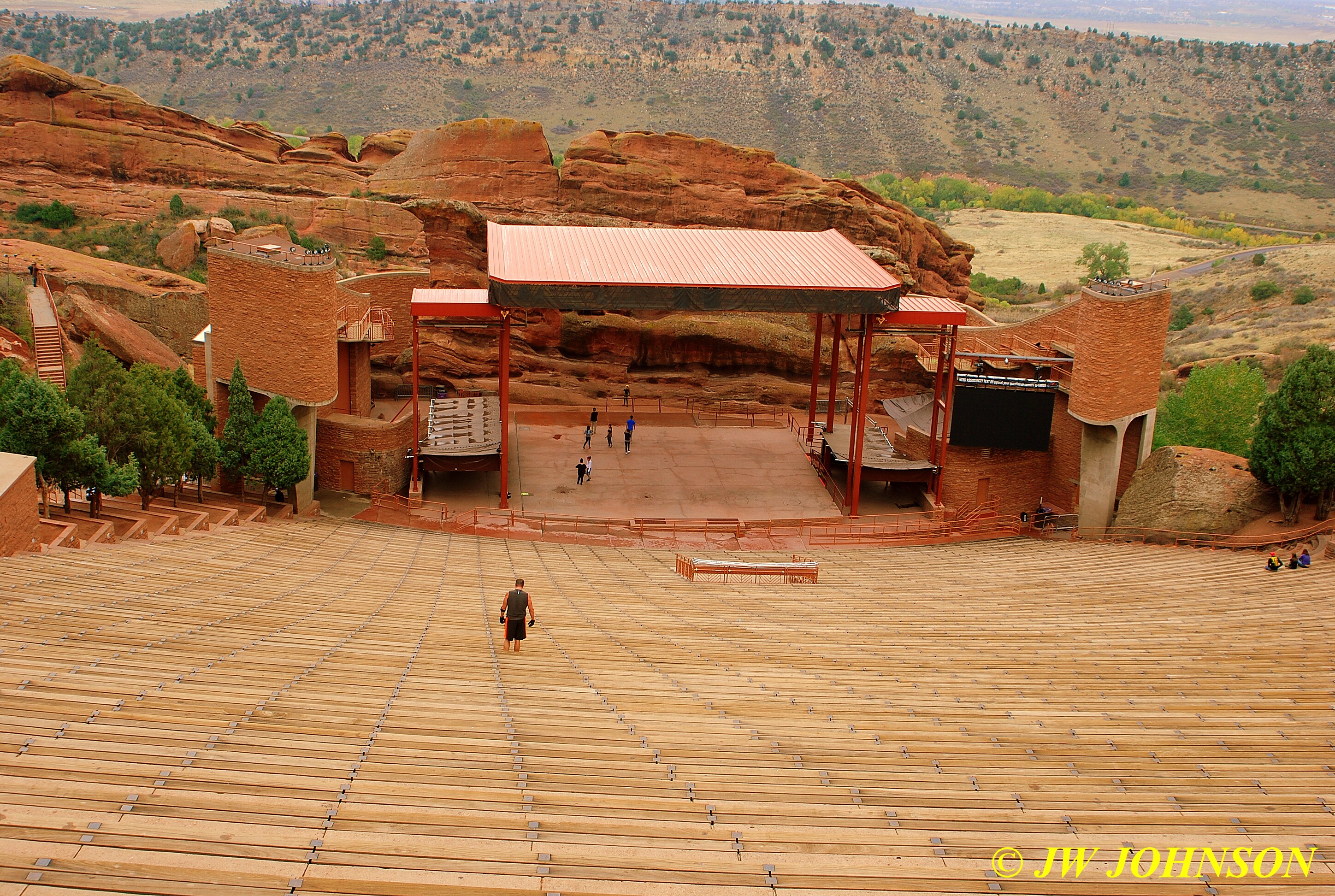
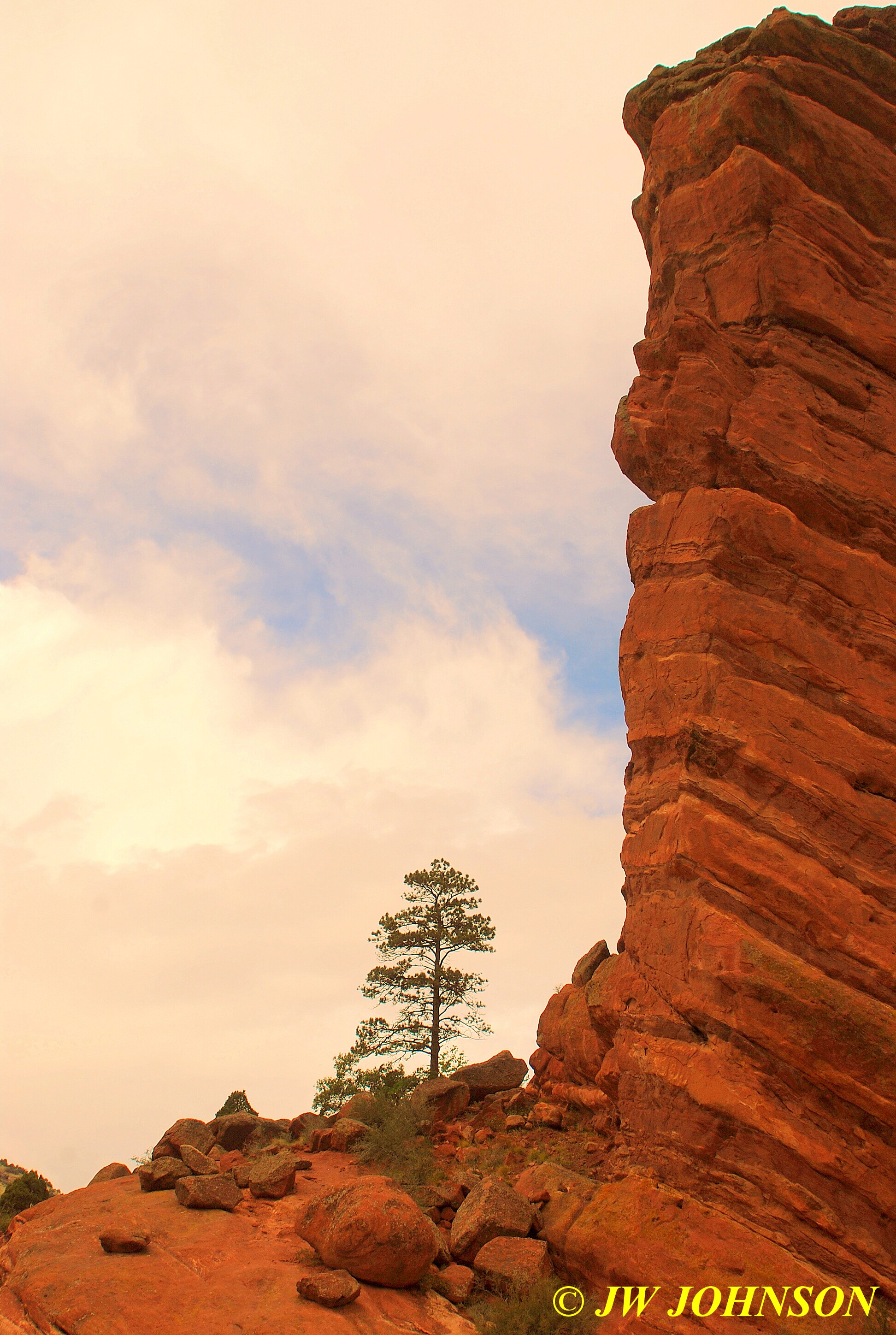
..we parked in a lower parking area where it was a bit cool and windy…Mom decided to stay at the truck and I grabbed both cameras and headed up the stairs to see the view and ampitheatre above. There was a guy working out on the benches as I took the photo above and there were people all over the place above and below, most with jackets on, bundled up like they thought it was going to snow soon. I didnt think it was that bad, just had my long sleeved FD shirt on…they probably thought I was nuts. From this vantage point, one could see the skyscrapers in downtown Denver to the west, but that view was a bit hazy so I moved over to the south wall and photographed this storm approaching from the southwest….
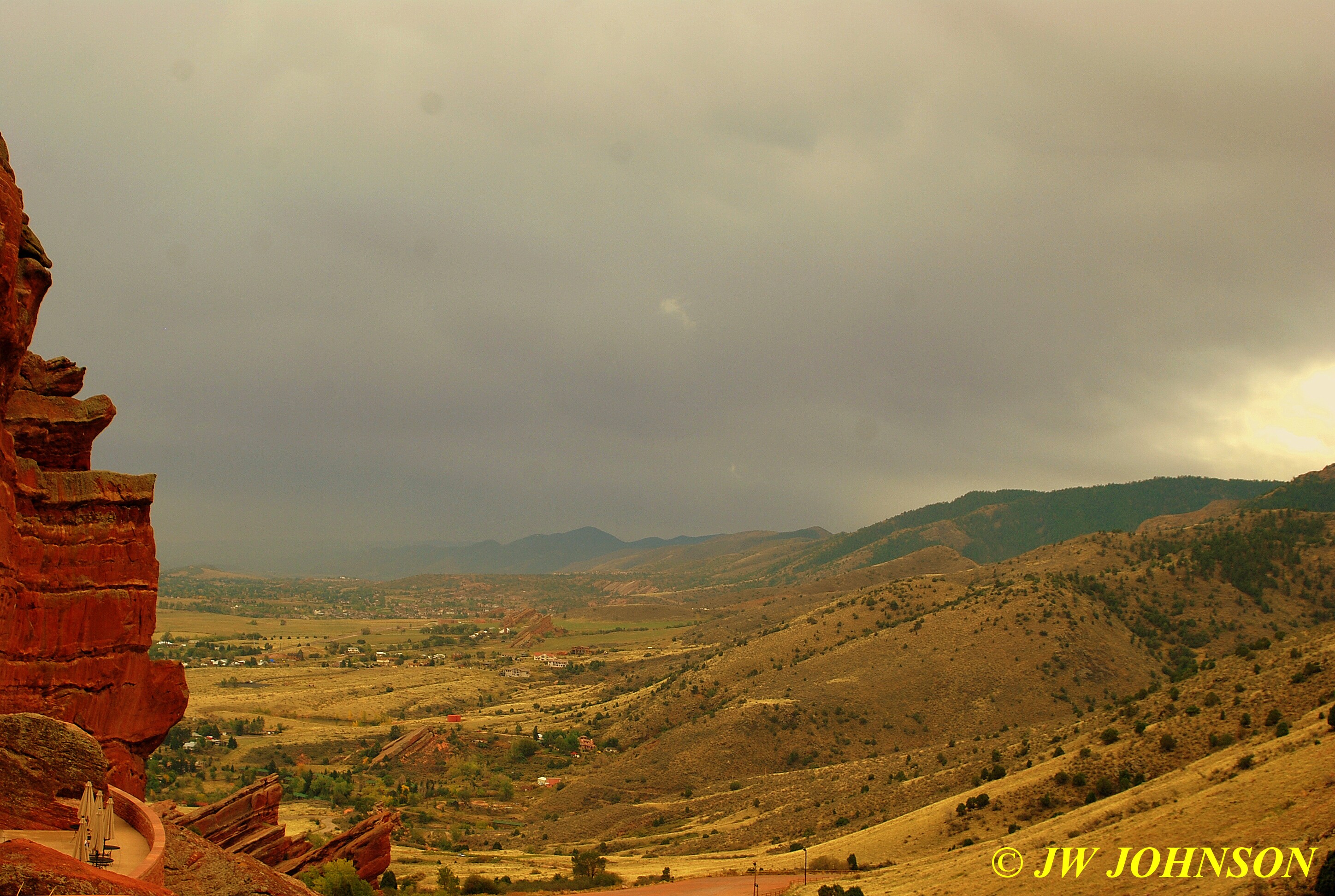
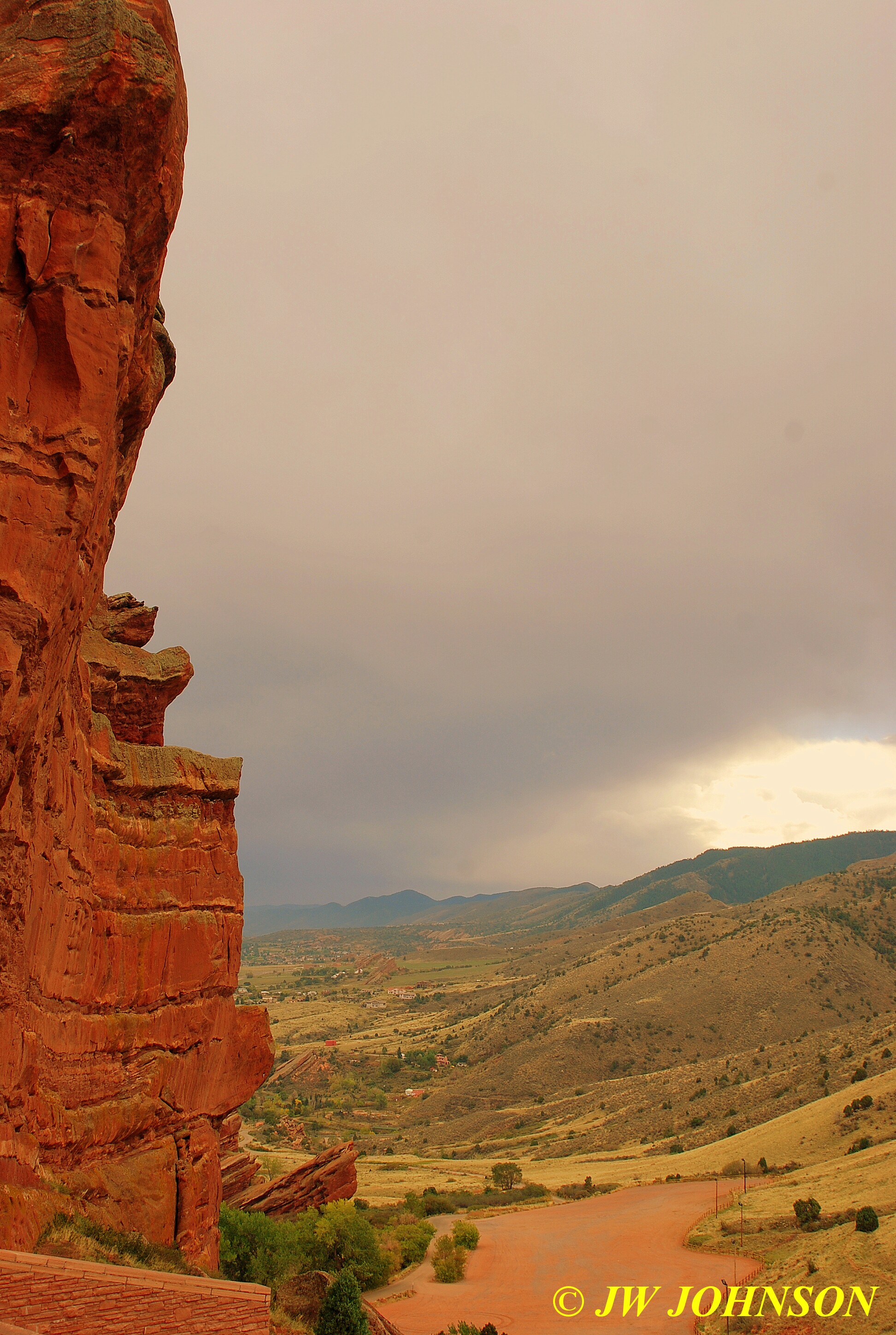
…I was really impressed with the tall stately red rocks on either side of the ampitheatre cut…this was a nicely designed location for concerts and events, would have loved to have heard John Denver in this beautiful place.
…..and then we started back down the hill, driving through the tunnel cut into the red rock near the top….
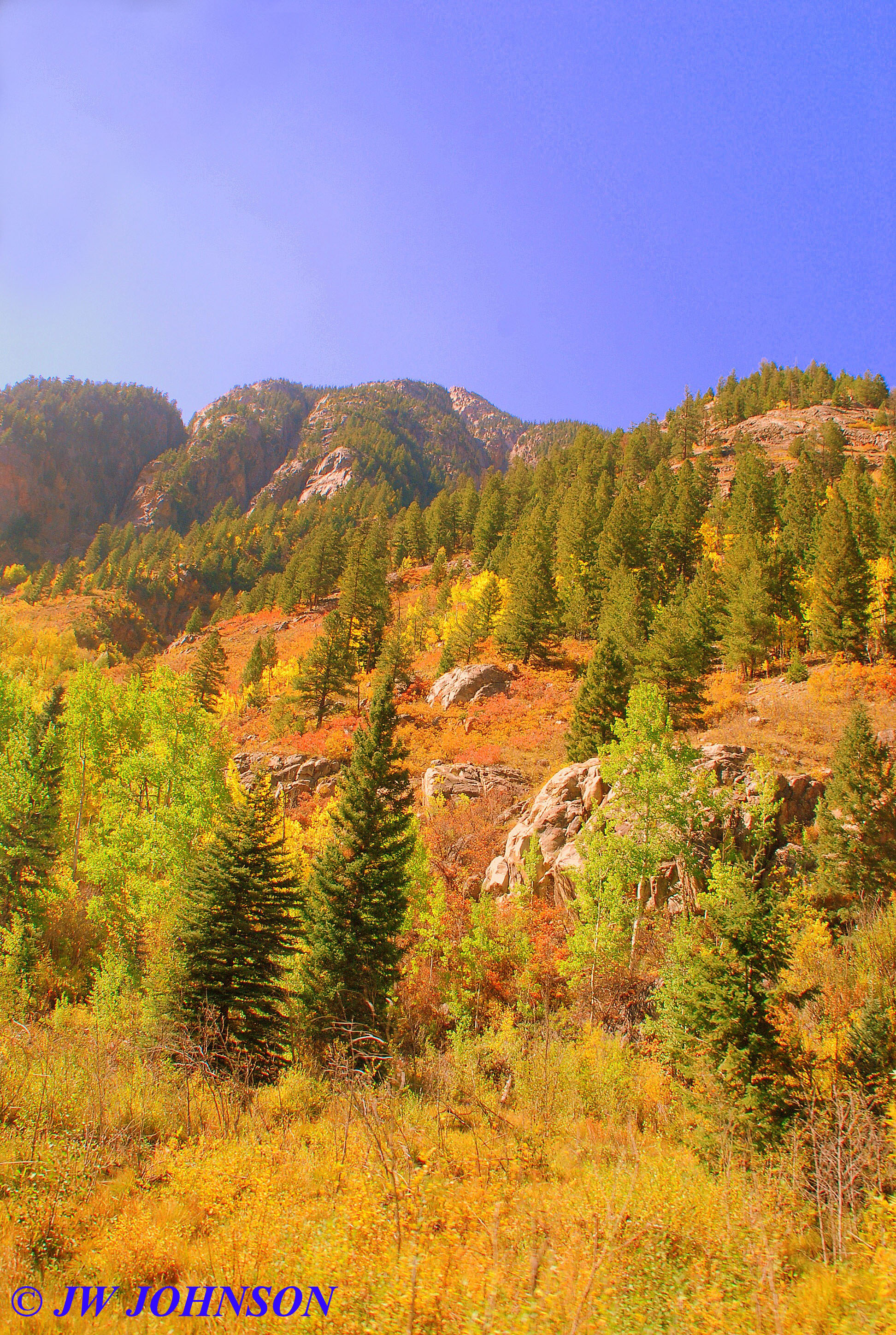
..and then back down to the town of Morrison, where we found the lowest price of gasoline all week, and stopped to fill the tank. We then drove north on 470 and crossed over the interstate into Golden and picked up Hwy 93 north through the valley…. and then turned west on Hwy 72 and started climbing up into the mountains. We started seeing color as soon as we gained some elevation and began our Peak to Peak Highway drive for the afternoon, following Coal Creek to the top of the hill and then started down into the valley on the other side. We began to see some snow capped peaks ahead as we started down that hill….
…and some interesting clouds as well as some storms at the higher elevations…despite having driven across Kansas through rain showers, it soon became obvious that there were still some weather here as well, but luckily it was supposed to clear off the next day.
Halfway down the first big hill, we stopped at a series of switchback curves to photograph the color and snowcaps once again…
..and then turned north on Hwy 119 and drove into scenic Nederland. We turned east on 119 and drove a few miles out of town to see Boulder Falls, but after driving about ten miles and not finding the parking lot or sign for it, we returned to Nederland and turned north on Hwy 72. We climbed to the top of a pretty ridge soon after….
…and as we drove down the highway, around every turn, it just got better and better….

…and right after we stopped to photograph this pretty meadow below..
 .
.
…we saw a gravel road turn off and I could see a neat fence and some color down the road, so we turned around and headed back to this beautiful aspen grove with an aspen pole fence surrounding it…
….and shortly after getting back on the highway, we came across this pretty wood frame barn and corral set against the pretty aspens up on the hill behind it…
…. we continued north on Hwy 7 to Meeker Park where we stopped to photograph Saint Malo Chapel, located on the west side of the highway, and at then entrance of a retreat called Saint Catherine. This was one of the sites of interest I found while researching the Forest Service sites. Its a beautiful stone chapel built on a chunk of granite, with a pretty little pond in front of it, surrounded by lush fall scenery, which makes for great reflections….
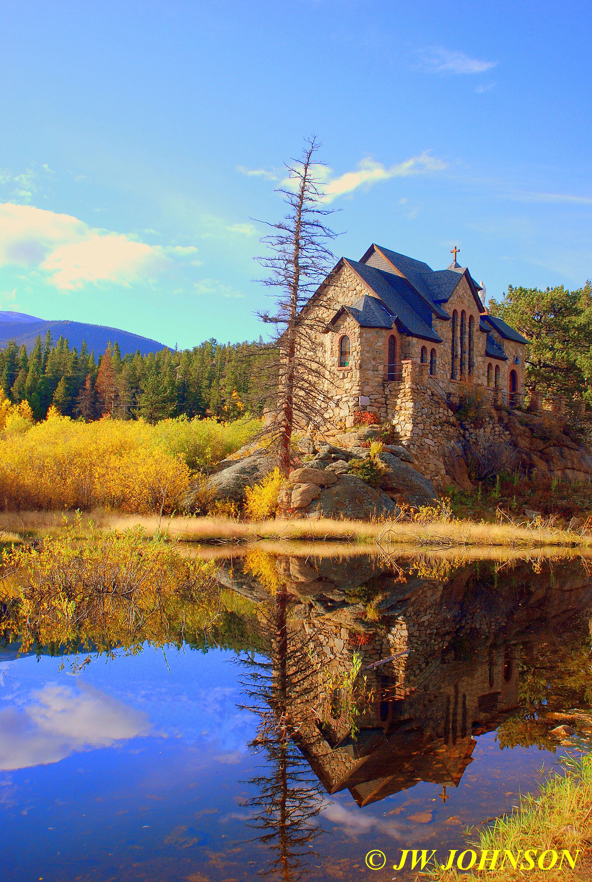
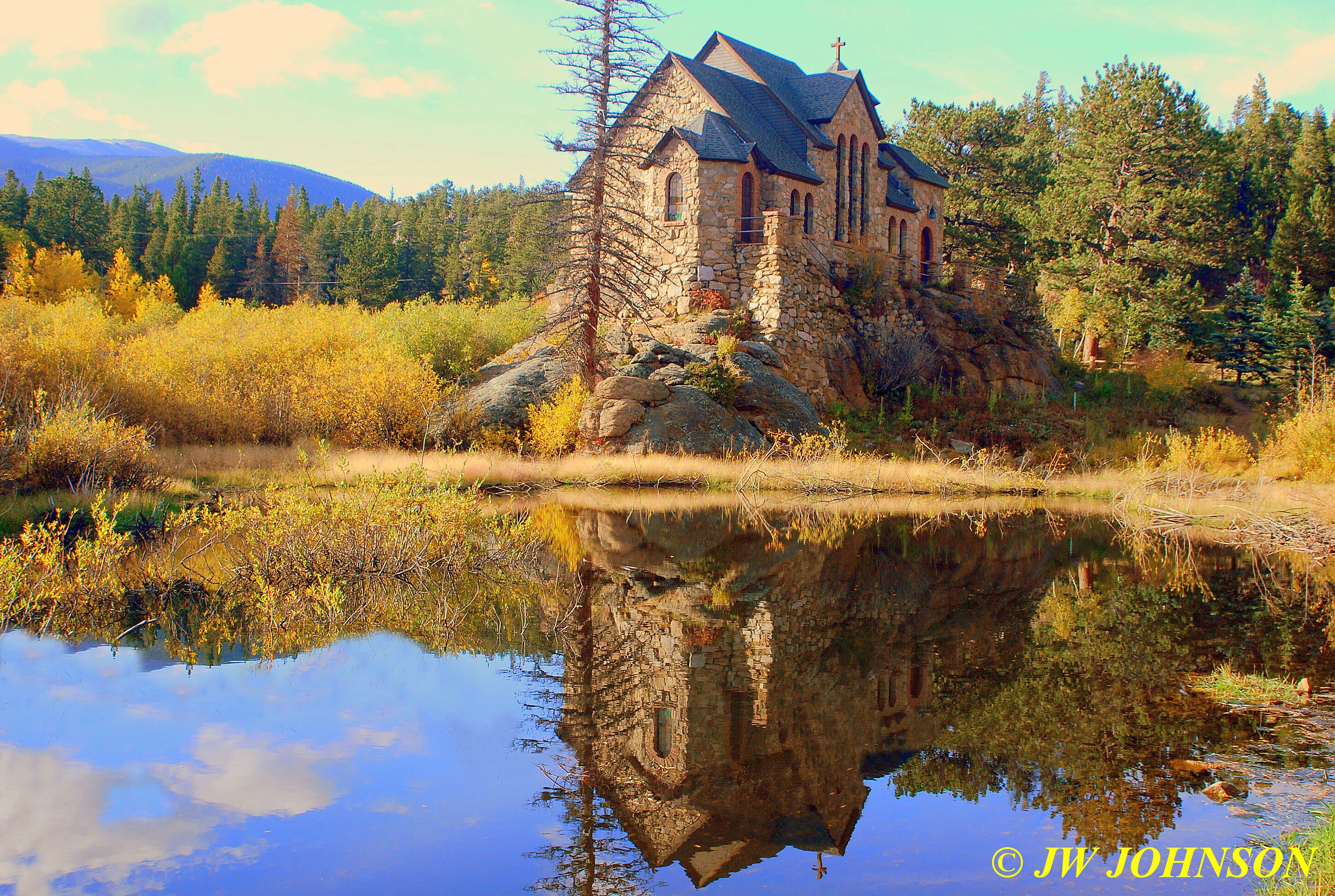
…to the left of the chapel and out of sight in the background, is a huge lodge that is part of the main retreat, and is the updated and rebuilt version of an older lodge that suffered heavy damage after a bad forest fire last year in that area. On a hill above and behind the chapel, is a large white stone cross, too…very pretty place and well worth the stop.
By this time it was about an hour before dark and we decided to turn back and head for our hotel at Longmont. We doublebacked on Hwy 7 and began a long descent down the mountain through a narrow canyon, with steep rock walls on the north side and a cascading creek on the south side, that turned into red rock walls as we entered the city limits of Lyons, and then picked up Hwy 66 to Longmont, just a few miles to the east. We arrived at the Longmont Super Eight on Main Street just before sunset and again, found a very nice hotel to stay in. After walking Missy for a bit, I ordered a pizza from Papa Johns nearby and shared it with Mom and Dad.
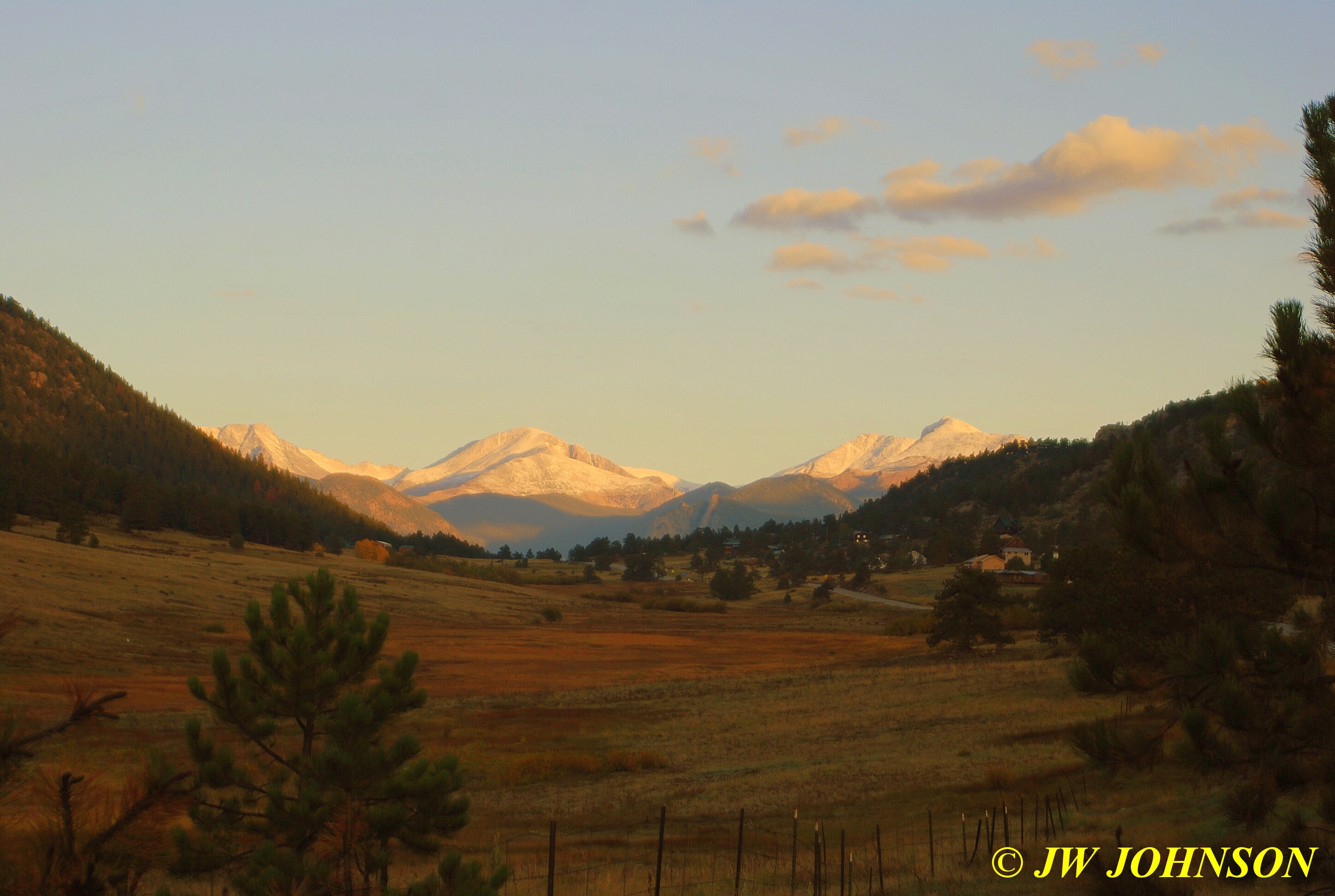
We rose early once again, with a need to get into Rocky Mountain Park by 9 am, so that we would be able to drive up to Bear Lake rather than be stuck riding the shuttle bus up there and back. The Forest Service controls the amount of traffic on Bear Lake Road mainly due to construction crews working in two separate areas on the road on two various issues, widening the roadway and also rebuilding a retaining wall along the road in two areas. We had been hearing from friends who were there a few weeks before, that we definitely needed to go to both Bear and Sprague Lakes. We drove up through Lyons and on our approach to Estes Park, the sun came up over the hillside behind us in a beautiful sunrise…

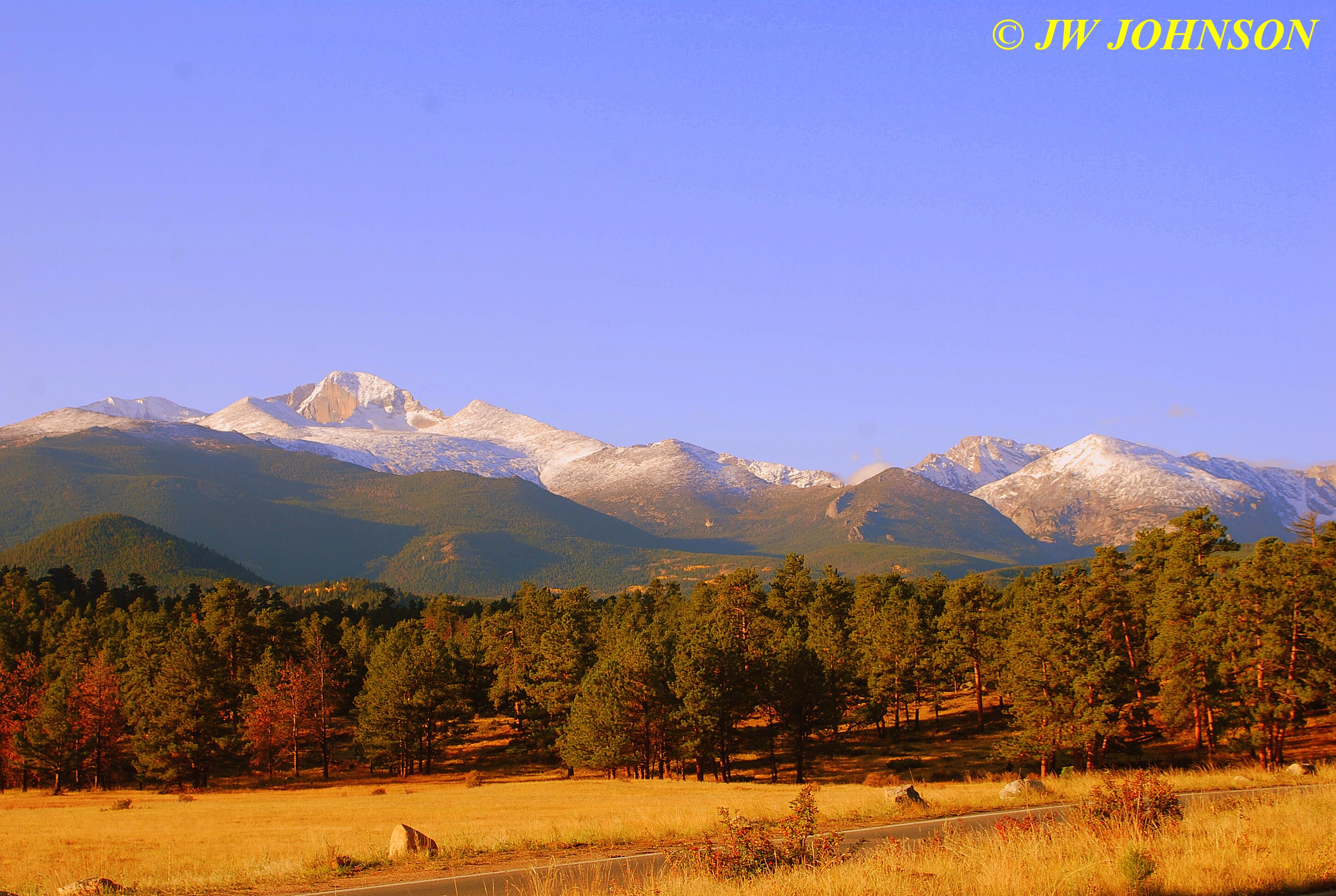
..and a few minutes later, we saw this beautiful scene as we drove down the valley of Elk Meadows on approach to Estes Park...
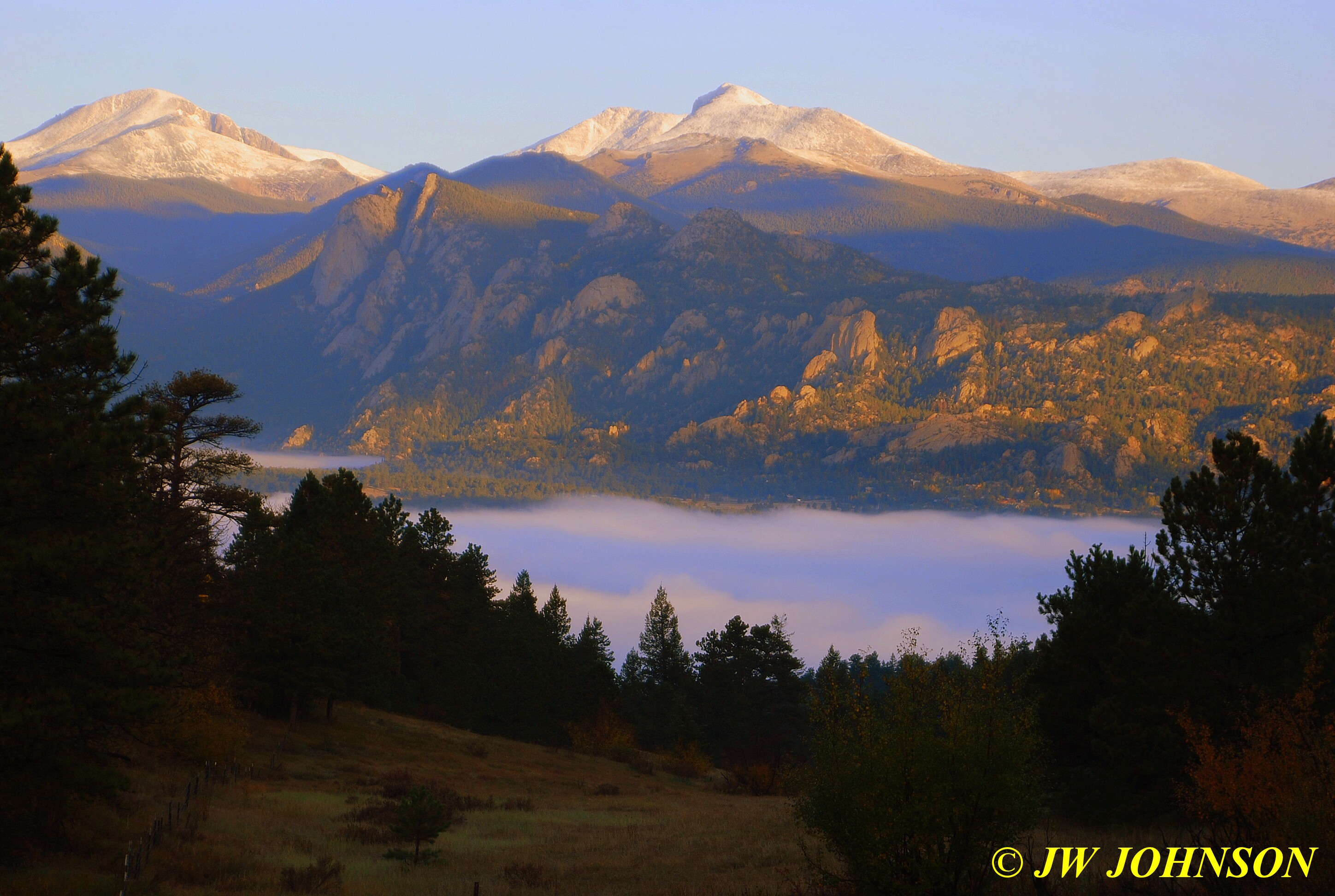
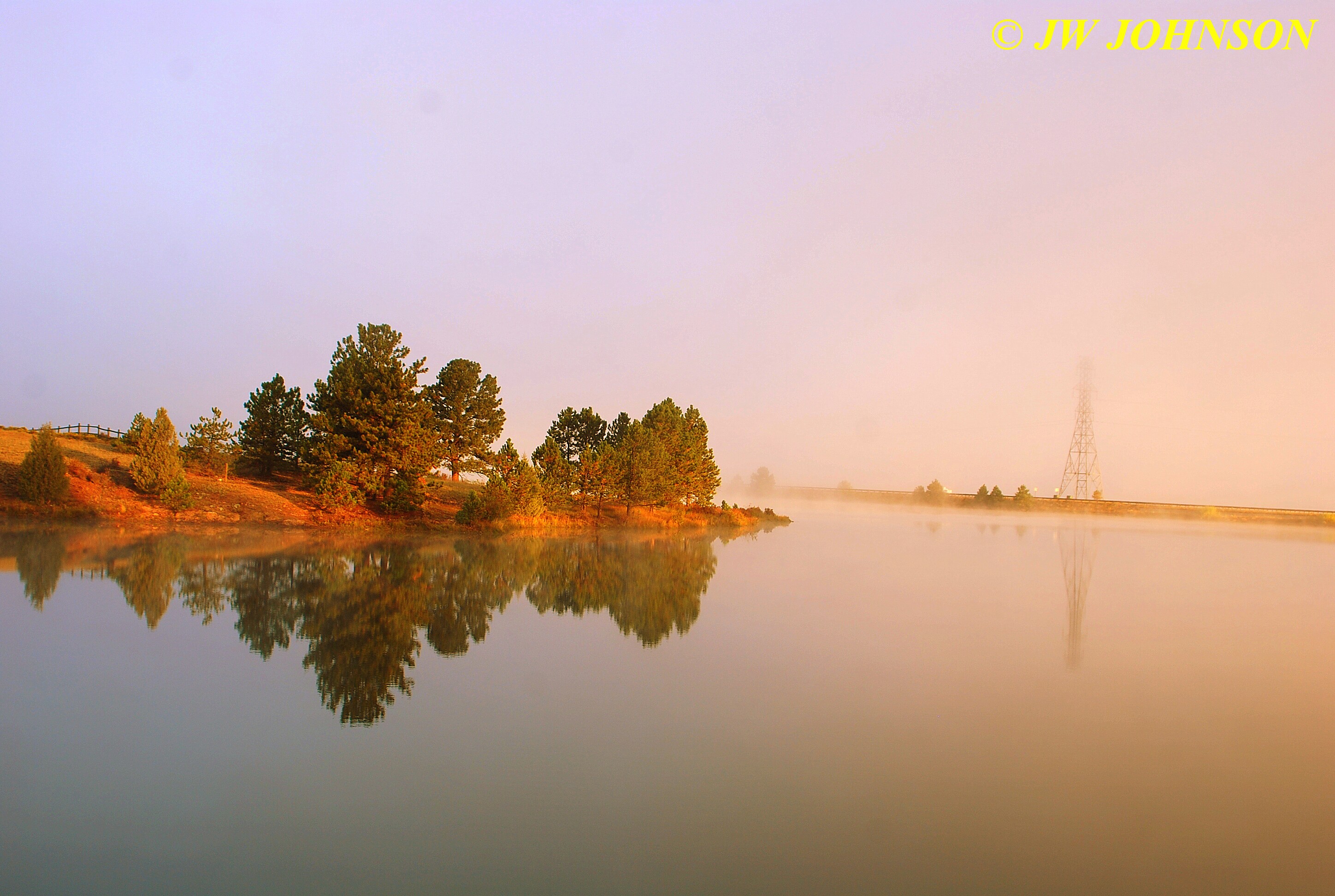
….we then dropped down a big hill into the valley of Estes Park. As we were starting down this hill, I looked off to the side and spotted this pretty layer of fog covering the reservoir at the foot of the hill….
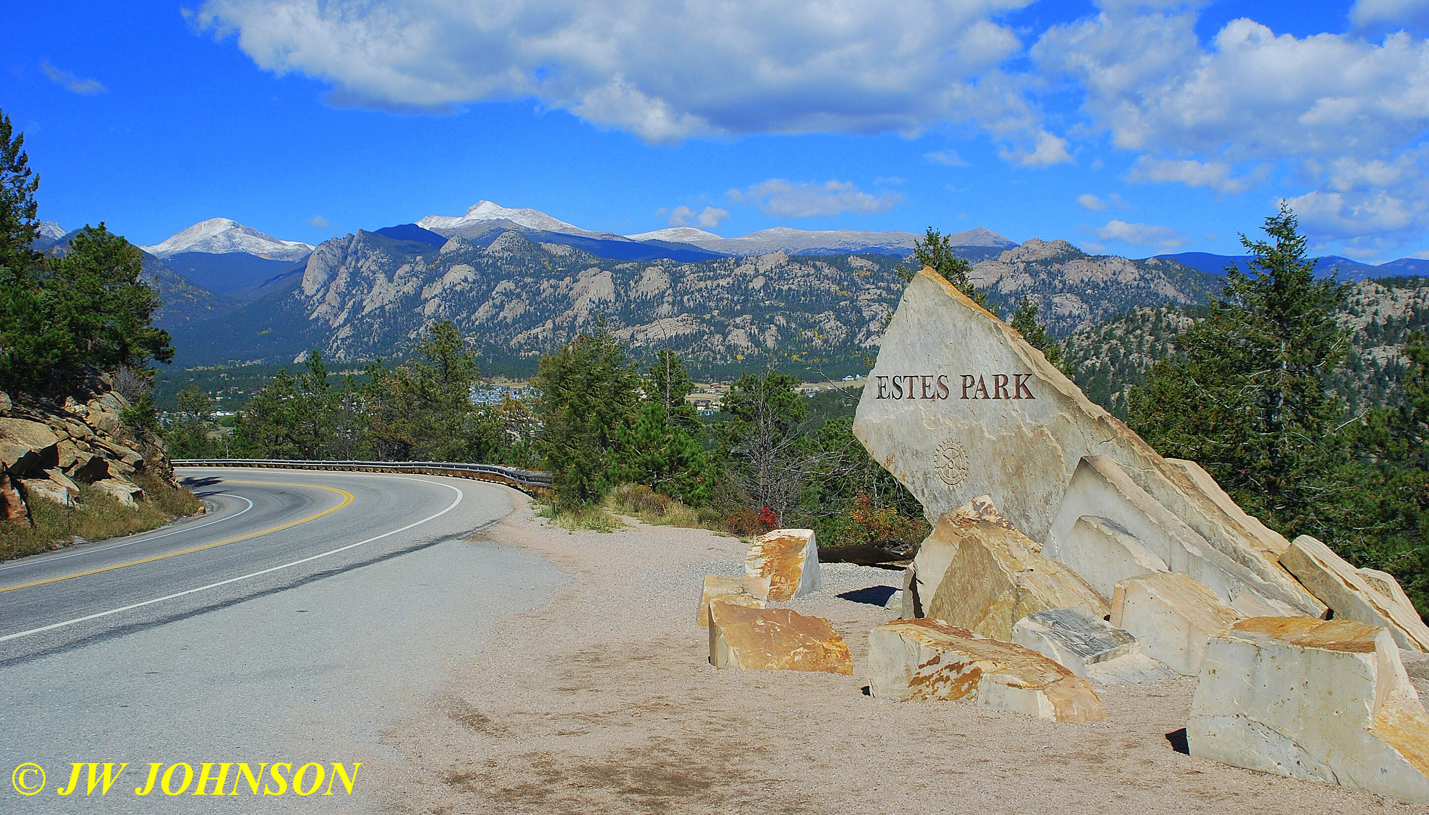
…and halfway down this steep hill, we came upon this pretty sign, that Mom wanted to stop and photograph….I dont normally stop and photograph signs, but had to admit this was a very pretty sign with a great view behind it, save for the guardrail and roadsigns….
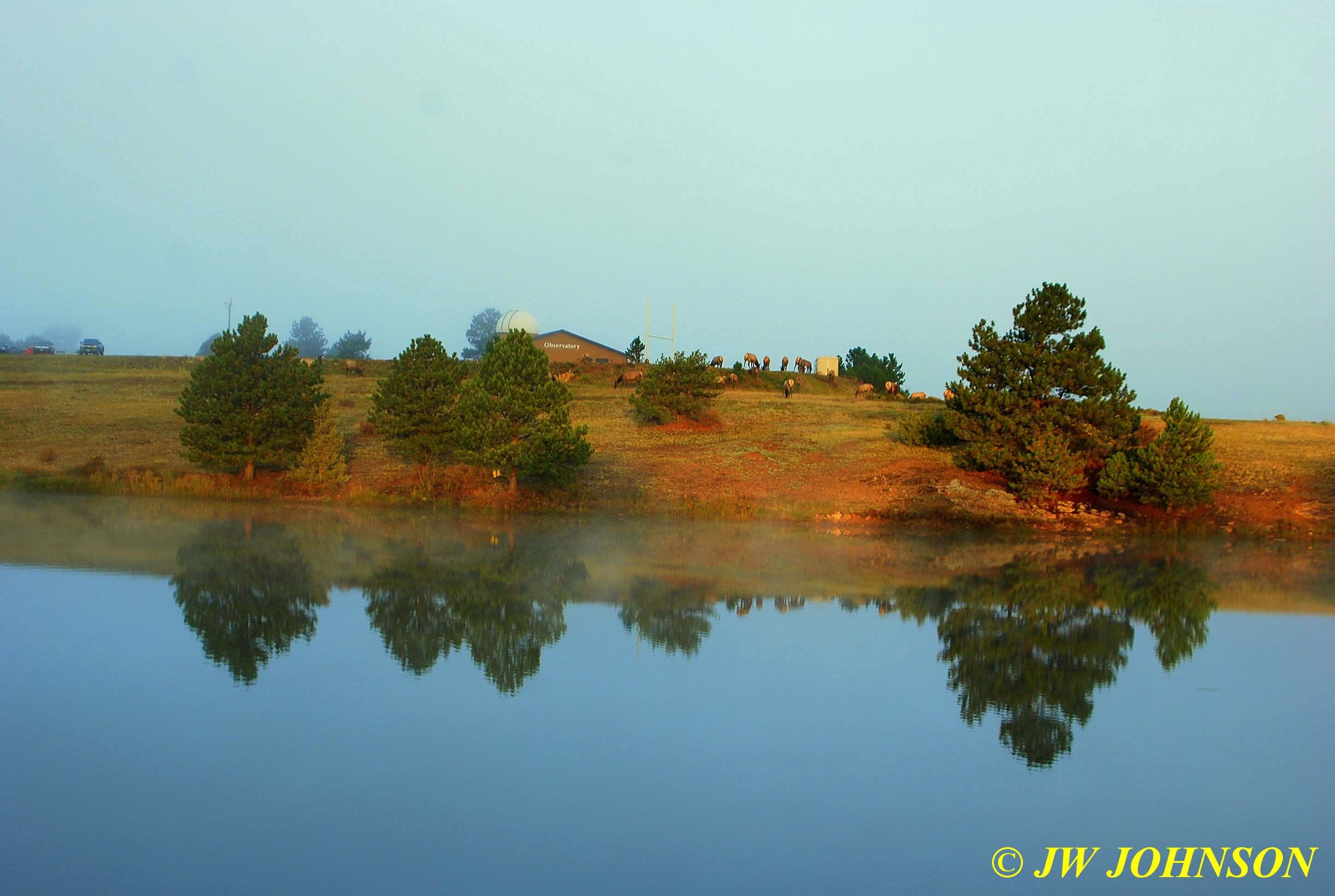
…at the foot of the hill, we spotted a small herd of elk in what appeared to be a city park on the shores of the reservoir…
..so we turned down a side street and pulled off where we could safely photograph the elk herd on the far bank….
…after shooting a few photos, we decided we would likely see more elk in the big park, so we headed toward the park entrance once more. We drove through Estes Park and as we approached the entrance station to Rocky Mountain National Park, next to a very pretty and scenic campground, we saw this beautiful vista in front of us looking to the west….
…and then on toward the entrance station, we started seeing elk on both sides of the highway….
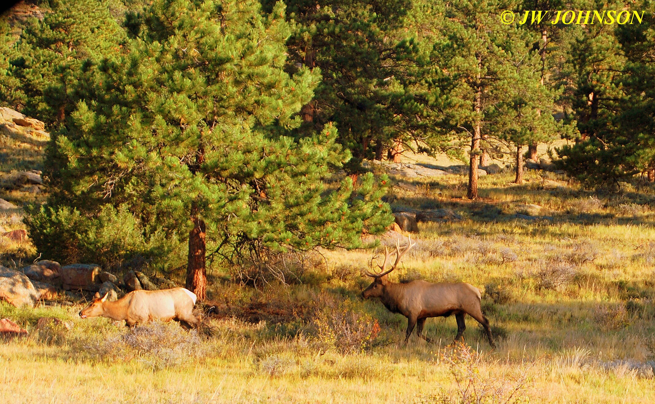
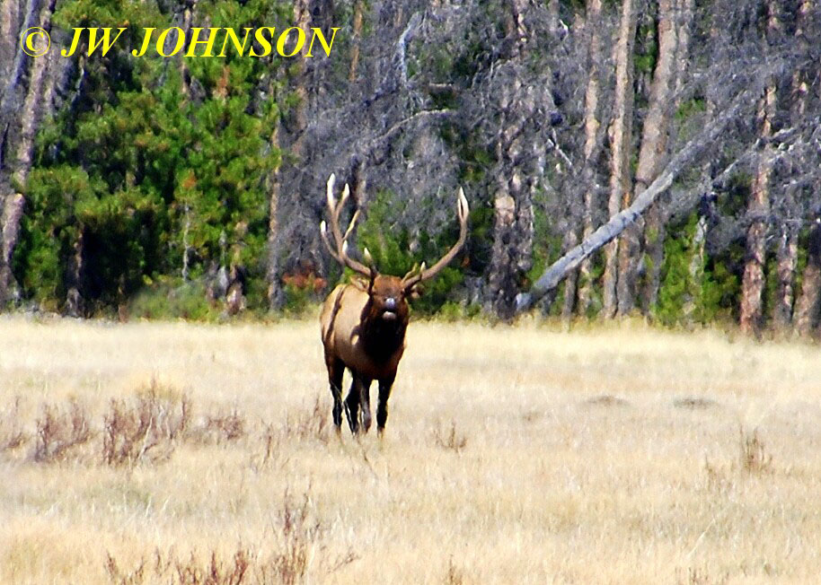
…we first saw three elk in this meadow grazing on the grass, three bull elk I should say. Initially, these two guys to the left were peacefully grazing side by side….
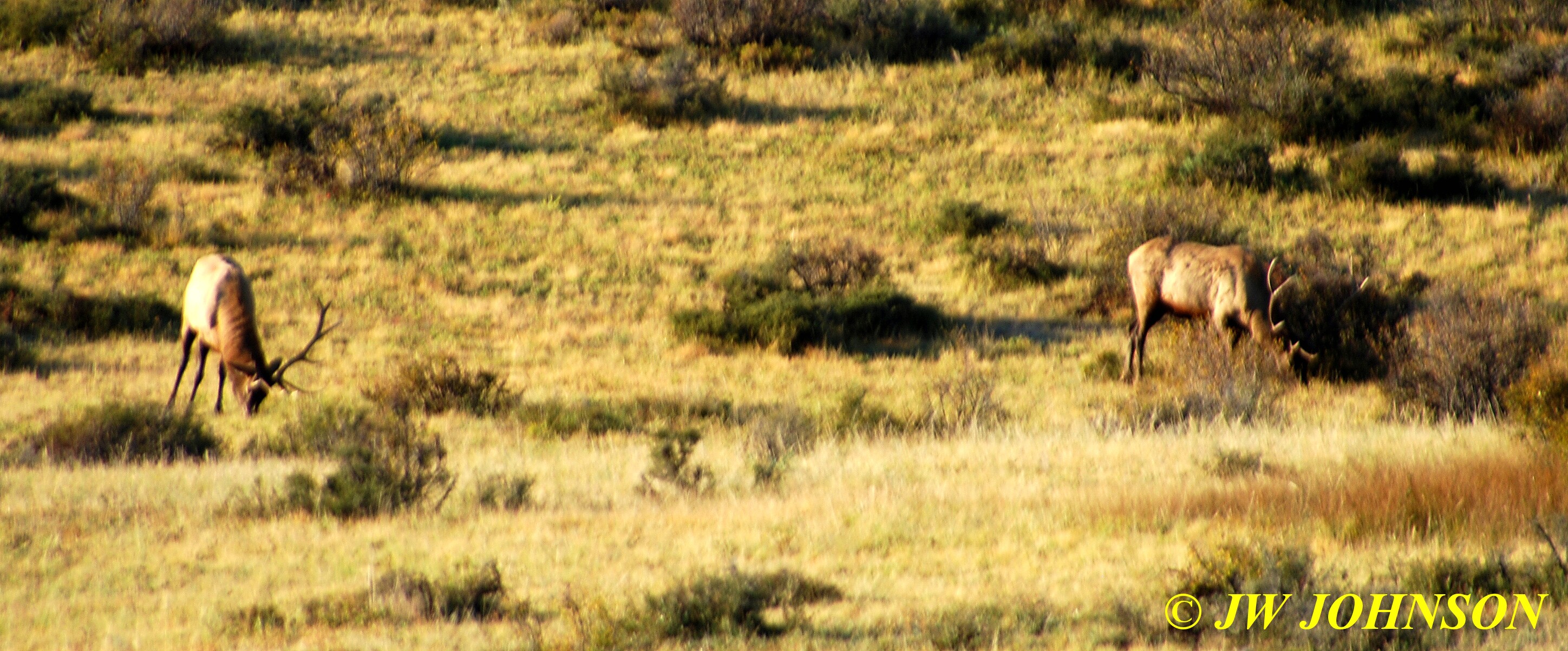
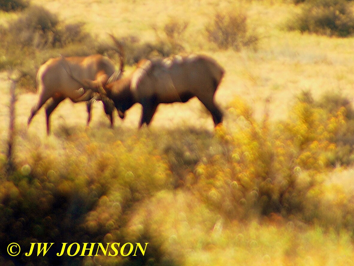
..but after a few minutes, peace went out the window and they were fighting…
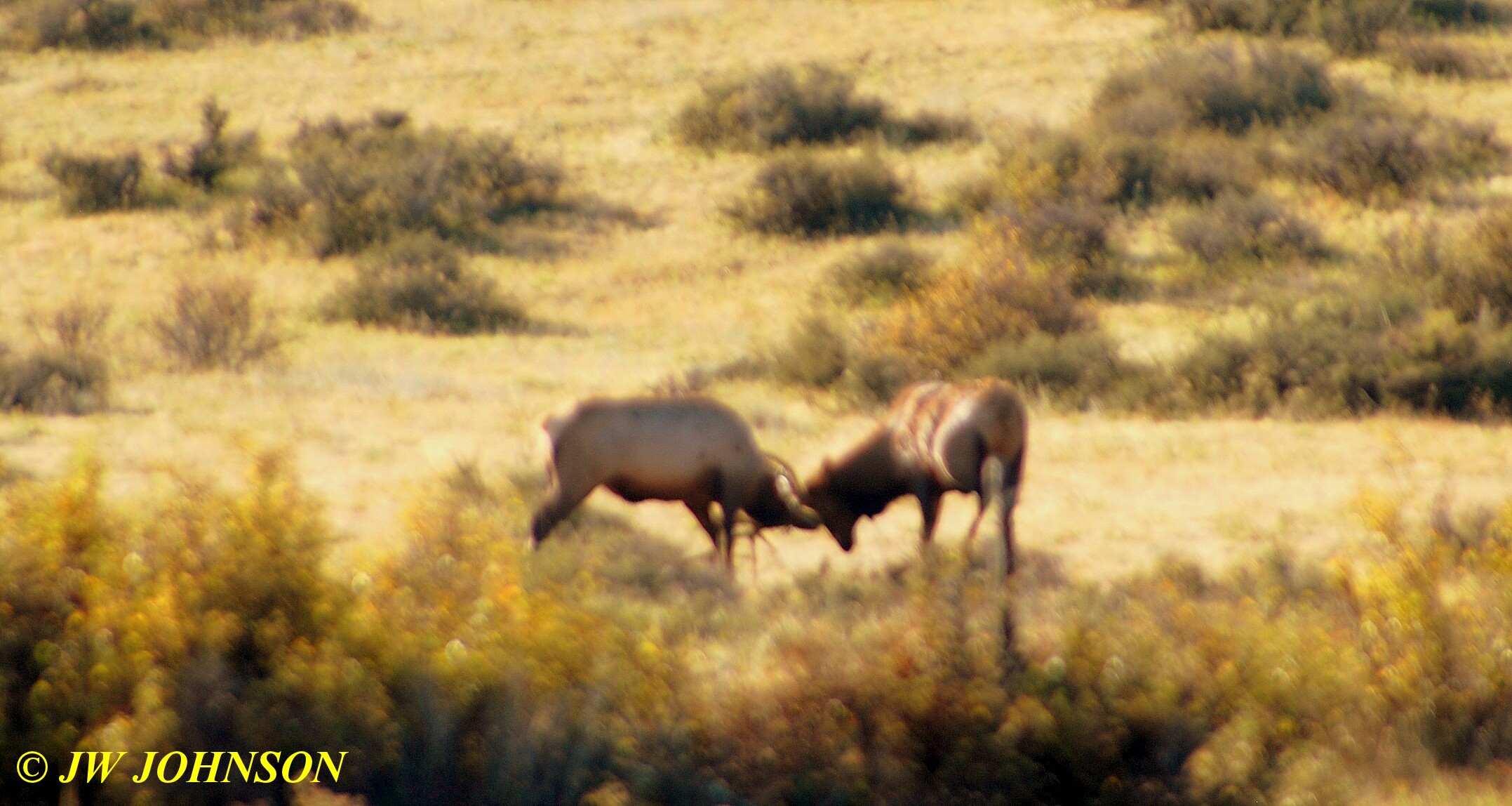
…sorry for the blurry photos but these two guys wouldnt stop moving for me….
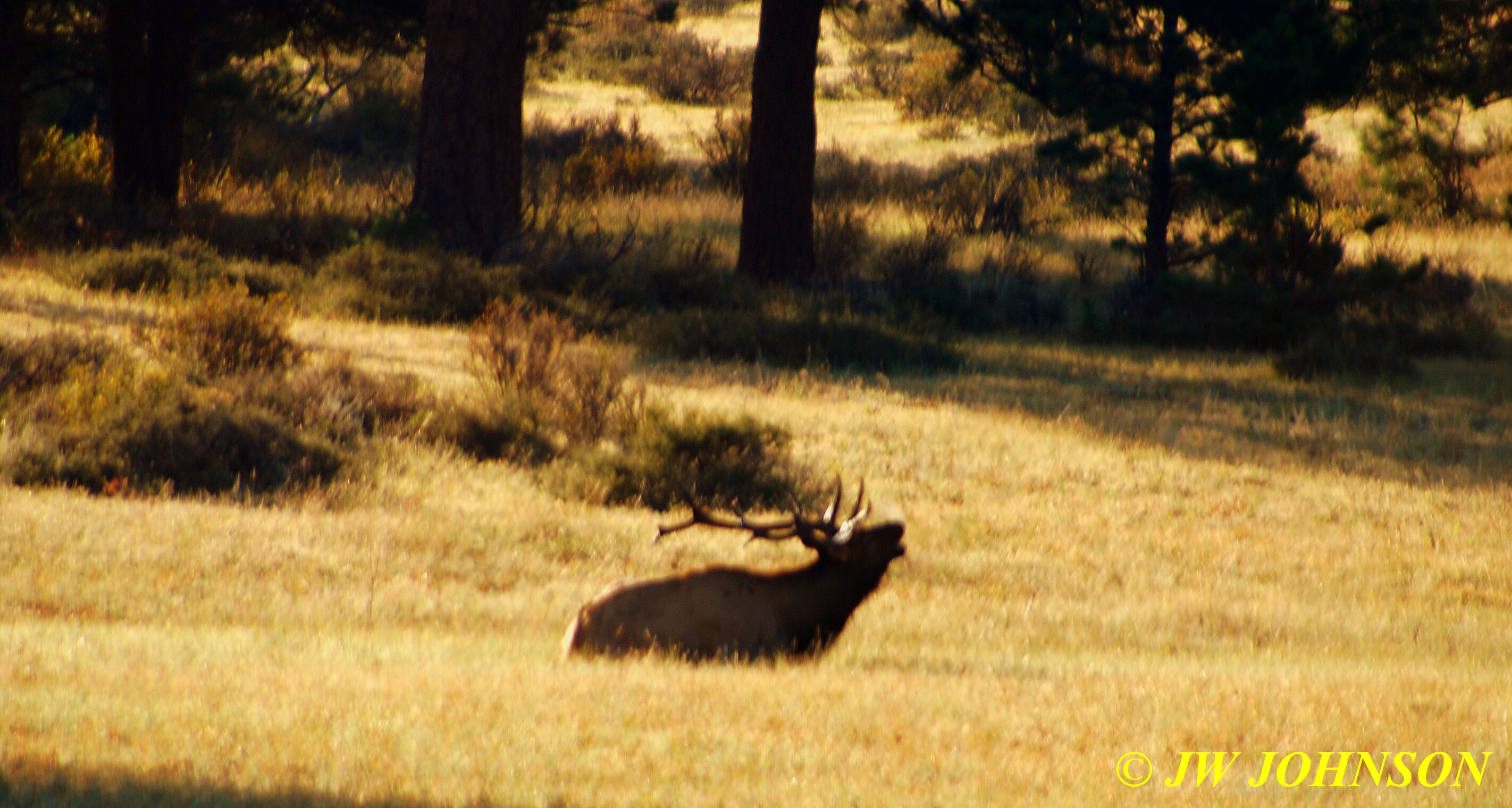
…and reclining nearby, watching the fight, was this guy……

…as we stayed to watched him, he soon began bugling…this was their mating season and so the bulls were bugling and chasing the female cows during their rutting season…

..we drove closer to the entrance to the park, and spotted this guy chasing a couple of females around up on the hillside not far from the roadway….
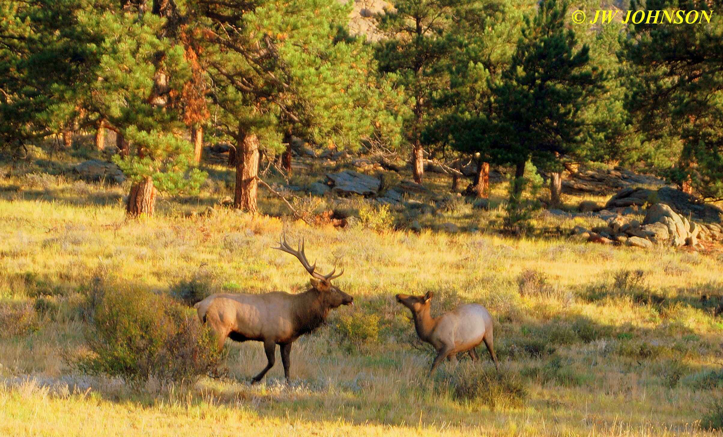
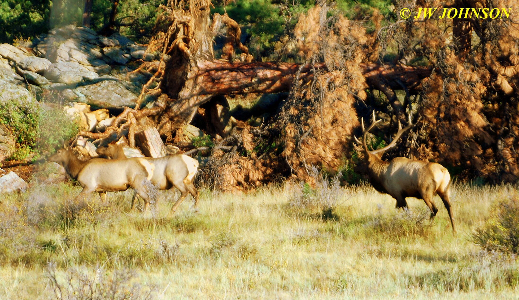
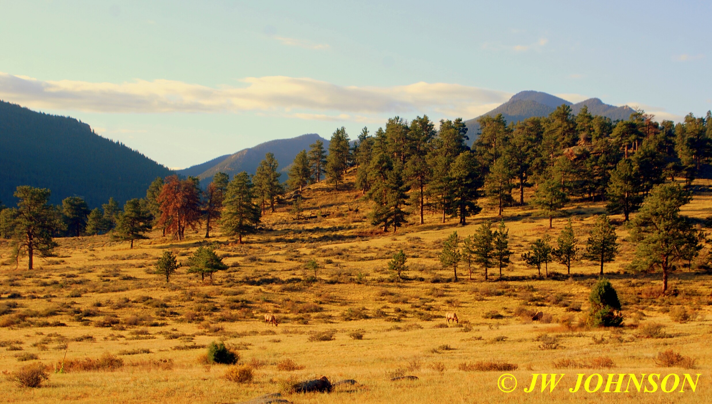
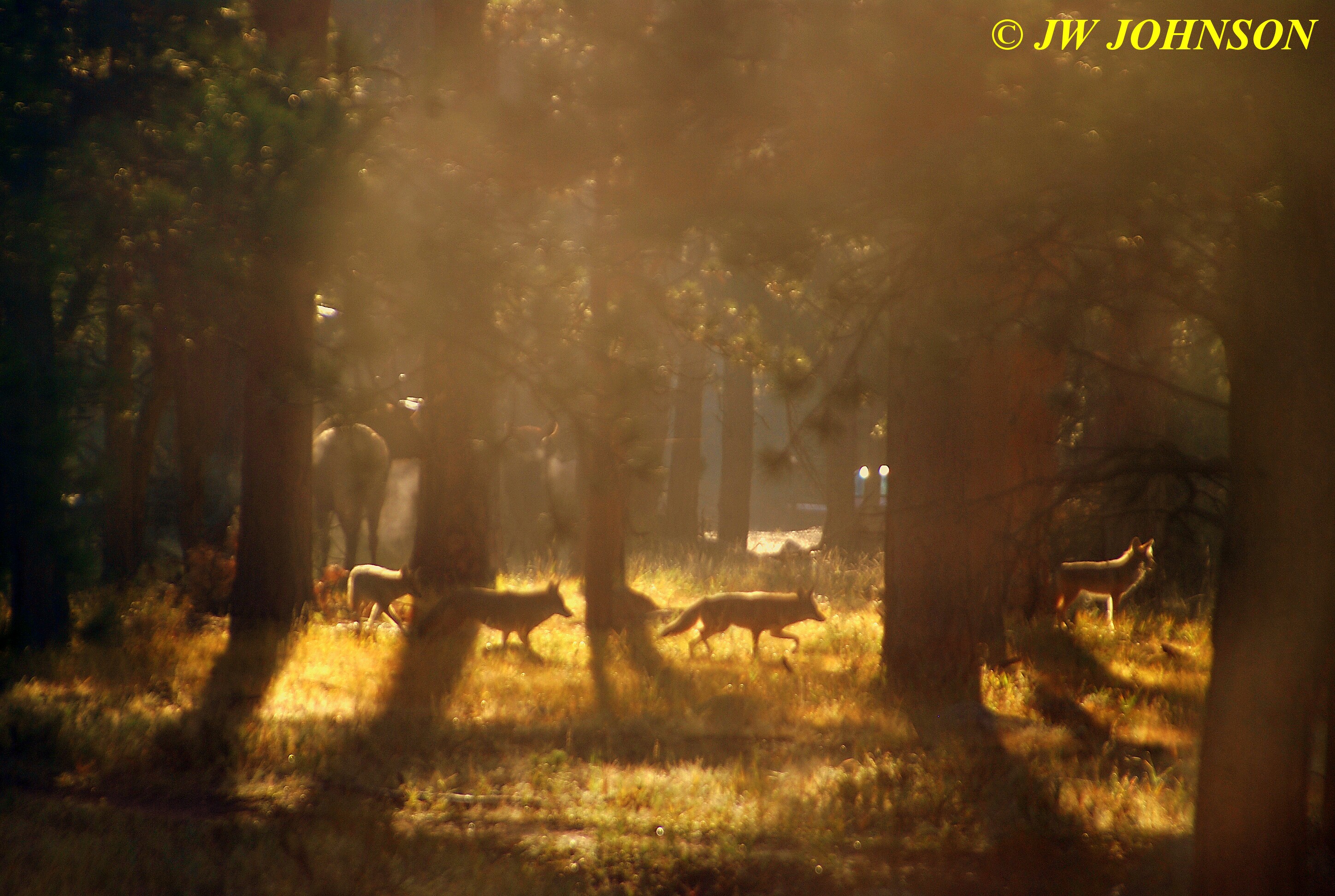
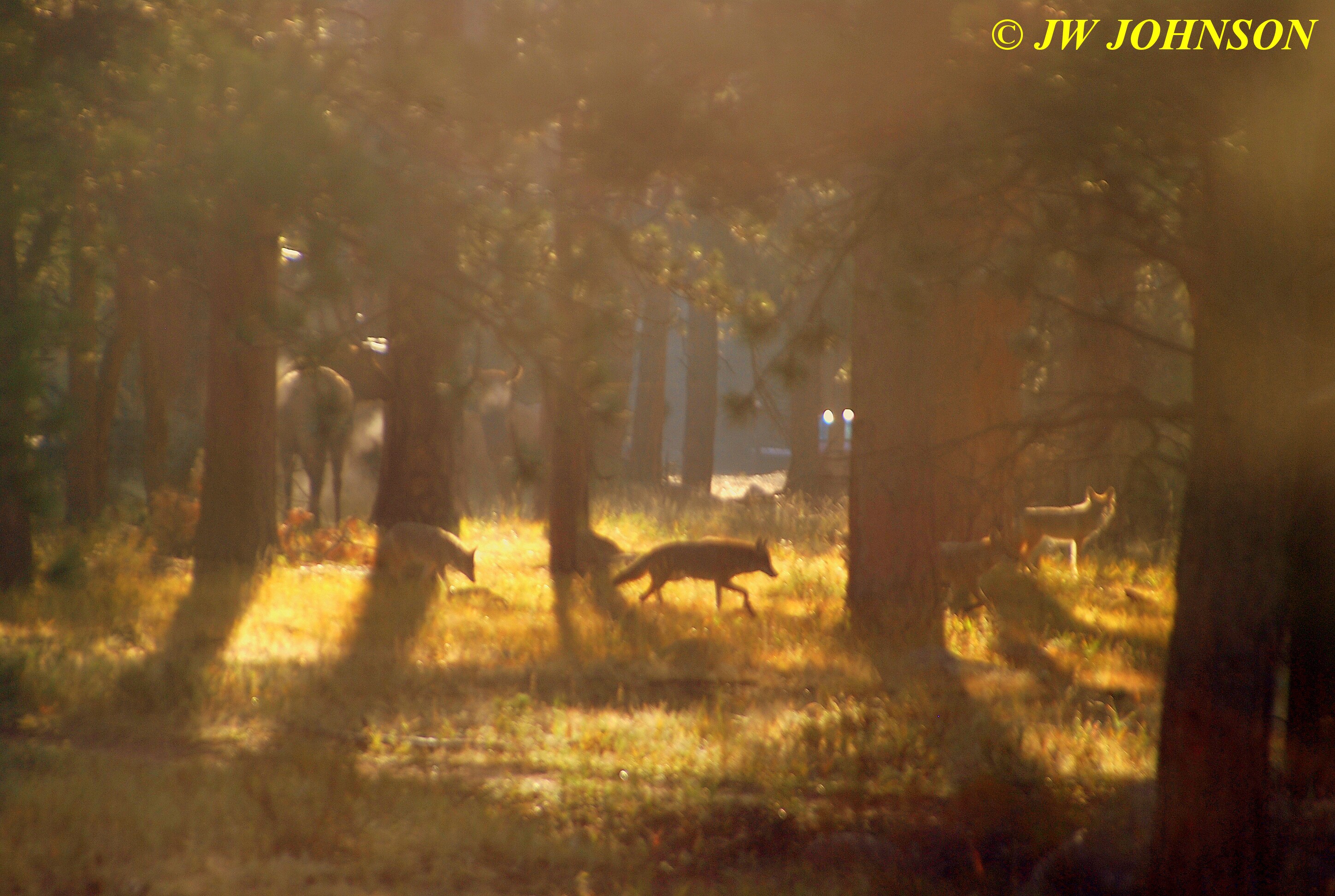
We could have stayed there all day and photographed the elk…. they were all over the place…. even a few of them taking naps in the driveways and yards of nearby residents. We decided to get on down the road to Bear Lake, so after talking to one of the friendly rangers at the entrance station, we headed to Bear Lake. We were only about a mile down the road, when I suddenly spotted movement at the foot of the first hill on the left side, and pulled over. I grabbed my camera and walked to the opposite shoulder and squatted down to see and photograph a bull elk sitting on the ground under some fir trees with two cows standing to either side of him and a little bit of morning fog rising around them through dappled sunlight…that was likely the movement I spotted…..however what I didnt see in that fleeting moment, but now saw from the side of the roadway, were four wolves sneaking up on the elk…they appeared to hear me photographing them, and turned to leave….I was in AWE…I never expected to see or photograph half of the wildlife that we saw that morning, let alone four wolves !!! The next few photos show you what I saw there….

Driving on down the road, as soon as we made it through both of the construction areas, and climbed up in elevation, we began seeing some gorgeous color on both of the hillsides on either side of the road…
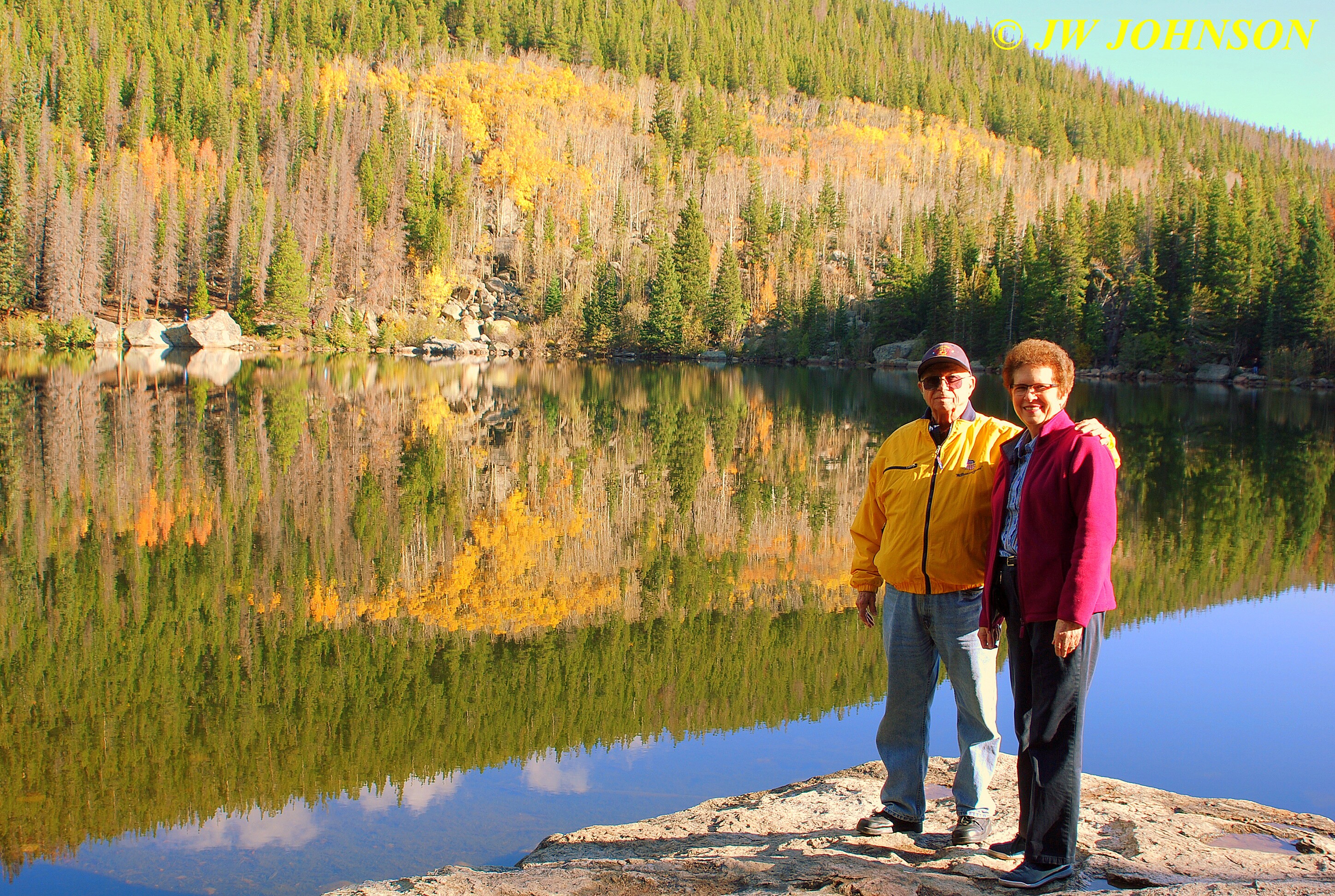
…and then on to Bear Lake…which was a treat in itself…alot of pine and fir trees on each hillside, with a few aspens in the middle of one hillside…nearly non existent on the other side…we walked around to where a few large rocks jutted out into the water from the bank ….and I photographed Mom and Dad on the rocks…
..Mom and I got our wish…beautiful blue skies and some fluffy white clouds, which we only saw late the previous evening. We had to leave Missy in the suv due to restrictions on pets in national parks, luckily it was fairly cool at this elevation. From here, we drove over to Sprague Lake, about a third of the drive back. There were a lot less people at Sprague Lake…and a few were preparing to catch some trout…there were bigger and fluffier clouds in the sky above, as well as more aspen trees in color around the lake…
…we soon left this lake and returned to the highway, turned west and started up the mountain, climbing steadily toward the divide pass. Our ears popped several times, as we climbed 14,000 feet to the top of the divide. We stopped near the top where there was a little snow on the barren ground, and let Missy out for a short walk. At one of the stops, we talked to a few people who live in the Brentwood area, near where I work in St Louis County….they were vacationing out west for three weeks and were just on their way home.
We started down the west side of the divide and quickly realized we had a brake problem on the trailblazer…apparently the brakes glazed over halfway down the steep slope, and became very hot…in fact, it seemed the suv in front of us had the same problem as we could smell the hot brakes on their vehicle. It was a long way down that hill let me tell ya, and by the time we got down there, I was beginning to wonder how the rest of the trip would go as we had several mountain ranges to cross yet.
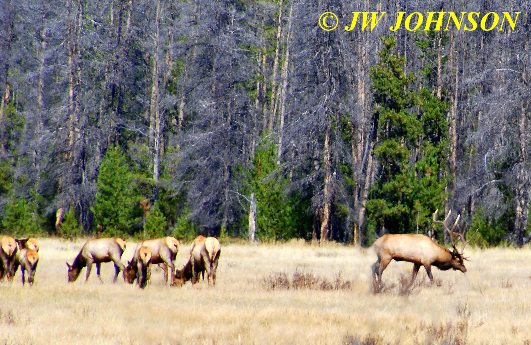
Just as we were leaving the park on the west side, we spotted a herd of elk in a huge field. I wasnt able to shoot any good photos due to the distance across the field to the elk, but we soon spotted a road to the west and turned down it to see if it would get us any closer to the herd. Dad had spotted some buildings near the herd and speculated that this road likely led to those buildings. As we neared the field, we spotted two rangers picking up damaged sections of a pole fence and stopped to ask for permission to walk to the edge of the field and photograph the elk. They were okay with the idea so I pulled off into the shade and grabbed my camera with the large lens and walked down into the small wooded area at the edge of the field.
From the highway, all we could see was a large herd of what appeared to be elk grouped together in the field…when I walked to the edge of the field through the small patch of woods, and raised the lens up, I was pleasantly surprised to discover a large bull elk standing in the middle of about thirty cows a hundred yards or more away in this field……
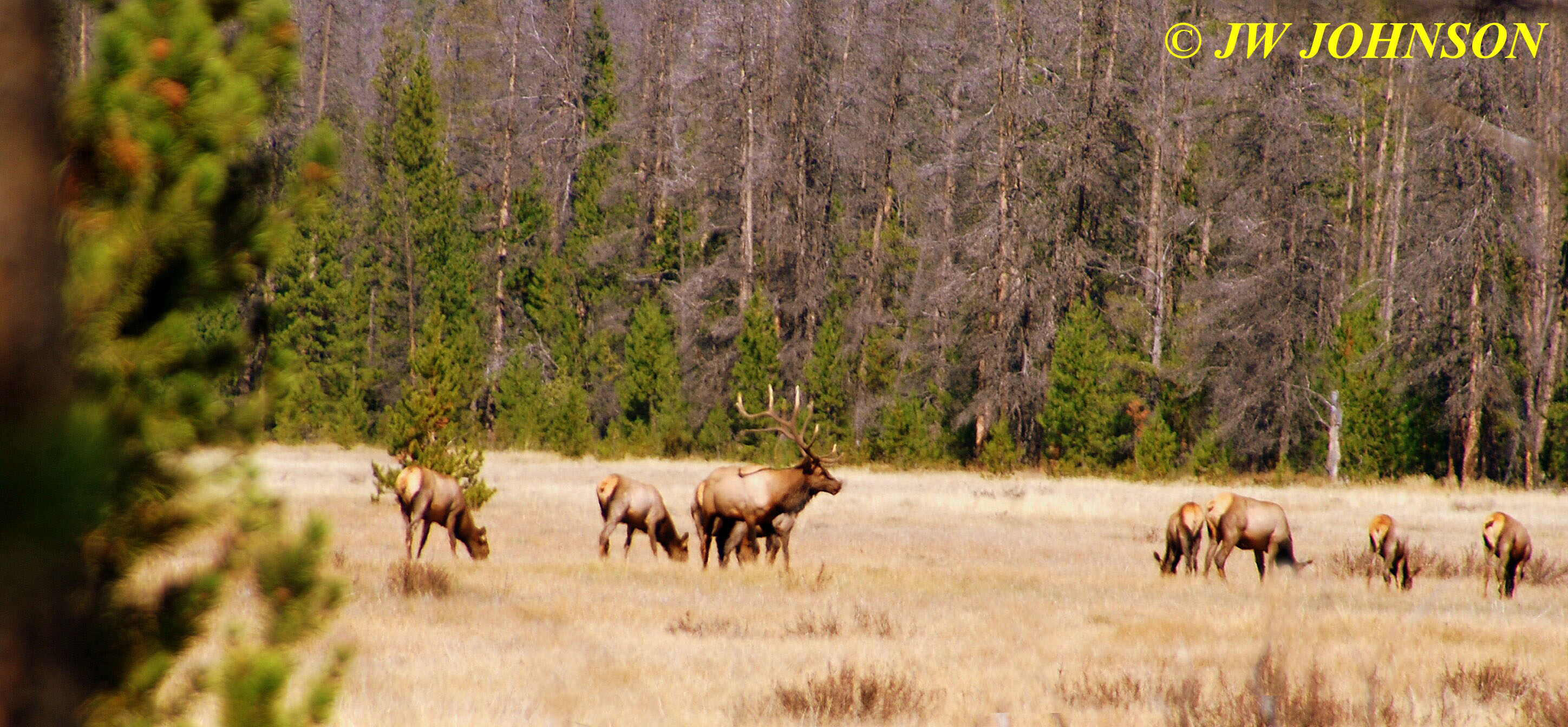
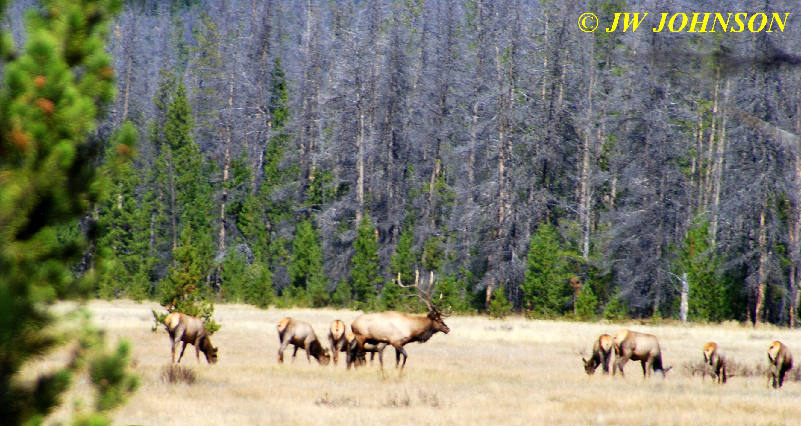
…as I was standing there snapping photos of the herd and bull elk, a couple of guys pulled up and parked, then walked down to where I was standing…they turned out to be a couple of guys from the Colorado Springs area who had spotted the herd as well and drove over in much the same fashion as we did, seeing if the road would get them closer. One of the men had an elk call and said he would use it to see if he could get the big boy`s attention and see if he would come closer. One of the guys said the bull elk was one of the biggest seven pointers he had ever seen. The other guy tried the call several times, imitating a female cow in heat…and while the big boy alerted to the call several times and bugled a few times…
..he never did take more than a few steps in our direction. As I told those two guys, who could blame him…would anyone in their right mind leave a herd of thirty gorgeous gals to go check out one ” possible ” gal ???? I dont think so…when I left to walk back to the suv, they were still trying the call….and all he was doing was walking around…
We headed south once again through some beautiful scenery and soon came to the community of Grand Lake, on the shores of Grand Lake, which was very pretty with beautiful aspens clustered on the east shore hillside and very pretty log houses all over the hillsides too….
…and then on down to Lake Granby, which we also stopped and photographed at the marina, again with beautiful color on the far side up on the hillside….
…we stopped off in Granby and grabbed some water and then continued south toward Empire and I-70 again, where we intended to meet up with my buddy Ian, who is a geologist for Henderson Mine, one of the largest producers of molybdenum worldwide…I had another care package with me for him and figured we would meet up, hand it off to him and then head for Breckenridge to get some supper after a long day on the road…. and cookies and tea for lunch. As we drove through Winter Park, I gave him a call to see where he was at….
…and when he picks up, I asked him where he is at…he is up on top of a drilling rig at the mine making sure things are working properly…so we made arrangements to meet in Empire on the edge of town in about an hour…and it took us about an hour just to get through the next few little towns along the way and down off the mountain via several switchbacks….while waiting for him, we observed a guy pull up to an obviously dilapidated gas station with a very low price of gas advertised on the sign…the car had Colorado plates…the guy gets out and for some reason cant comprehend that the pumps are not workable…he then spots us sitting close by in the suv, and he walks over to ask us about it…as he was walking over to us, I mentioned to Dad that it must be a rental car and as he came up to our window, dad told him that station wasnt in business any longer… he asked if we knew if there was a gas station closeby…I told him he should probably drive back down to interstate and check for one, that we were visitors there as well and really had no idea. I hope he wasnt in desperate need of one at the time.
Ian came along shortly after and convinced us to follow him back to his place, twenty miles east in the Evergreen area, so he could give me a care package in exchange for the minerals and crystals I brought him. So we drove over to his place and after visiting with him at his beautiful country home, where the elk and the buffalo roam freely, we then headed west to Silverthorne…along the way, seeing the rails of the Georgetown Railroad and driving through the Eisenhower Tunnel, which was bored through the Rocky Mountains and is at least a mile or two long…the only bad part of this drive was coming down the long steep hill, after exiting the tunnel… after the previous problem with the brakes glazing over, it didnt take long for us to experience problems once again.
Howver we made it down safe and sound and turned south on Hwy 9 to head to Breckenridge…I had told my parents about this great place to eat at, called Eric`s Place…..its like an Applebees but located in the basement of a business strip of several stores along Main Street.
Since I had been there last, the city of Breckenridge had the highway re-routed around Main Street to relieve the tourist traffic congestion, and then created parking lots behind the businesses and along the Blue River. We parked behind Eric`s Place and walked down the stairs and inside..it was bustling but not yet full, and we were ushered to a table and provided with their large menu`s. This place has more flat screen tv`s on the walls than Applebees does. I was looking for the hamburger that I had told my parents about and didnt see it…so had to ask the waitress about it…she said they no longer carried it and had replaced it with some newer burgers and styles…Mom saw a salad that she liked the looks of and ordered it, Dad ordered their fish and chips, and I ordered a Calzone…and just like always, the food there was great…we came out to darkness and drove back up to Silverthorne, located our hotel up on the hill above the highway, the La Quinta Inn, and checked in for the night. What a beautiful hotel this was, it overlooks the valley, the town, and the interstate with a commanding view for only a few stories tall. The rooms were beautifully furnished and the beds had the pillow top mattresses…so I slept like a rock.
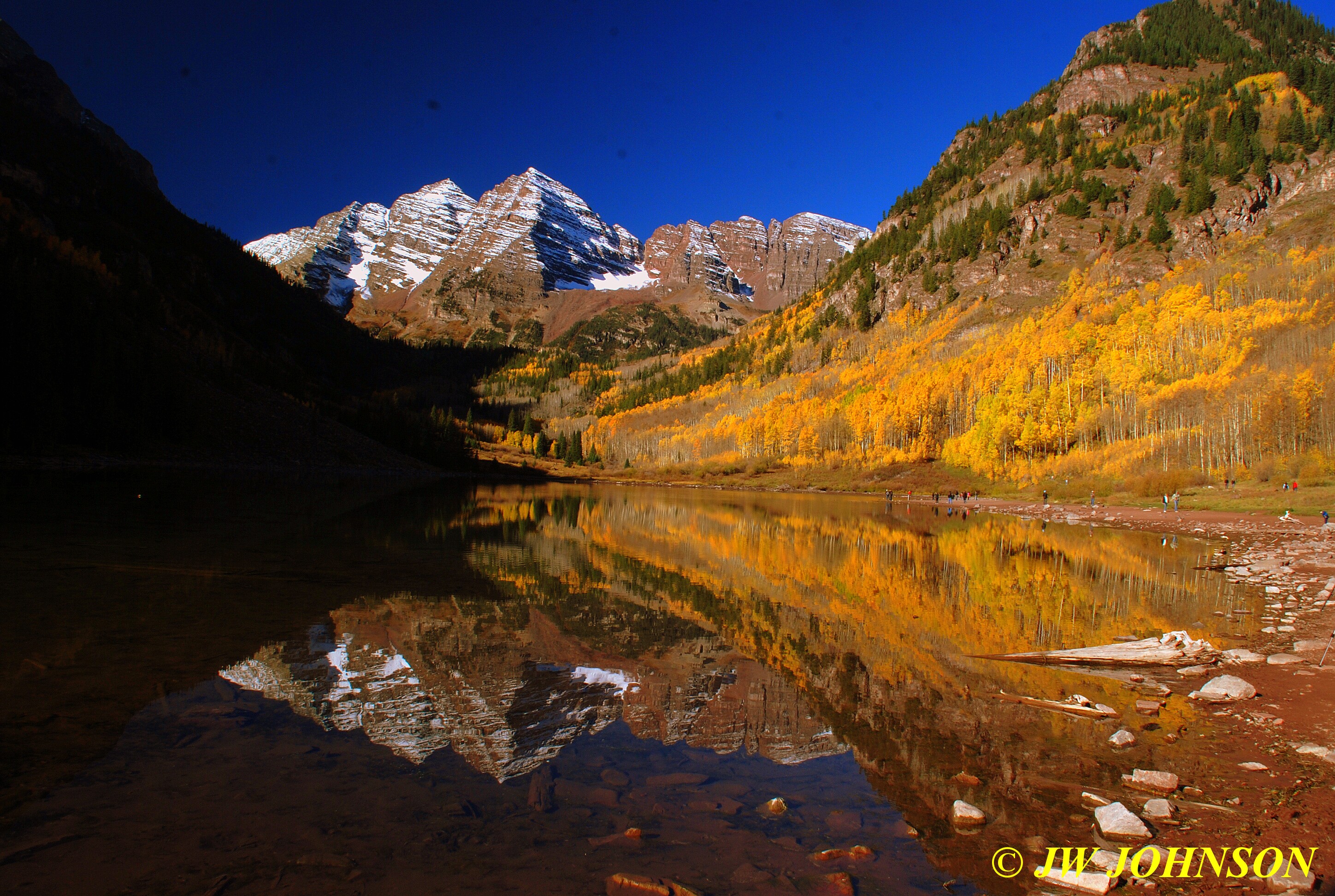
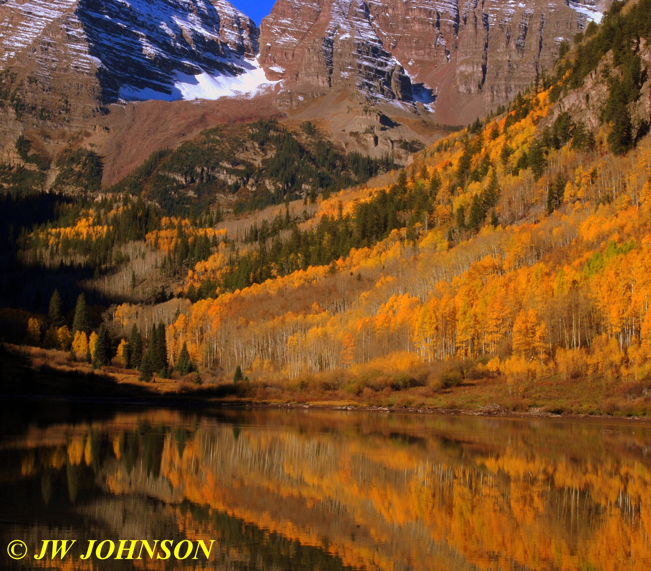
Again we had to get on the road early…..we were headed to the Maroon Bells at Aspen, another road controlled by the Forest Service in much the same way as Rocky Mtn Park, and again we had to be through the gate by 9 am or faced with a shuttle bus ride. It was about 35 degrees outside, as we drove to Glenwood Springs, passing through Copper Mountain, Vail, and Eagle, as well as Glenwood Canyon, before turning south on Hwy 82 to Aspen. Mapquest had indicated a three hour drive down to the gate, however I think we made it with about thirty minutes to spare…and the ranger working the gate told us it was a free day as well, National Land Day or something like that. On the way up Maroon Creek Road from 82, I had pointed out the horse ranches with the pretty groves of aspen trees that are set against a steep bluff of red colored rock and bordered by Maroon Creek on the other side of the road…we decided to stop and photograph them on the way back later in the morning when they would be better illuminated by the sun. We drove on up and found the parking lot quickly filling and were directed to a improvised parking spot by a Ranger who has family in Salem, Missouri. We talked to him a few minutes and then continued to walk to the lake, Missy with us this time on a leash.
The Maroon Bells are in the National Forest and controlled by the Forest Service, but since it isnt a national park, the rules for pets are quite less restrictive, allowed on trails as long as they are leashed. Mom and I walked over to the edge of the lake, noticing right away the water level was down at least ten feet from years past, and we had a little wait ahead of us before the sun would rise over the mountain behind us, to illuminate the aspens in the valley between the lake and the Bells. The Bells are two mountain peaks sitting side by side, that actually sit about twenty eight miles north of the lake, but appear to be right behind the lake. There is a valley of aspens that appear to be right between the lake waters and the foot of the mountains as well, and then there are aspens up the hillside to the east framed by red rocks near the top and the western hillside is mainly gray rock and fir trees.
There were at least fifty photographers waiting at the edge of the lake when we arrived…I`m talking serious photographers, not tourists with point and shoot cameras…about the only thing good about the deep shadows this time of the morning….they did help block out the many people standing near the lake shore…..
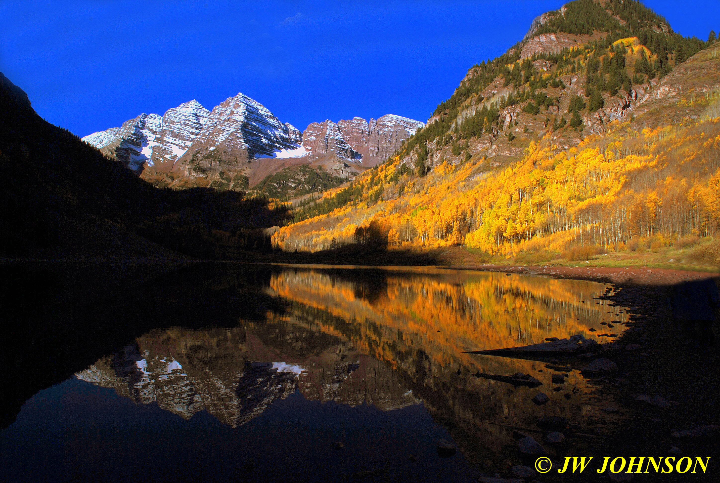
…Dad soon grew tired of waiting with us for the sun to come up…..so he and Missy returned to the truck…while Mom and I toughed it out and waited for more illumination...
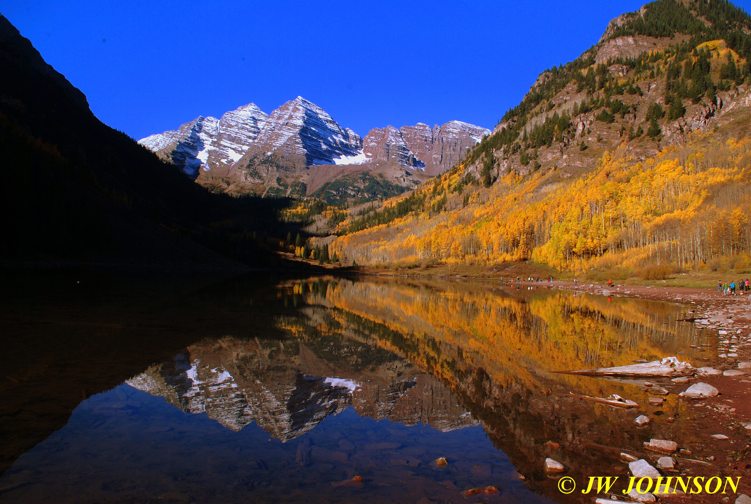
…which makes it all the more worthwhile…
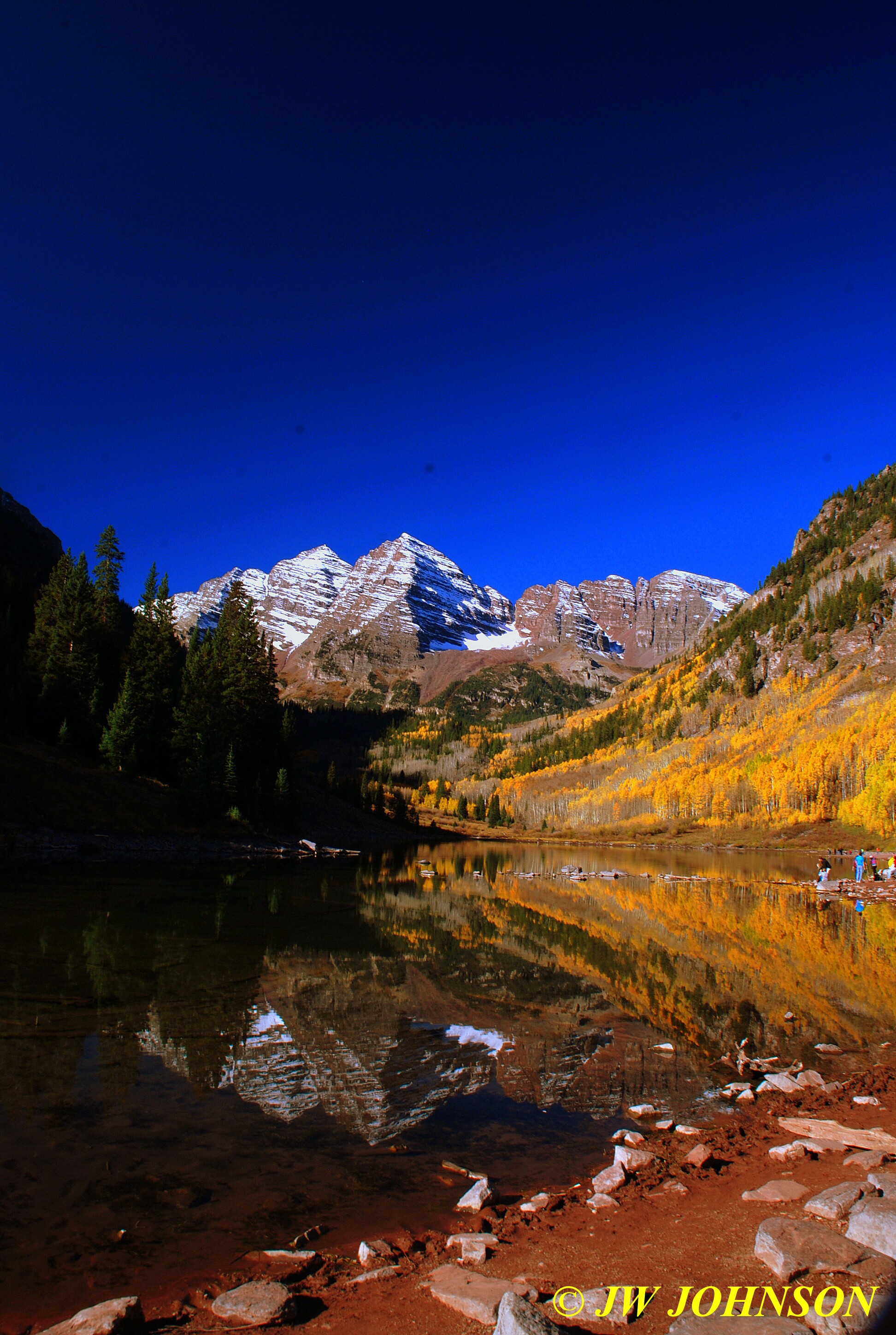
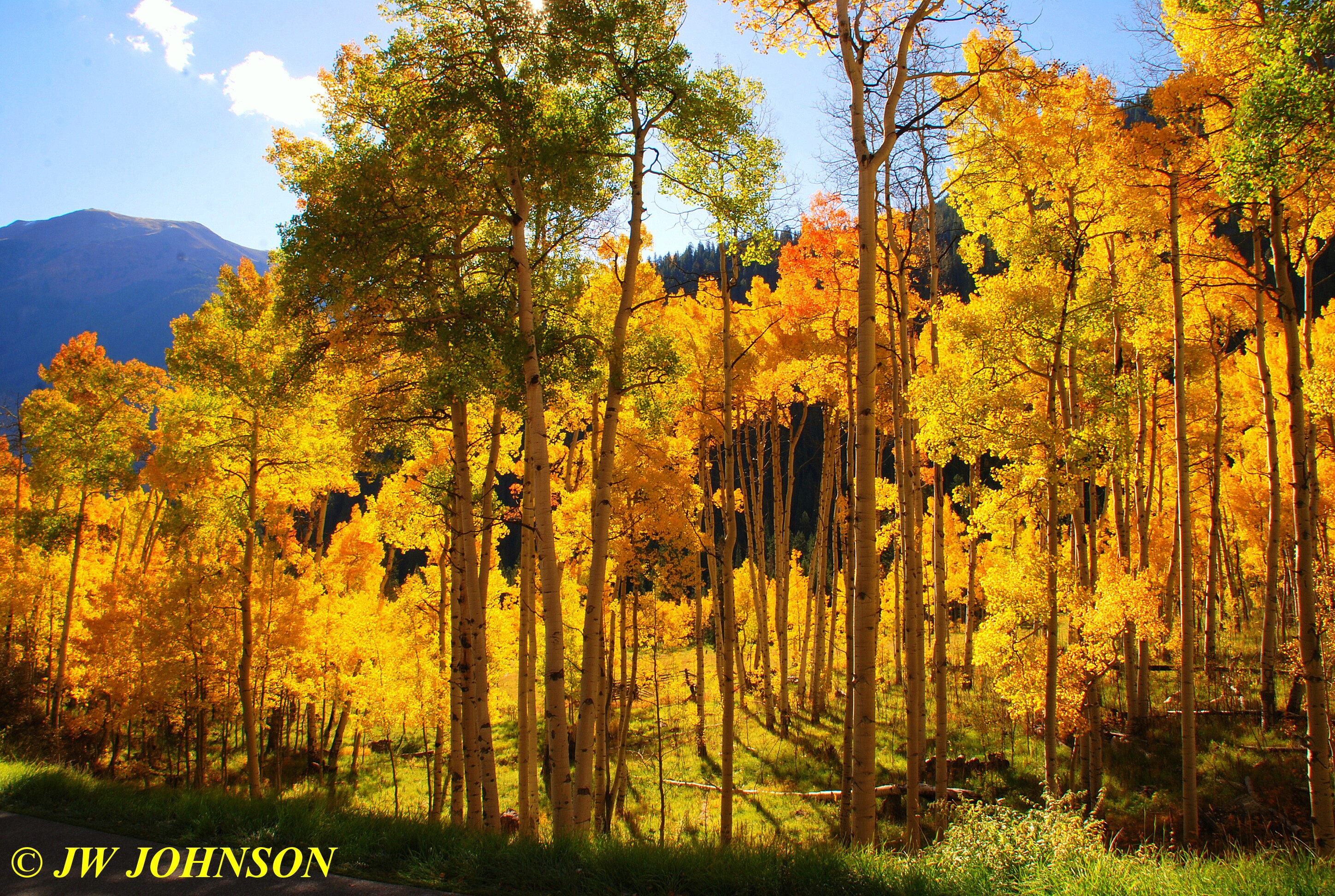
…..this is where a good polarizing filter comes in handy…gives you a darker shade of blue sky and makes the aspen colors pop right in front of your eyes….
…after the sun came over the mountain top about 9 am…and started illuminating the west hillside, I snapped a few more and then headed back to the truck….
…and….
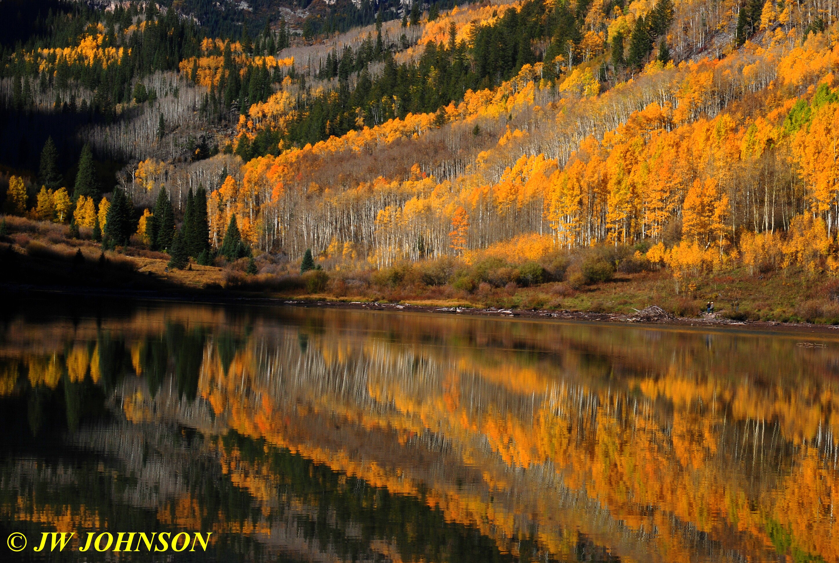
…we drove back down Maroon Creek Road and now that the sun was fully up and over the mountains, everywhere we looked,the color was popping right and left…we came around a slight curve in the roadway and found a photographer shooting a grove of aspen trees with a camera on a tripod…we pulled over past him….when I walked across the road and up the hill behind him, I could see what he was looking at…the grove of aspens were nicely backlit and just about glowing vivid colors of yellow, orange and green right before my eyes….
…I looked down the road to the south and spotted a grove of aspens up on a bluff above the road that was quite pretty as well….

…while we were stopped there photographing the trees in the valley and nearby…several others stopped as well and joined us shooting from the roadway…. the original photographer was still out in the road too…I was standing up near the curve we had come around and noticed other passenger car drivers and a bus driver coming down the hill fairly fast…I started motioning for drivers to slow down…the shuttle bus drivers were coming down the hill a bit too fast in my estimation…for a few minutes, I was once again back in my element as a firefighter, directing traffic on a call….luckily the drivers cooperated and slowed down.
While there, Dad spoke to a guy that had a similar experience with his brakes glazing over and he said our experience was similar to his, his front brake drum damaged like ours…he assured us that ourw would likely repair itself as his did. He turned out to be correct, our drum repaired itself as well later on in the trip, but we continued to shift down the engine to second gear on the long descents of the steep slopes, too.
We drove on down to the horse farms but didnt see many horses in the fields, opting instead for the colorful barns and foliage against the deep red rock bluffs and blue skies…..

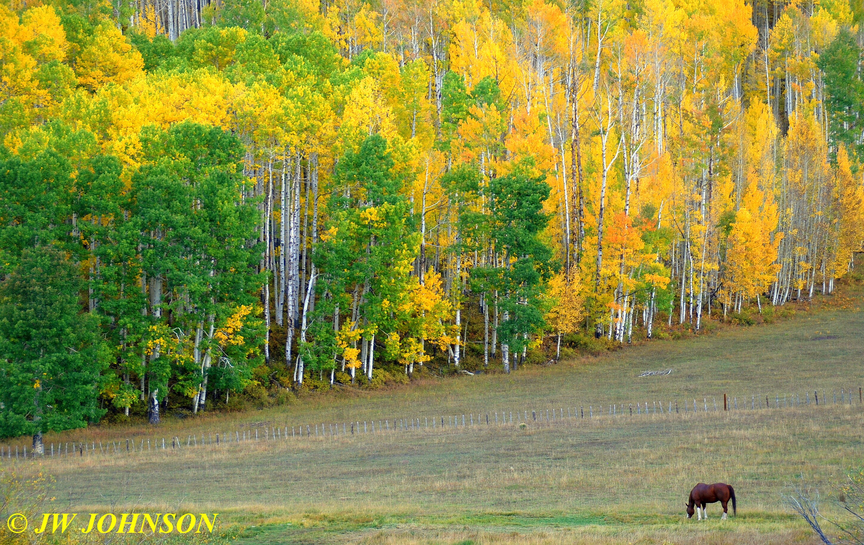
…I was standing there wondering where the horses were at today…the fields had always been full of horses in years past…like this one taken about seven years back…
….all of a sudden, Dad honked the horn to warn me that several horseback riders were coming down the path I was standing on……

…so that`s where the horses were at….well that made sense and gave me opportunity to shoot some more photos of them…

…and here is the farm they were headed to…
...we then returned to 82 and headed north to Carbondale, where we turned southwest on Hwy 133 and started toward Montrose, the scenic route I should say. This route takes you through a variety of scenic terrain changes, starting out in aspen dotted mountain ranges, giving way to rolling hills, then dropping down into farm fields and winery grape vineyards, and finally reach the intersection of Hwy 50, at Delta, which sits on the southern edge of the Grand Mesa area…the terrain looks more like the painted desert.
We drove down the Crystal River valley first though, and through the small resort area of Redstone, named after the large red rocks in the area, some found in the river itself….
..and then we climbed back up into the mountains and again saw beautiful aspens at every turn, this one looking back east, near the turn off to Marble….
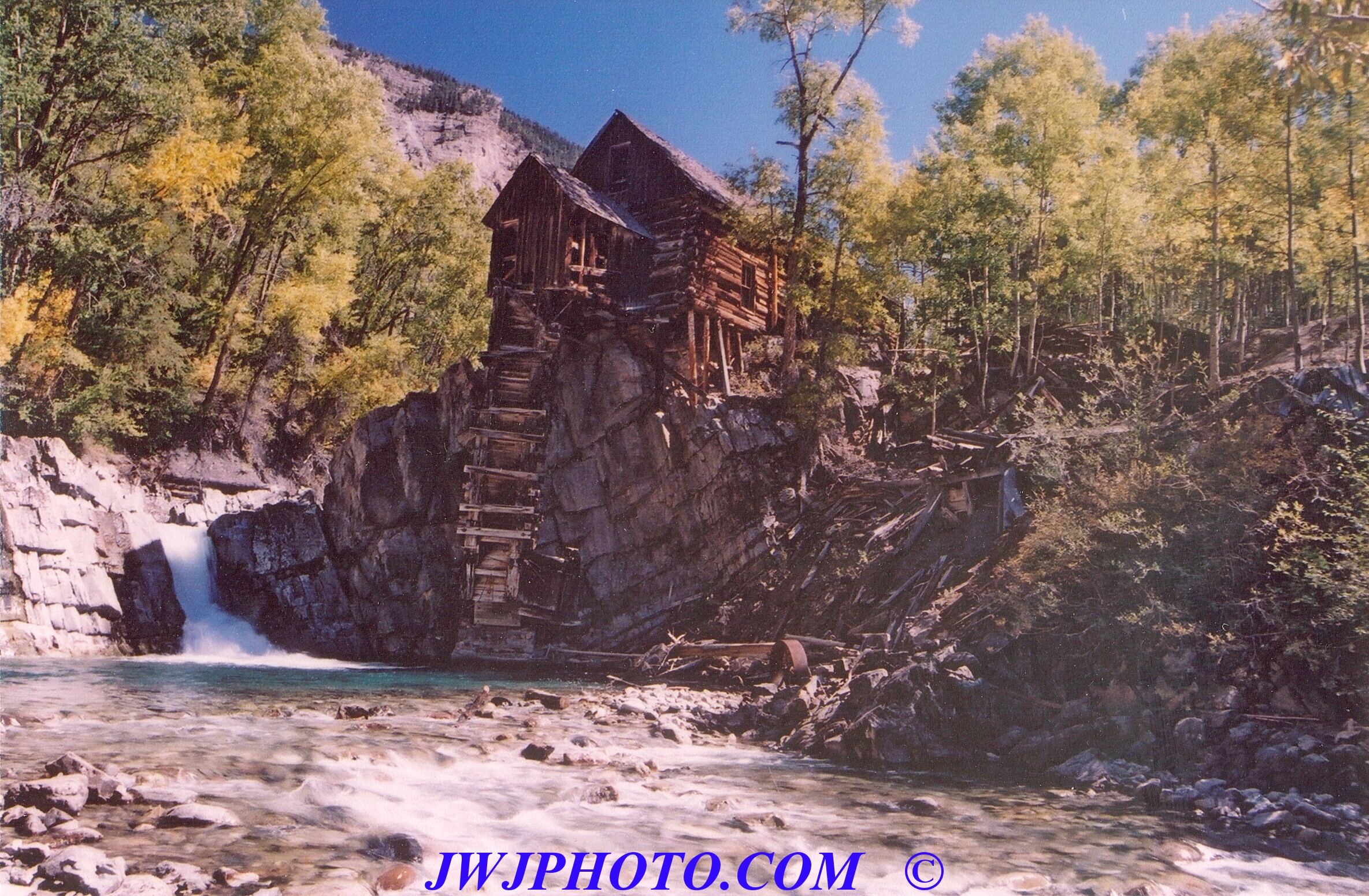
…. a very historic little town that is well worth a visit if one has some extra time…in years past, I drove to Marble and on past, to the old Crystal Mill, which resembles a weathered log cabin perched high on a rocky wall above the Crystal River. The old mill was a source of hydroelectric power for the gold mines and town of Crystal, which sat above the mill on the old road. This old mill is one of the most well photographed spots in Colorado even today, but the road getting there is narrow and extremely rough. It`s only about a six mile trip to the mill from Marble itself, but that six miles can easily require an hour to drive…mainly because that road is nothing more than a rough boulder strewn goat path most of the time, and makes one wish they had signed up for a jeep tour ride instead. I drove my Ford Explorer up there a few years back, much to the dismay of several area residents, and took these two photos of the beautiful Crystal Mill then…

Marble is also the location for a quarry and mine where marble has been mined for many years…its located halfway up the side of the mountain just west of the town…you drive across the Crystal River and then ascend up a very steep mountainside road that is narrow and you hope and pray that you dont meet one of the huge flatbed trucks coming down that road as you are going up, especially if its loaded down with a nine foot square chunk of marble…cause if he is loaded down with one, then you have to yield the right of way and that means you have to move over on the left side of the road…where the deep drop off is on the side of the road, after you back down the road to find a spot wide enough for the truck to pass you without incident…and even if you find one, you then have to wait for the driver to get to you and pass you, cause the truck is only moving ten miles per hour or less on that road with the load he is carrying on the bed of the truck…that`s prob why most visitors prefer to just stop at the bridge and look for a piece of marble in the river…much less drama and stress that way. Down by the river bridge are the remains of the old marble mill as well, some of the walls are still standing and makes for a scenic picnic stop, too. The marble from this quarry/mine, was used exclusively for the Tomb of the Unknown Soldier and many of the monuments in Washington DC, such as the Lincoln Memorial Statue and many others.
This year we didnt have a lot of extra time built in for a trip to Marble, we were on a pretty tight schedule to get on down to a couple of scenic roads before we even made it to Durango. So we drove on down into the valley at Paonia, which is coal mining country, passing between two huge coal mines and watching large dump trucks wind their way down the mountainside on switchback roads to dump their large loads of coal onto the conveyor belt at the mine mills. We also passed a huge reservoir as we neared the bottom of the mountain, which is normally full but this year was nearly drained empty, most likely a testament to the drought that Colorado has suffered from this year. This reservoir serves, as many others in the state do, as a source of drinking water and irrigation needs for the local area. As empty as it was, I sure hope they have other sources for their drinking water supplies, because it is nearly two miles long and a quarter mile wide, and normally fifty feet deep.
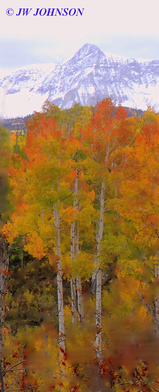
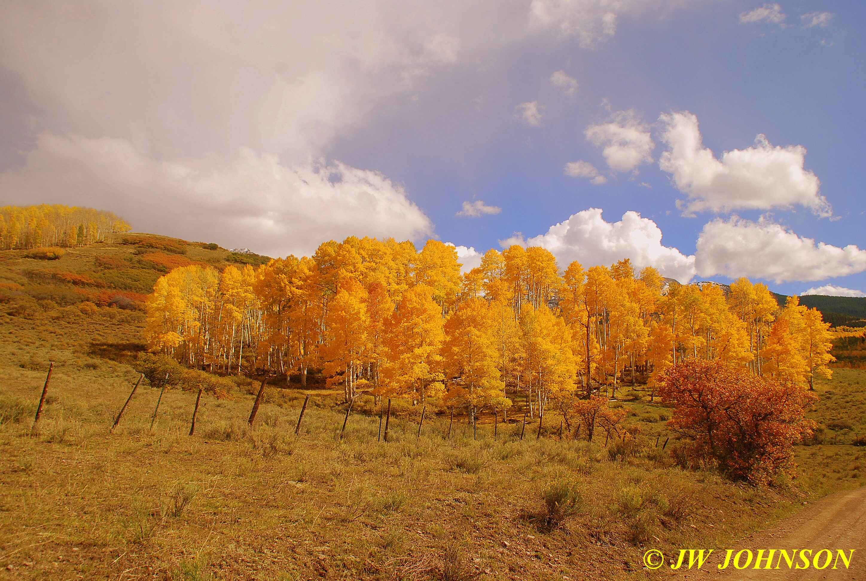
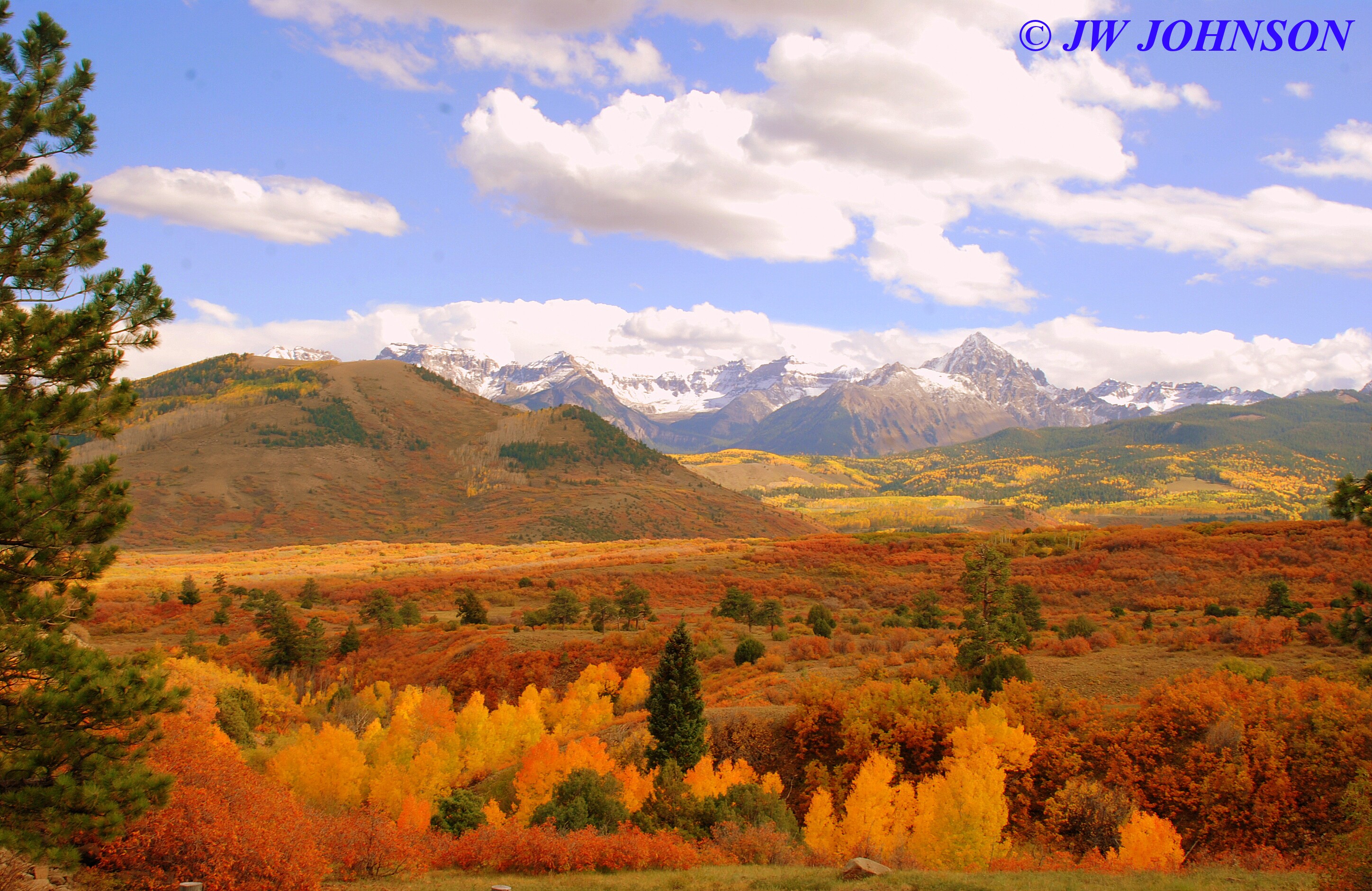
As we drove down into the valley, we saw several farms and vineyards, many of which had sprinkler systems operating, and we observed later that a nearby river and creeks were being utilized for the sources of water for irrigation needs. We stopped in Delta for lunch and fuel and then continued south to Ridgway, where we took Hwy 62 west to Last Dollar Road, which is a well known shortcut over the mountain pass to Telluride…only we didnt intend to drive that far…just a few miles up the road to find some color and scenery…this is the road to take if you want to see the Sneffels at their finest, cloaked in gorgeous fall colors. We drove up to the Dallas Divide, passing photographers pulled off on both sides of the roadway to shoot the scenery…the sun was peeking in and out of the clouds and providing some dazzling displays of light against the groves of multicolored aspen trees, and many were taking advantage of it…we passed up a few opportunities and turned on to Last Dollar Road and started up toward the pass…this was the first scene we came to….
...this turned out to be another of those roads, where around every turn and over every hilltop, you can easily find yourself stopping to take another photo or several….enjoy the photo tour of the next few miles down this road…
…not even two miles down the road and we drove up on the entrance to a ranch, it was just beautiful…we joined about ten other photographers to capture the many views to the east and north….
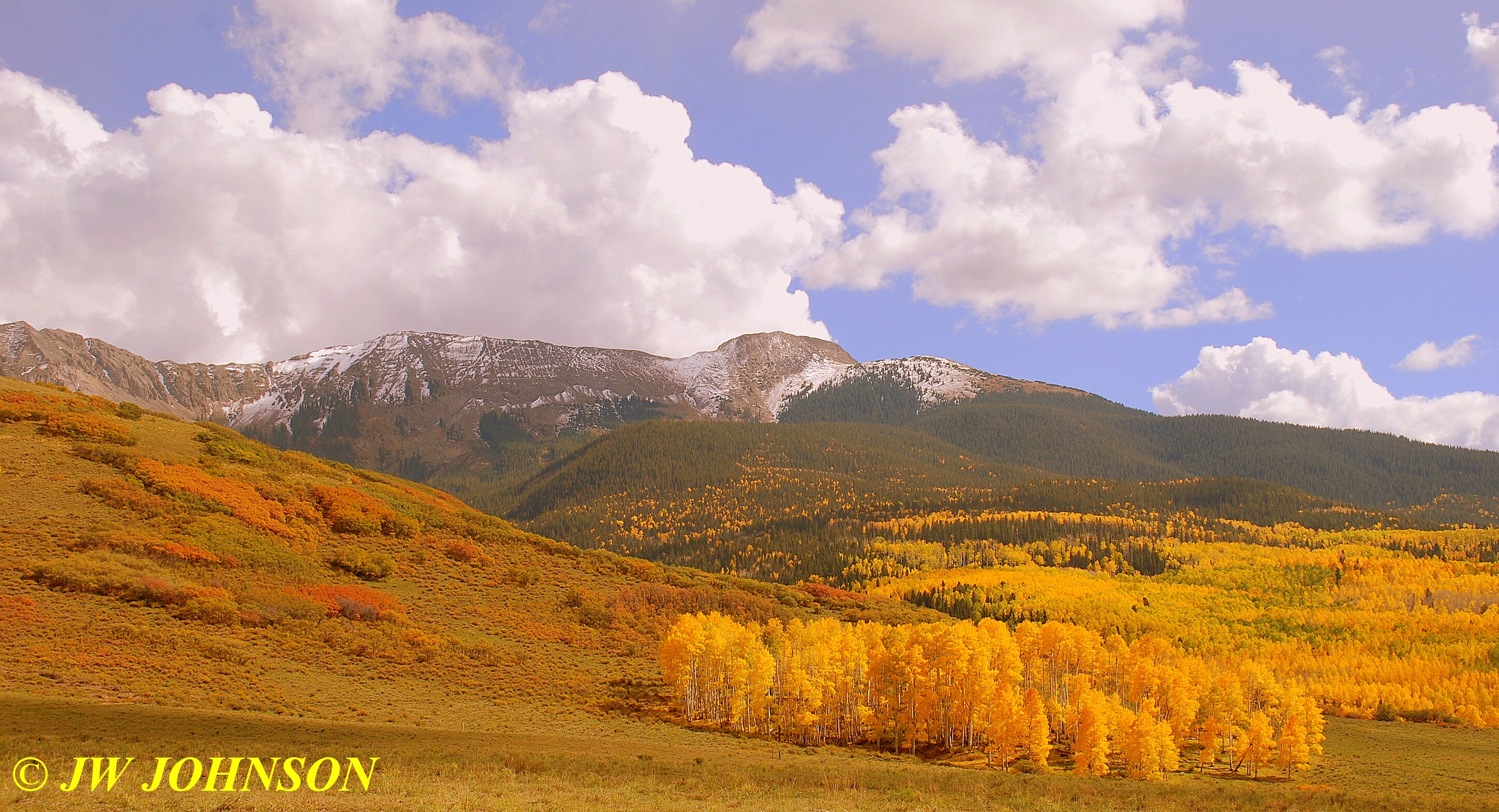
…we drove on up the road, wondering can it get any better than this….and stopped at this point, photographing the view on down the road if we were to continue toward Telluride…

We decided to head back to the highway and see if we could capture some of those spectacular scenes we passed up…by the time we got back to those areas, the pretty sunlight and sunbeams had moved on to other places and we were left with stable sunlight and big fluffy clouds, which I am happy with anytime…and our answer to the previous question was answered….
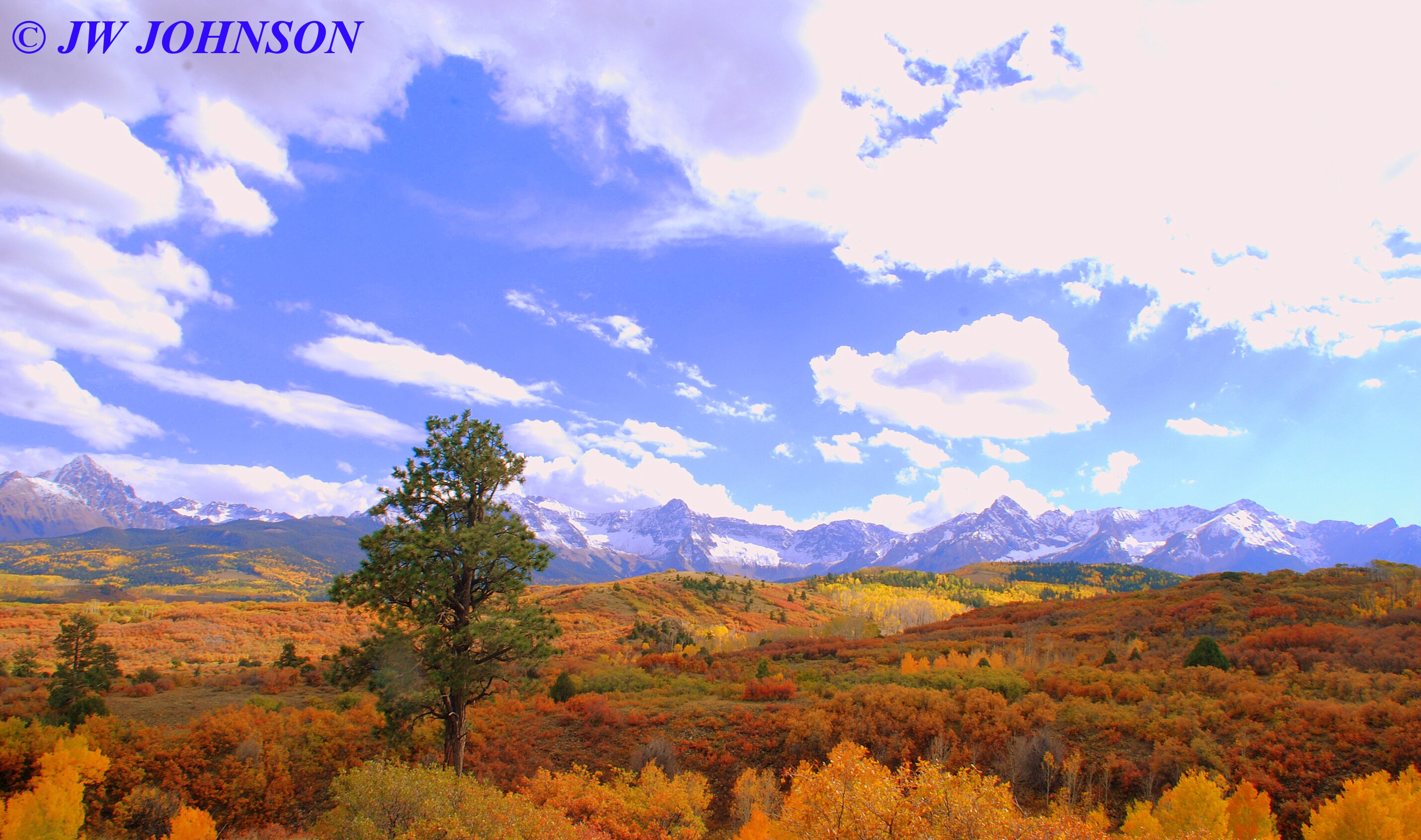
…YESSSSSS…it does get better….the scenery and color that is….
We got back on the road south toward Durango, elated from the gorgeous color we had already experienced today and looking forward to the train ride tomorrow…Mom was a little nervous cause we had one more ride along some deep drop offs just south of Ouray…and what a neat little town Ouray is…located down at the end of the Compaghre Canyon, and very scenic mining area…here we are approaching Ouray through the pretty valley on the north side…
…and as we drove down through the downtown business area, we passed a police officer, driving a CJ 7 Jeep, black and white colored of course…and then climbed up the mountain on the south side…where I pulled over to shoot a few photos of the historic buildings surrounded by high sheer walls of red rock….sooo pretty….
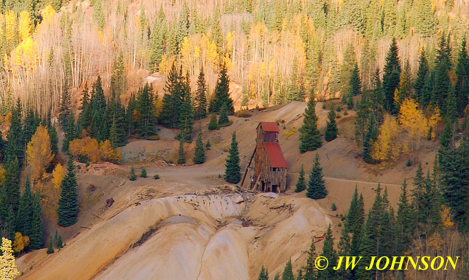
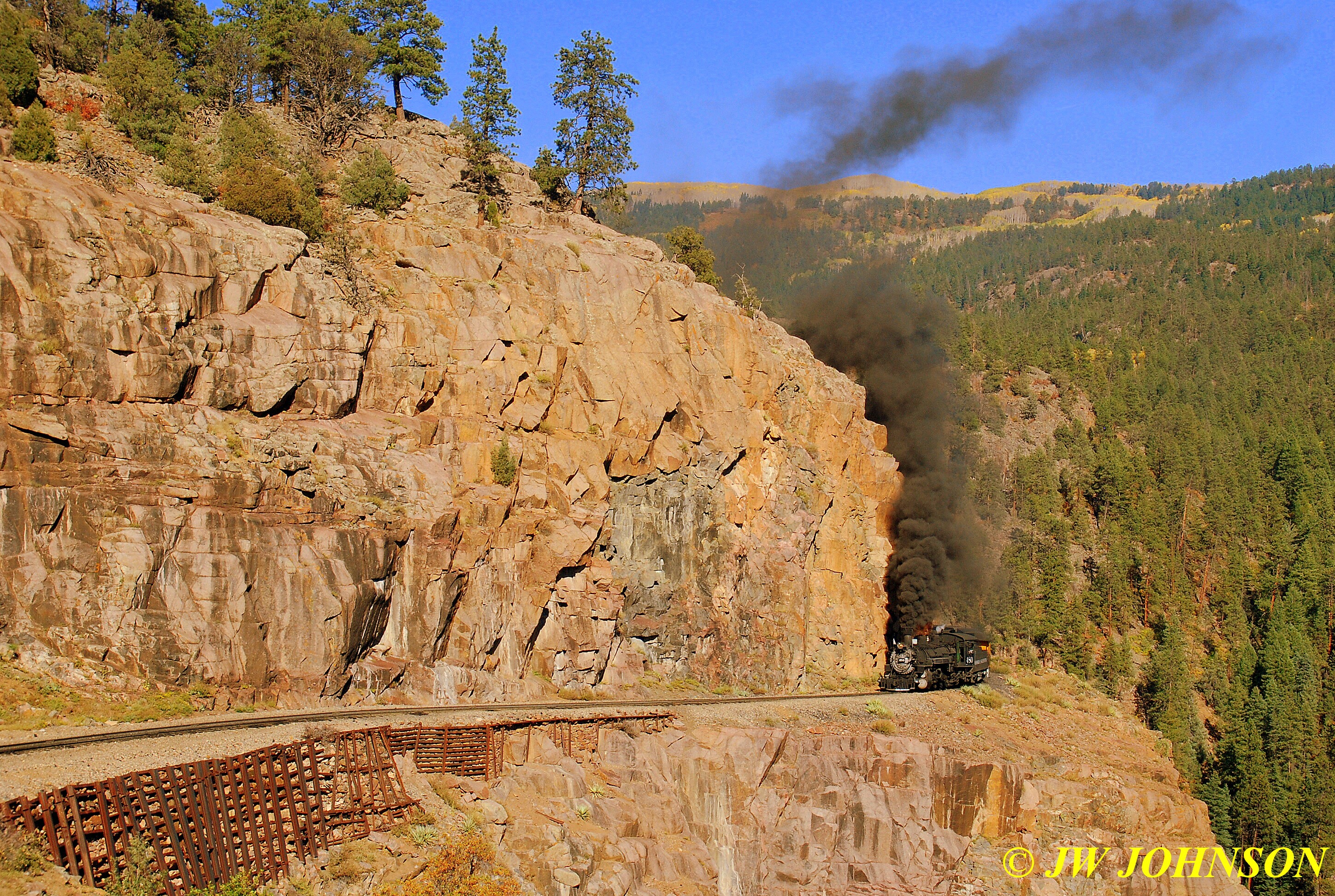
and we continued south on Hwy 550…through the Red Mountain Mining District, where old gold and silver mines dot the scenic landscape on both sides of the highway. There are some scenic places along this stretch, however the drought had really taken its toll here as it had in other scenic areas of the state, as there were places like Ironton Park where hundreds of aspens occupy the valley hillsides yet were dead and barren of any leaves. I stopped only to photograph a few of the old mines near Red Mountain itself….
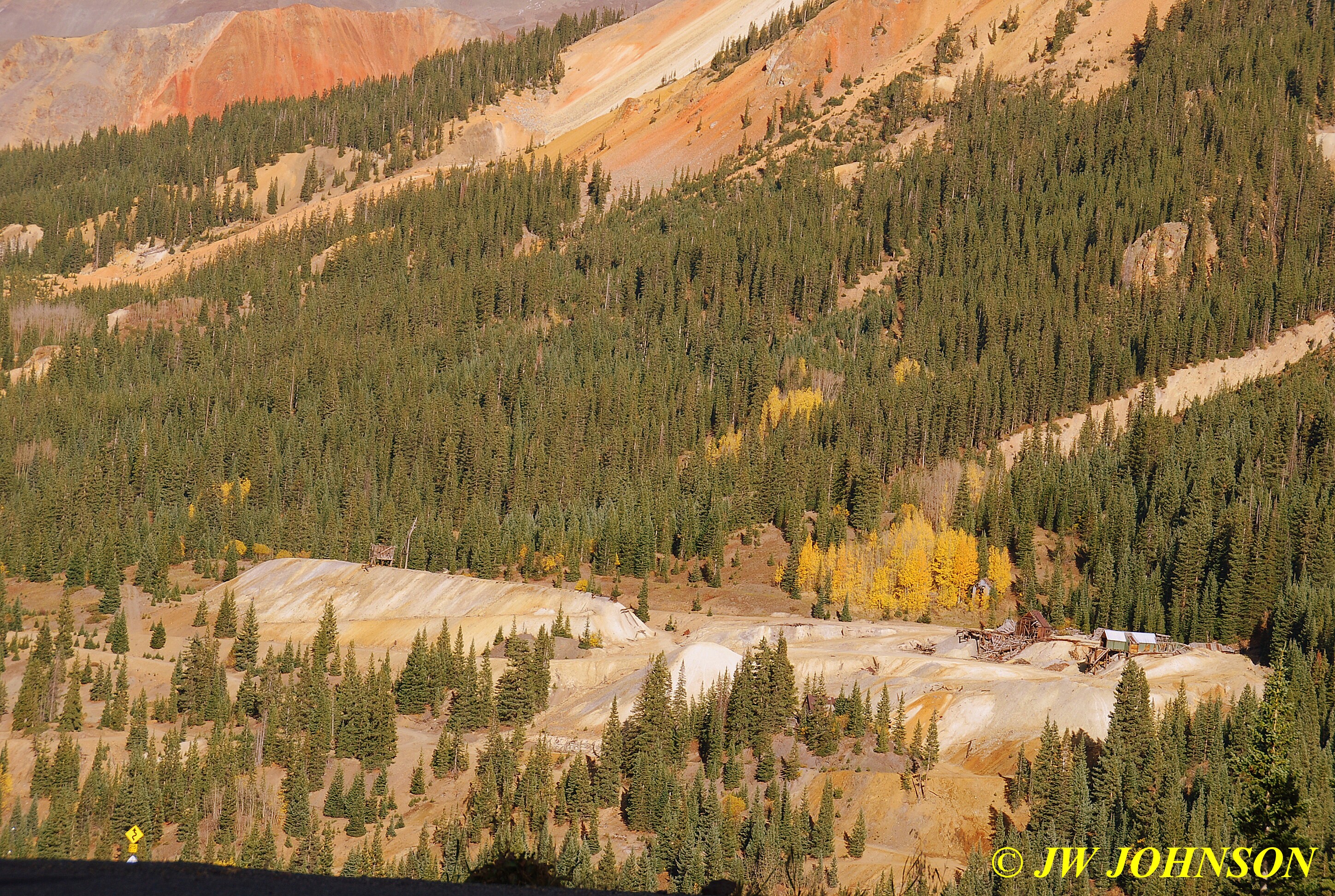
…specially this old mill which sits by itself up on top of the old tailings pile near the S curve in the highway….
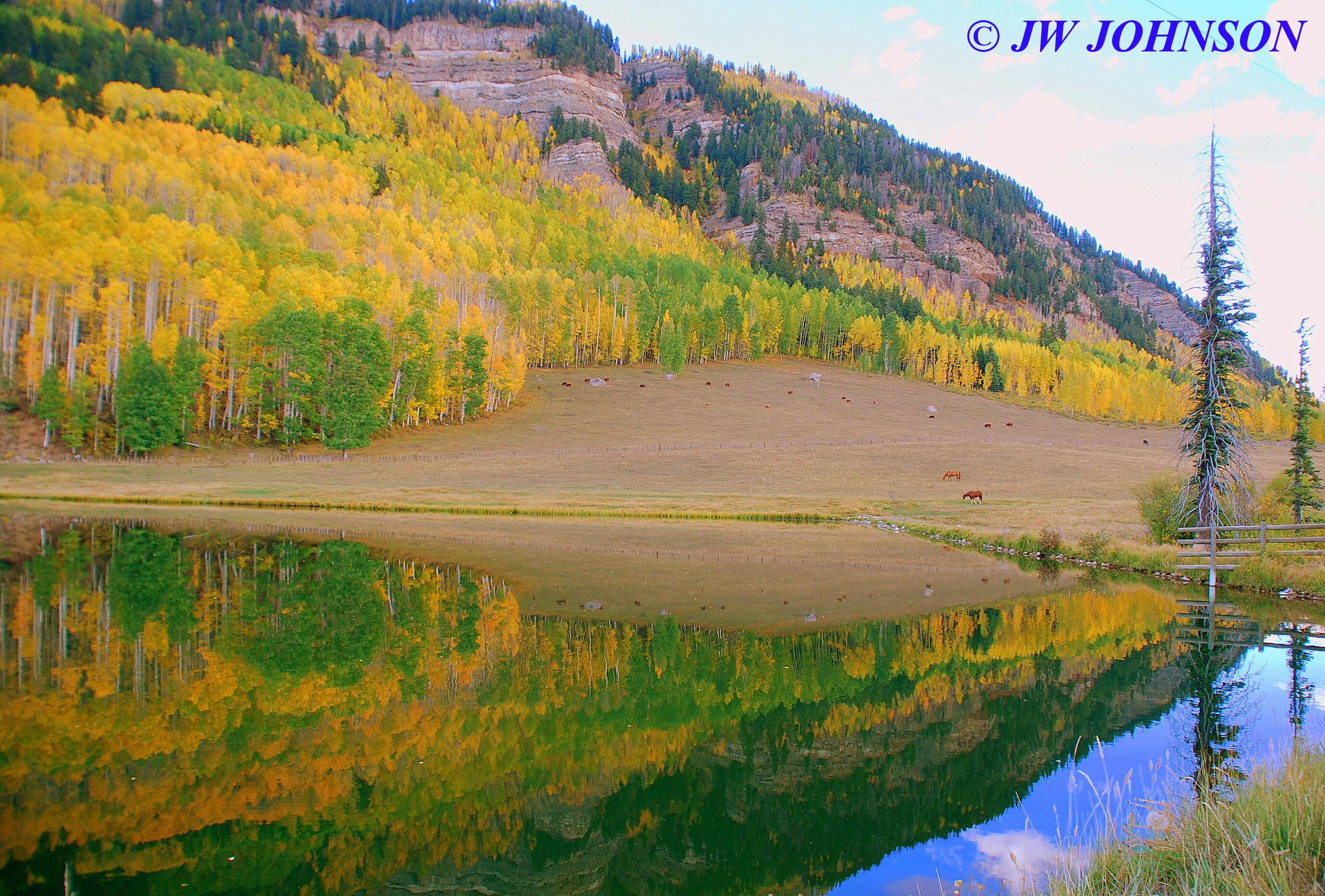
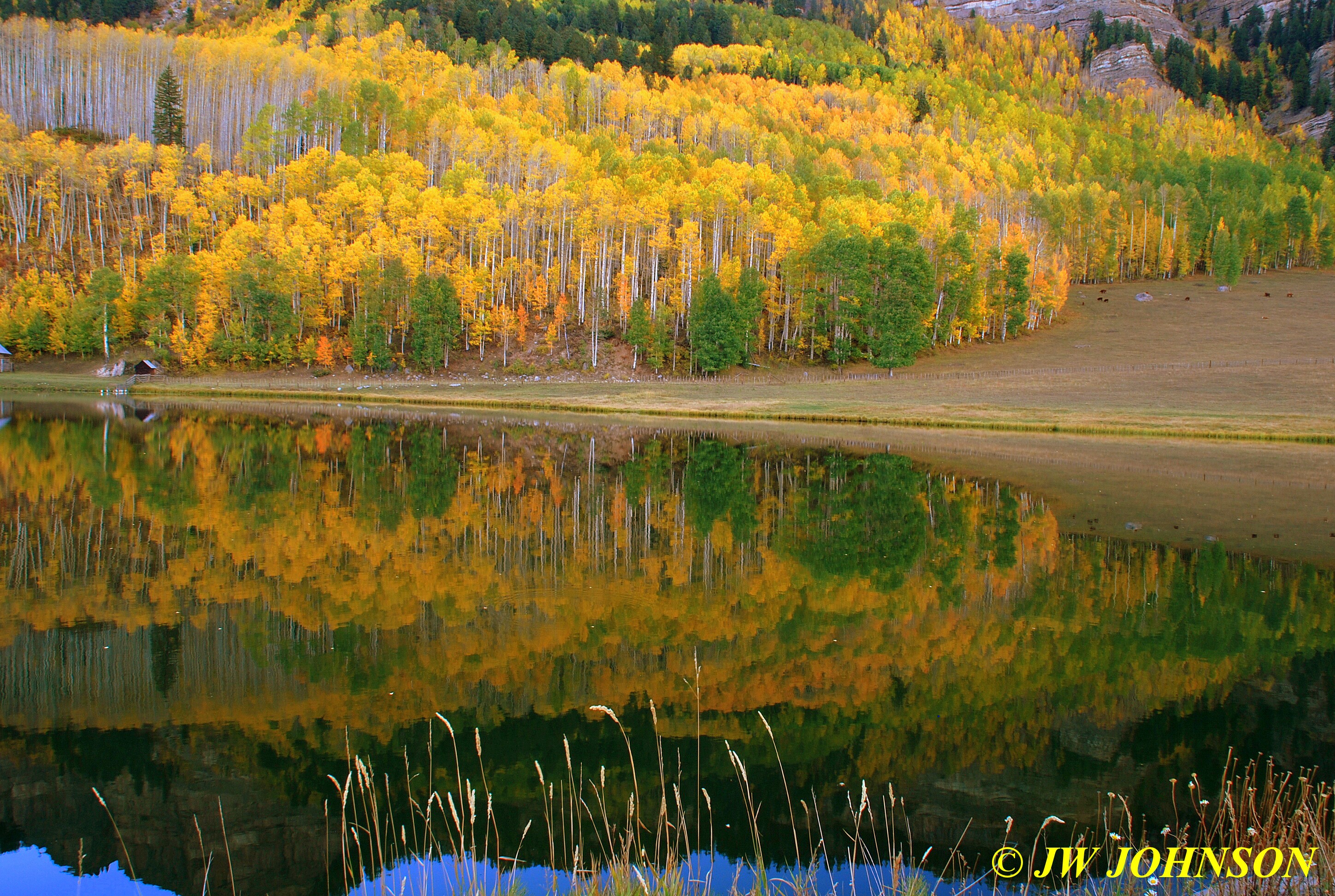
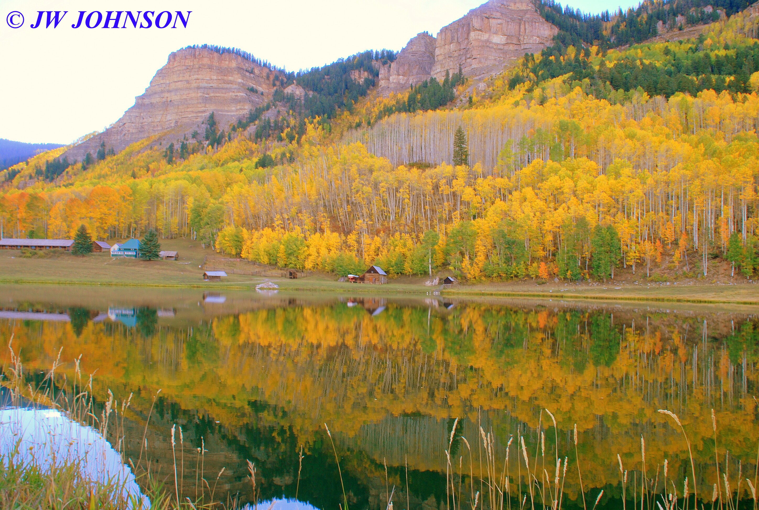
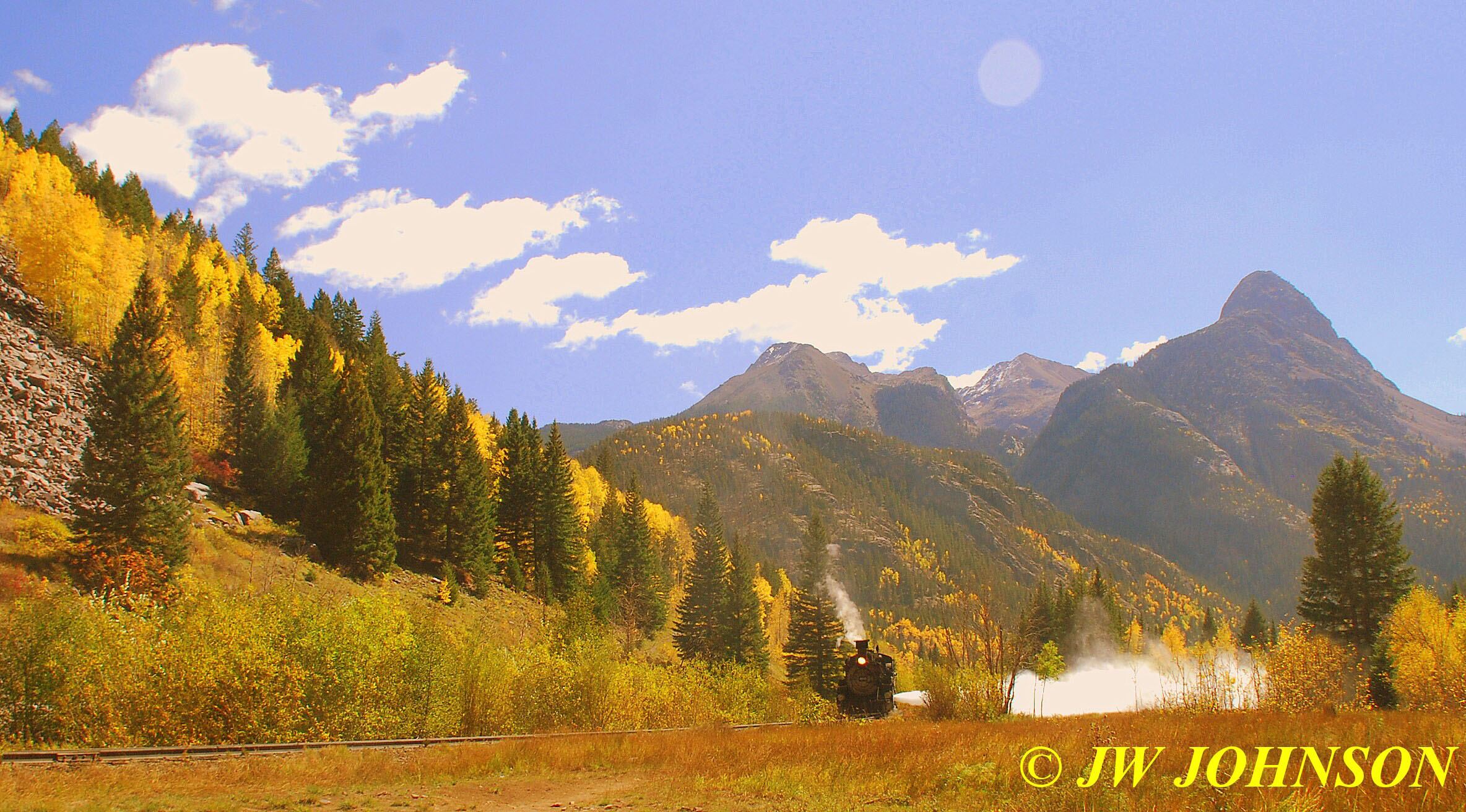
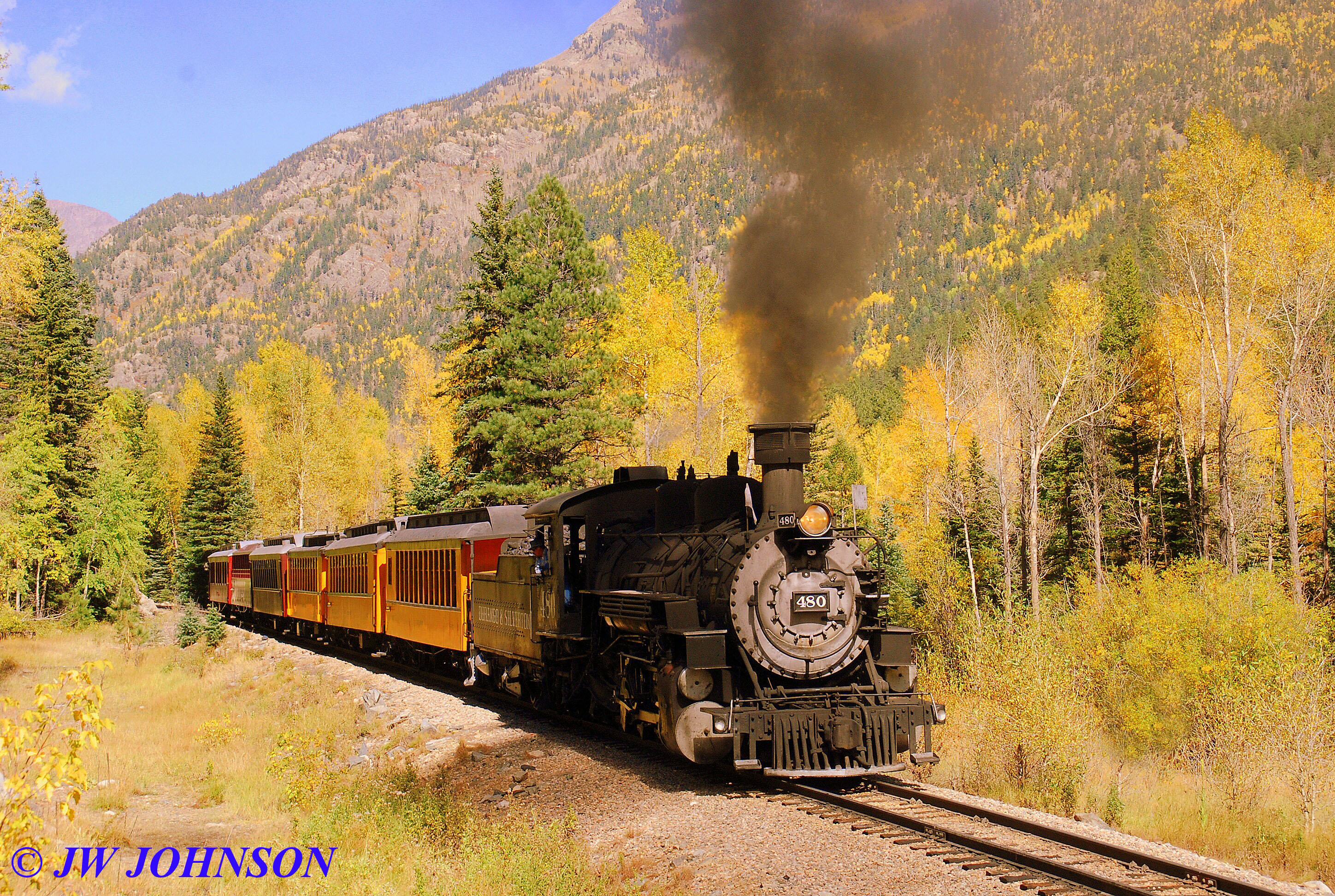
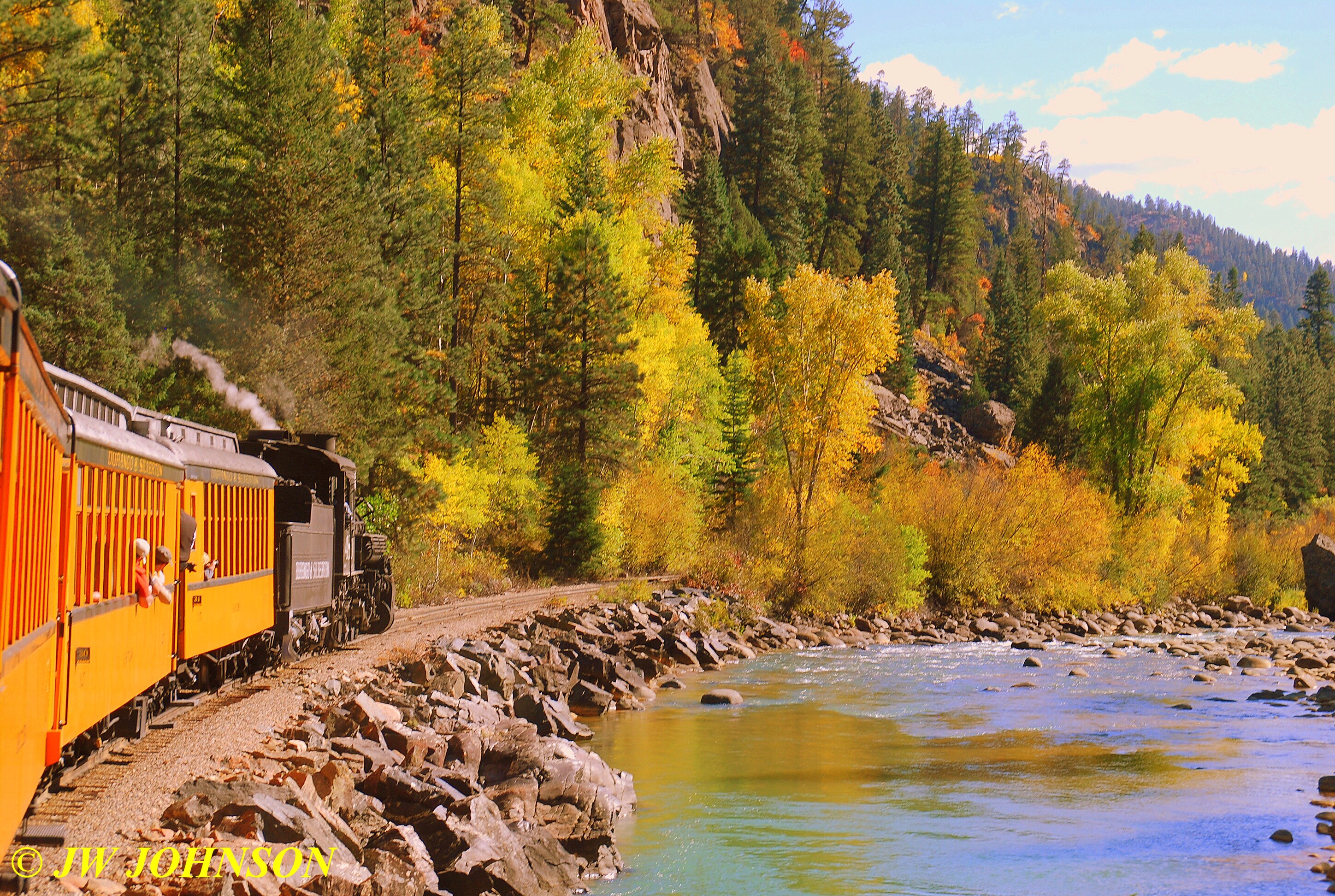
...we passed on through Silverton, where the color had peaked two weeks before due to the higher elevation and was now fading…and continued south toward Durango. Even the colors up near the three mountain passes between Silverton and Durango were gone or fading, so we kept on plodding along. As we were heading down the hill from Purgatory Pass, the ski resort area north of Durango, we came up on a very pretty lake on the west side of the highway…there were two horses down by the lake and several cattle up on the steep pasture above the lake, a long line of beautiful aspens of multicolors on the hill behind the pasture and ranch buildings…needless to say, I told Dad that supper at Durango was gonna have to wait, turned around and parked roadside so Mom and I could photograph this beautiful spot…see for yourself….
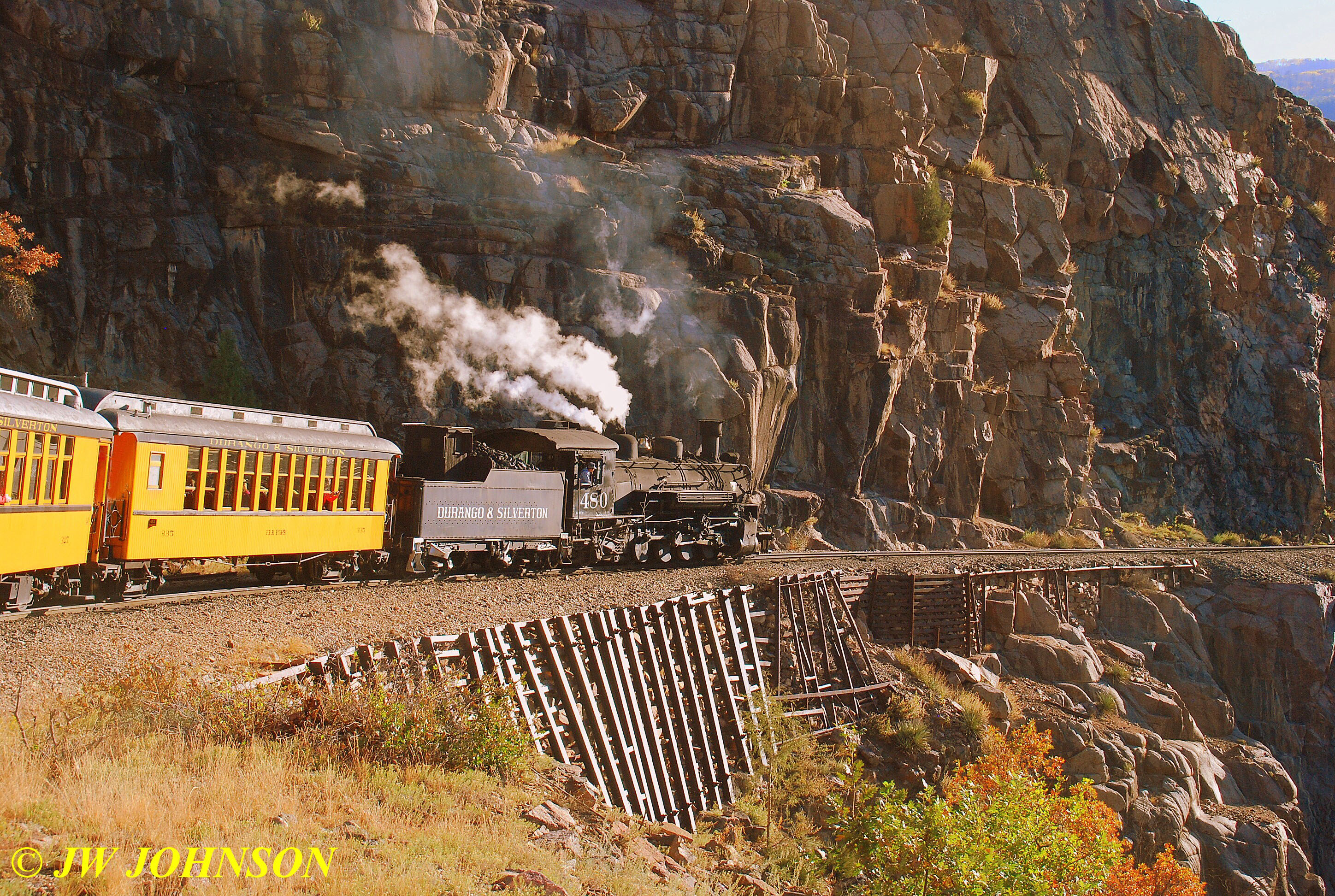
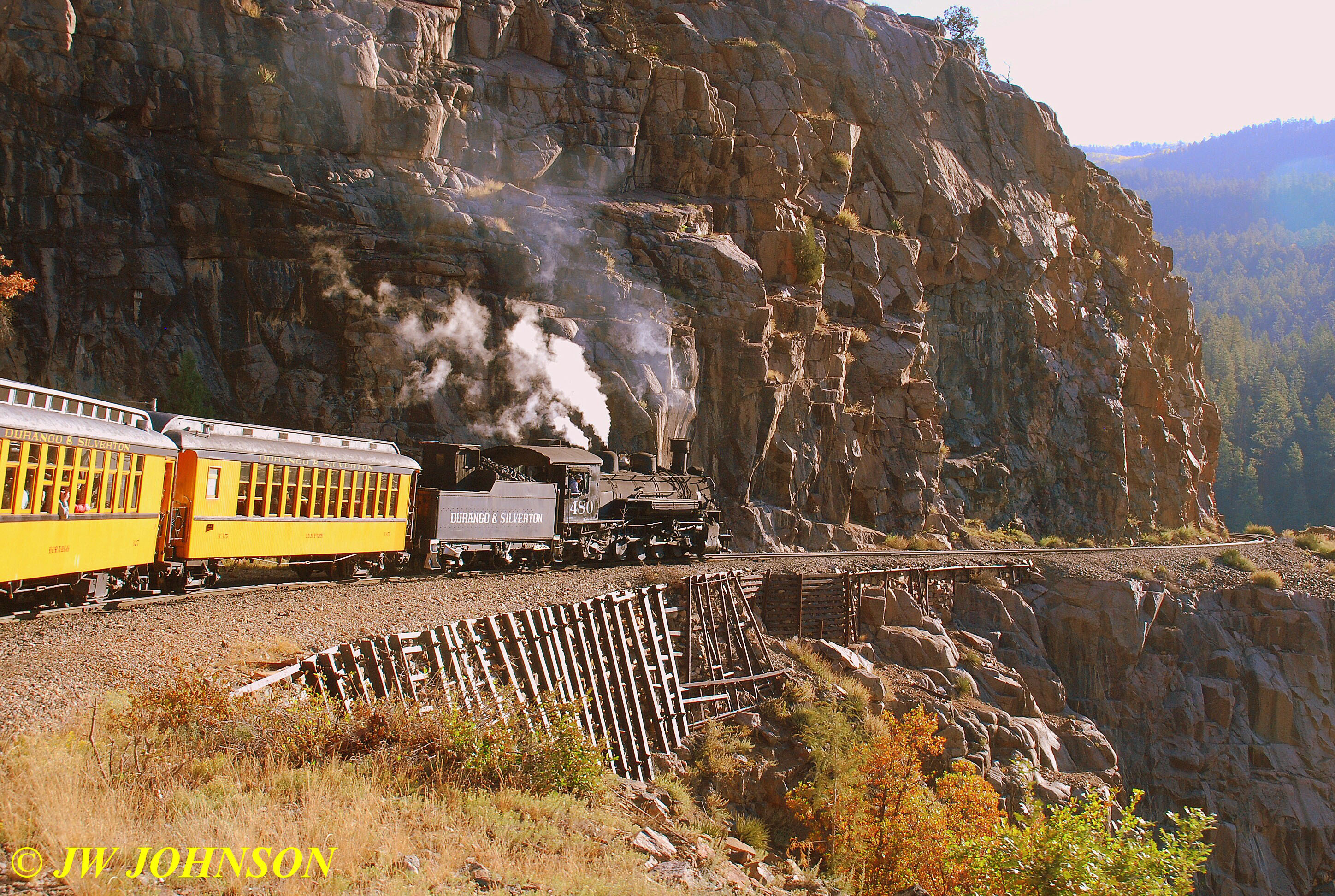
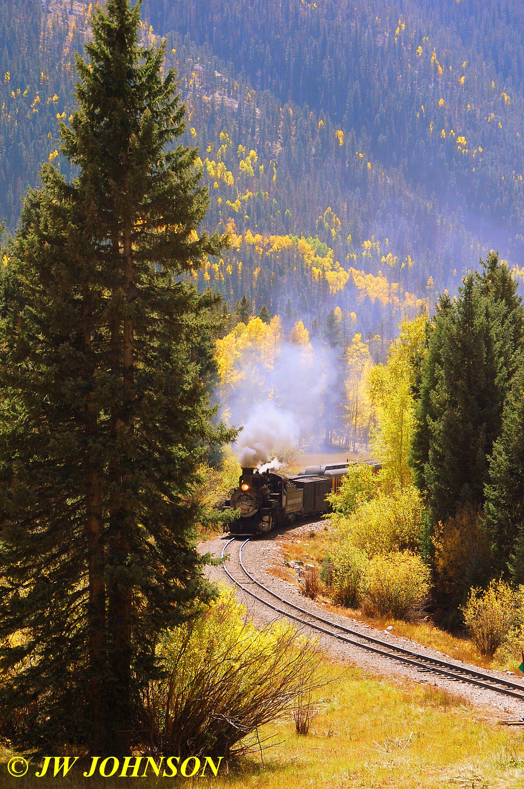
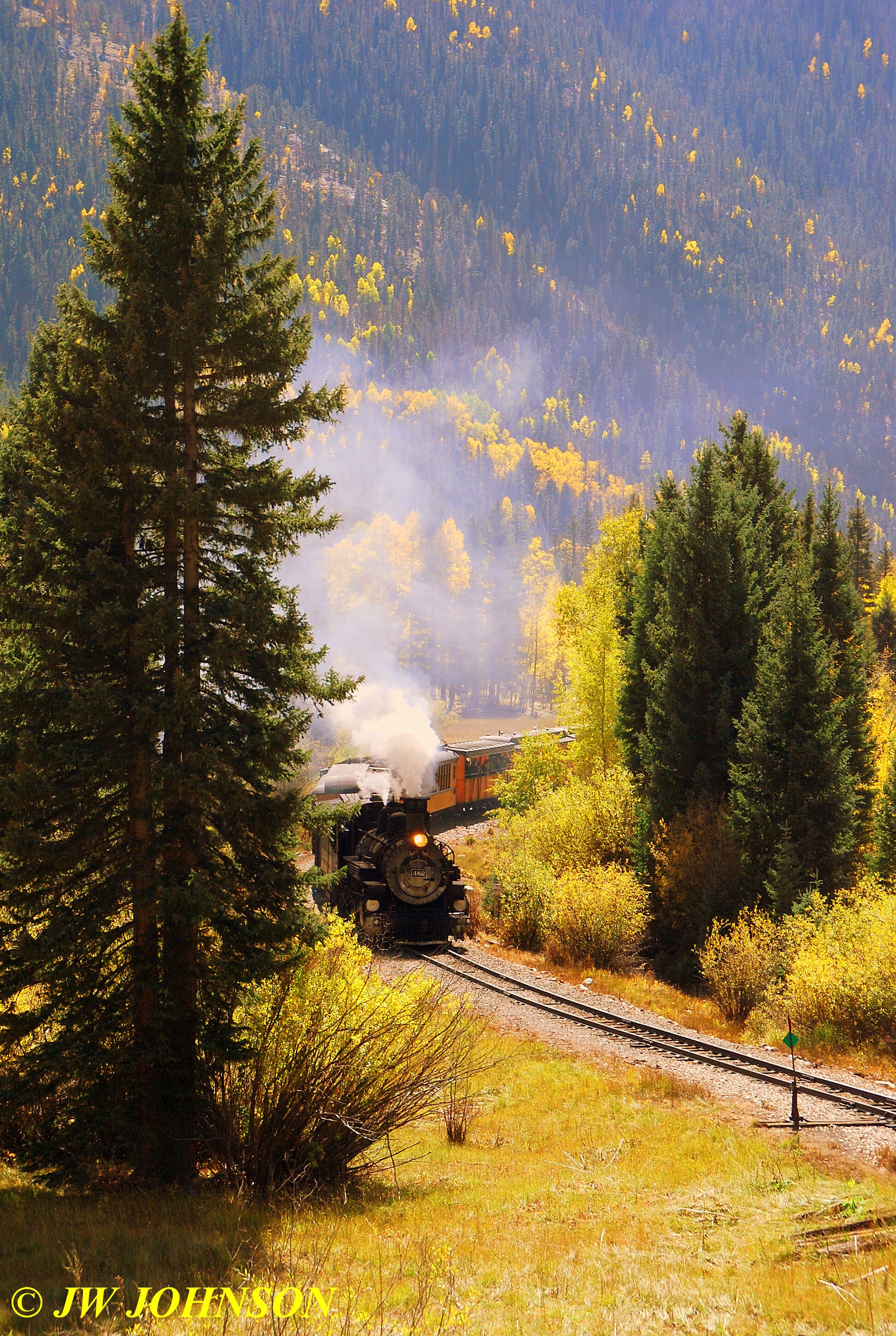
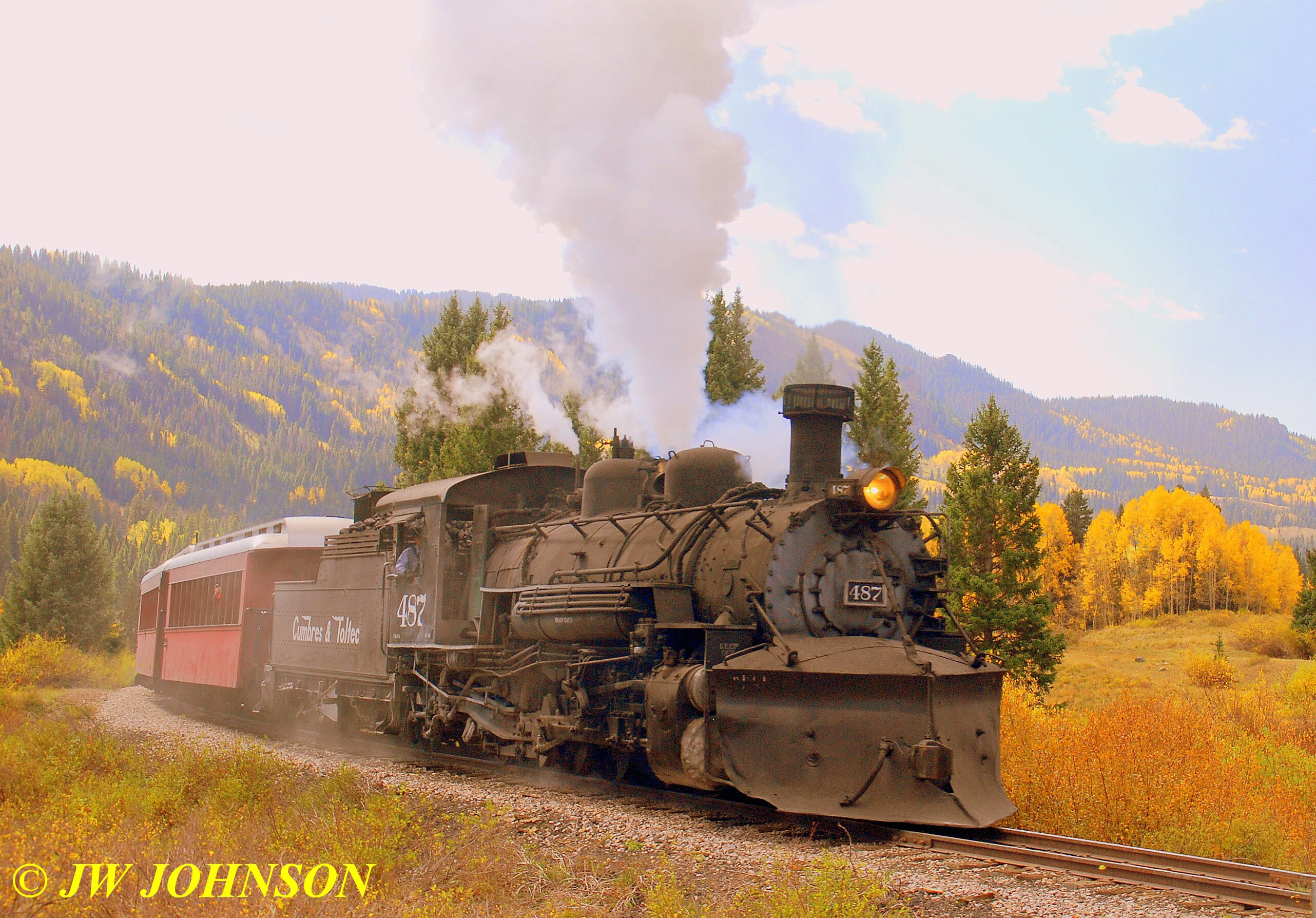
…after enjoying that ourselves, as well as several others who pulled over to see and photograph it as well, we continued down the hill into Durango and as we did, we caught up with the last train returning to the depot, so I pulled over and Mom and I grabbed our cameras and crossed the highway to shoot it steaming down the rails…
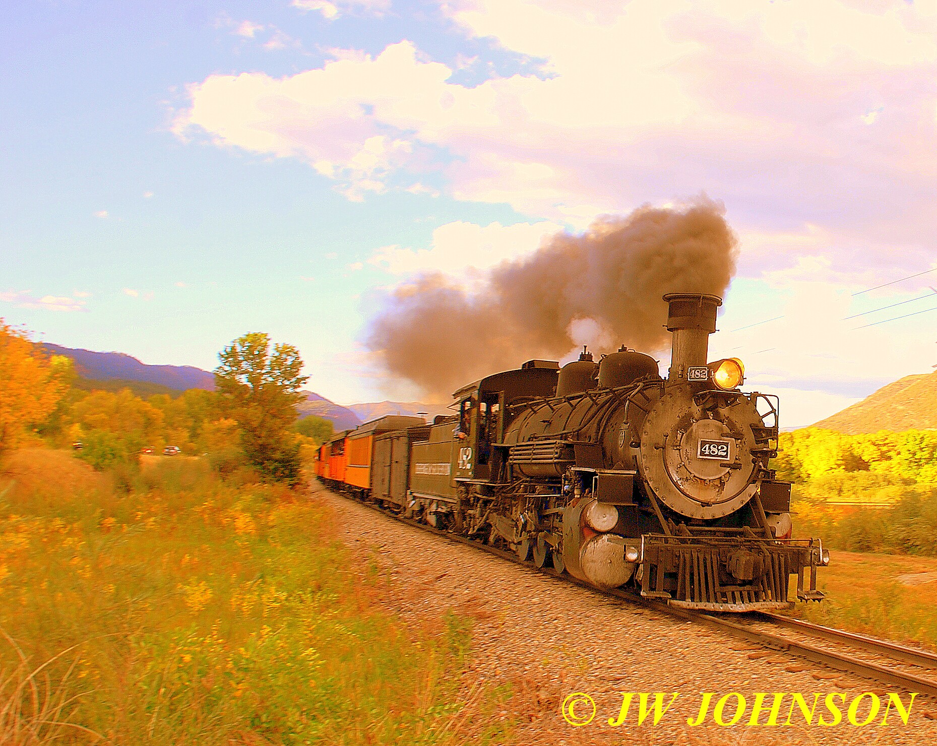
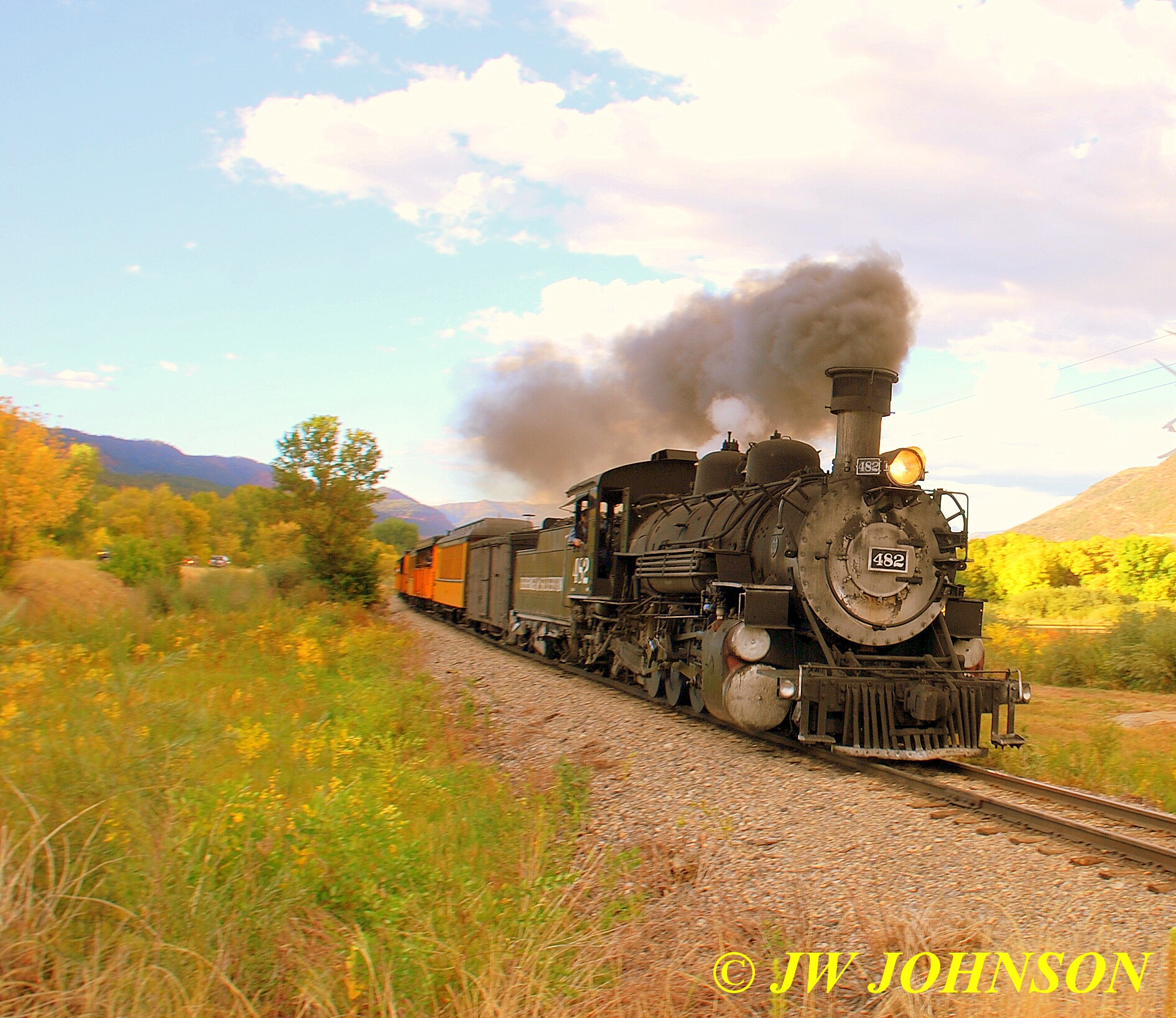
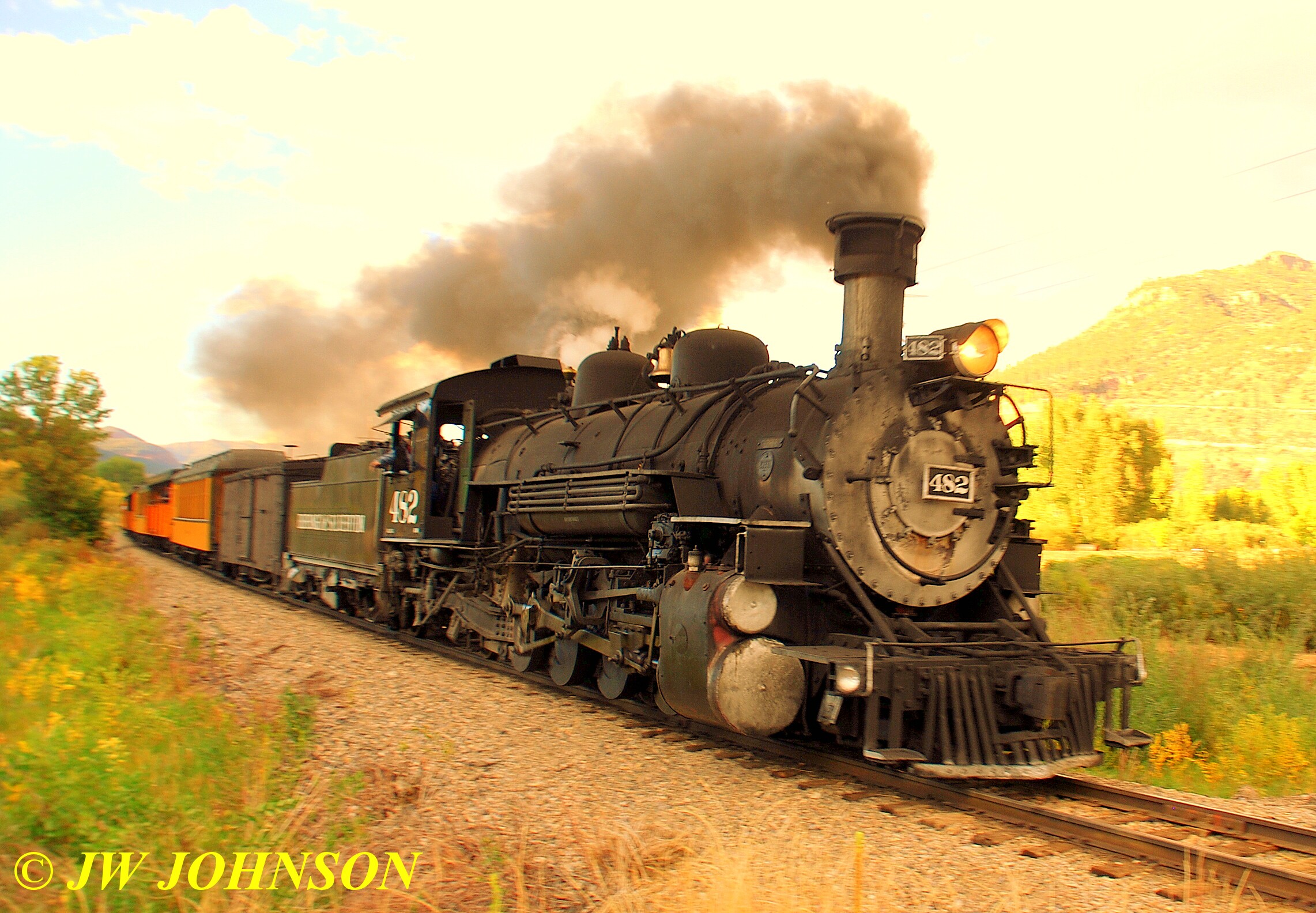
…while shooting the SB 482, we met one of the photographers that would be on my train tomorrow as well, he was out chasing the train, too. We continued on to the train depot to pick up our train tickets for tomorrow and then headed to our hotel, a few blocks north of the depot.
Mom and I had extensively researched every element of our trip, and one disturbing item we found along the way was the fact that there were no restaurants in the entire Durango area that had home cooked American food at reasonable prices, we checked three sites online that evaluated and rated restaurants based on customer surveys and visits and let me tell you, most of the reviews were not very good. There was a pizza place on the south side of town that stood out, visited heavily by most of the local sports teams and a mom and pop diner in the middle of town that only served breakfast and lunch…since we would be on the train all day and were looking primarily for a place for our evening meals, the latter place wasnt going to help us out at all. So while there, we fell back on two favorites considered to be fast food joints, and had great experiences at the Dairy Queen and Kentucky Fried Chicken both. Mom and Dad wanted to try their New Bites meal and were very happy with their food there.
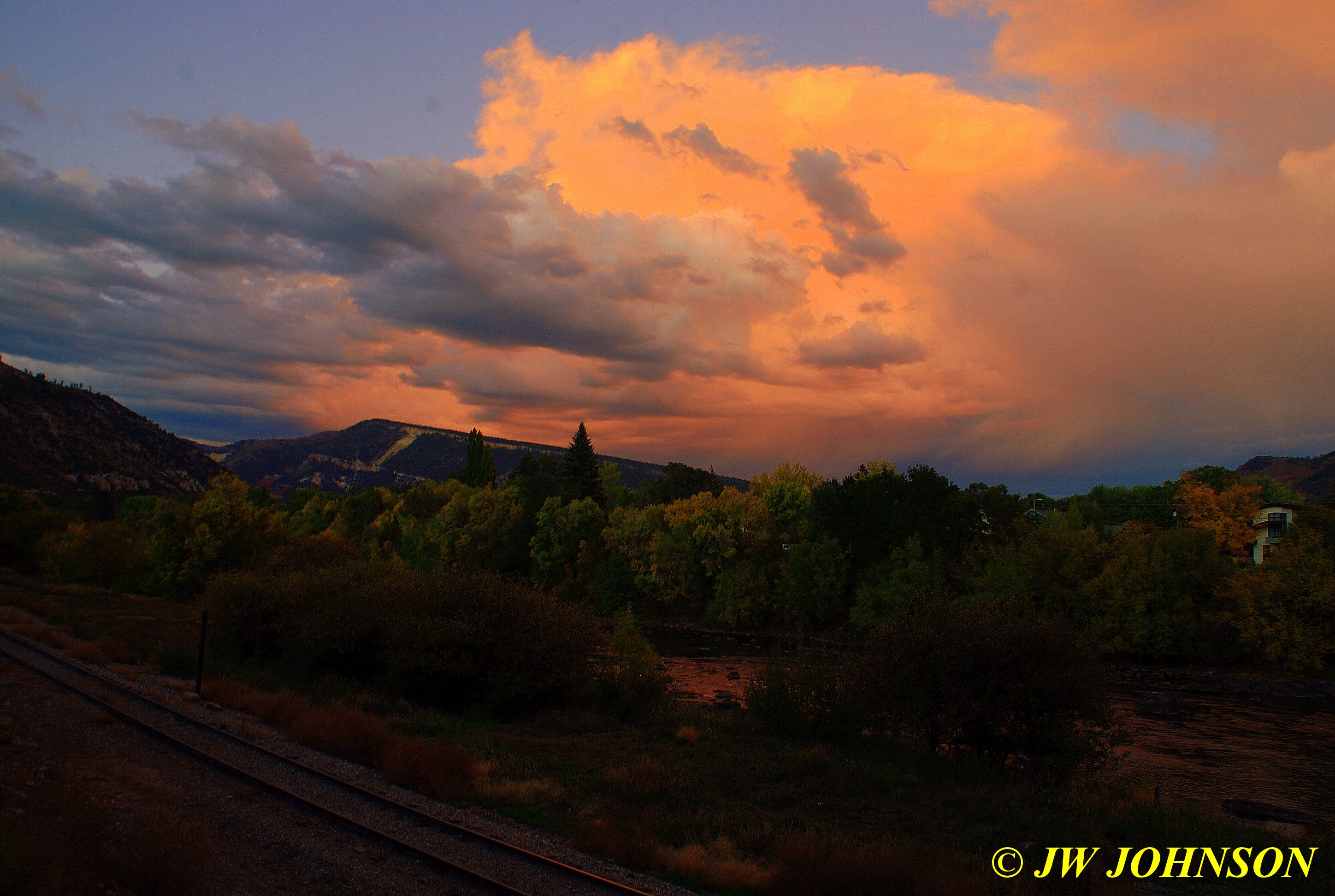
After dinner, Missy and I took a walk down by the Animas River, which runs right behind the hotel, and I took my camera with me and photographed the sunset...
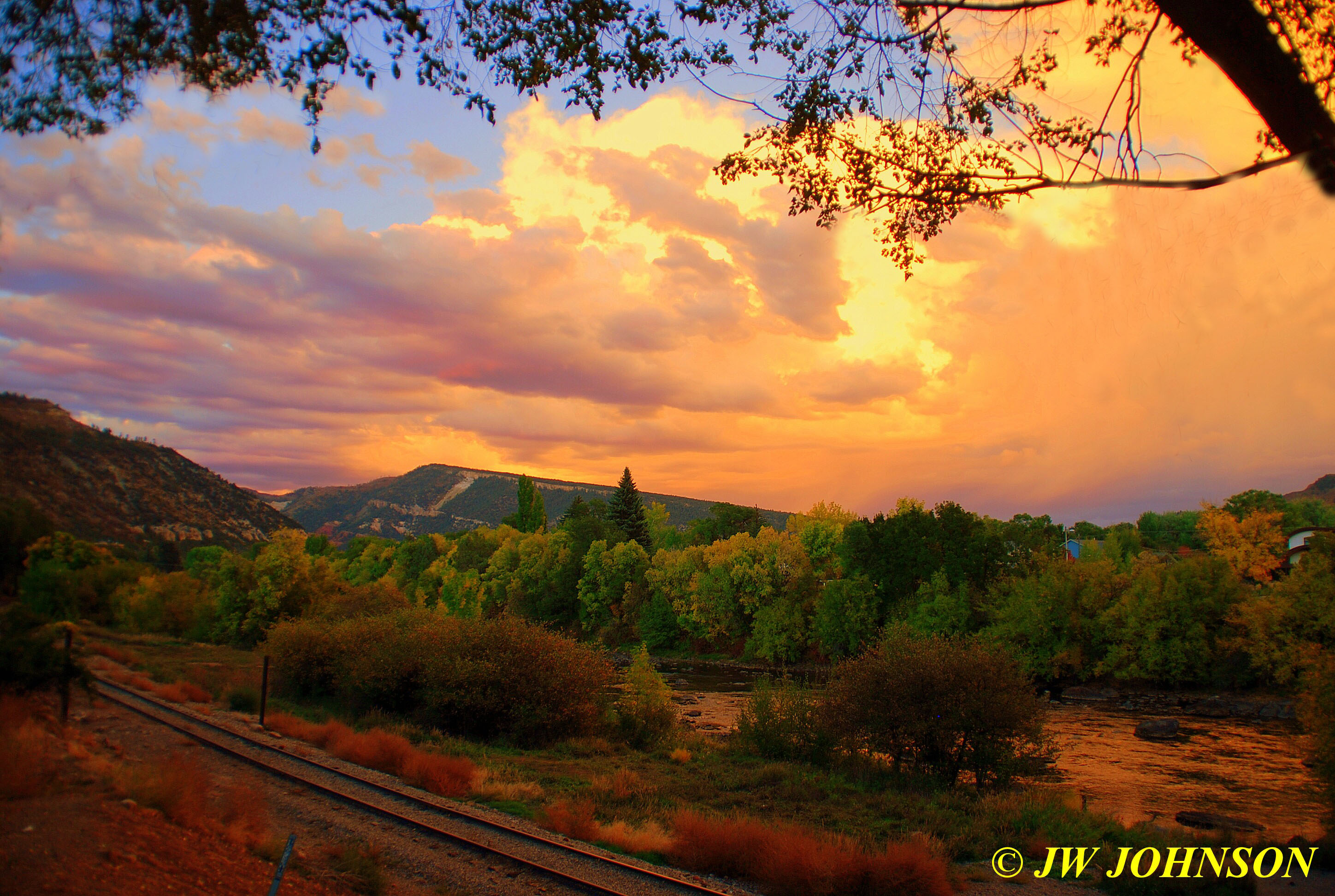
which filled the entire river valley with gorgeous color…
We retired early Saturday night since our trains were going to depart fairly early as well and we had been on the road since 5 am. My train, the Fall Photographers Special, was set to board at 7 am and depart at 7:30 am, plus I had to walk Missy and prepare her for an all day stay alone. We got up early and enjoyed a VERY good continental breakfast at the hotel with a few other train riders. This hotel serves a good hot meal for breakfast, scrambled eggs, link sausage, waffles, as well as cold cereal, bagels, and donuts…it was a welcome change let me tell ya.
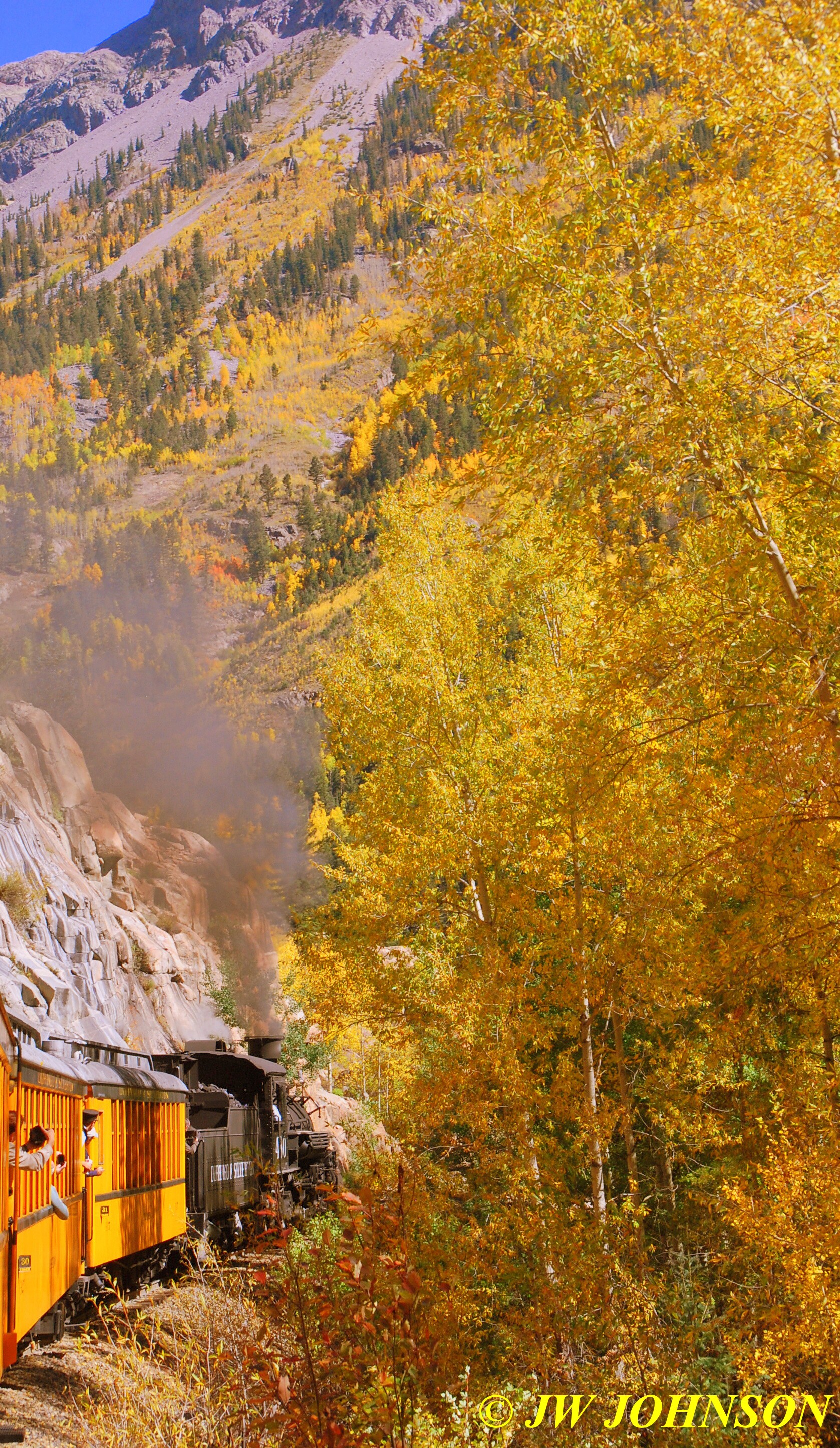
We headed over to the depot, taking advantage of the ticket master`s advice the evening before, arriving early and getting our pick of parking at the Sunday meters which were free parking on the street that day, instead of paying at one of the local parking fee lots. After meeting up with a few of the photographers inside the depot, we were allowed to board our cars…I had chosen the San Juan Coach, a maroon red coach car that had been restored a few years earlier by the DSNGR ( Durango Silverton Narrow Gauge Railroad )…and took a back seat on the right side…the seats were nice and cushy, very comfy for a long ride ahead. As the car filled it soon became obvious I would have the seat to myself and after a little bit of small talk with Bill, the guy across the aisle from me, I found out one of the Conductors was his son in law and he had been on this trip once before, a couple of years earlier. He was photographing the ride with his I phone, as were a few others, where most of us were shooting a camera or two and some were shooting video.
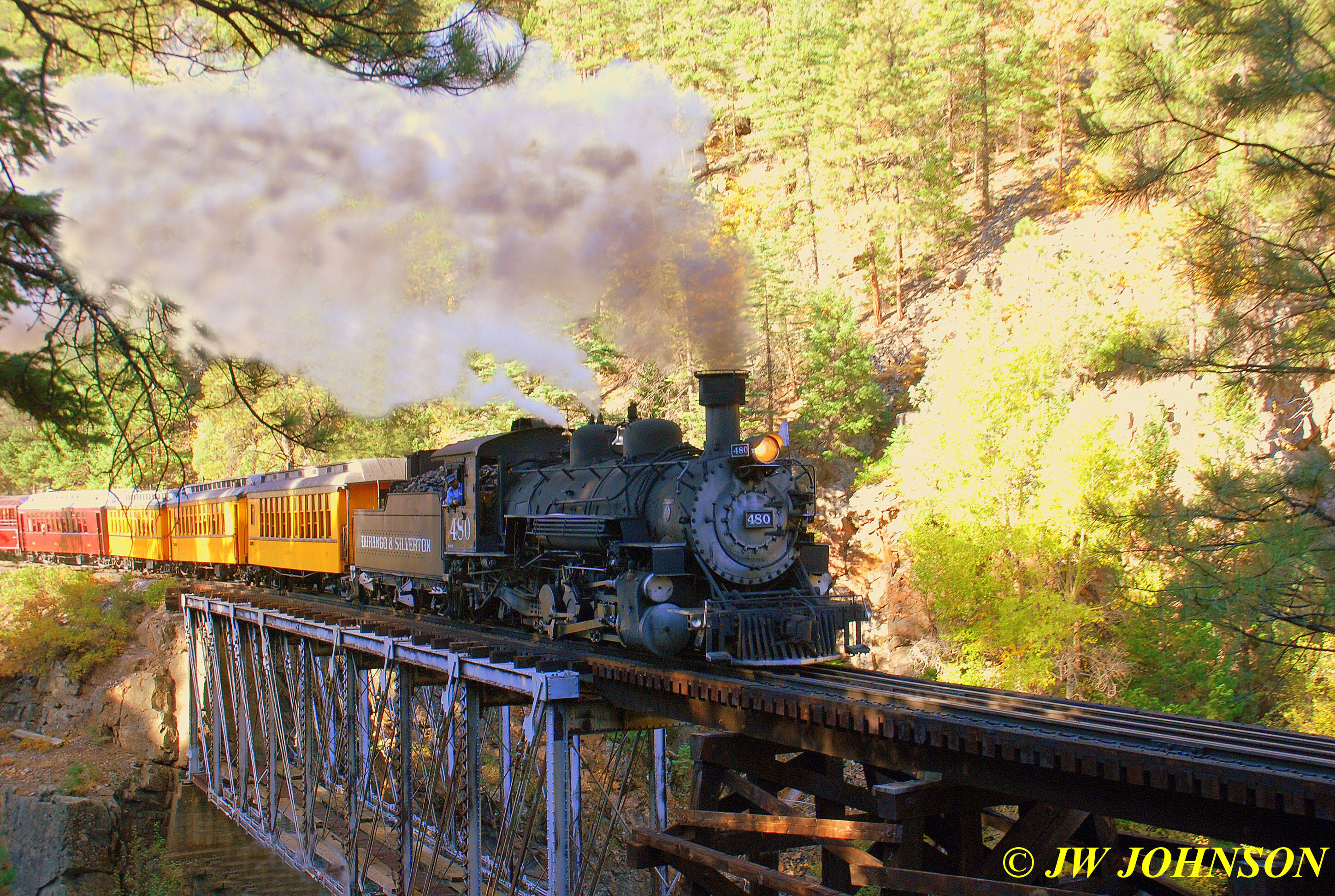
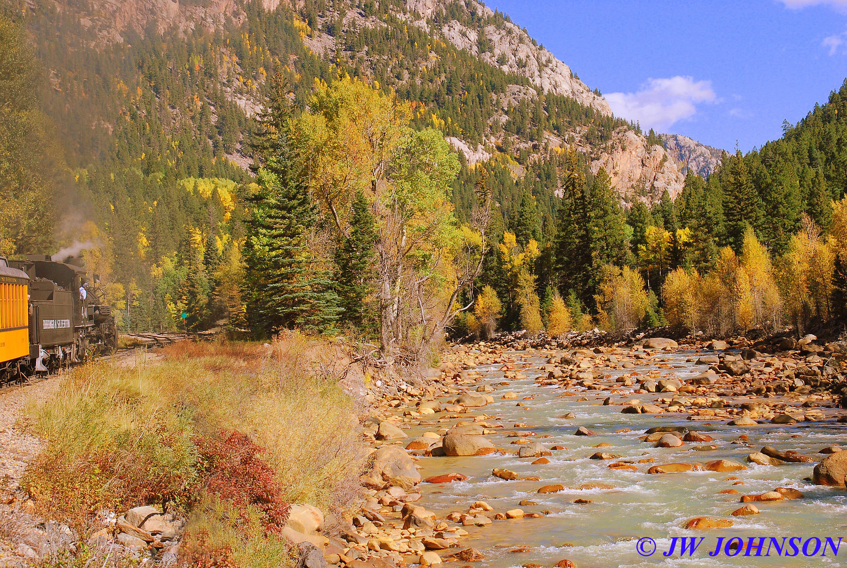
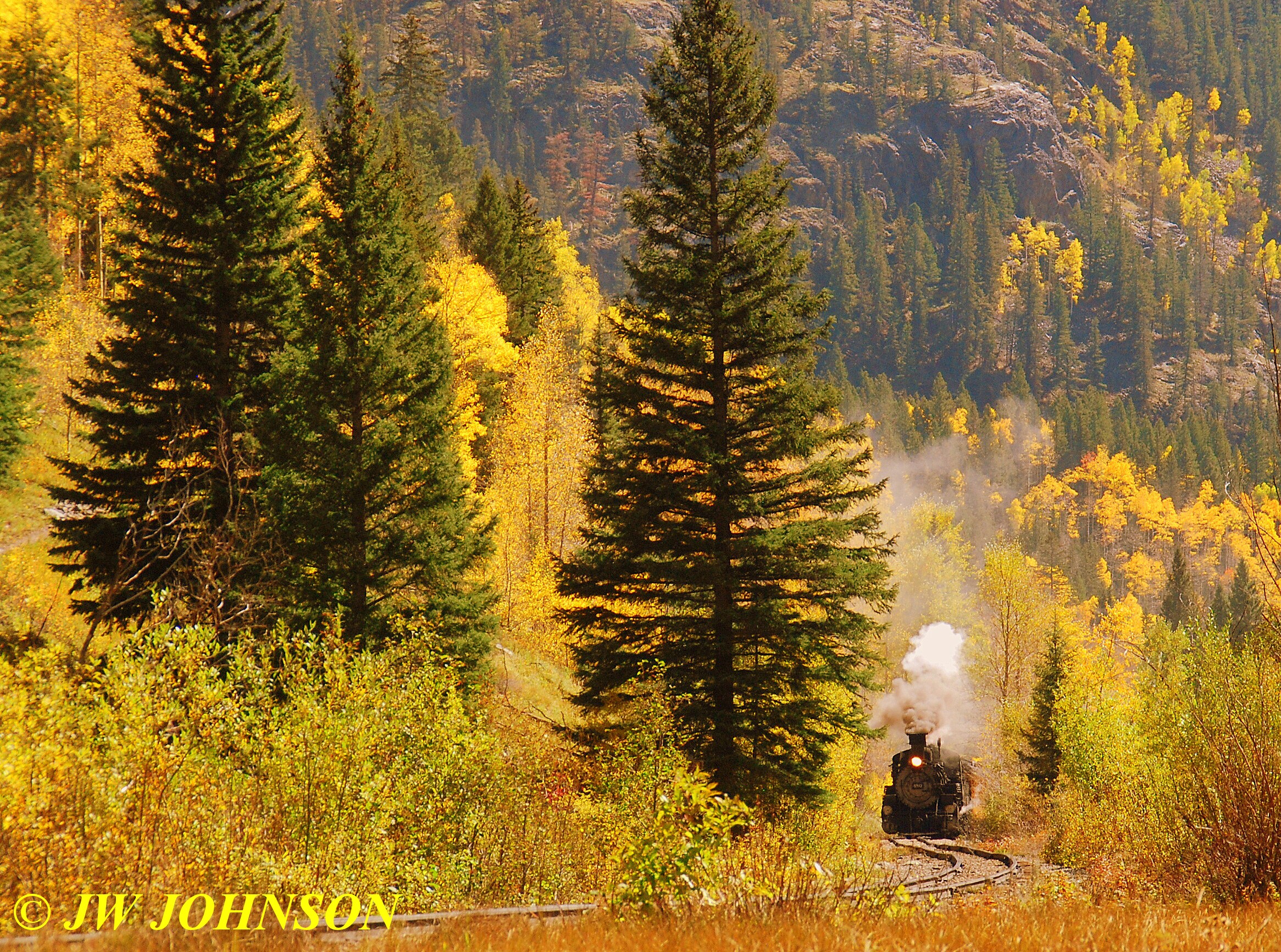
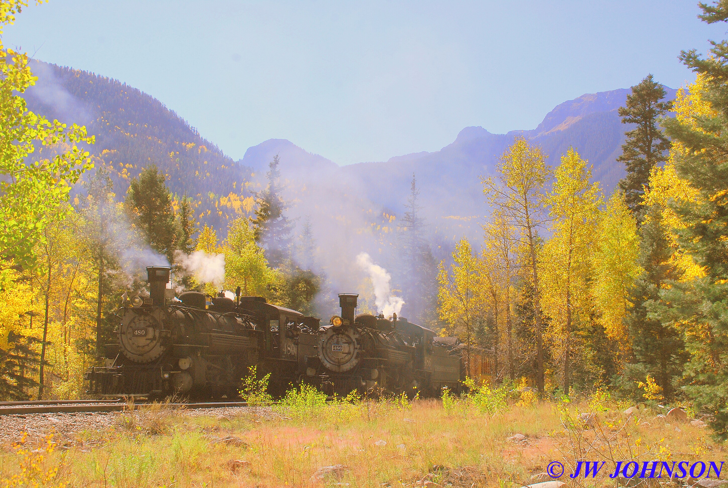
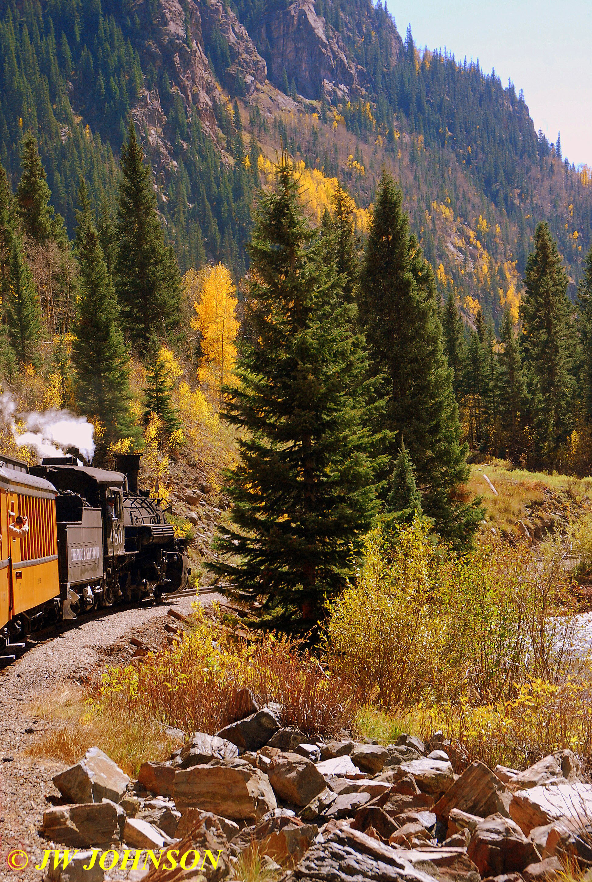
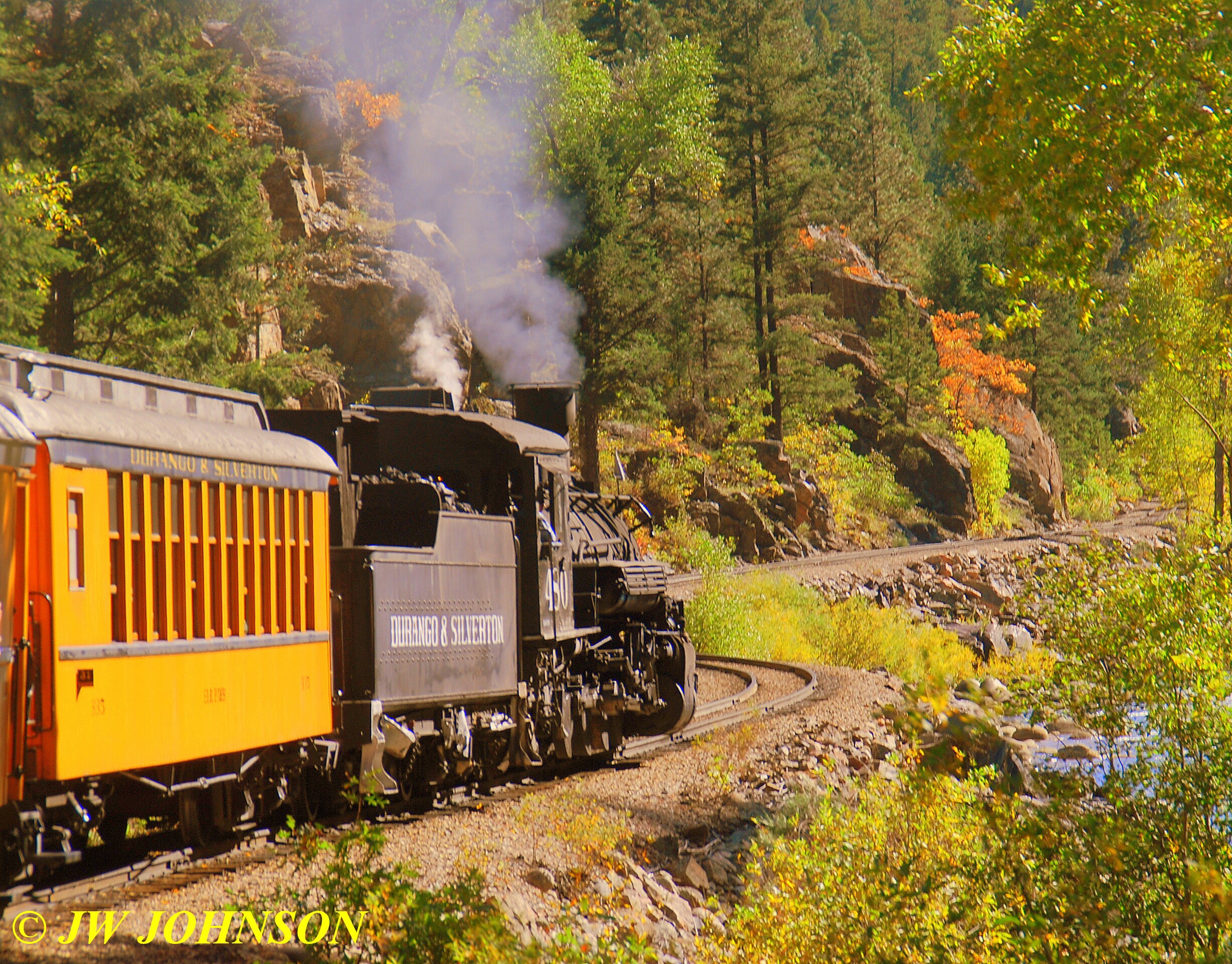
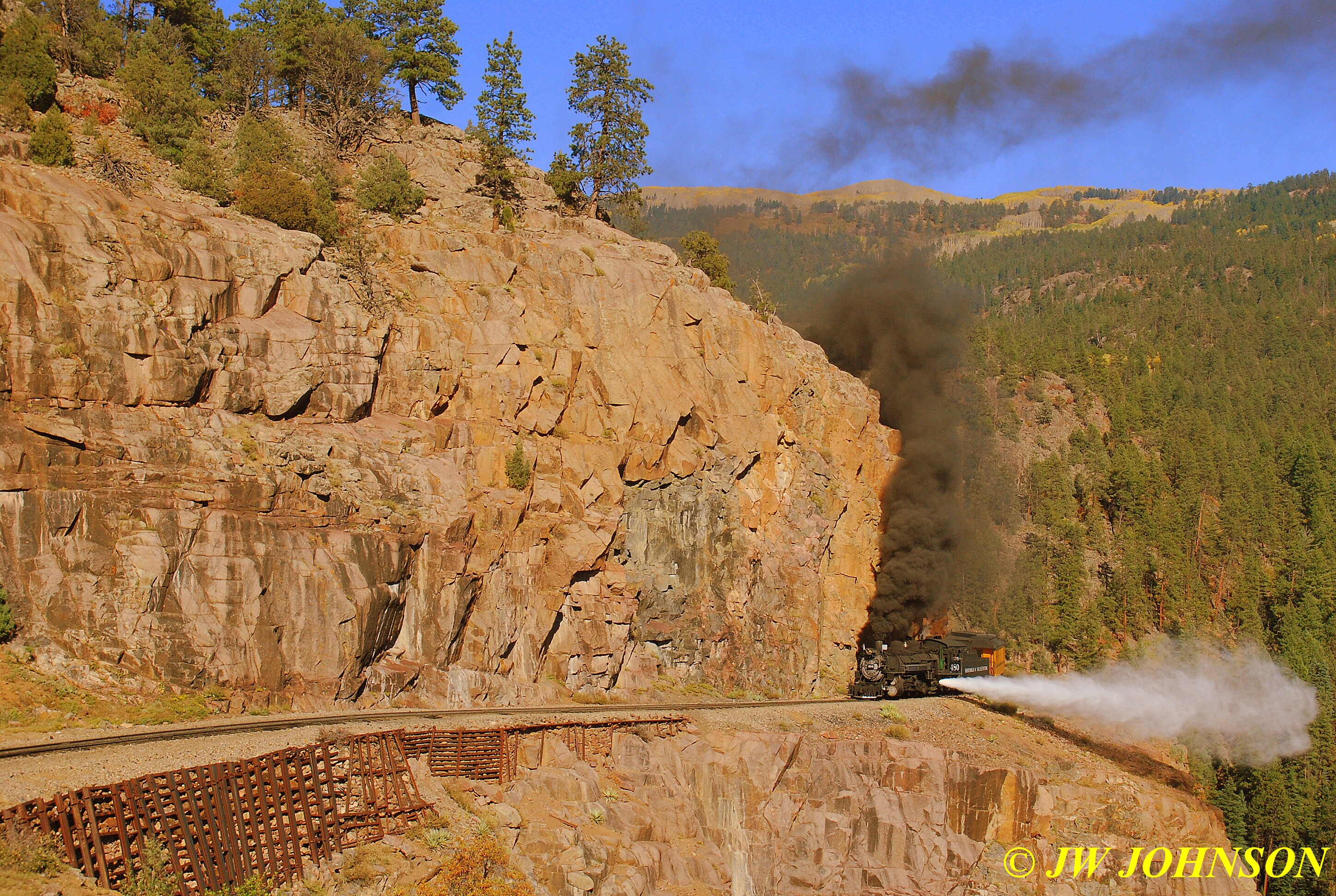
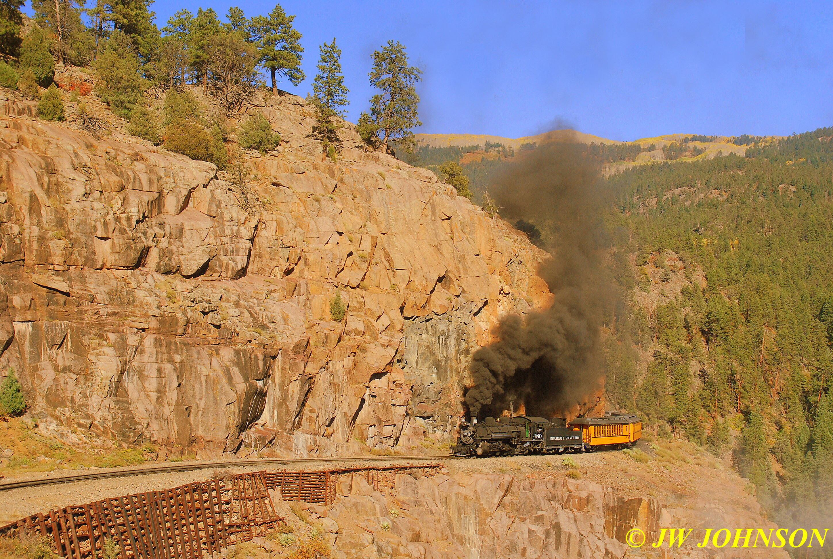
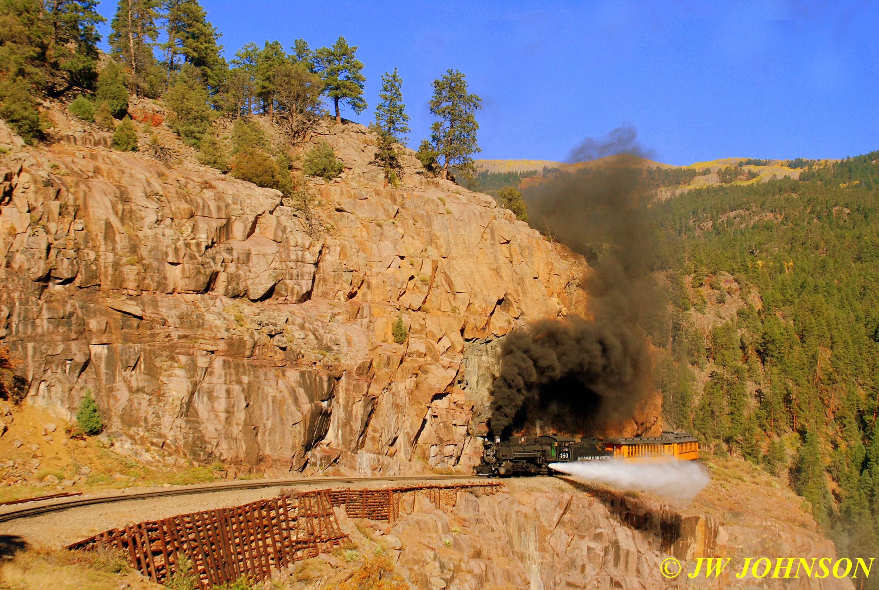
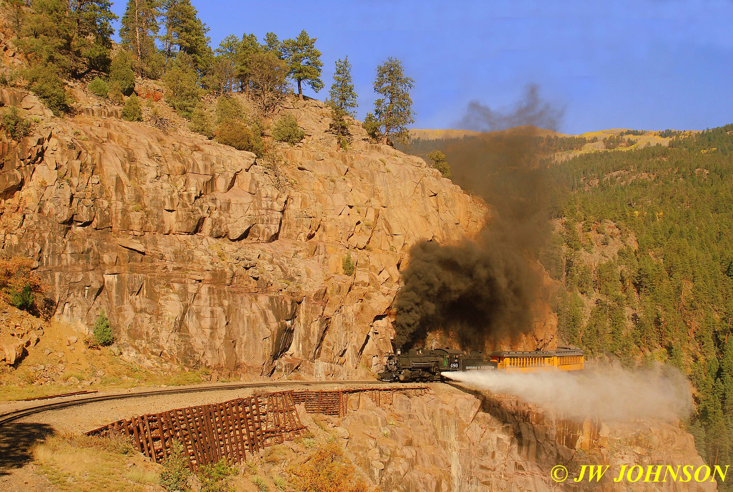
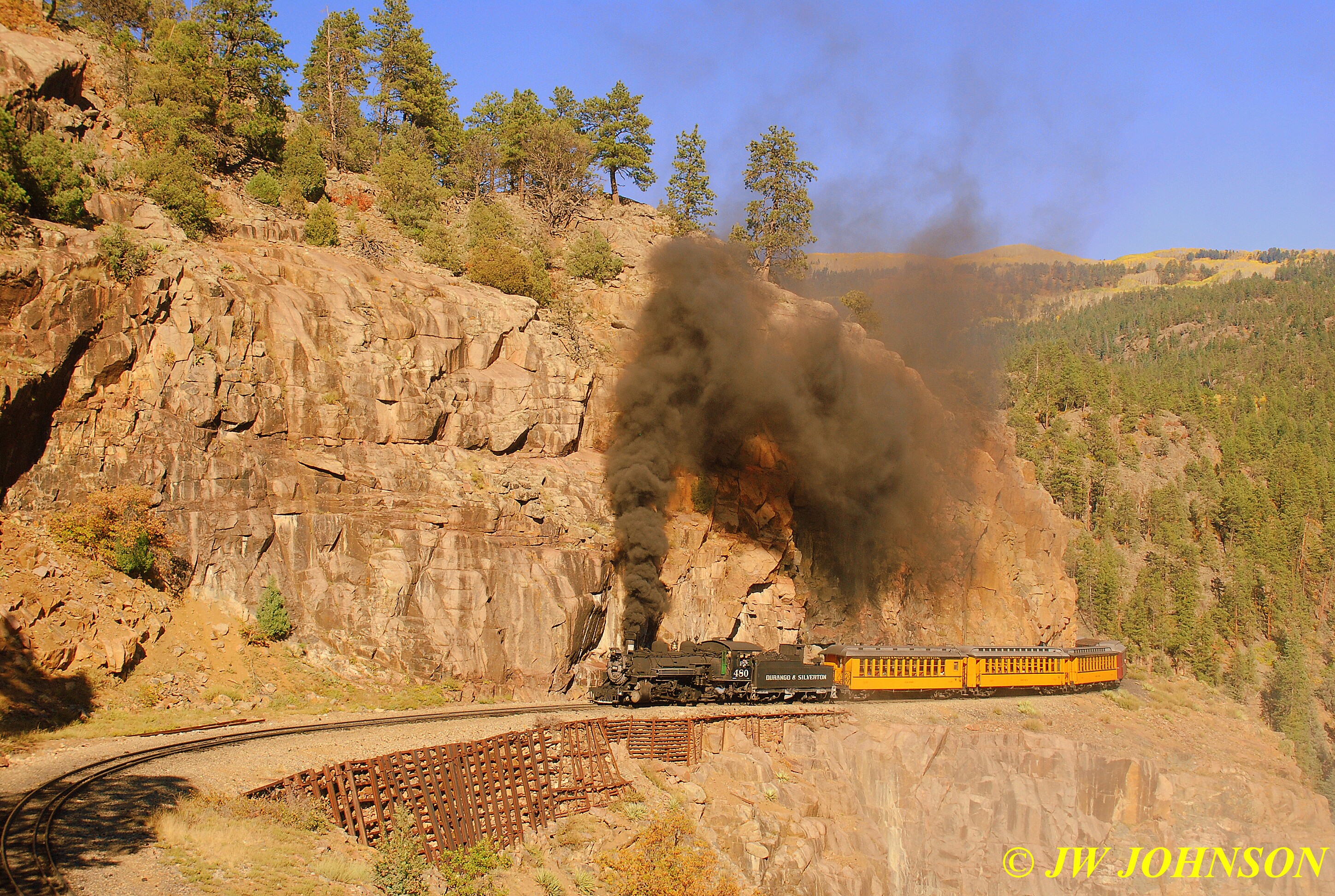
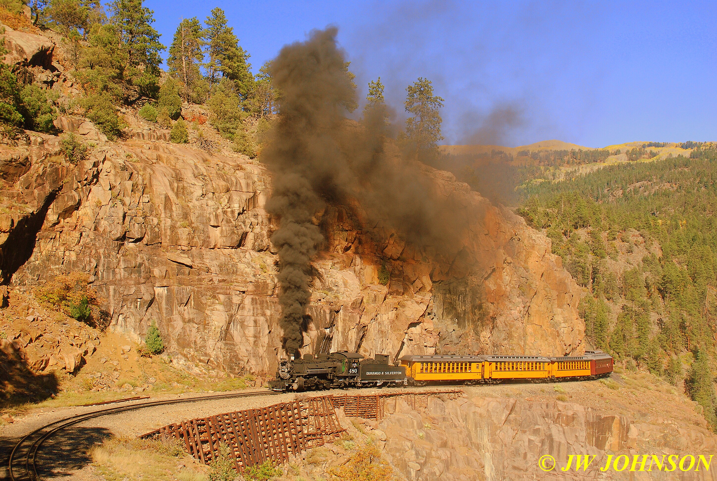
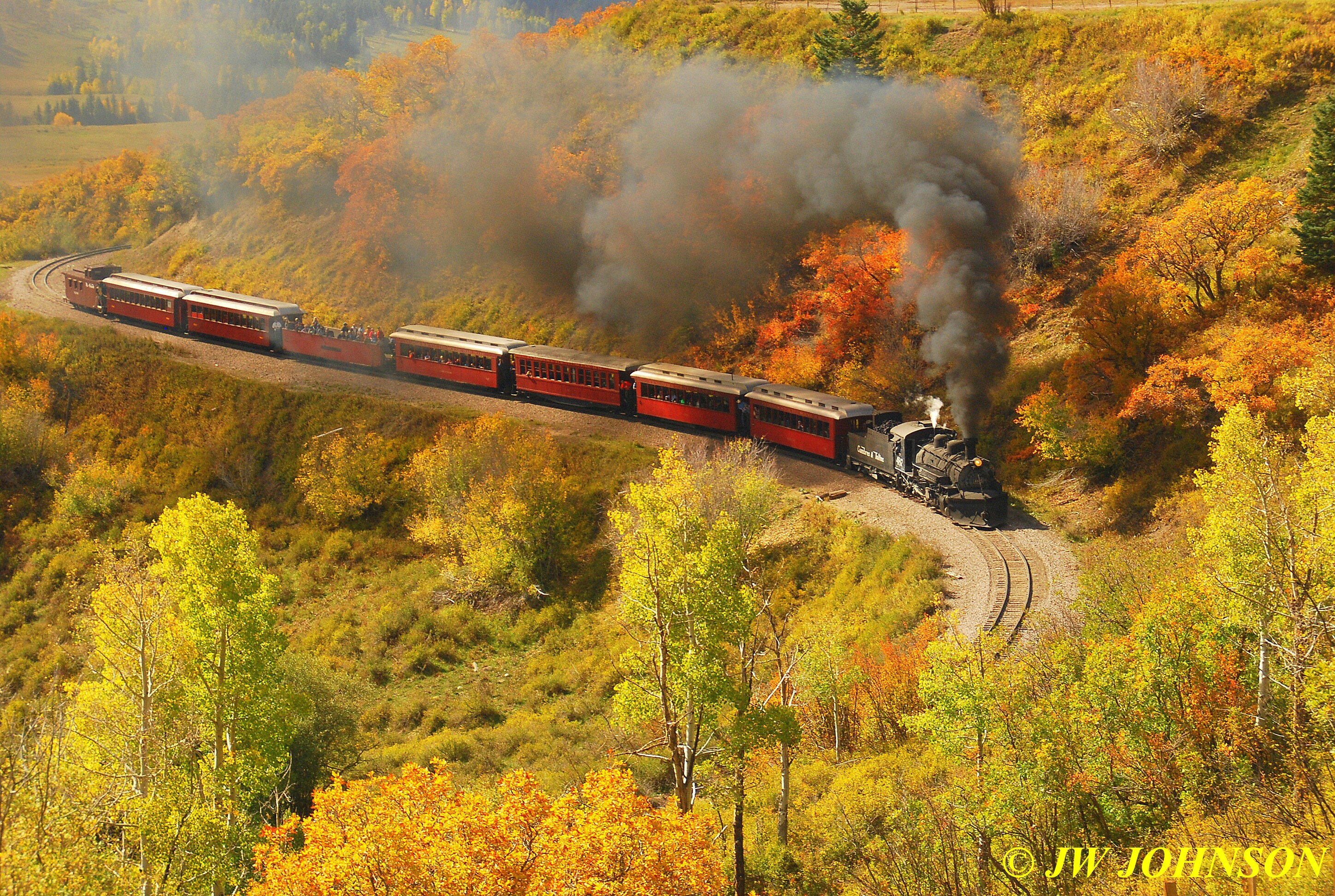
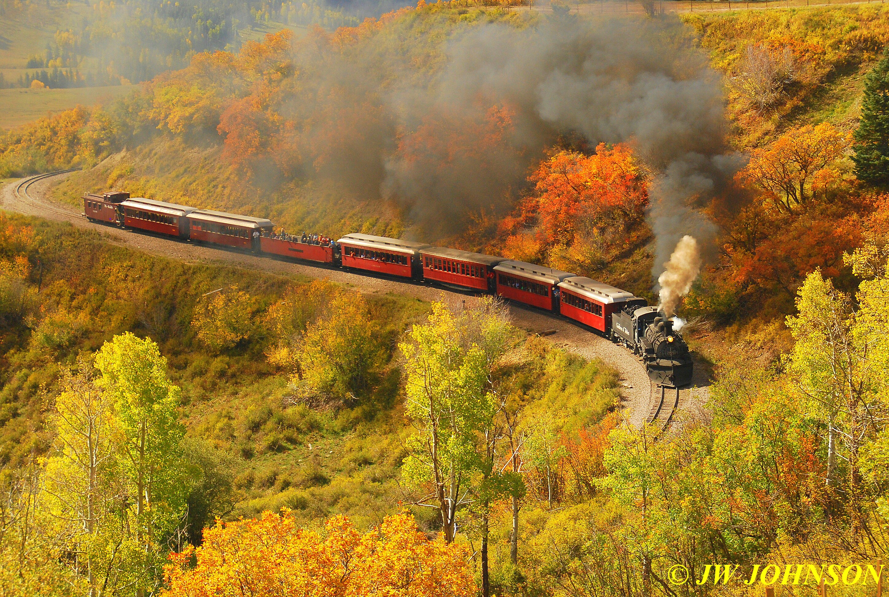
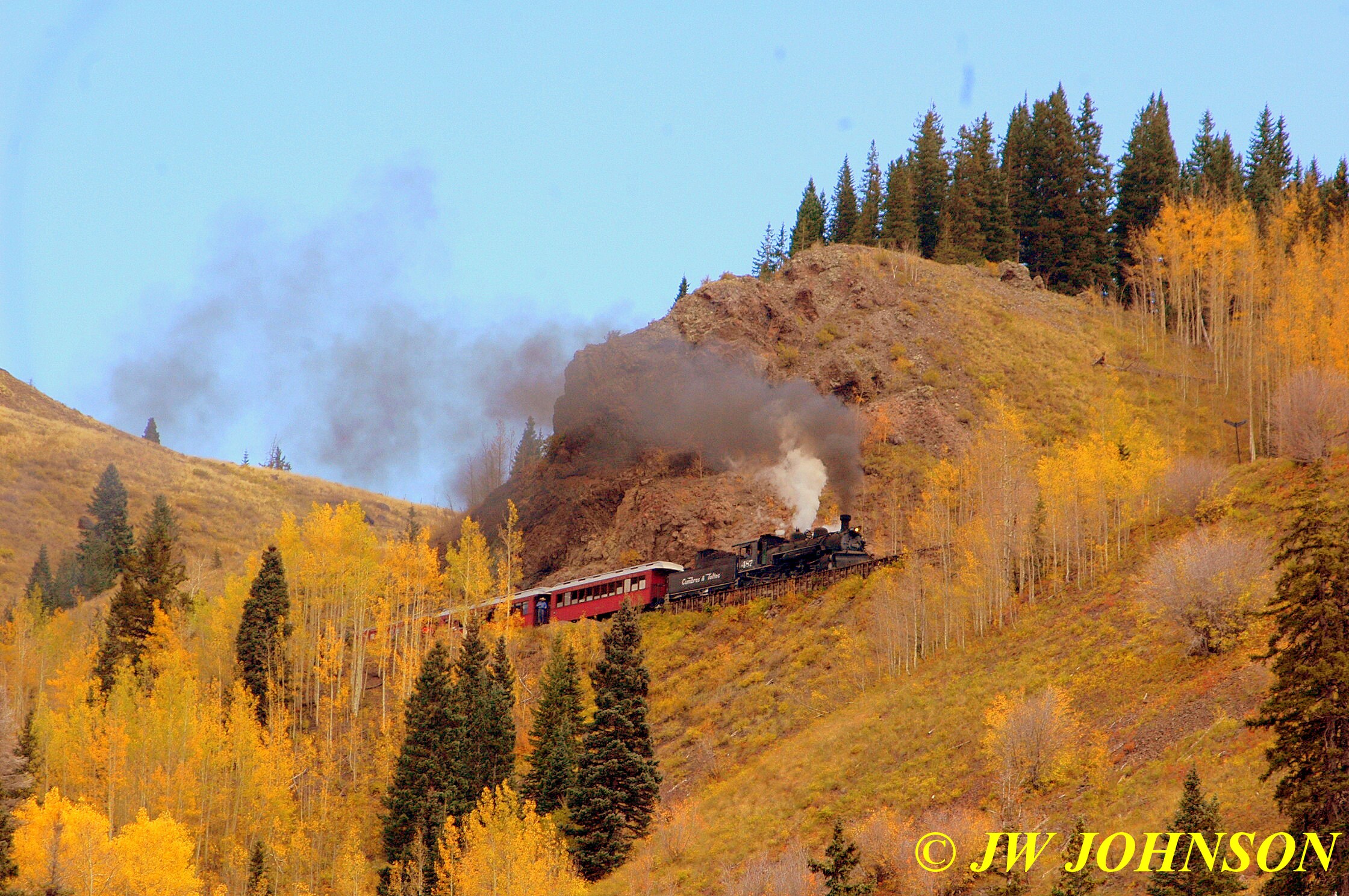
Sitting on the right side of the train, this far back, gave me a unique advantage…I would be able to photograph the locomotive and a few cars back as they rounded left hand curves….such as up on the highline past Rockwood Depot and coming out of Horseshoe Curve…
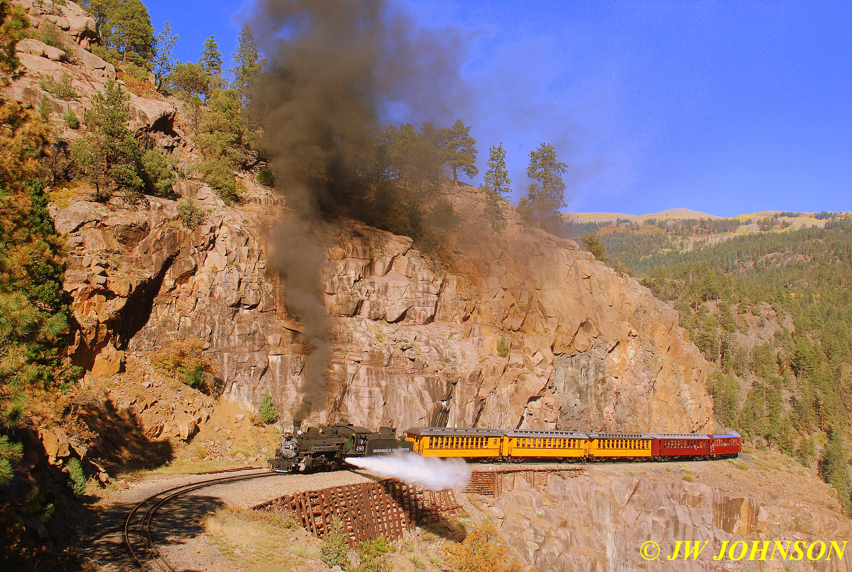
We stopped at the first run-by, the high bridge, and all of us got off the train and walked over to the area designated by the Conductors…it was soon apparent to most of us that there was a unique shooter among us…I had climbed up on the rocky hillside to get a higher advantage point above many of the other photographers, when I looked down and noticed this very pretty ornamental looking view camera mounted on a heavy tripod, and a guy in a blue jean jacket and jeans, setting about getting ready to shoot with it….this is the type of camera that famous photographer Ansel Adams used to photograph Yosemite National Park back in the early 1900`s, what they used in the 1800`s in the western towns….where a photographer would duck under a dark colored hood and take your photo…and if he needed a flash, well he stood there with a thingamabob in his hand that had a handle on it and a groove on the end that held flash powder, which looked like gunpowder and ignited like it too, made a big bright flash when he took the photo.
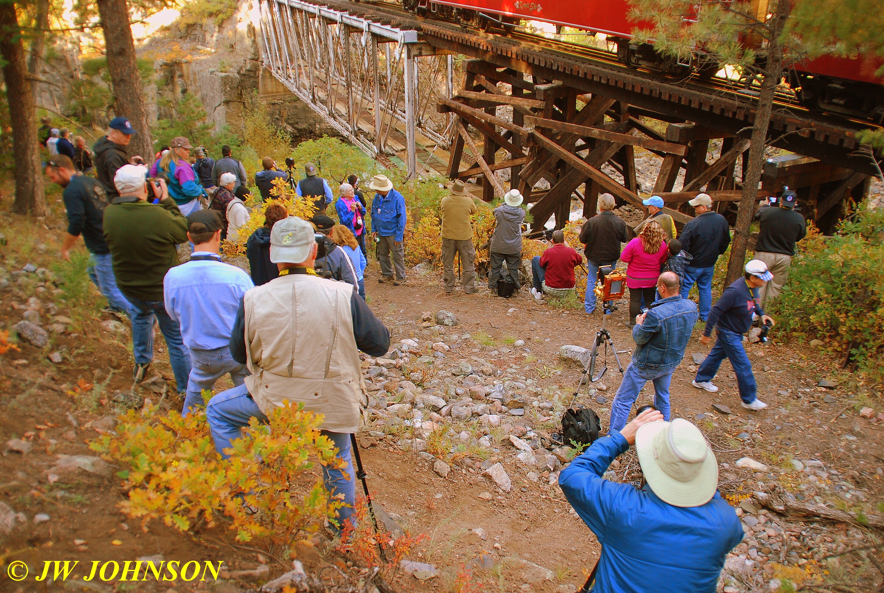
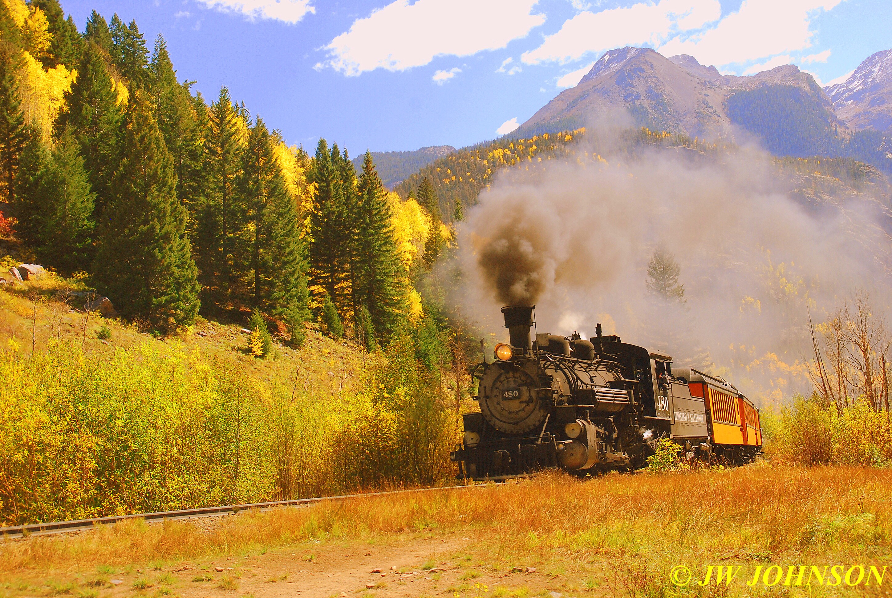
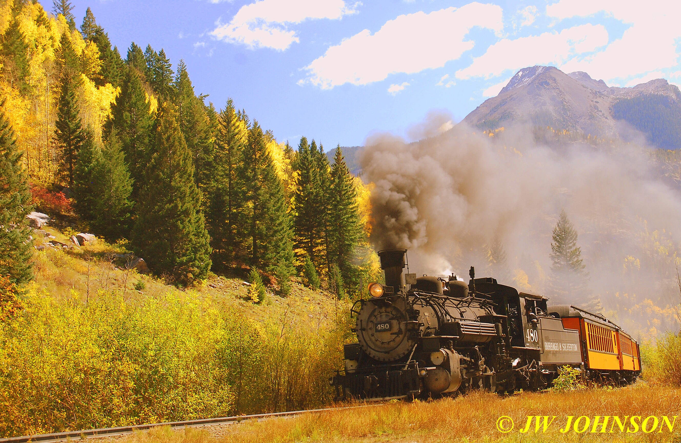
Here above, you can see the train on the tracks on the High Bridge in the background, this is where we shot the first run-by…meaning the train would back up and then after two short whistle blasts, steam forward and run across the bridge by us, and then stop again…and while most of us were shooting digital cameras or phones, and would be shooting practically at the speed of sound and therefore many exposures…this guy with the view camera, was going to have an opportunity to maybe shoot two images at the most of the train coming forward, and if he was lucky, maybe two shots of the train backing up as well…two to four shots total…..I think I shot about 50 or 60 shots hoping for a few good ones…he only got to shoot one or two, and had to pray that he had a good one in those two to four shots…and I say maybe, because I found out later he was shooting three different sizes of film, 8 x 10 inches, 5 x 7 inches, and 4 x 5 inches, in big plates, that he would mount to the back of that camera, then used his blue jean jacket as a hood to block out the light and a cable release to release the shutter and snap the photo…and if he was lucky to have enough time to flip the film plate over, he might be able to shoot a second photo as well. if he was lucky….
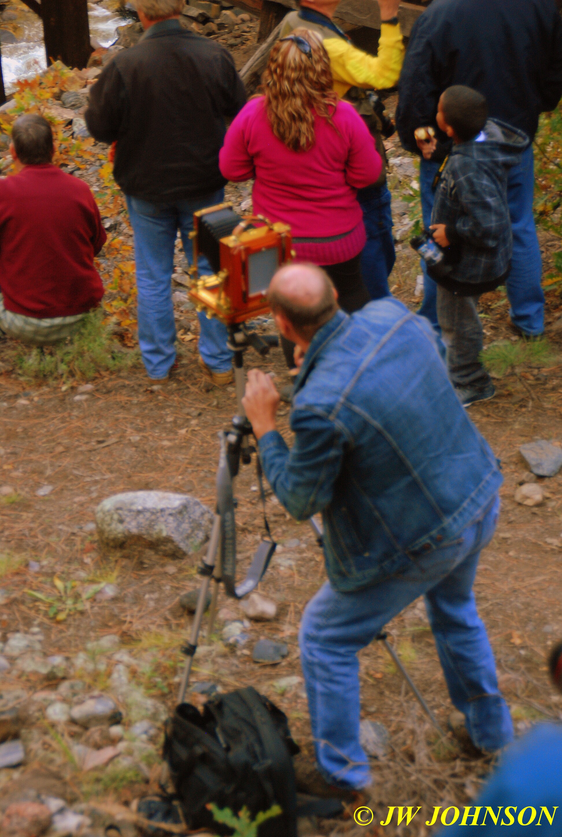
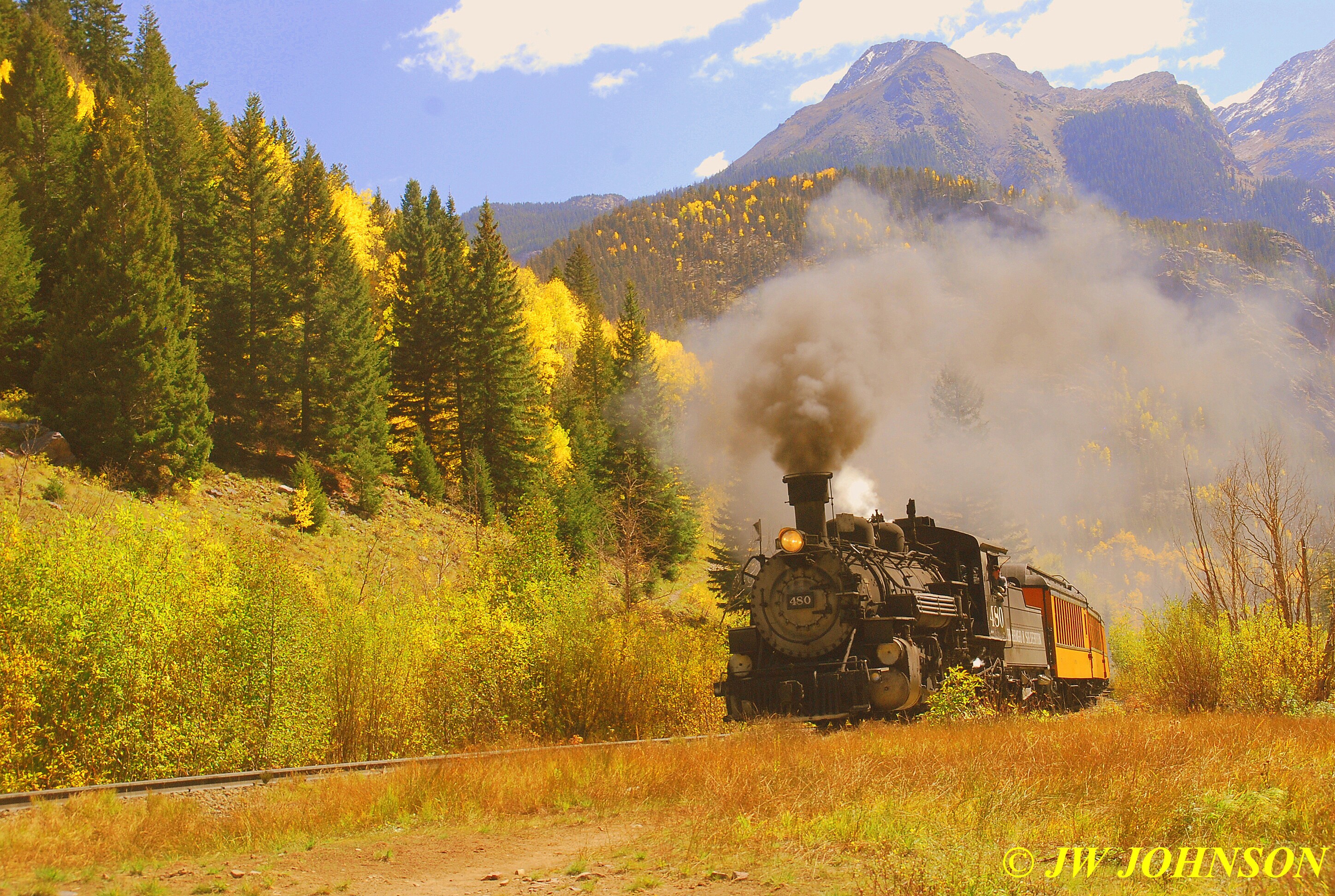
..in the photo above he is seen focusing the image….thinking about where in the view above he wants the train to be when he snaps the shutter with the cable release and focusing for that spot…and keep this in mind…that image he is looking at on that large focusing screen on the back of the camera there…he sees that image upside down…yes I said upside down…not right side up as you and I see in our cameras…making his job even more difficult…but the bright side is that his images are going to be ten times sharper than anything you and I take a picture of…it was a pleasure to talk to him along the route at one of the other stops for a few minutes…he has a very pretty camera and I truly hope he was able to capture some memorable images from that day…here is one of my images of the 480 backing up on the High Bridge….
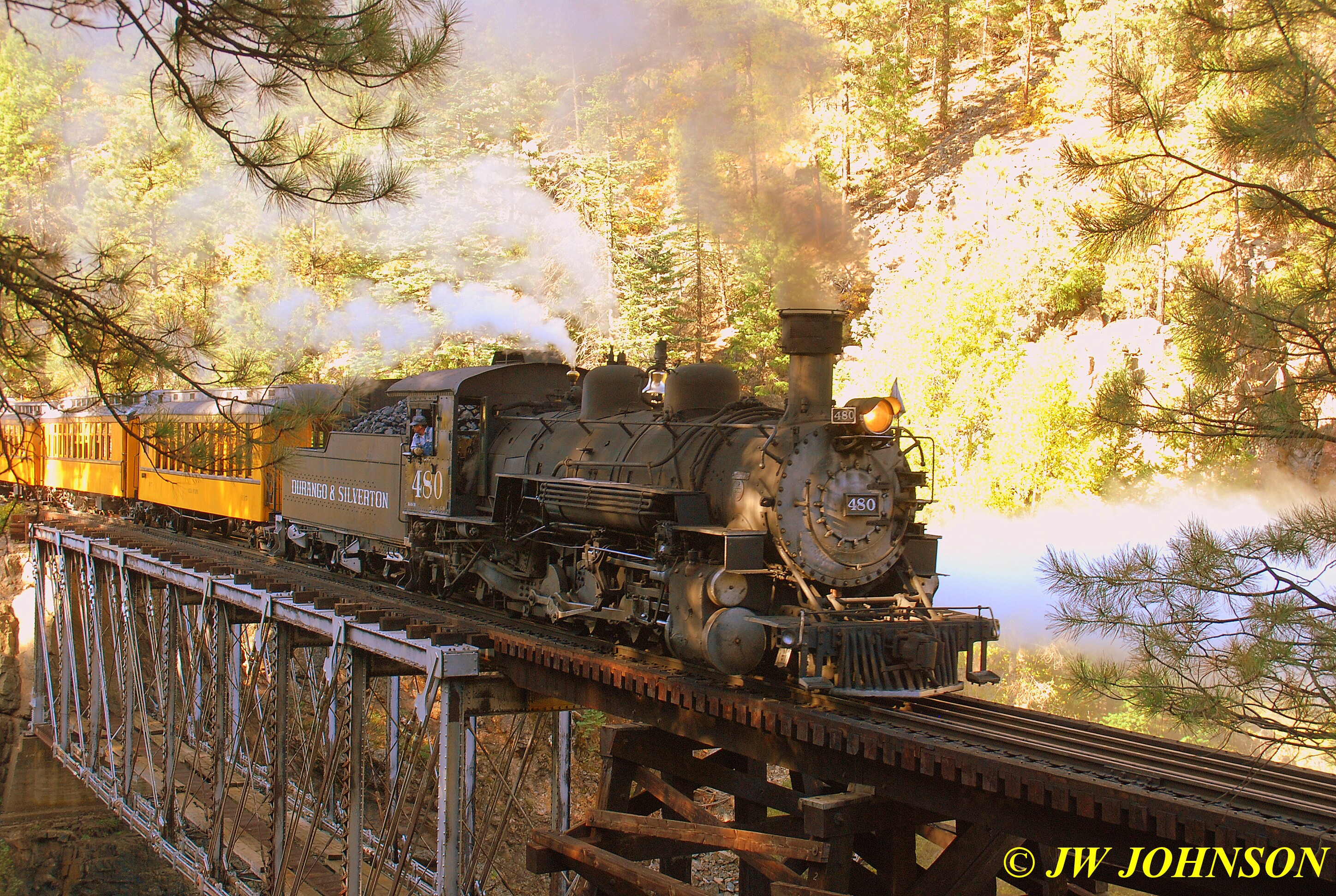
…and now steaming back across the bridge….
We loaded back up after shooting two run-by`s at the High Bridge and rolled northbound again. Between photo stops, several photographers were either hanging out the windows or shooting from between the cars on the platforms…some were shooting video and recording the sound as well, and would shoot forward to capture the locomotive on the curves ahead…I felt I had a good advantage for that since I was five cars behind the coal car and the locomotive was far ahead and enabled many of us to get the photos we wanted on the curves.
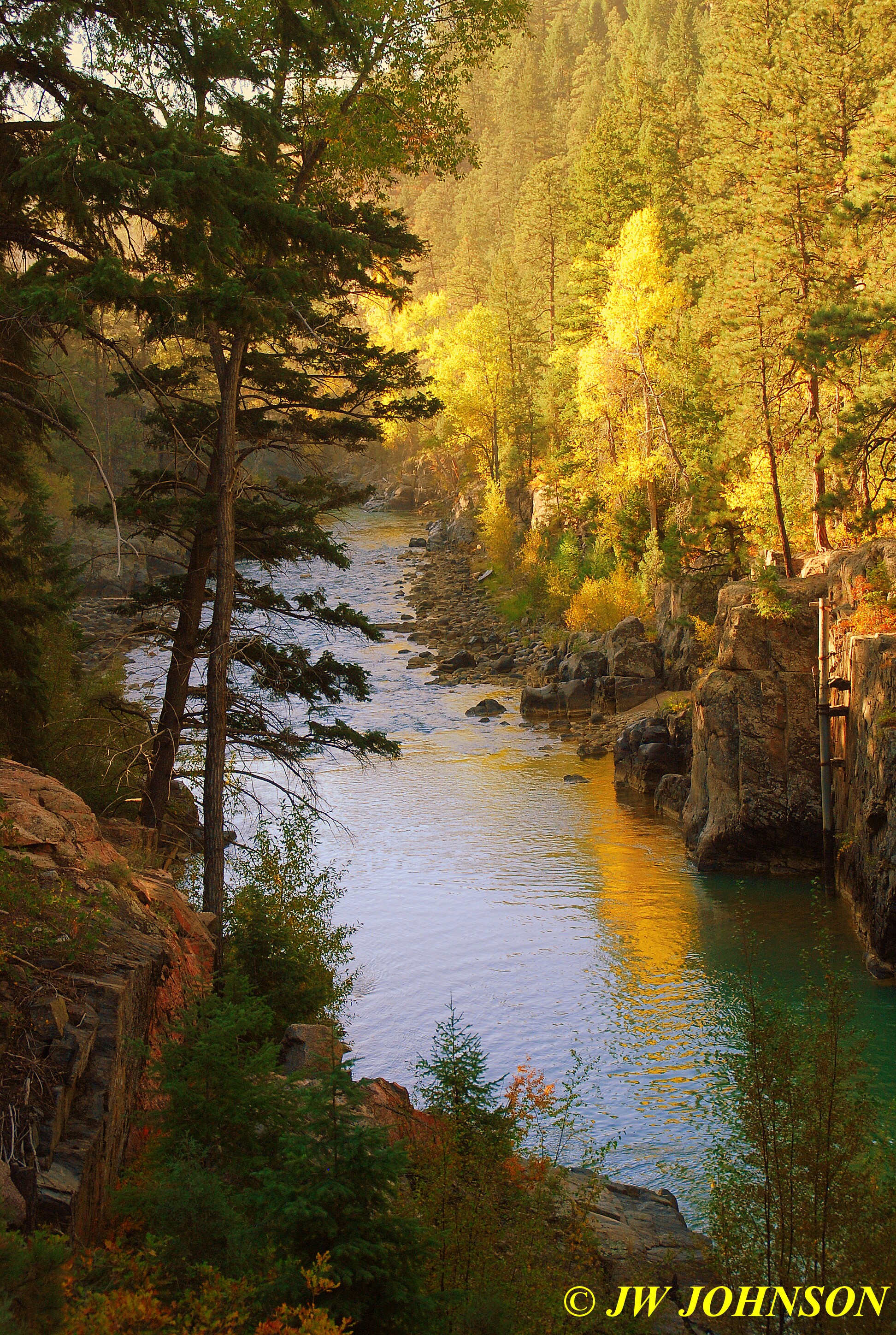
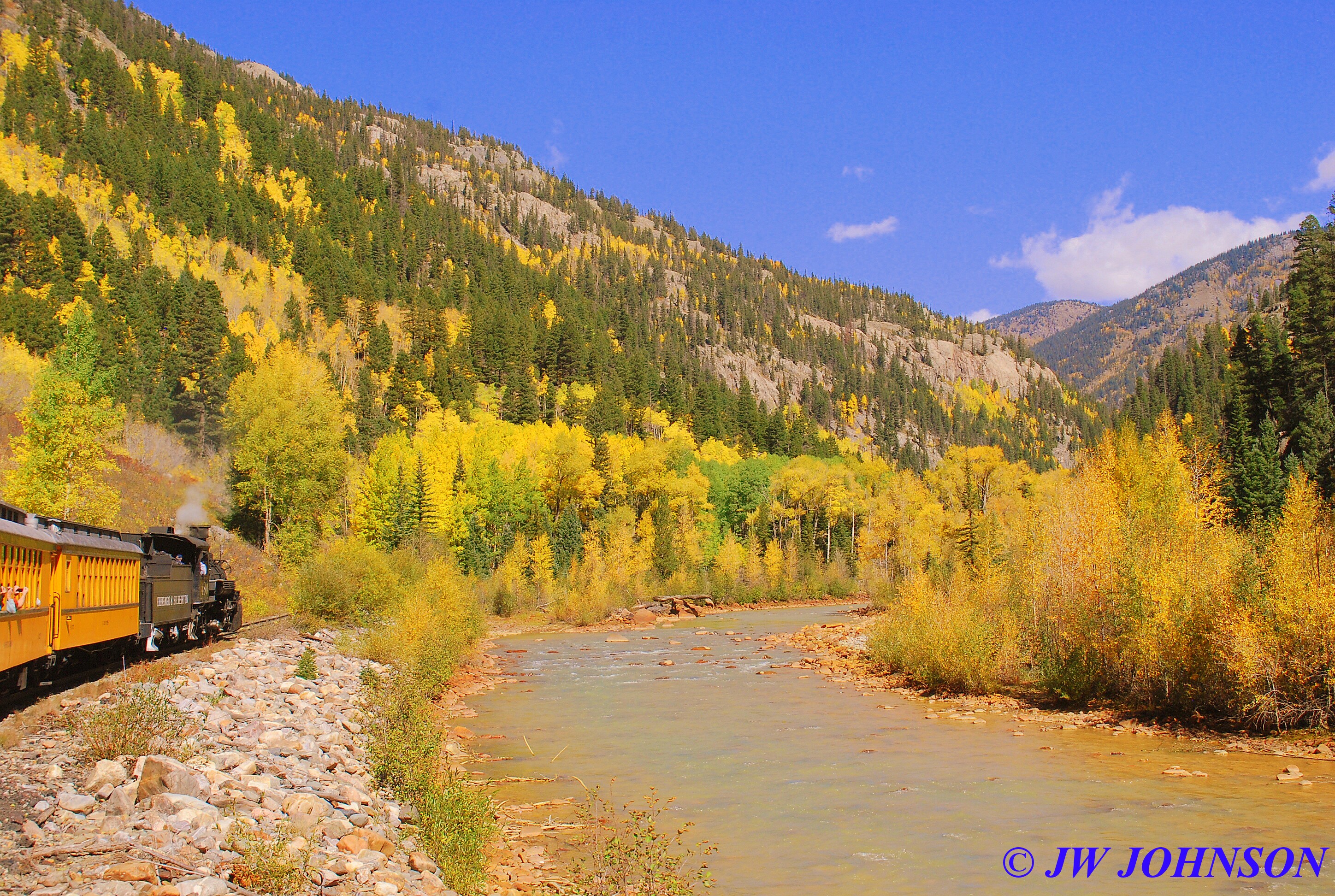
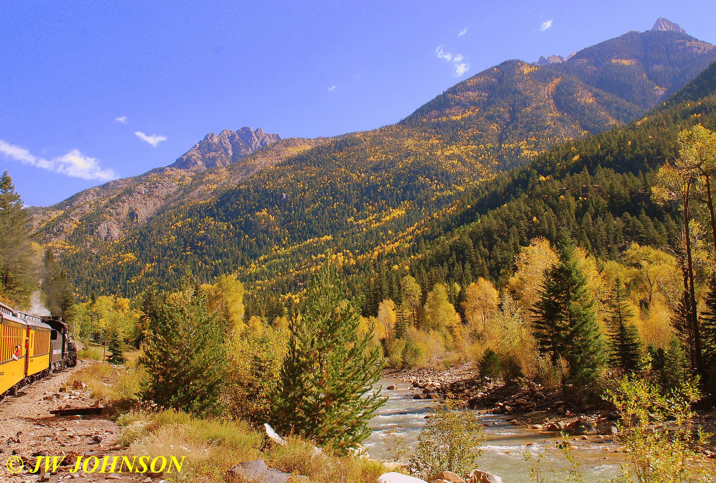
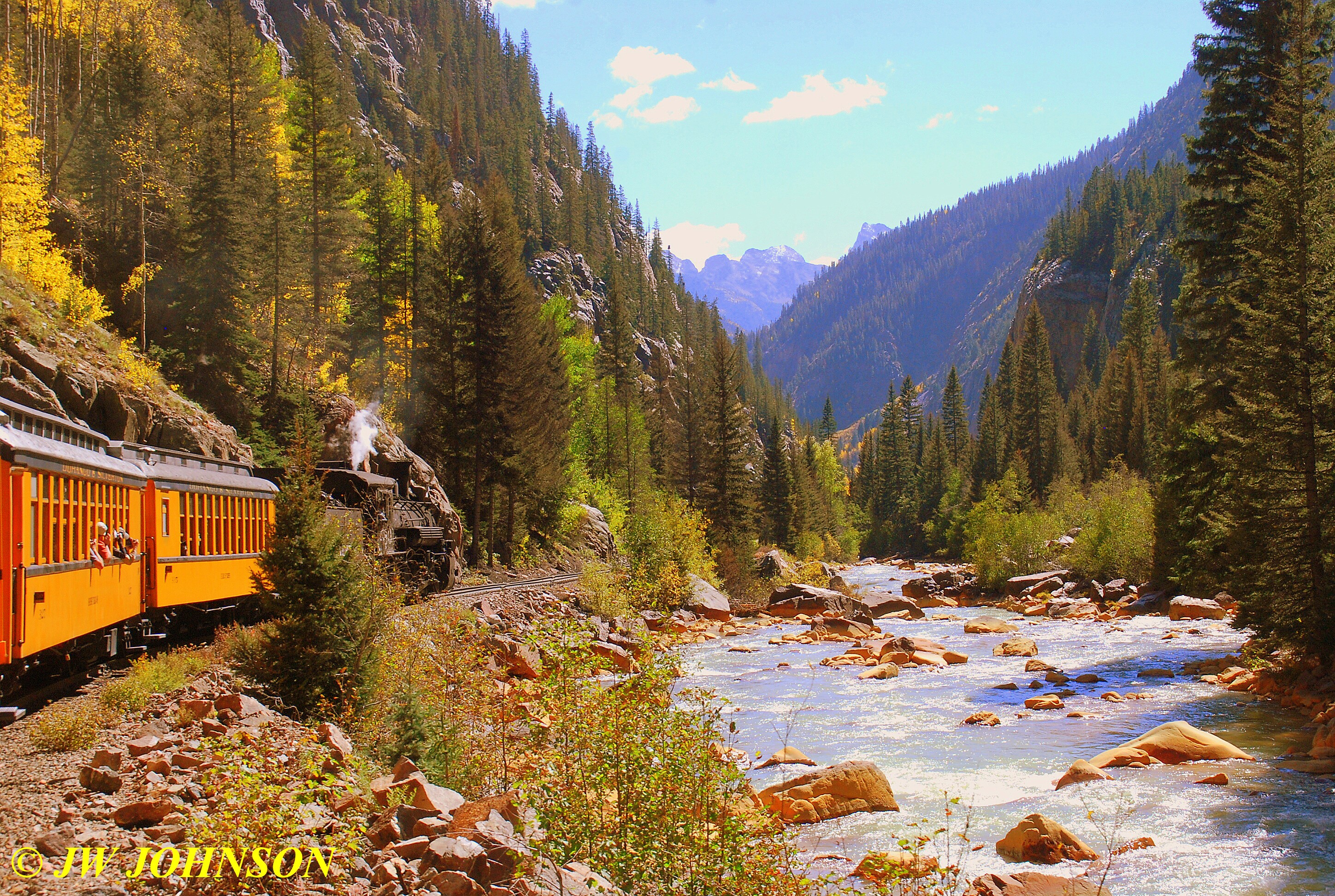
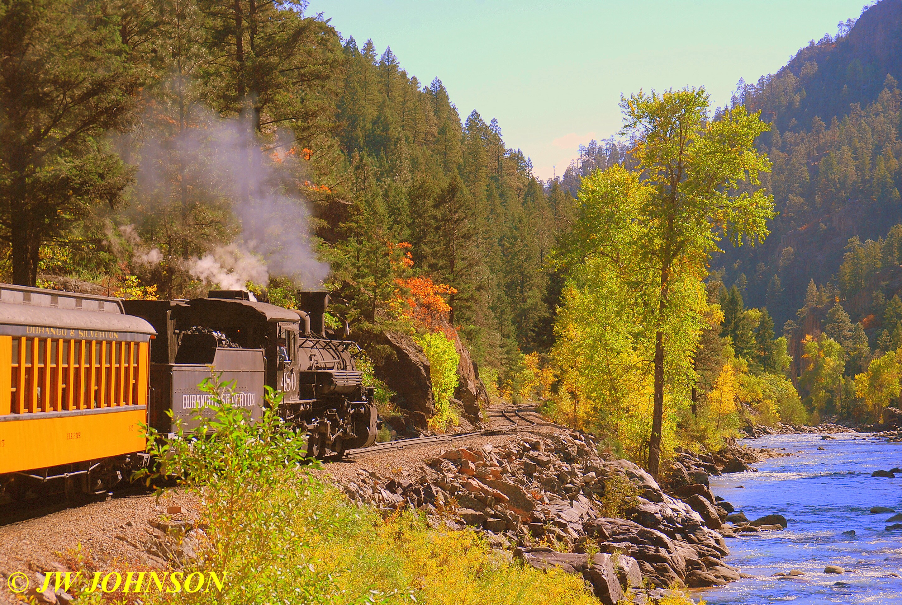
We also had great opportunities to shoot some foliage and river scenes that are not accessible to anyone that doesn`t hike in or ride the train in, because much of the canyon is not accessible to anyone by roadway at all. There is even a bed and breakfast resort a few miles inside the canyon that you reach by hiking or train, most visitors reach it by train. The scenes along the Animas River, which often runs right by the rails, are very pretty, with the foliage in full bloom this time of the year…this weekend is considered the prime time to view the colors in the Durango area, which is why they hold their Photographers Fall Special this weekend each year.
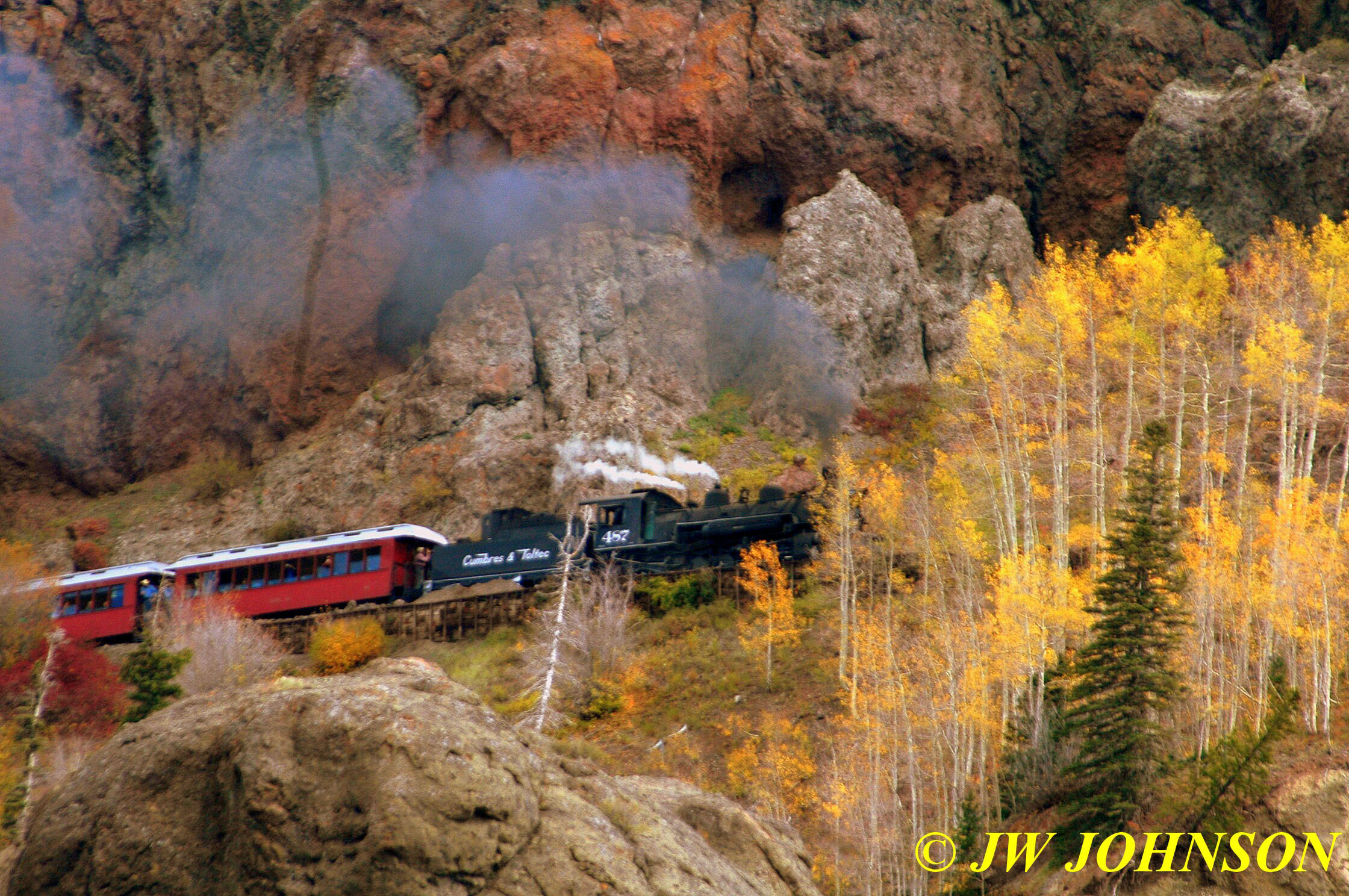
The next three photos show a colorful curve next to the river that we went through and by, just before we reached the siding for the run-by….

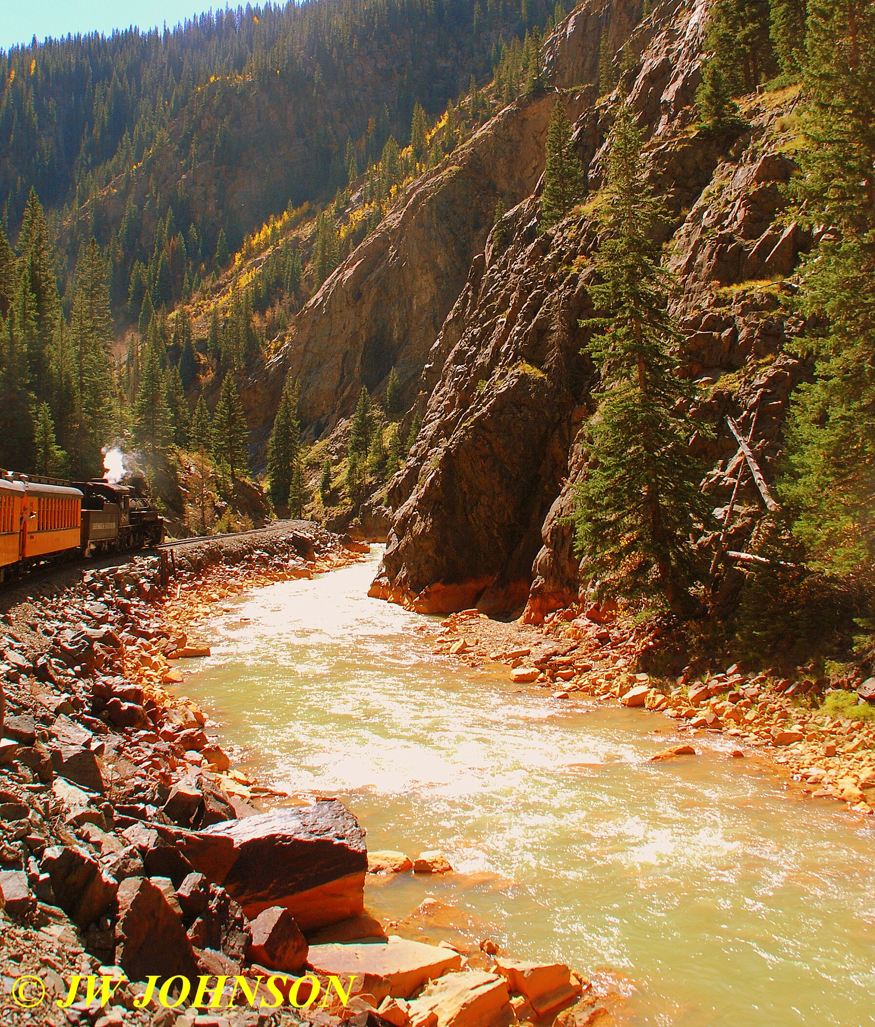
…and then we entered the siding, got off the train and assembled on the rocks to the right of the rails in the next photo….and shot the train from the riverbed and bank…
..it was funny to watch photographers trying to scramble across those big round smooth rocks trying to get as close to the waters edge as they could, while most of us were happy right in the middle…just as long as there was an angle, I was fine..guessing some wanted a water reflection but not sure if it was possible to capture that or not in this particular spot since the water was swiftly moving next to the bank here…
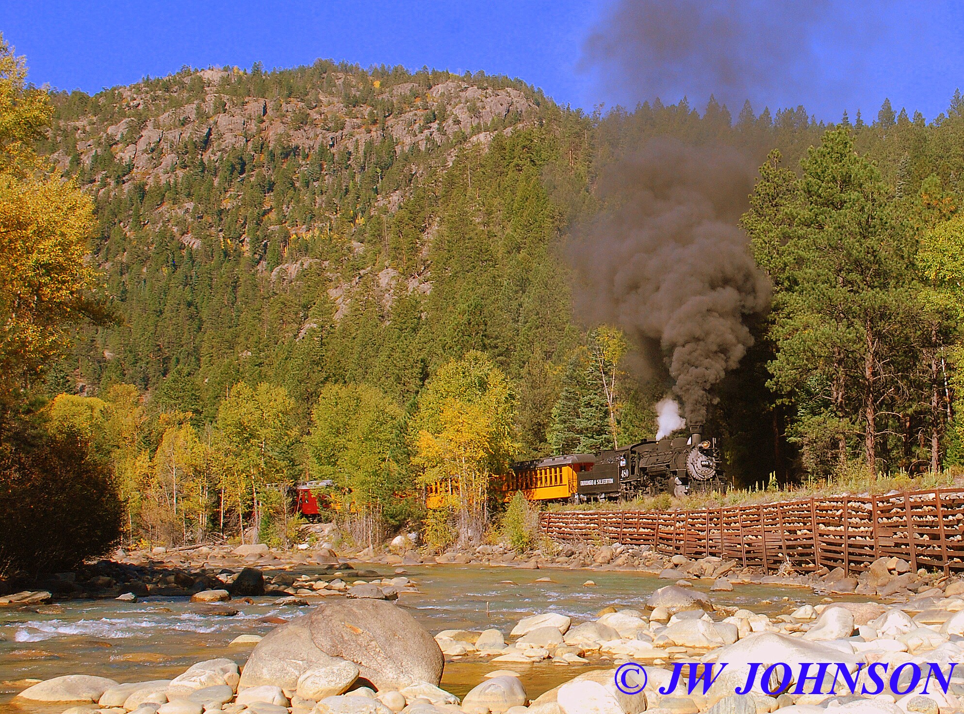
…the Engineer and Fireman were able to stoke the fire a little better in the firebox this time and the smoke was alot thicker…
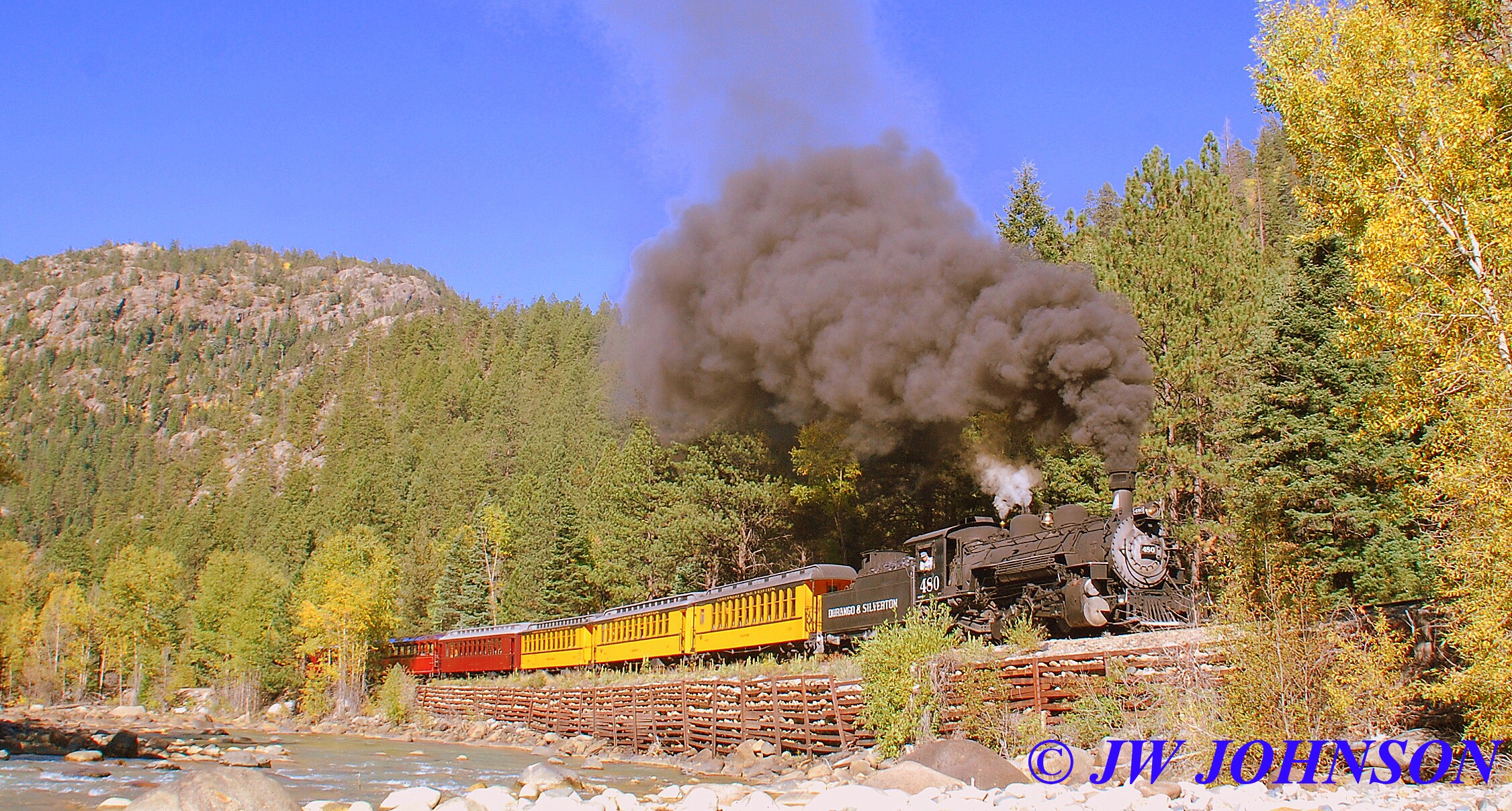
..on the second time, I decided to get closer to the bank and try for more of a down the throat shot…
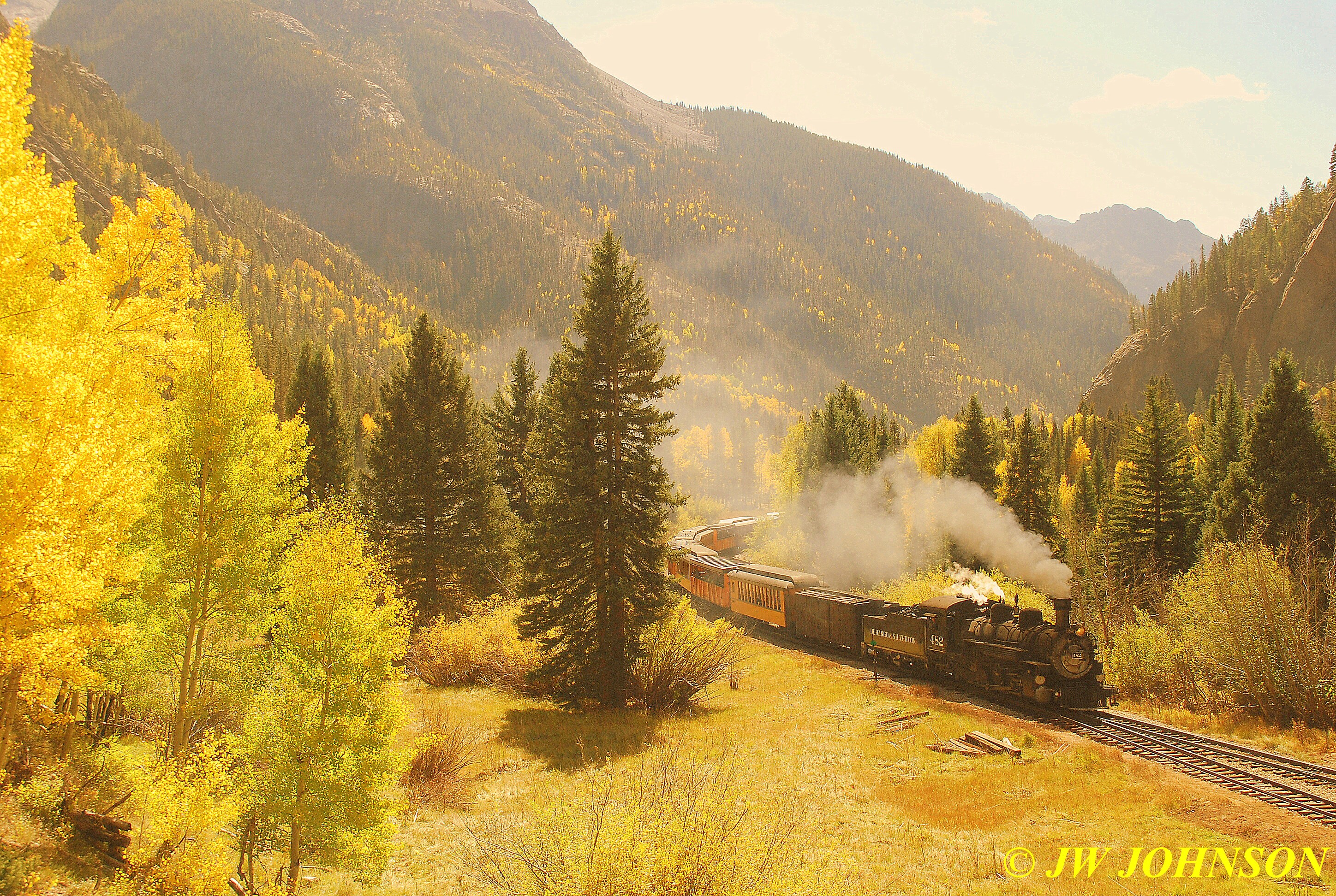
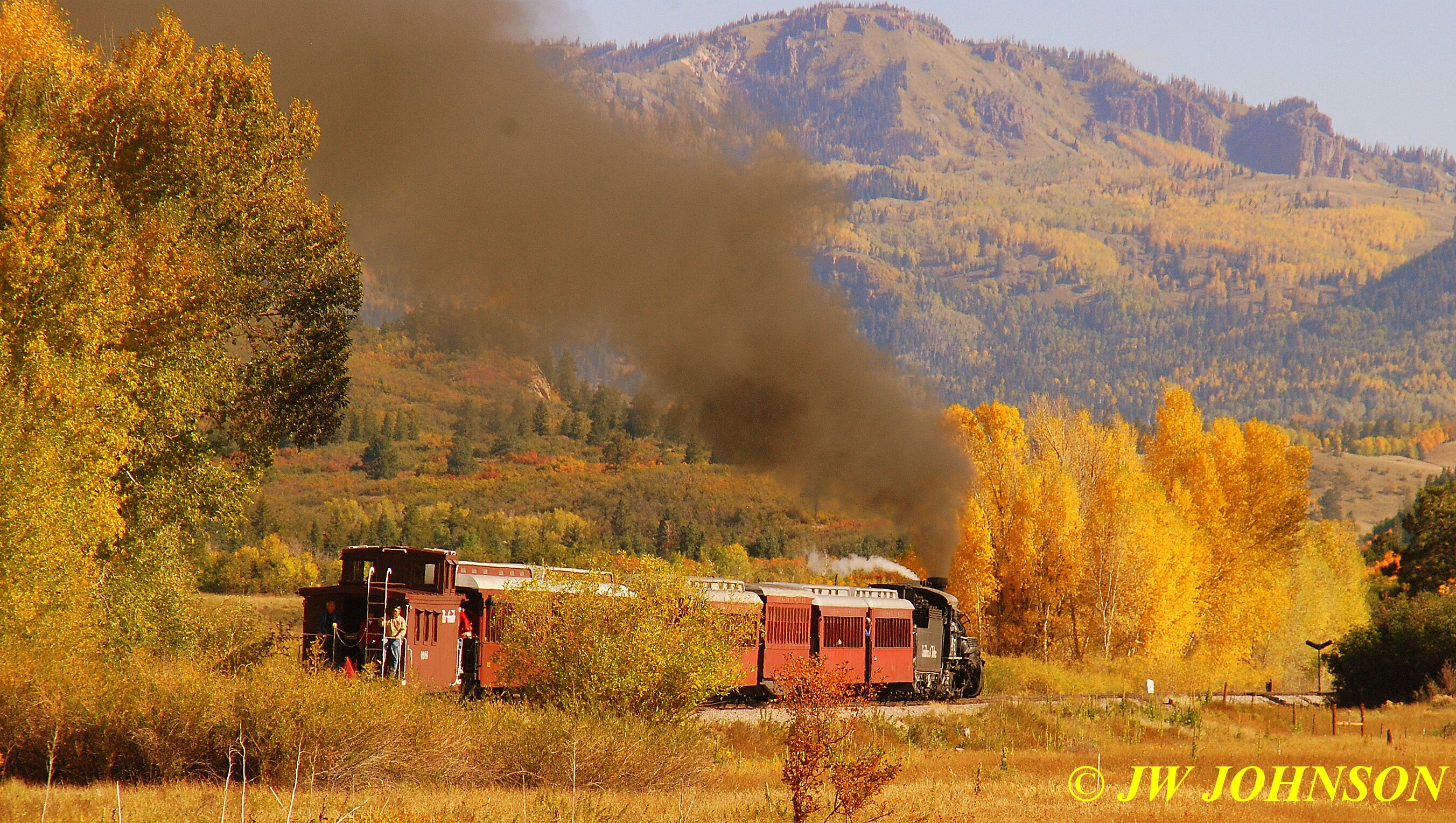
…and I was successful to some extent…the only problem being the heavy brush and foliage between me and the rails...…we re-boarded the train and rolled north again to the Needleton Siding for our third run-by and to shoot the 486 which was the next train behind us, having departed an hour behind us and enroute to Silverton…Mom and Dad were riding this train, and we would be photographing their train as it passed us in the siding.
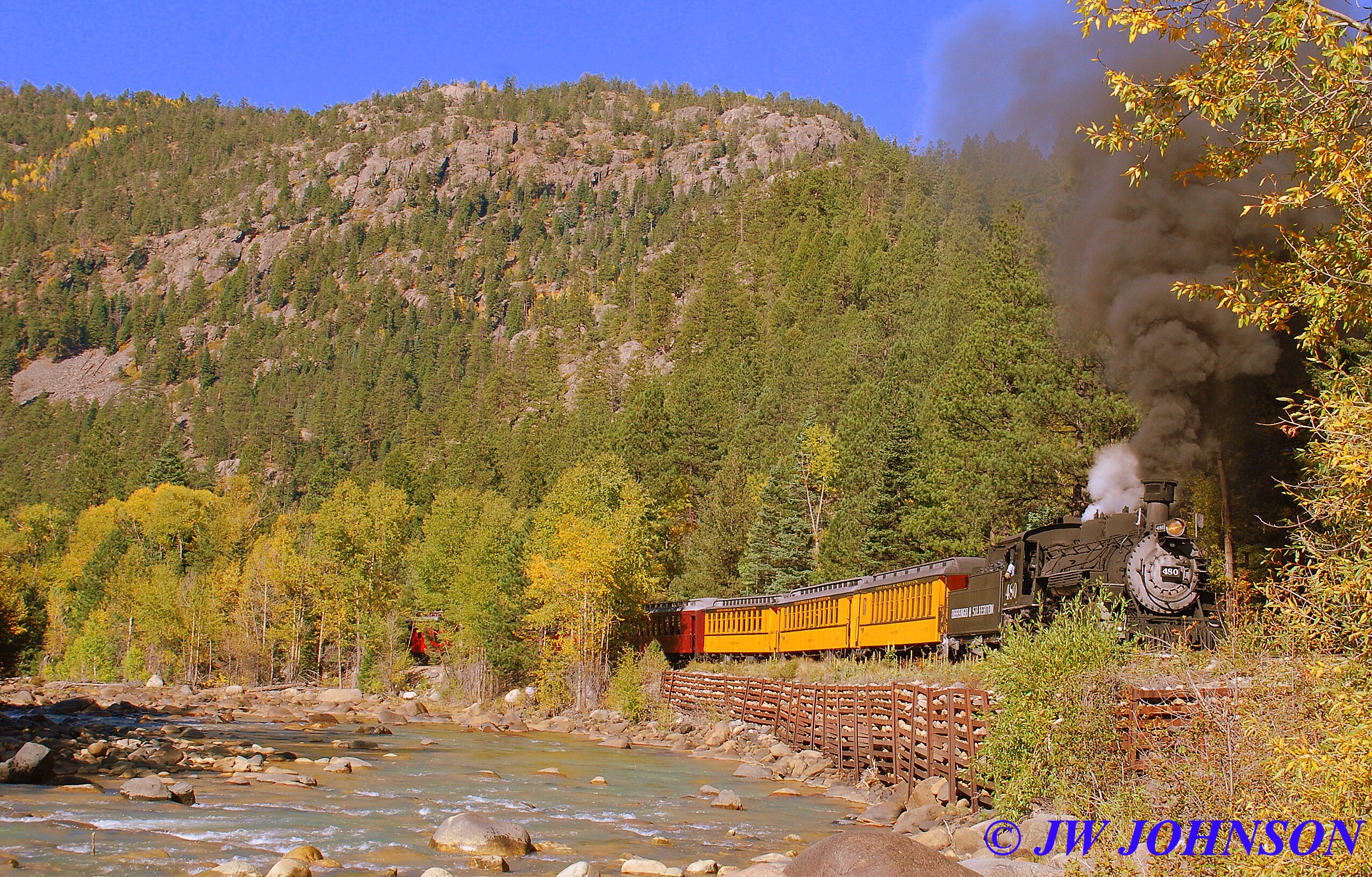
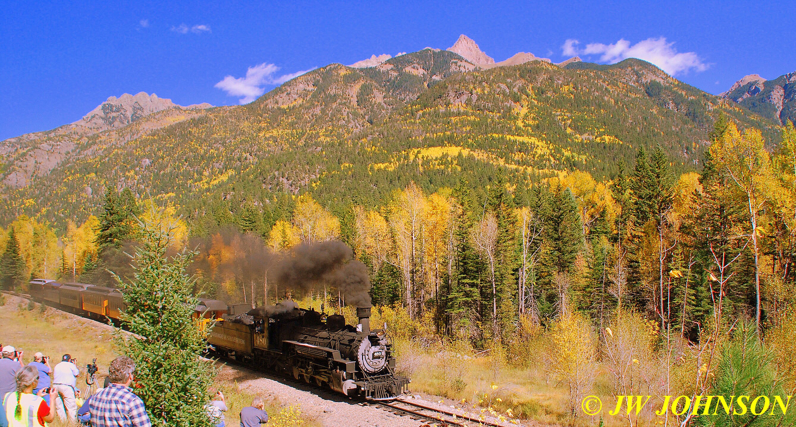
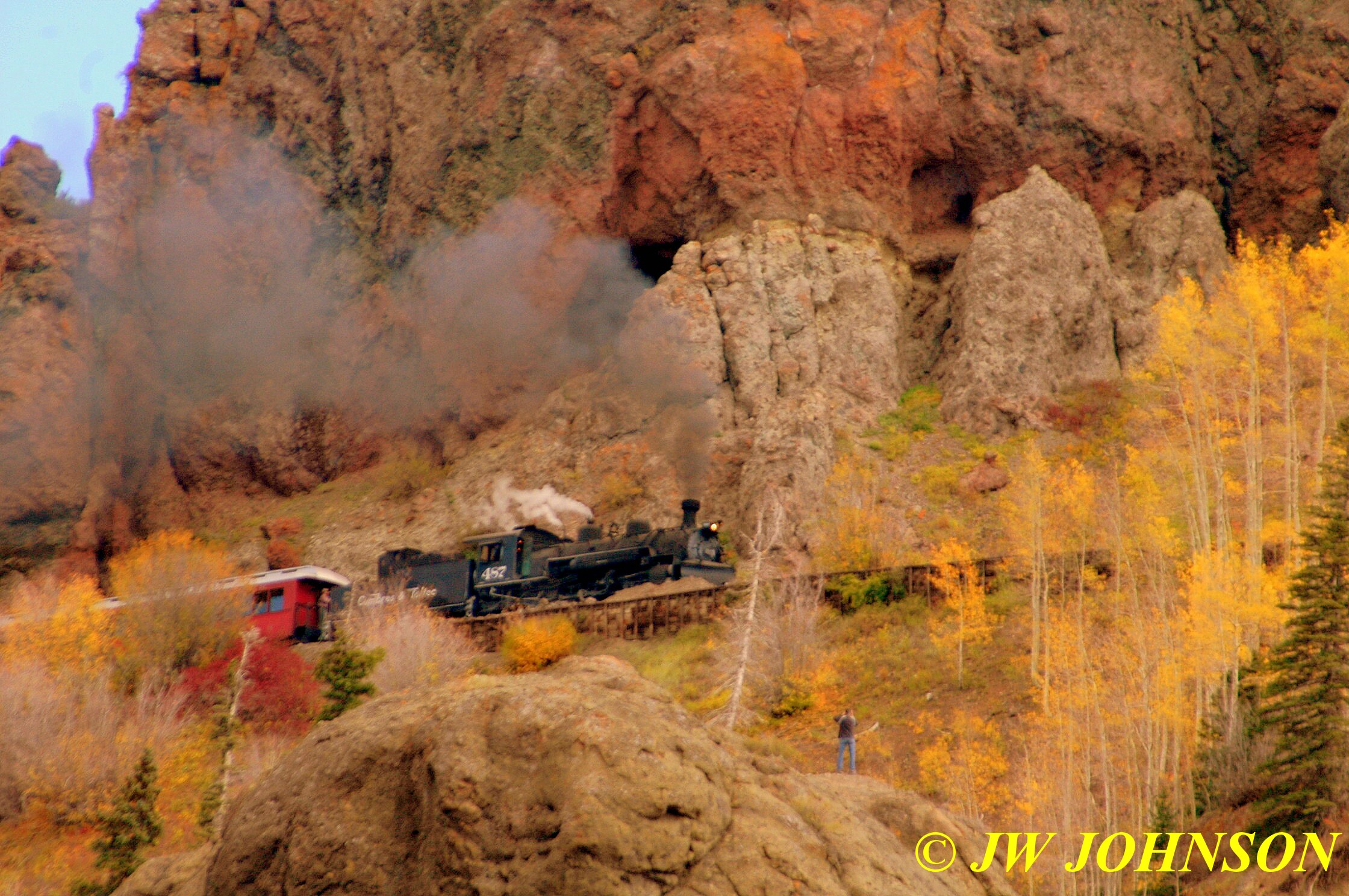
But when we reached the siding, we had some spare time before the 486 would reach us and so we shot a run-by of our train in the meantime. Several of us scrambled up on a rocky grassy hillside on the east side of the tracks, to get some height to shoot the train coming up the valley toward us, passing in between a couple of big fir trees…
…before the second run-by, I went over on the west side of the tracks and shot it backing up….
…and then started up thru the aspens and pines on the second time…
..and then the Engineer pulled up into the siding to await the 486 northbound train and most of us moved over to the west side of the tracks to get the shot of the trains side by side briefly. Here is our train, the NB 480 in the Needleton Siding waiting for the NB 486….

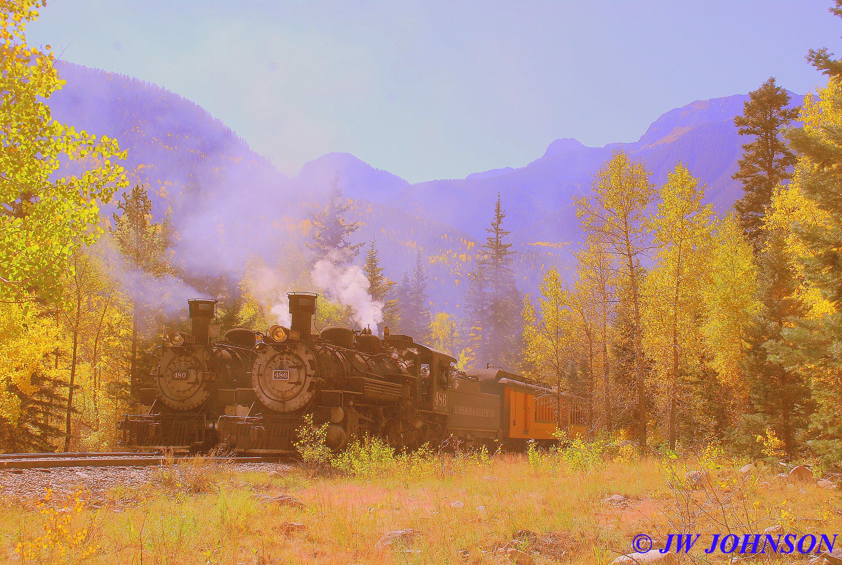
We steamed northbound once more and an hour later arrived in Silverton, after the second train passed us by as well…however we stopped for only twenty minutes and then turned around and headed south once again, getting a two hour jump on the other two trains which would give us plenty of time for run-bys without being pressed for time. Here is the scenery and river right before we arrived in Silverton….
…and a few of our first curves by the river on the return trip south out of Silverton…

..and it was quite colorful at the first stop along the way back for the next run-by….

…and more color seen out the window on the way back south….
The next few photos show the train rounding the curve by the very scenic Animas River….

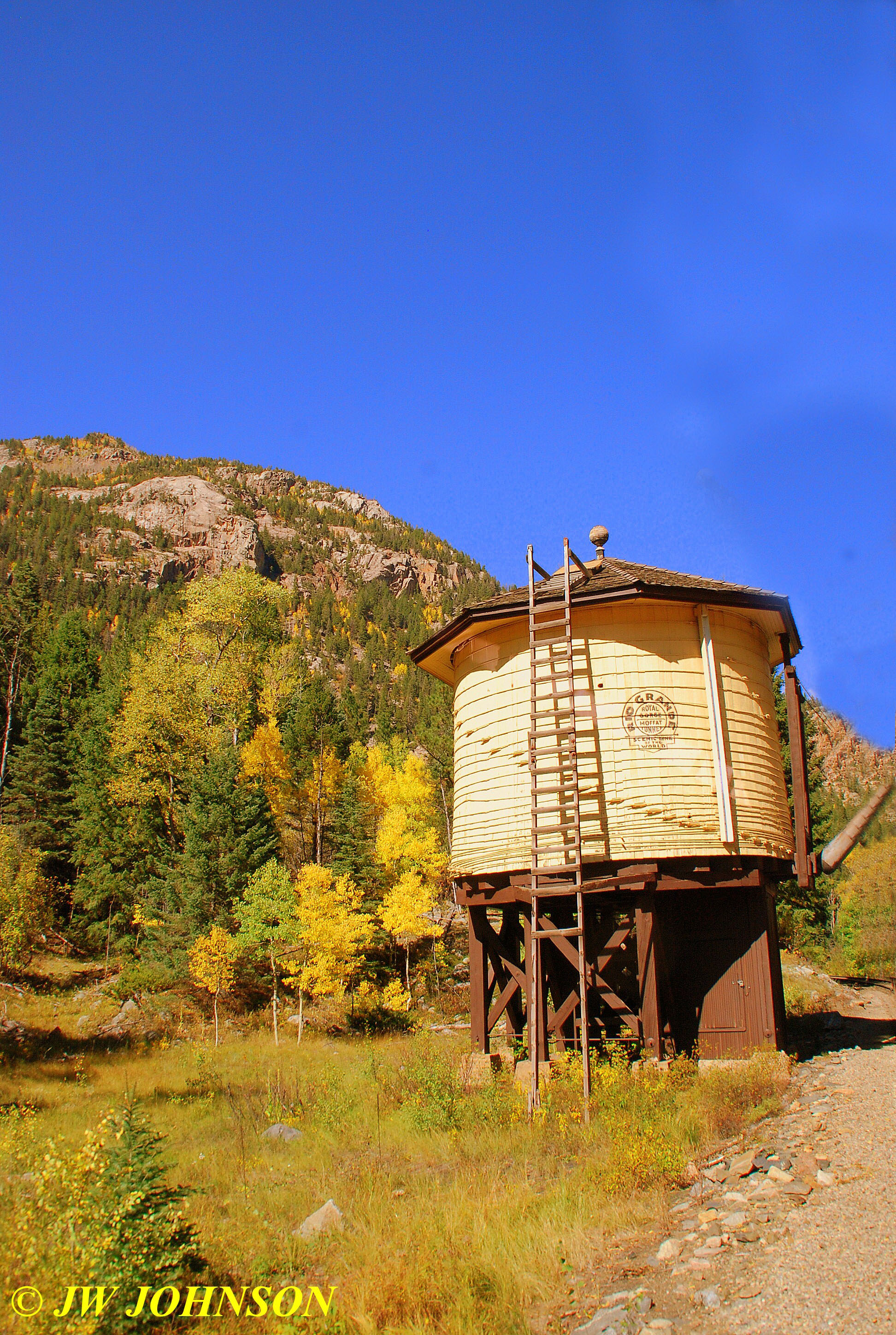
…and then soon after stopping at a new water source at the Needleton Siding, we passed by the old Needleton Tank, which I was only able to photograph after we passed by due to the angle of the sun…
…and then soon enough we went through a set of rocky curves with nice color….
Just before we reached Silverton on the northbound leg, one of the Conductors took a poll of the photographers aboard and gave us a choice of the wood bridge over the Animas River on the south side of Silverton for a run-by or a less accessible run by…the majority went with the less accessible and I can safely say I`m glad they did…we had about a ninety minute ride to get there and some of the photographers slept through it after we ate our box lunch that the DSNGR crew served to us…a good sandwich, bag of chips, cookie and apple. I stayed awake and shot more scenery, but I have to say that coach car was rocking so nicely that I almost went to sleep as well. Dad told me on the way home that their train ride rocked them so well it helped his back the next day.
After a good ninety minutes of rocking and rollin, we came up on the high bridge again….where the train slowed down and released some more steam…which I was told by the crew, is done by the Engineer to clean out sediment from the lines…

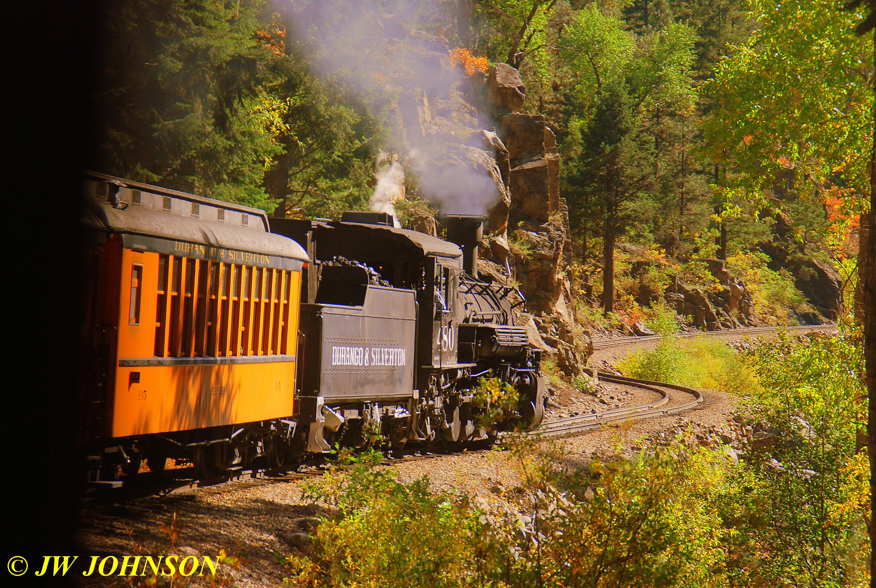
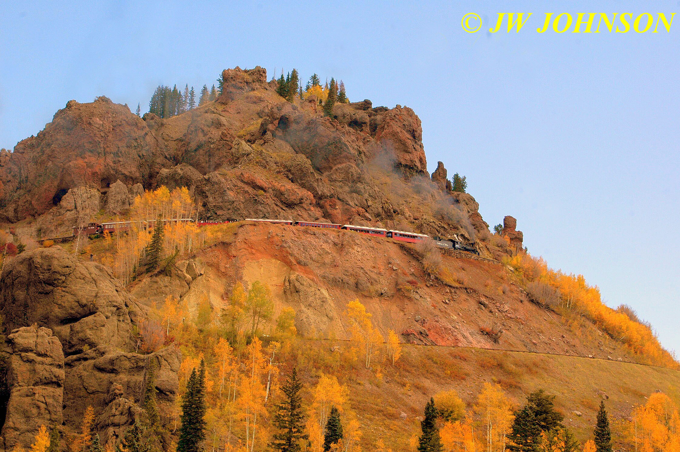
…and within moments we were rounding Horseshoe Curve on the High Line and came to a slow stop. The photographers left the train and most of us climbed up on the rocky hill in front of us….
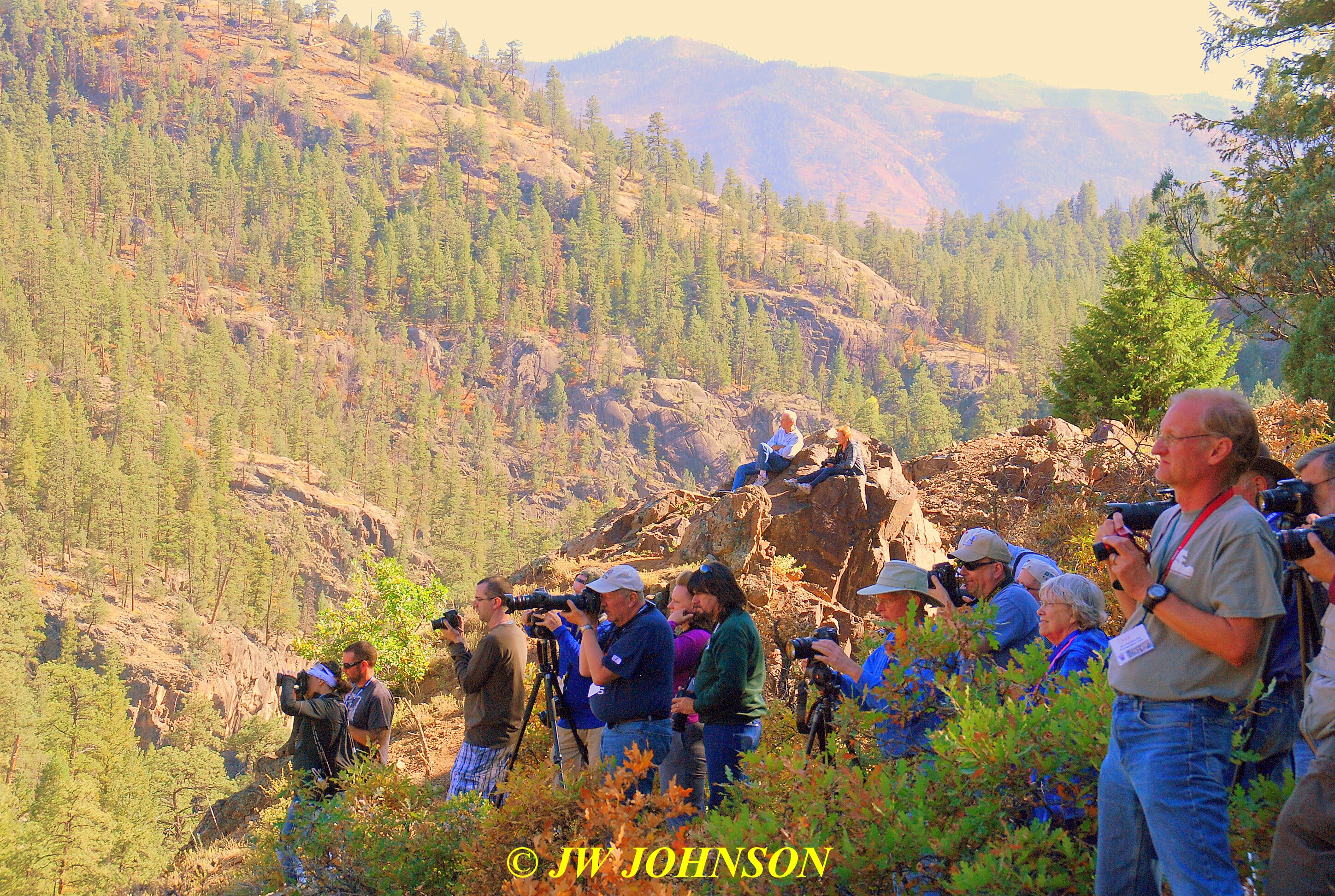
..while a few folks climbed up and sat on the rocks on the left side of the tracks…and the view camera photographer was down in front of me on the left side….

…and here is the series that I shot of the train rounding the curve on the High Line and entering Horseshoe Curve…
…and then we re-boarded the train and headed on to the depot at Durango for the end of the line…it was a great trip, one I hadnt made for forty five years…I dont plan to wait that long to ride it again…it was GREAT !!!!
I waited at the depot about fifteen minutes for Mom and Dad to arrive, and found out they enjoyed their train ride as well. We drove back to the hotel and found Missy sacked out in the room and after a short walk, we headed to Walmart to get her some dog food….I also tried to find a copy of Colorado Life Magazine there…in their current issue was a story on the DSNGR and I wanted to get a copy…and then we headed to Kentucky Fried Chicken for supper.
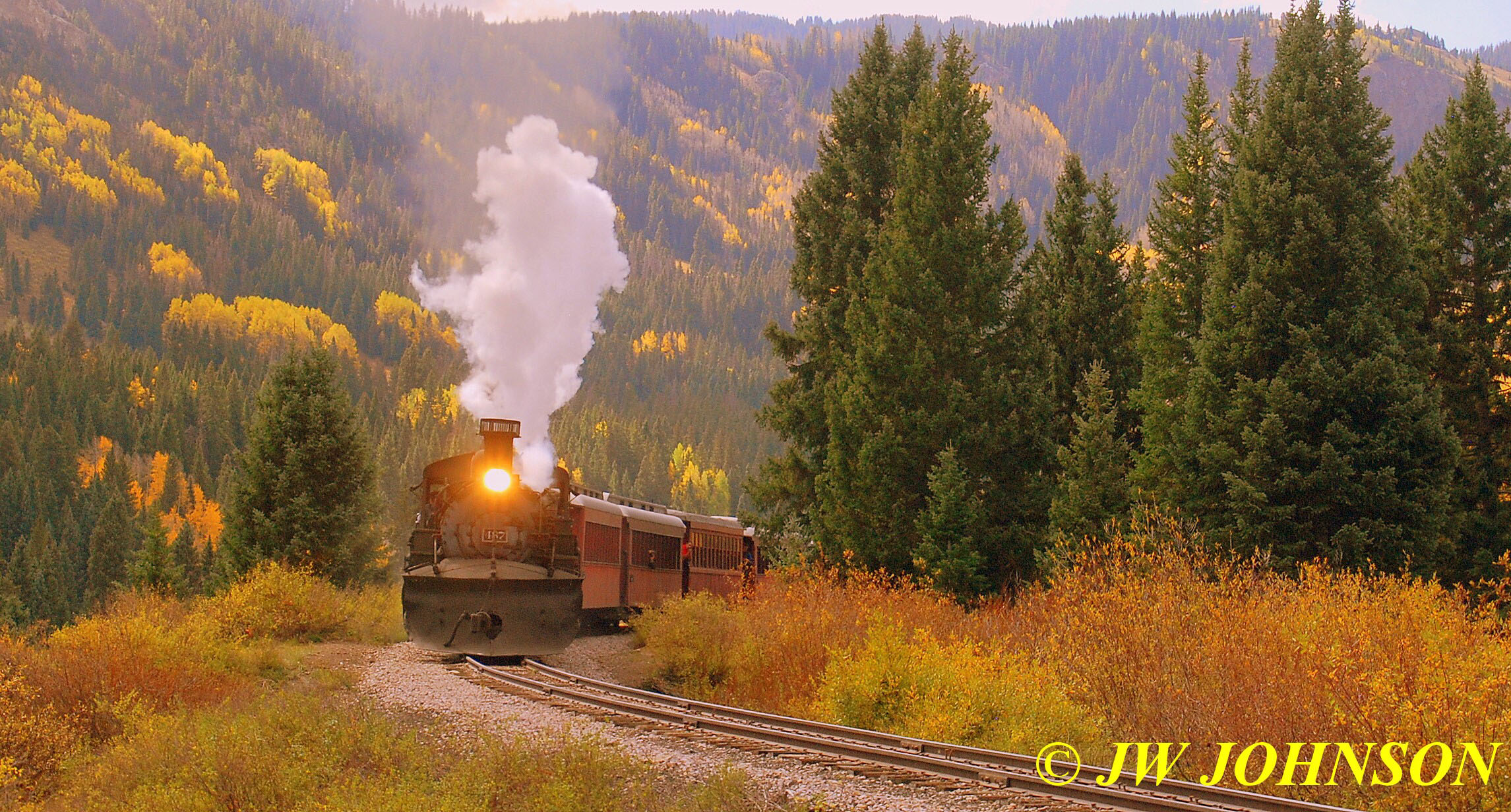
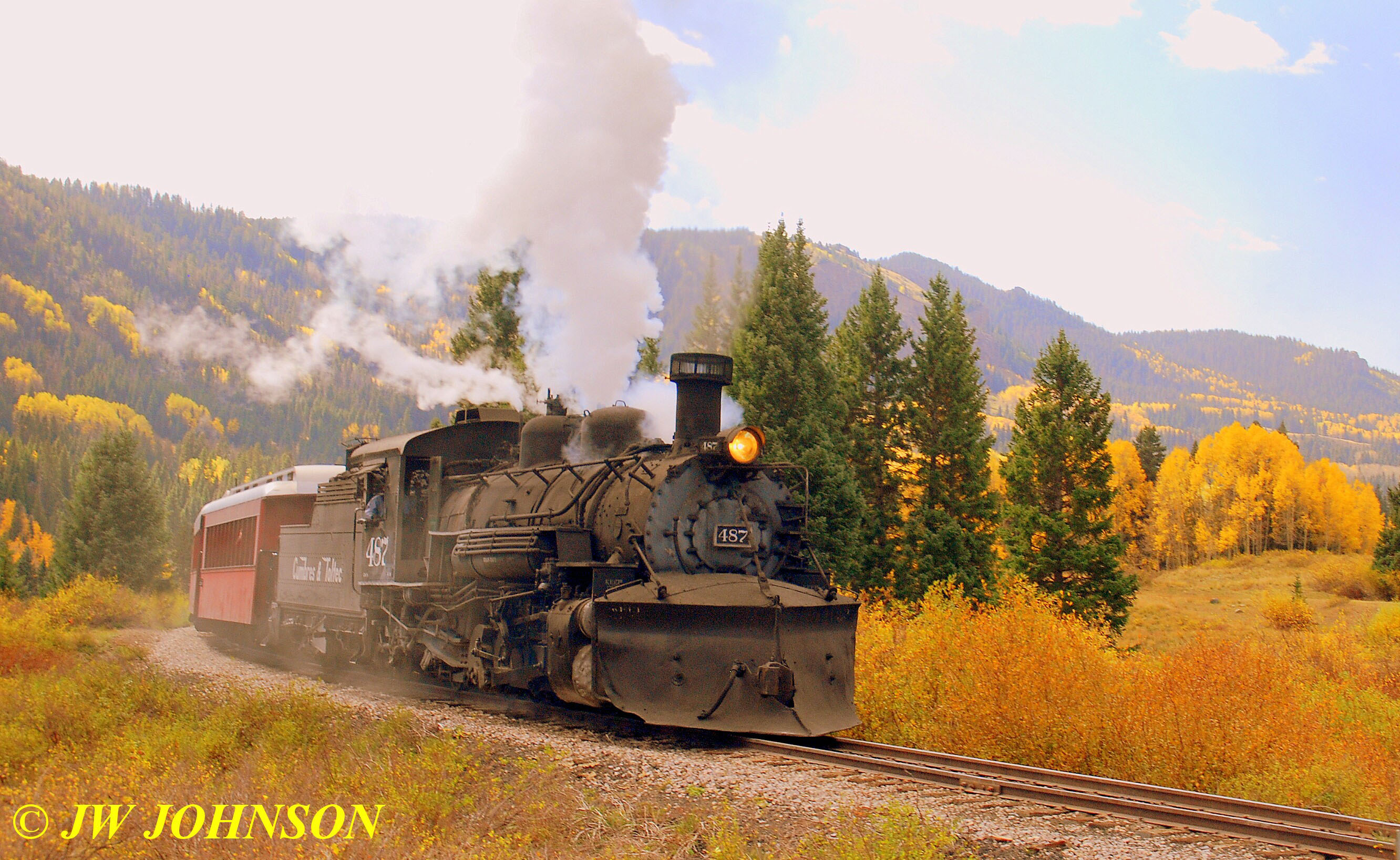
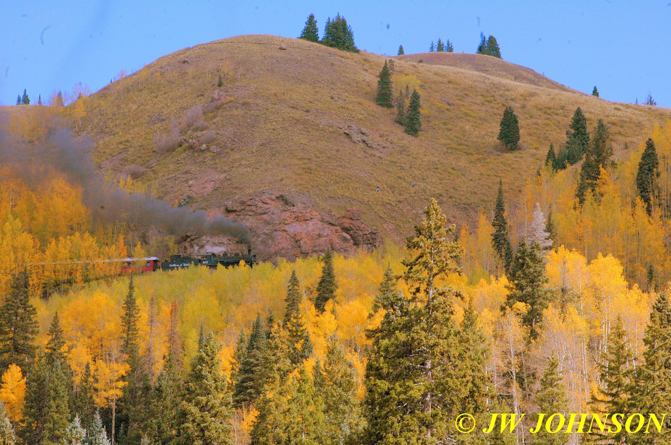
After a great supper, we retired after a long day and then rose early to head for home…making one stop along the way…Chama, New Mexico, to chase and photograph the train on its way up to Antonito, Colorado…the Cumbres and Toltec Train. We drove to Chama and I photographed the train warming up in the yard and then steaming up to the Cumbres Pass….enjoy the ride…

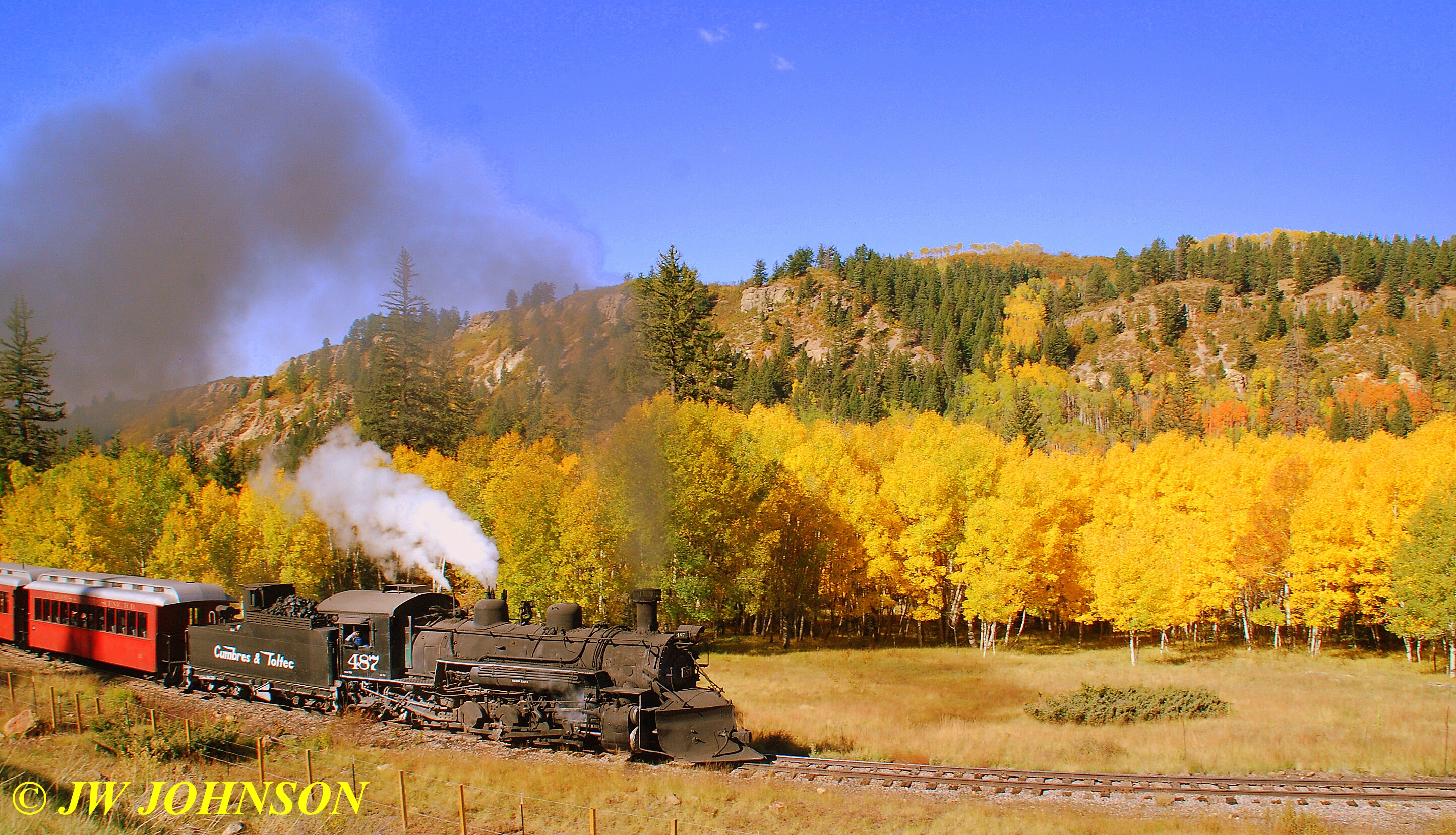
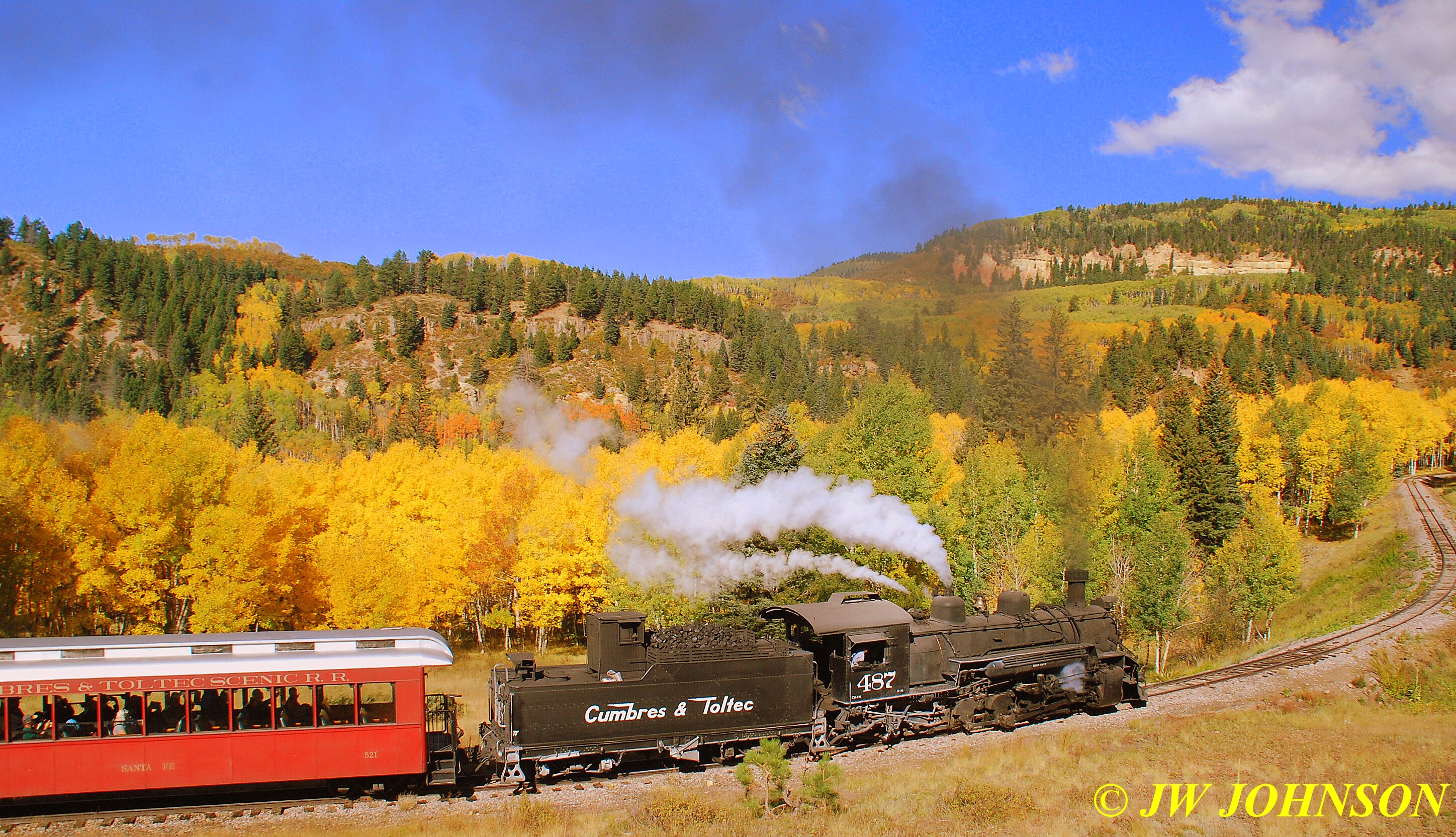


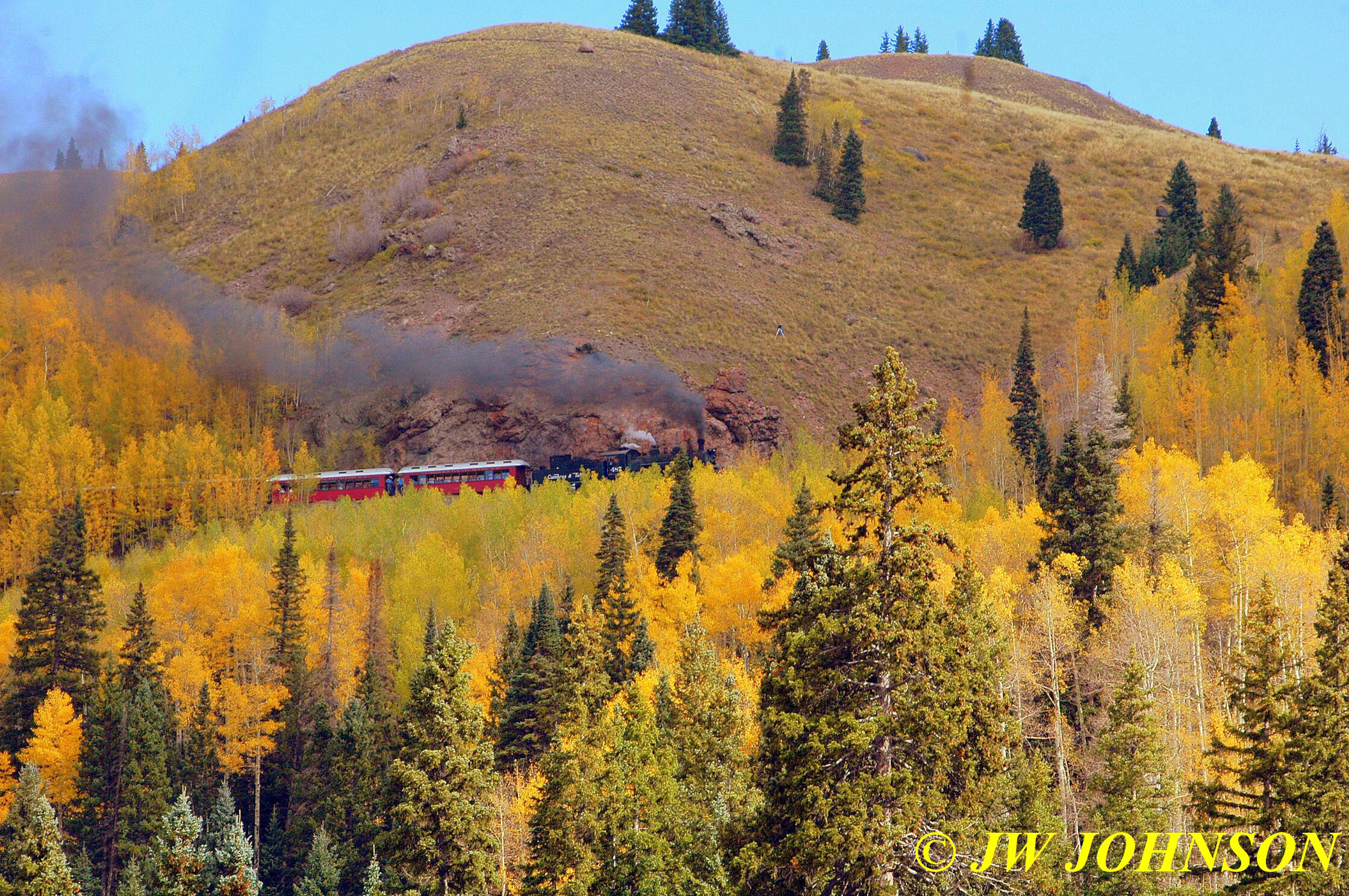
After the second highway crossing, the train traveled around a curve and through some colorful foliage on both sides of the tracks…

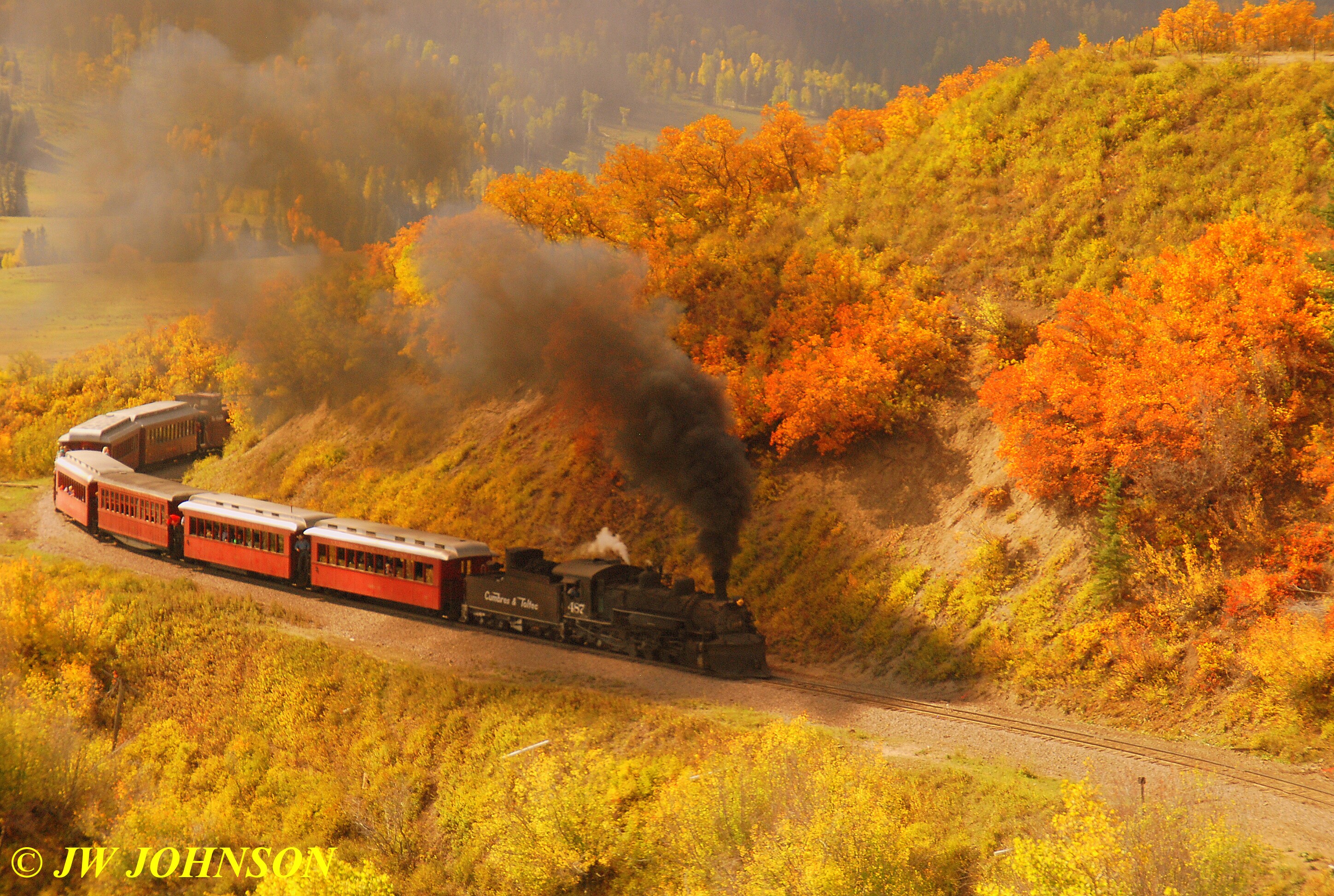
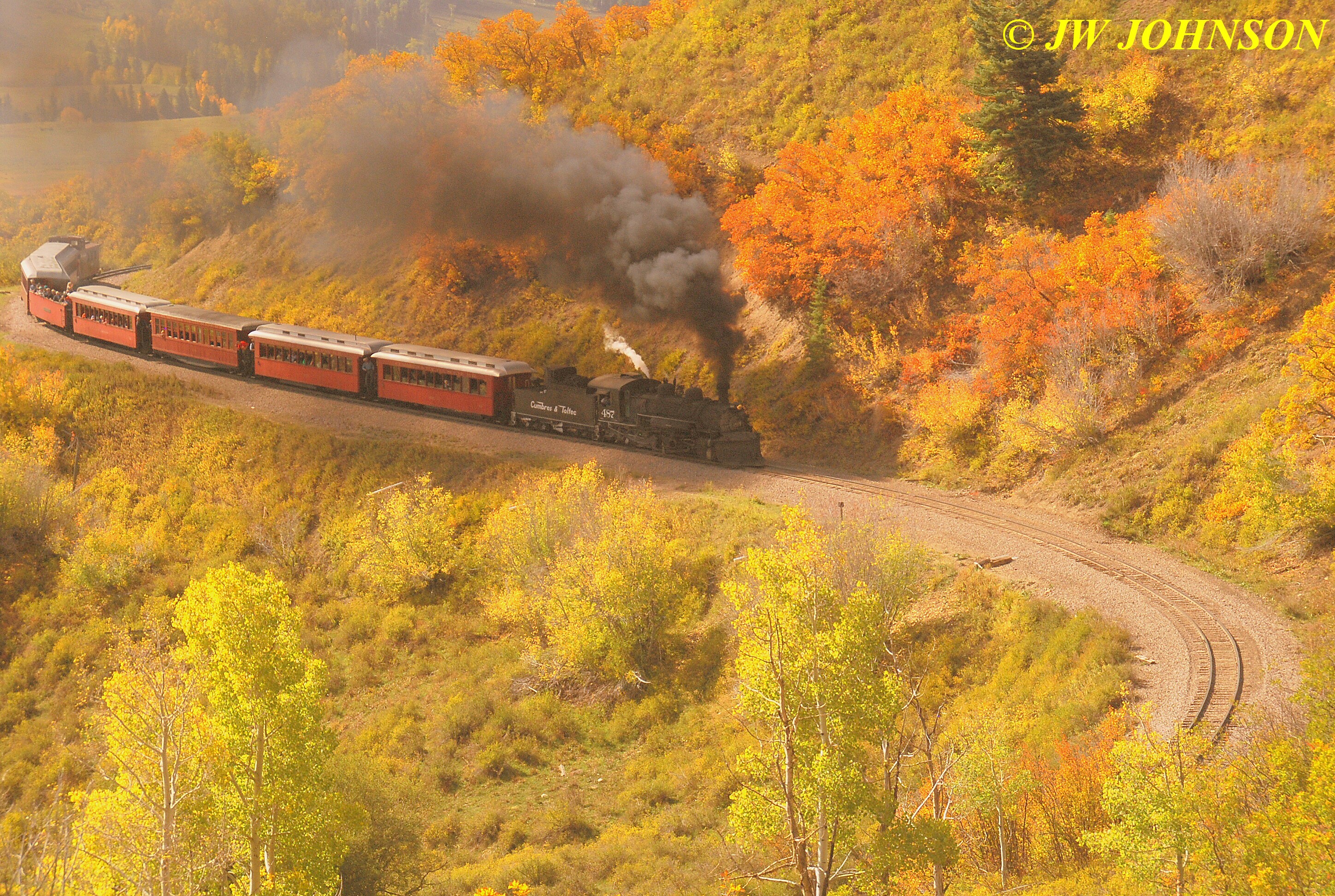
..and then it comes out at the third highway crossing….

…and now we wouldnt see the train again for a bit…as he had to loop around and start to climb up the big hill toward Cumbres Pass….the next series of photos show him climbing that big hill…
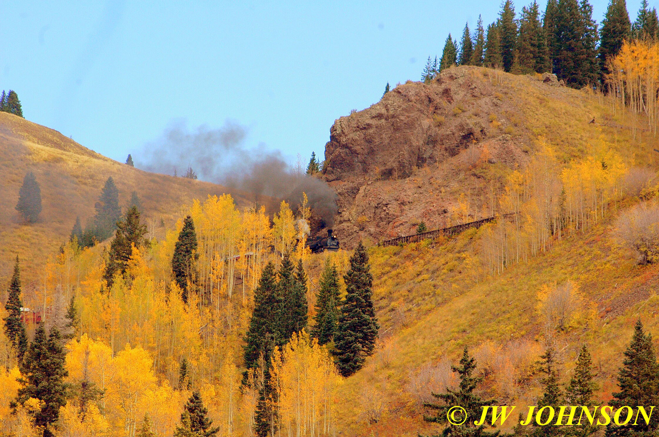

..and this guy apparently wasnt concerned about the big picture, he climbed up from the highway below to photograph the train closer up from that huge rock….
and here is the big rock that he was standing on…its on the south side of the highway and the compressed distance by zoom lens, just makes it look like its above the highway….
…and after that, we headed south from Chama to Santa Fe, and then on south to Interstate 40 where we turned east to Amarillo, Texas, for the night. By the next evening, we were pulling back into Sullivan. Its always great to get away and visit other pretty places, but Dorothy at the Wizard of Oz was very right when she said…there is no place like home…
Sometimes a good rainfall requires enduring a little bit of wind, but I dont think any of us figured it would last as long as it did Thursday afternoon, nor get as strong as it did. Missy and I photographed some of the wild looking clouds before it hit, from the railroad overpass on Hwy D….earlier in the day, it was reported that a cloud of hail was on approach to the area, so I photographed it from the north side of the west overpass….

…and then a bit later in the day, as the more severe storm began approaching the area, Missy and I drove over to the railroad bridge on Hwy D near the police station and photographed it on approach to town…

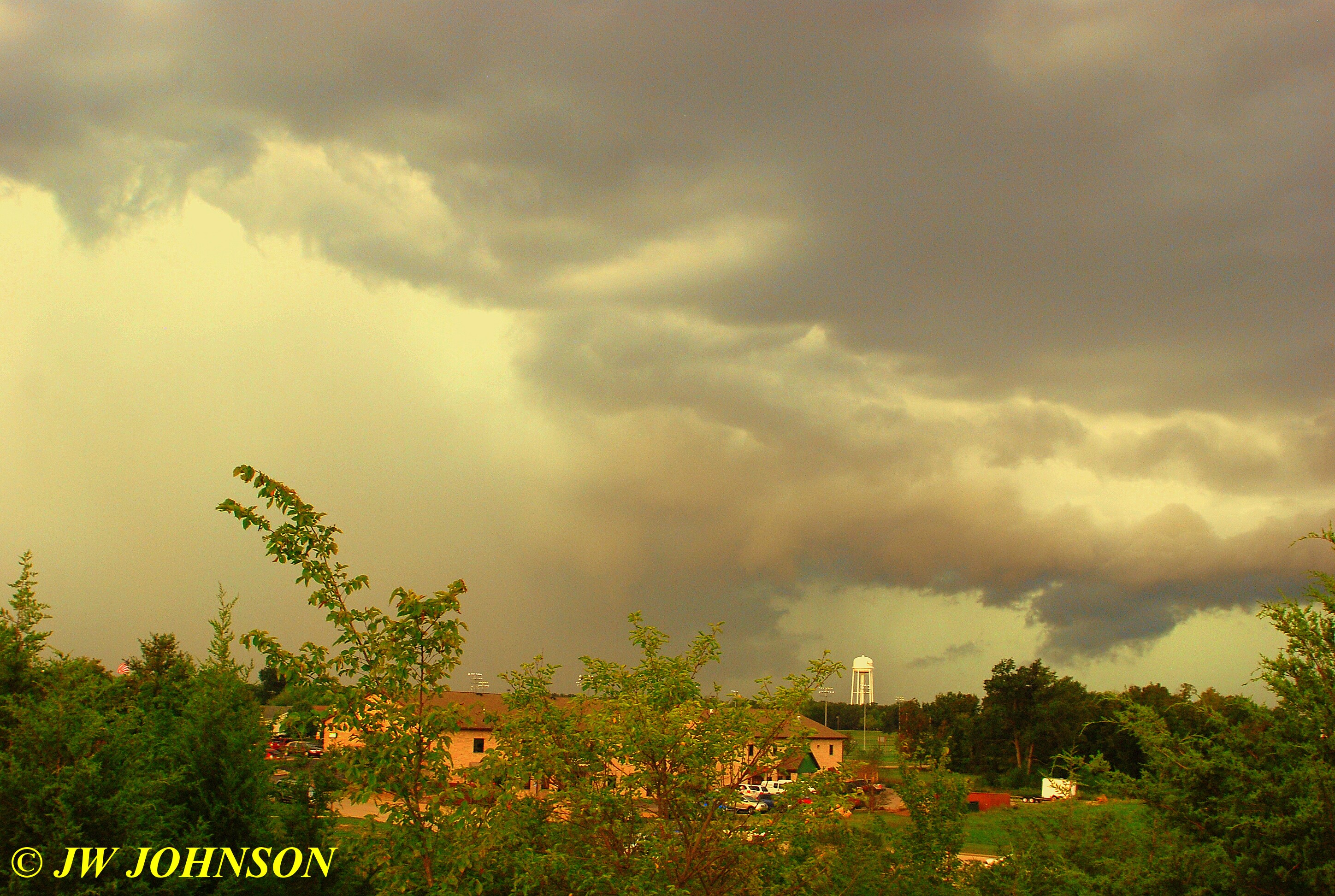
When we saw this, I wondered if I was watching a wall cloud form in front of me and began thinking maybe it was time to skedaddle back to the house, but I decided to stick around a few extra minutes and see what else would happen…
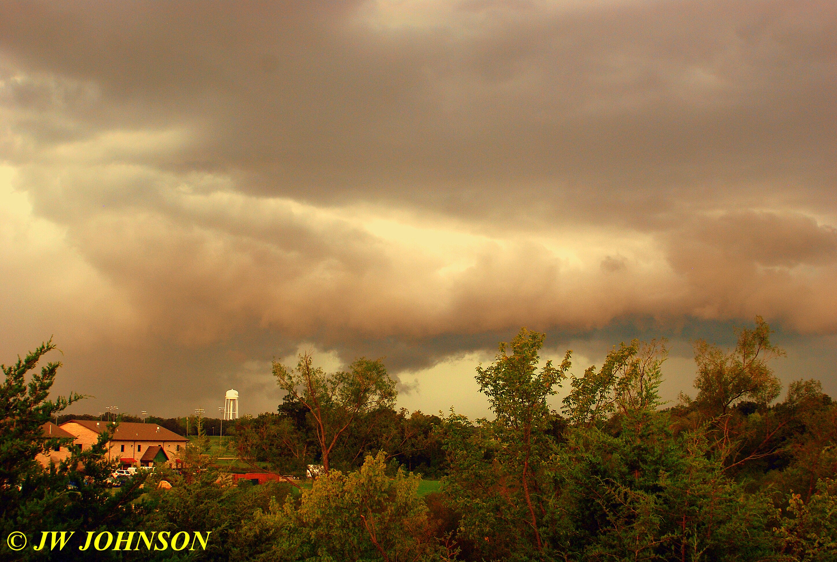

I kept moving back and forth about twenty feet, wished someone would cut those trees down so the view would be much clearer….

…then moved a little further up and had a much better viewpoint, but still wasnt sure what I was seeing here…

…but as it was, it turned out to be a roll cloud…not a wall cloud…and roll clouds occasionally are out in front ahead of some severe storms…this I learned from one of my rockhound friends who is also a storm chaser and meterologist…she said they can be quite scarey looking, and believe me this one was….
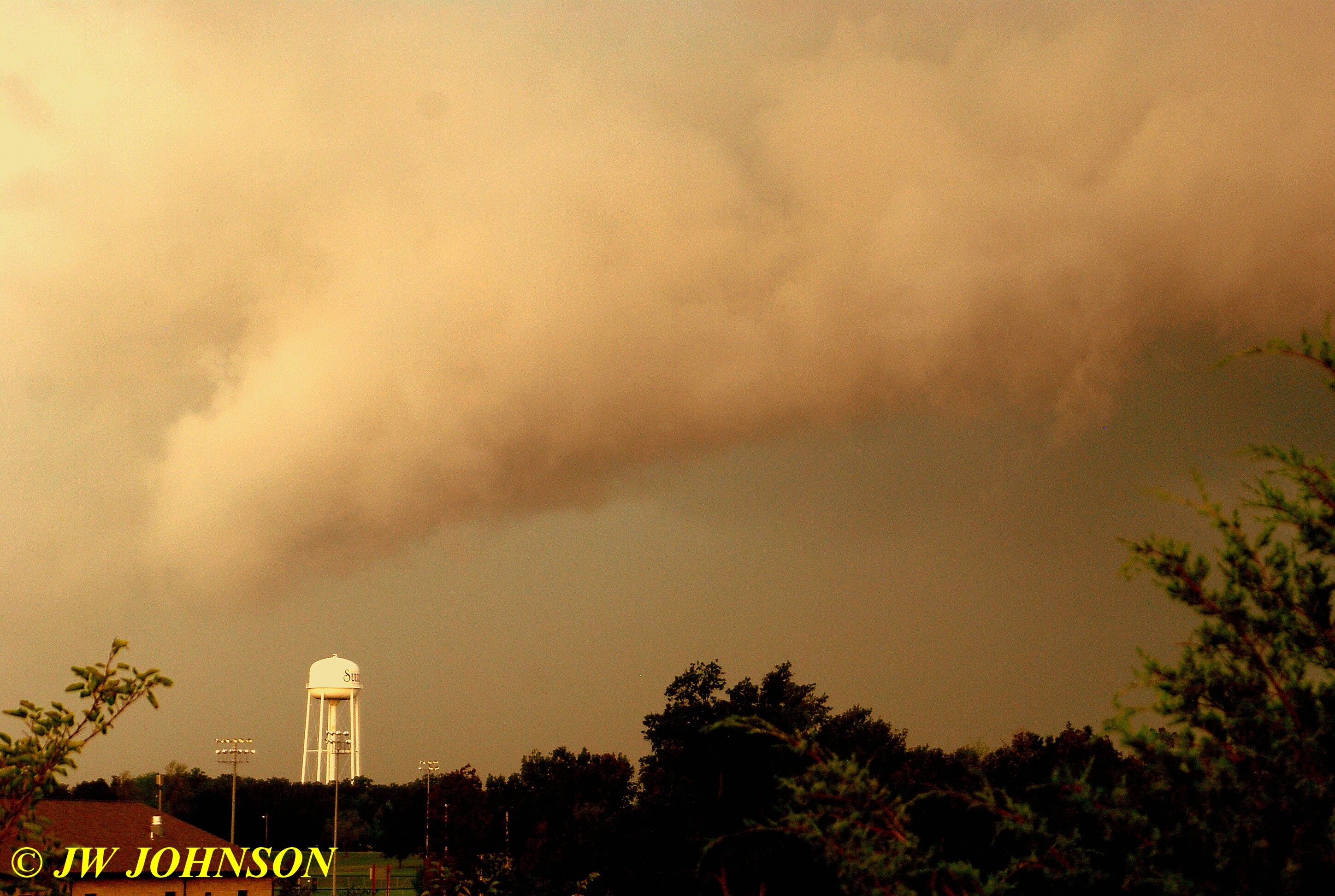
…and it became even more pronounced as the storm drew nearer…you can see the storm behind it gathering force in the next photo…
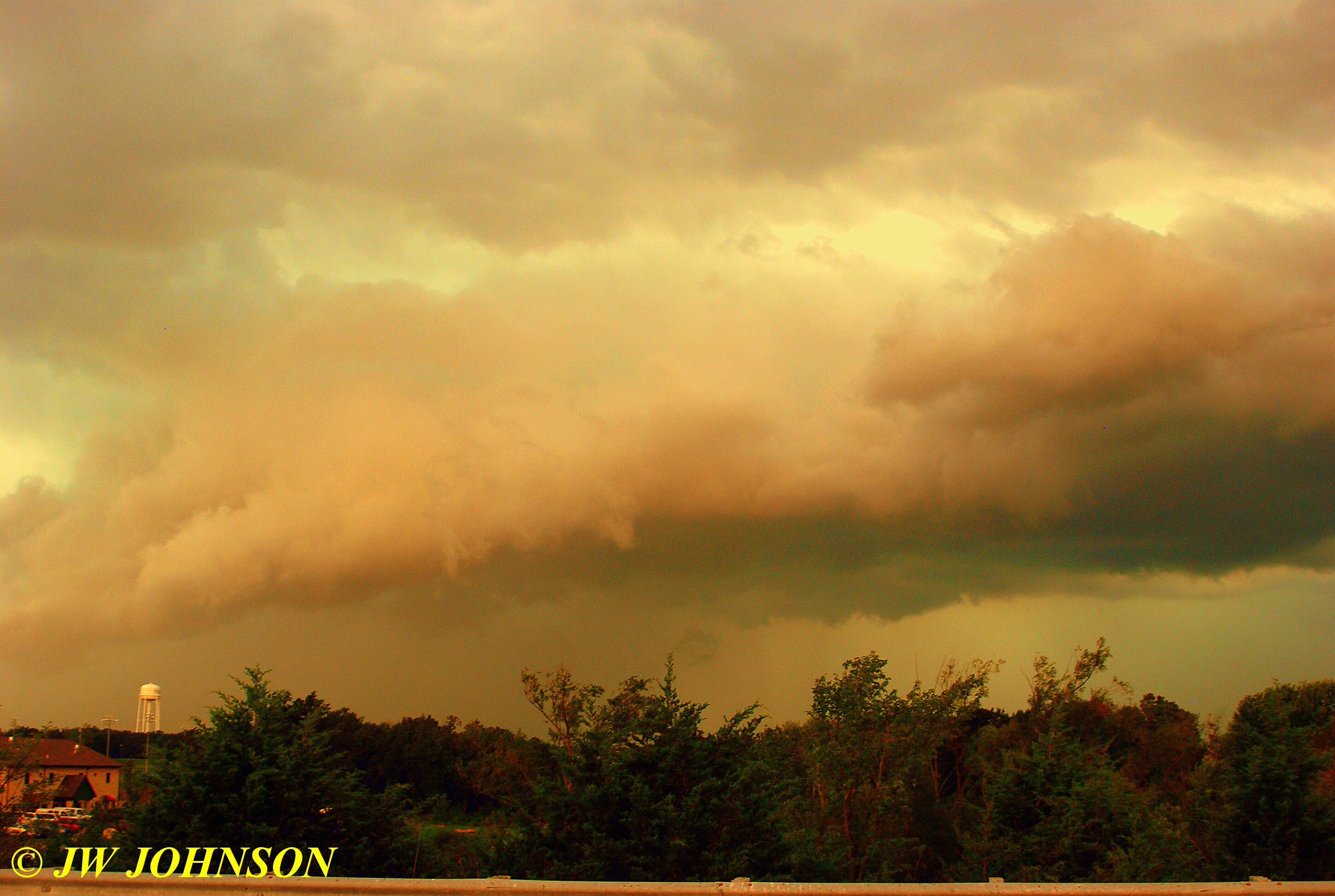

..and at this point, I decided the storm was very near and I headed home…and the wind was picking up dramatically, as seen in the next photo of the flag flying at one of our factories on the north side of the interstate…

After arriving back home, at times Missy and I headed for the basement when we saw the trees bending halfway to the ground, knowing that we were getting strong winds then…and I know we went to the basement three times only to return three times as well…my neighbor Glenn, across the street, was braver than us, staying on his enclosed front porch with a birds eye view of everything in front. In fact, he told me the next day that he saw the big limb rip off my front yard tree, fifty feet up, and come crashing down during the height of the storm, landing in the middle of Elmont Road in front of my house. Luckily no one was driving thru at the time it came down and a few minutes later, he observed some guy stop in the middle of the road and move it to my sidewalk, getting soaked in the process…the way the rain was being blown at force, horizontally down my street, I would imagine he was soaked the second he stepped out of his car…here is the limb, seven inches around at the base of it….

..and on impact, a limb tore away from it and skittered across the street on the wet surface and smacked Glenn`s white car as well..doing no damage luckily….and I lost a few smaller limbs as well that blew down the street a little ways as well…
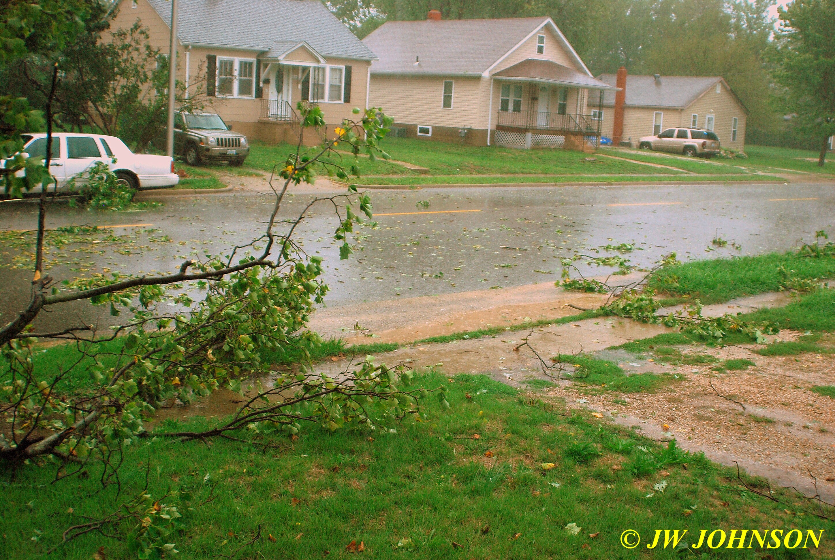
…while just a few blocks away, four trees came down in the front yard of St Anthony`s Church on Springfield Avenue….

..and our city park across the street and a few blocks north of me, lost a few trees as well….this one is fairly young age wise and blew right over…
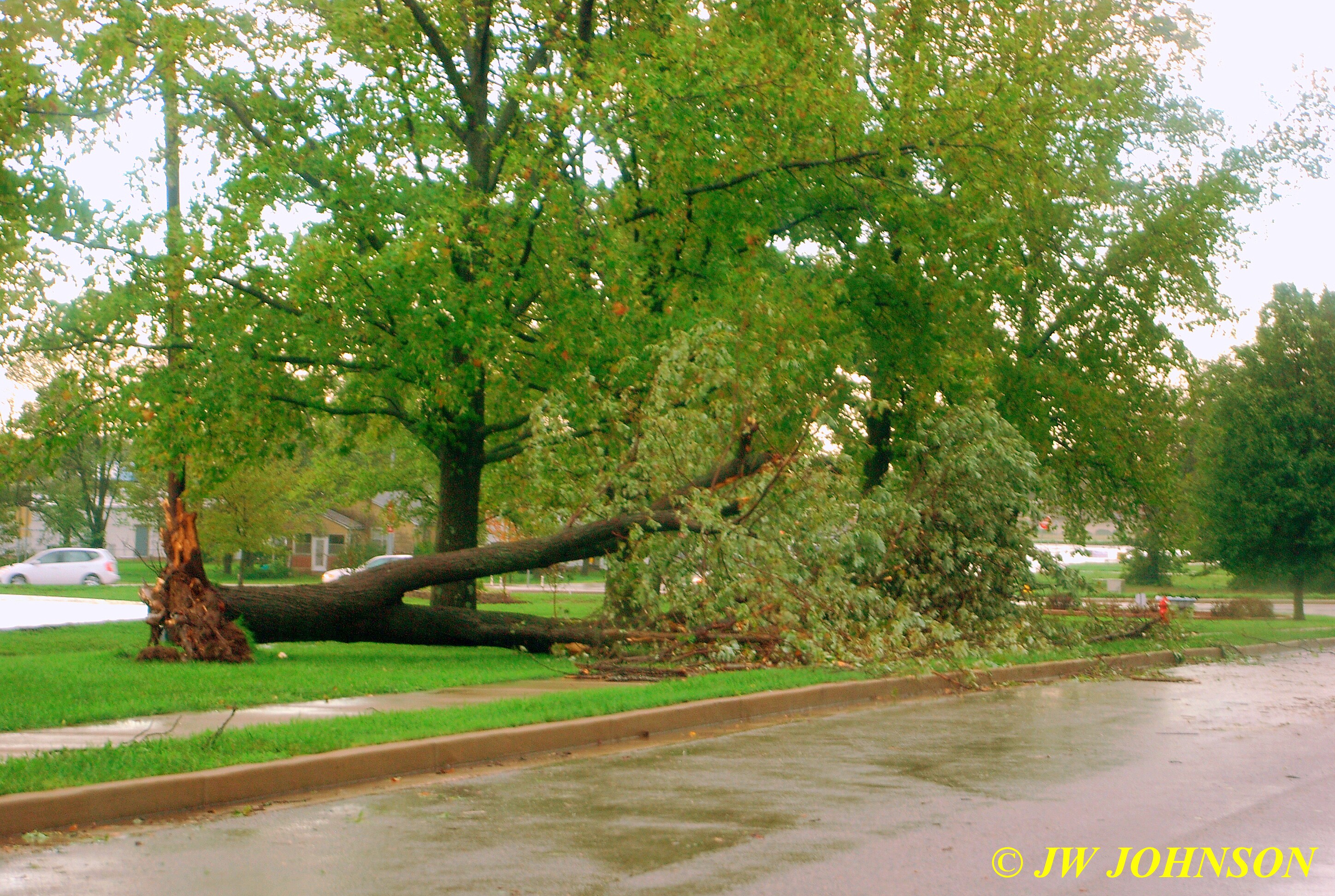
…while this one, an older tree in a line of older trees, had two big sections ripped off the large trunk by the winds, also along the Springfield Avenue side….
…and a couple of hours later, we were graced with a fantastic sunset following a horrific storm….I caught it while walking Missy at the City Park….
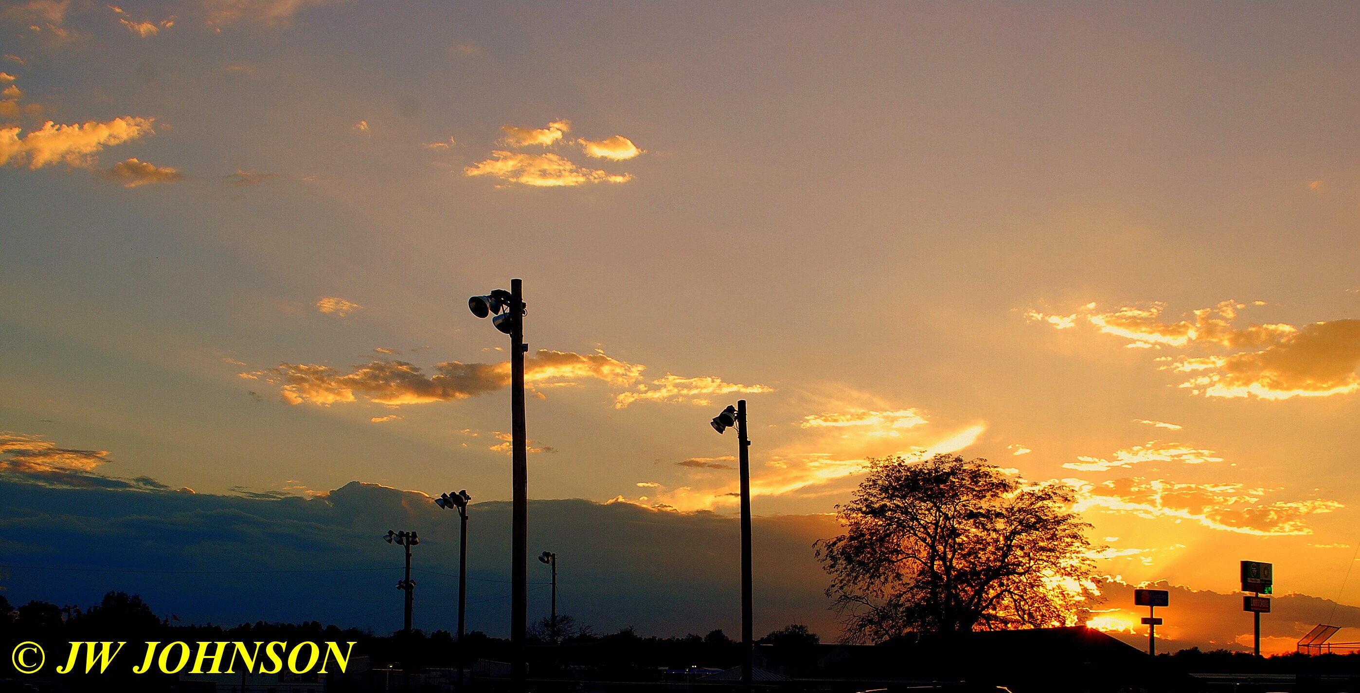
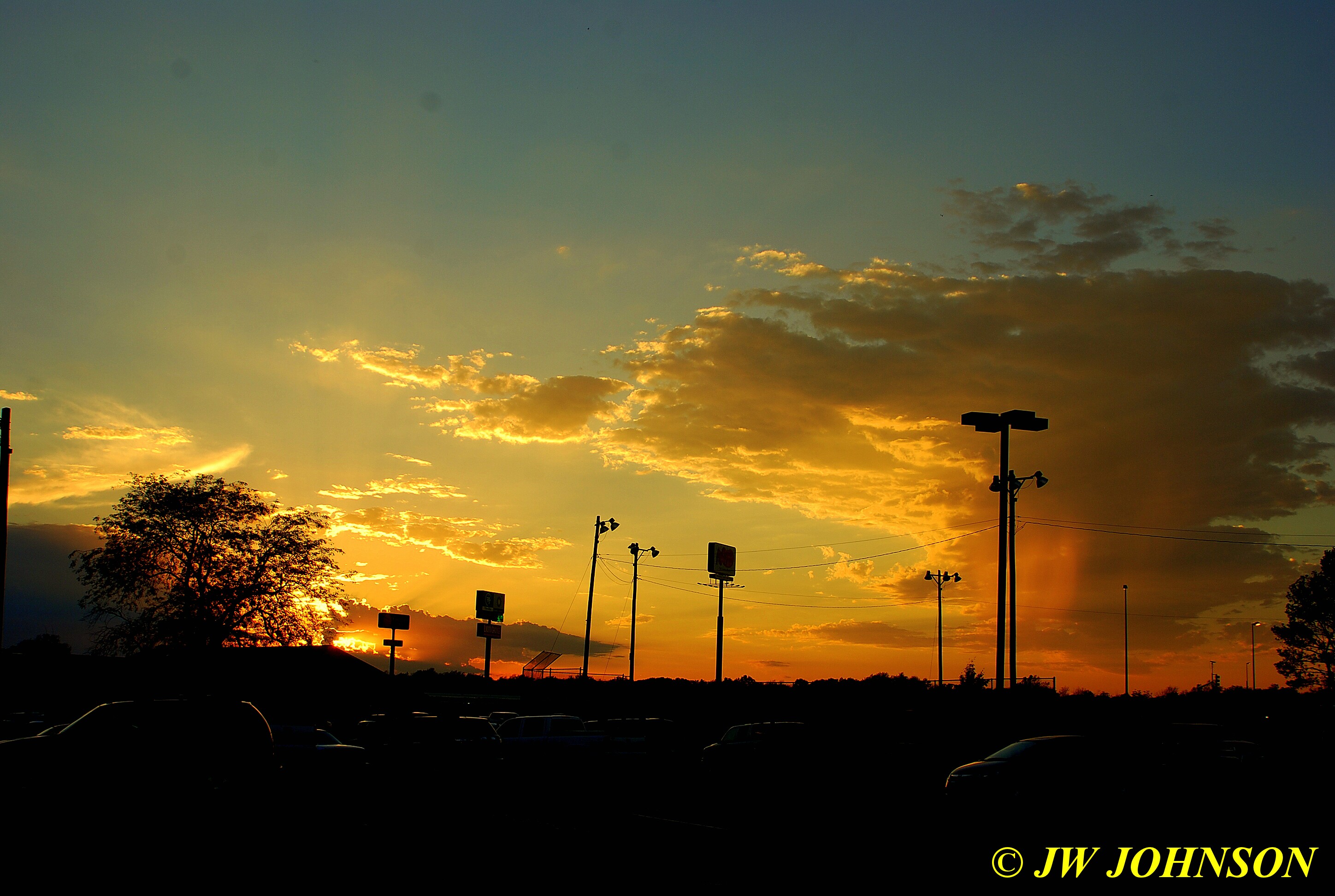
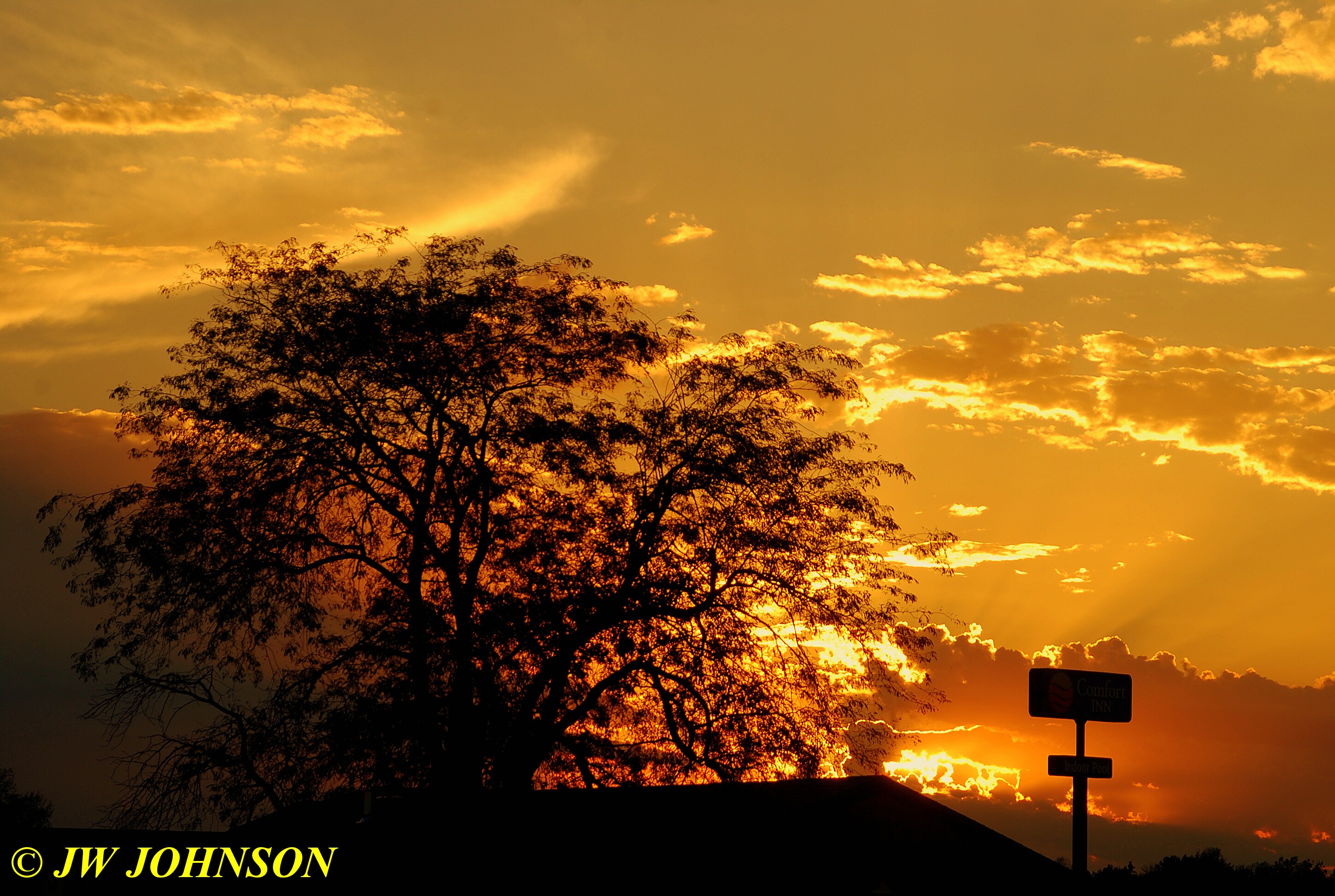
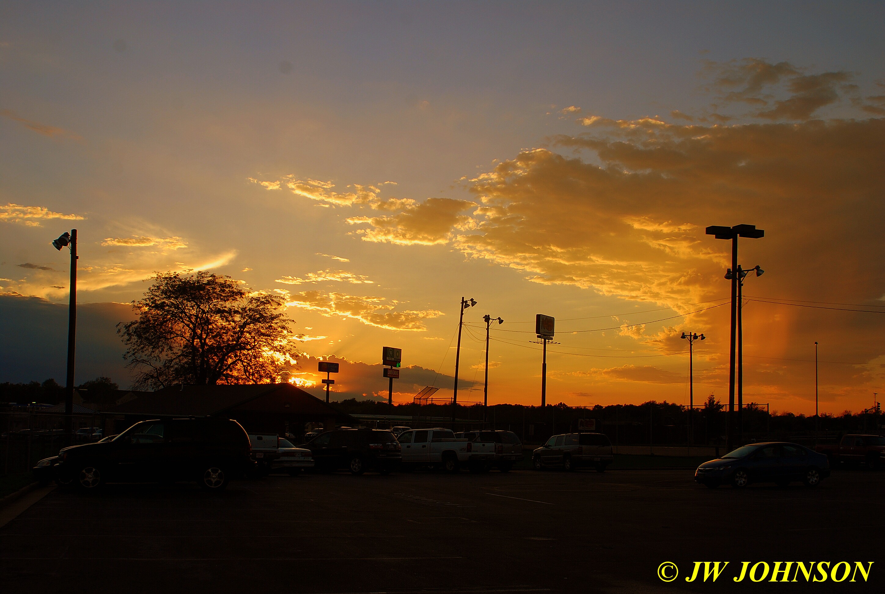
…and then went down our street a few blocks to where the new Elmont Road Bridge crosses I-44 to see even more of the pretty sunset with spectacular rimlighting of the clouds…
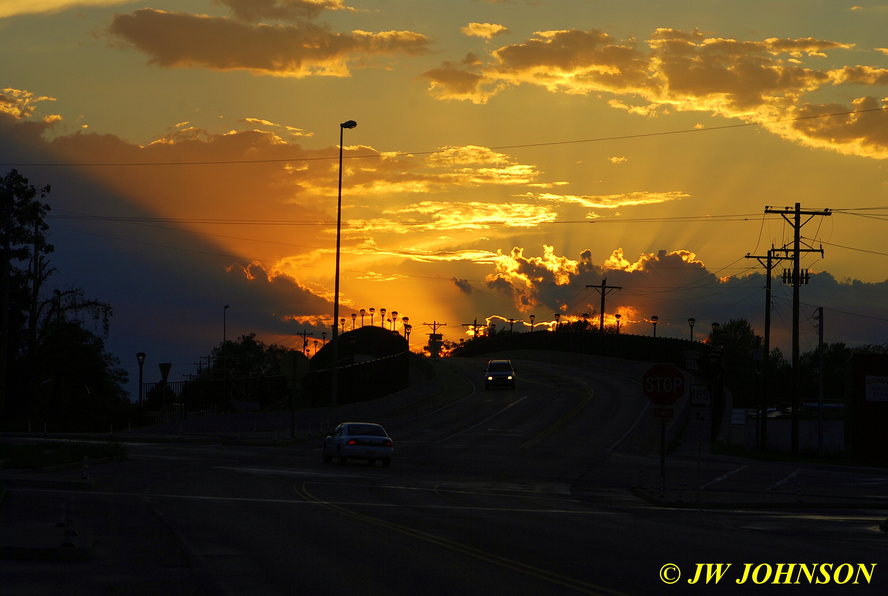
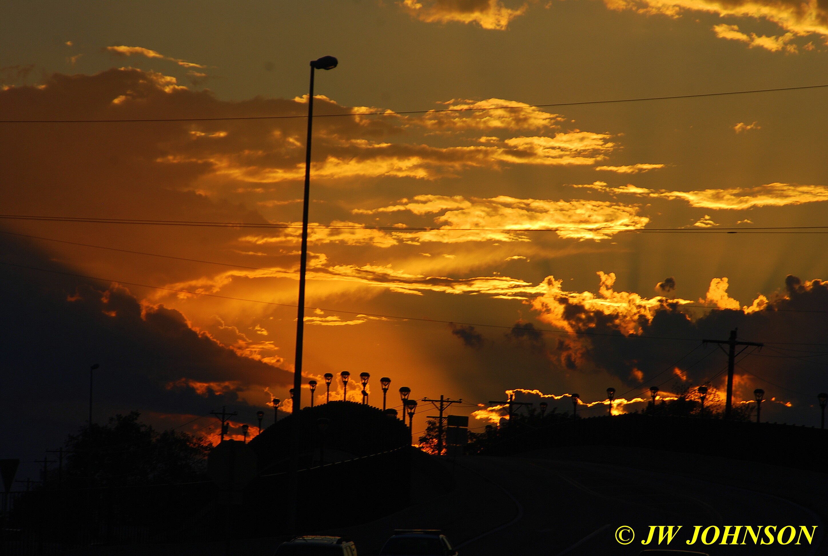
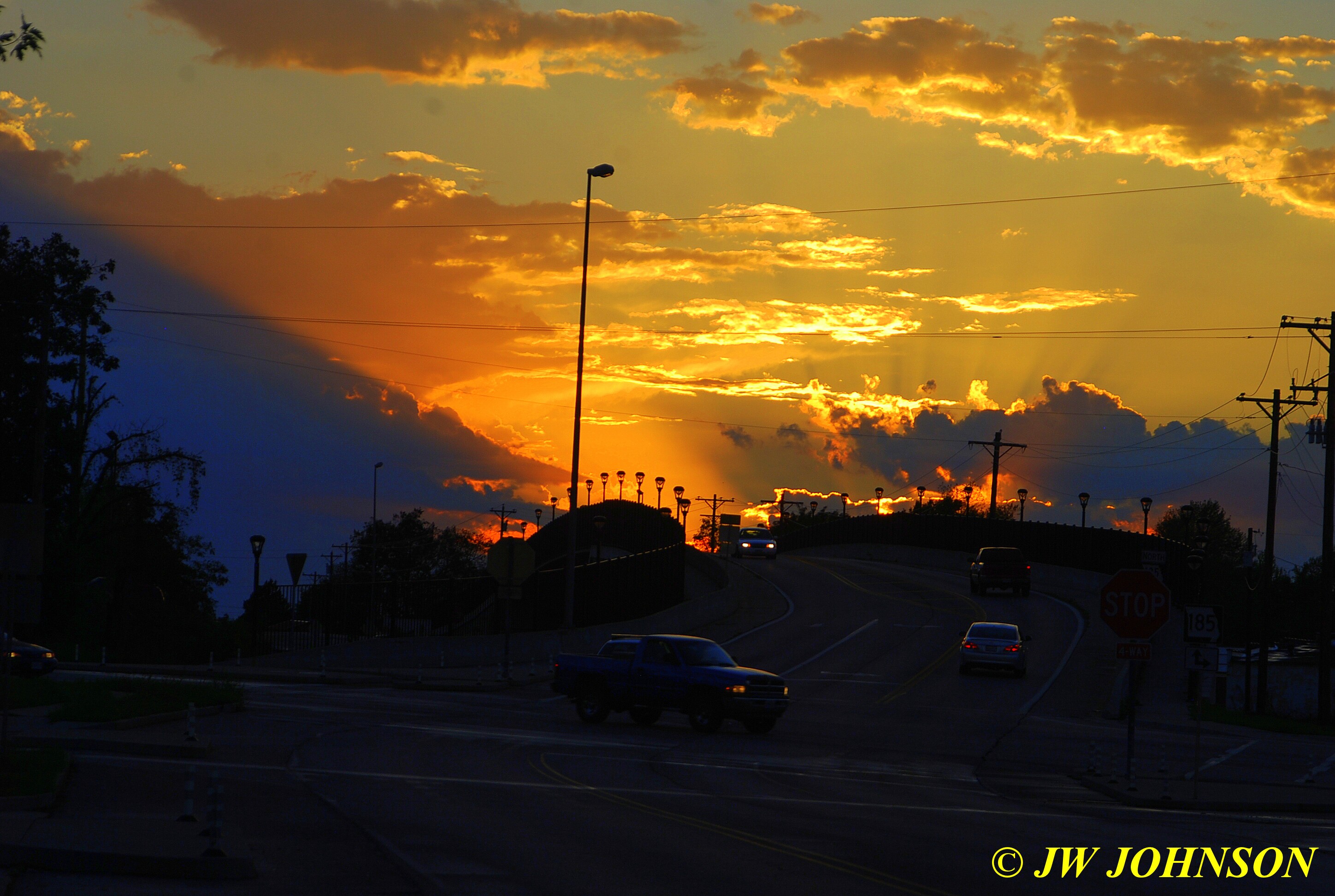
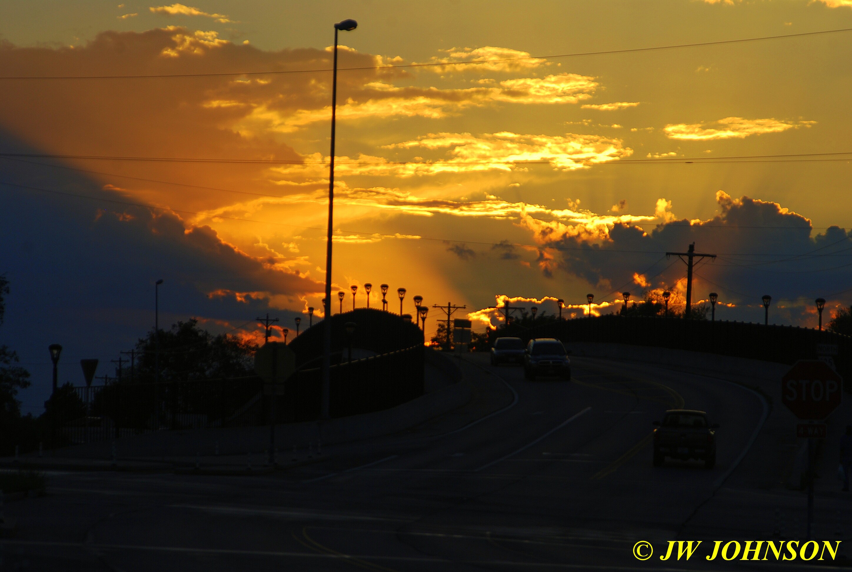
…and I was so taken with the rimlit clouds that I almost forgot about that other big cloud on the right side….
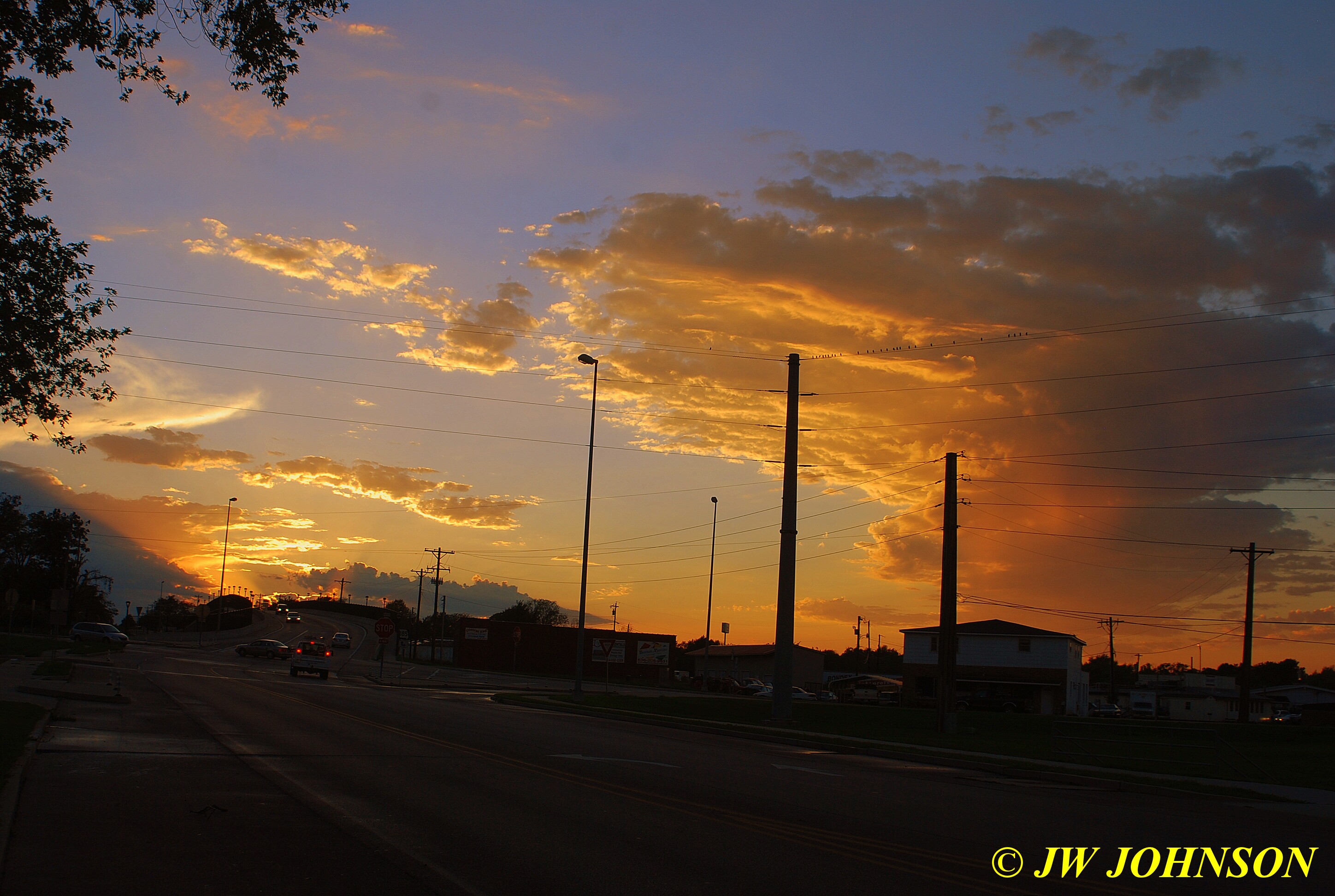
…so now I was back and forth from the rimlit clouds to the impressive cloud on the right….stayed there til the sunlight and colors faded….
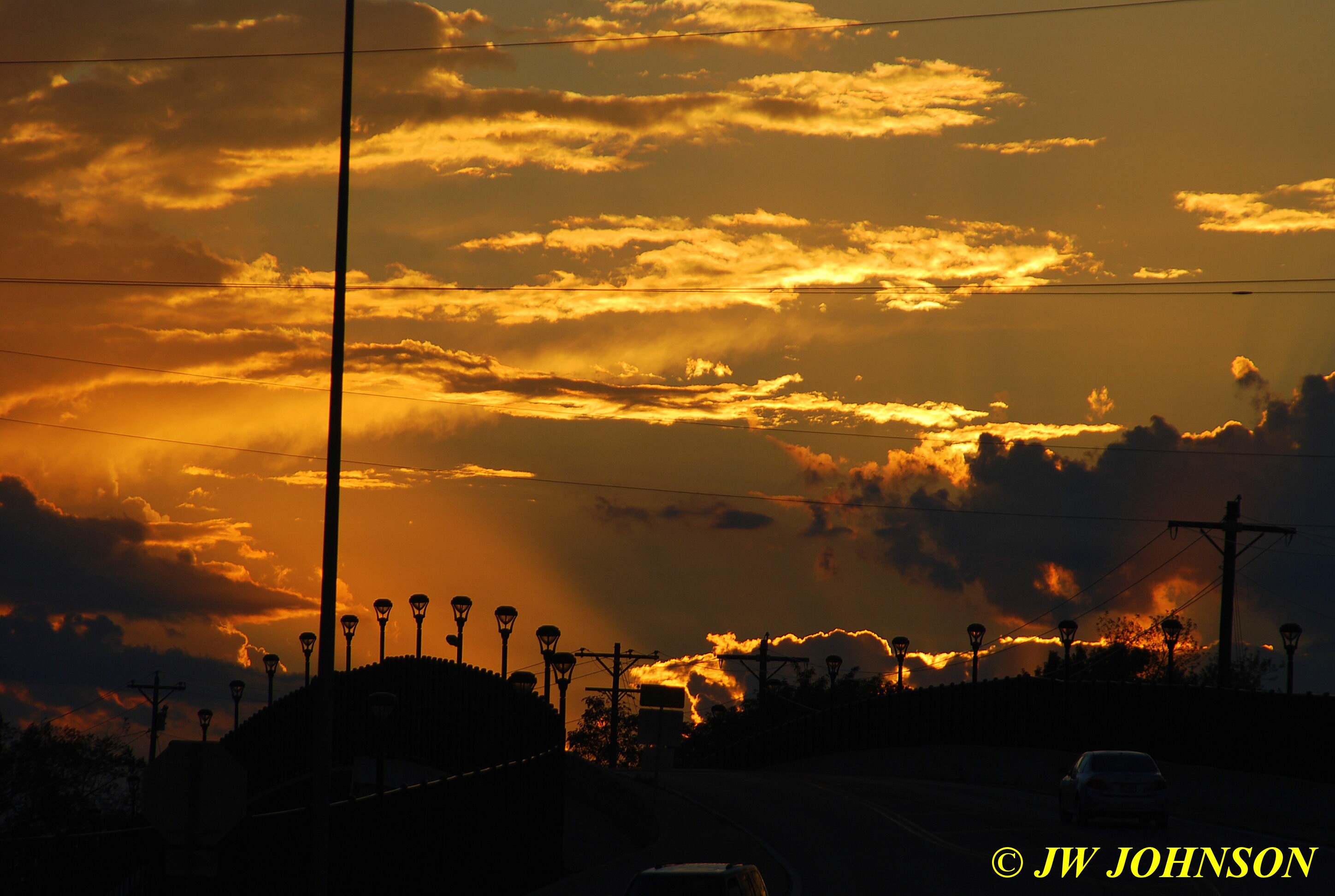
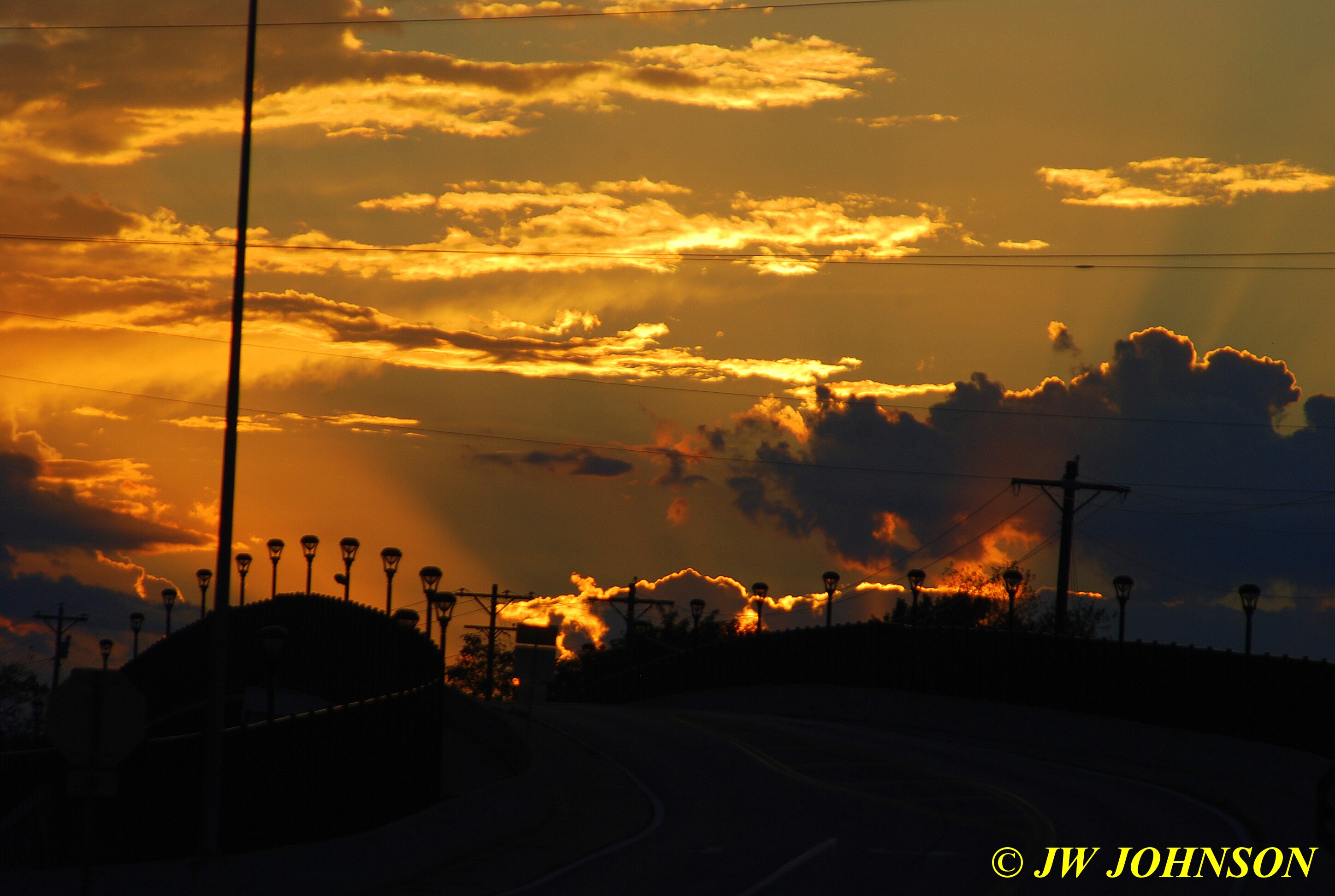
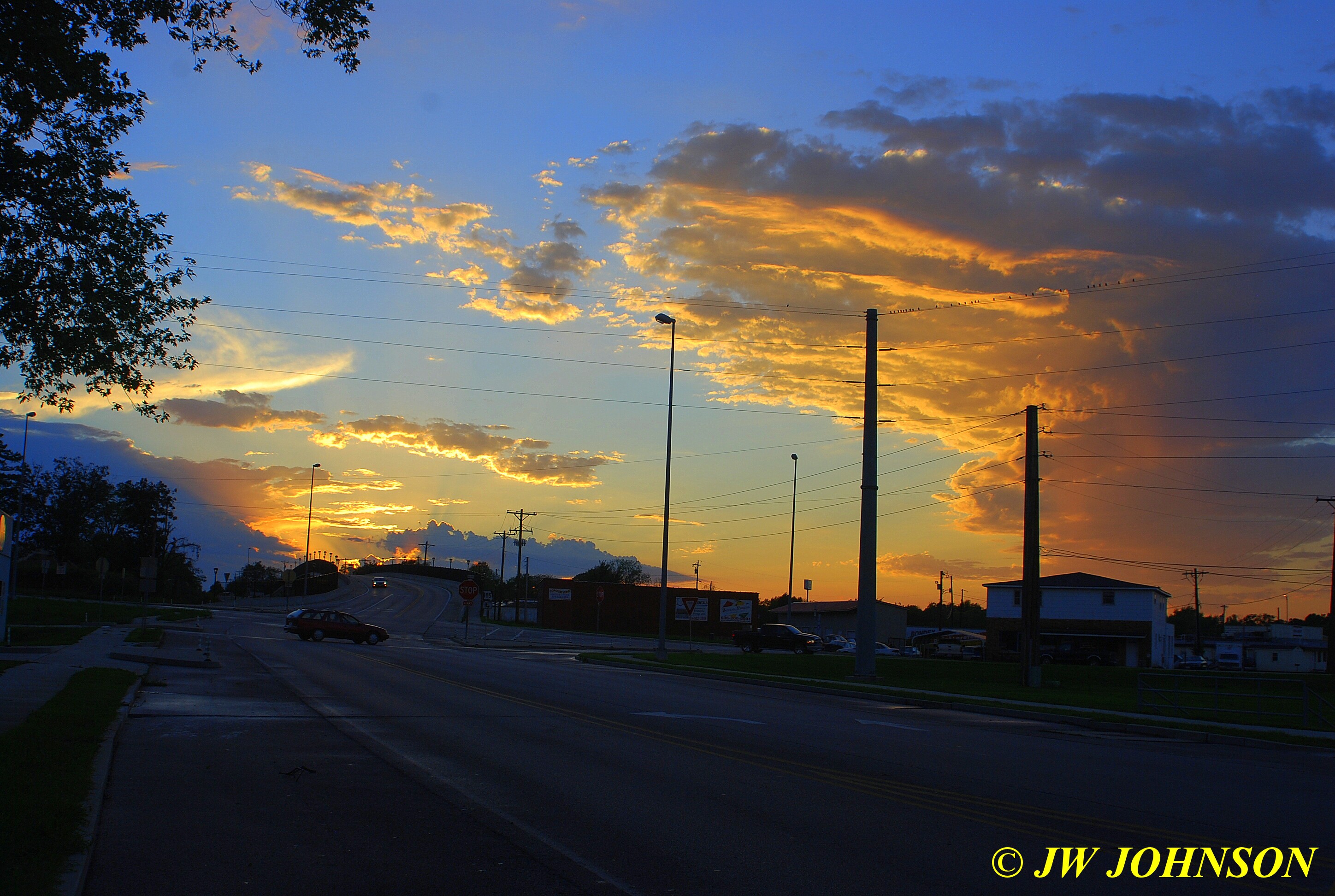
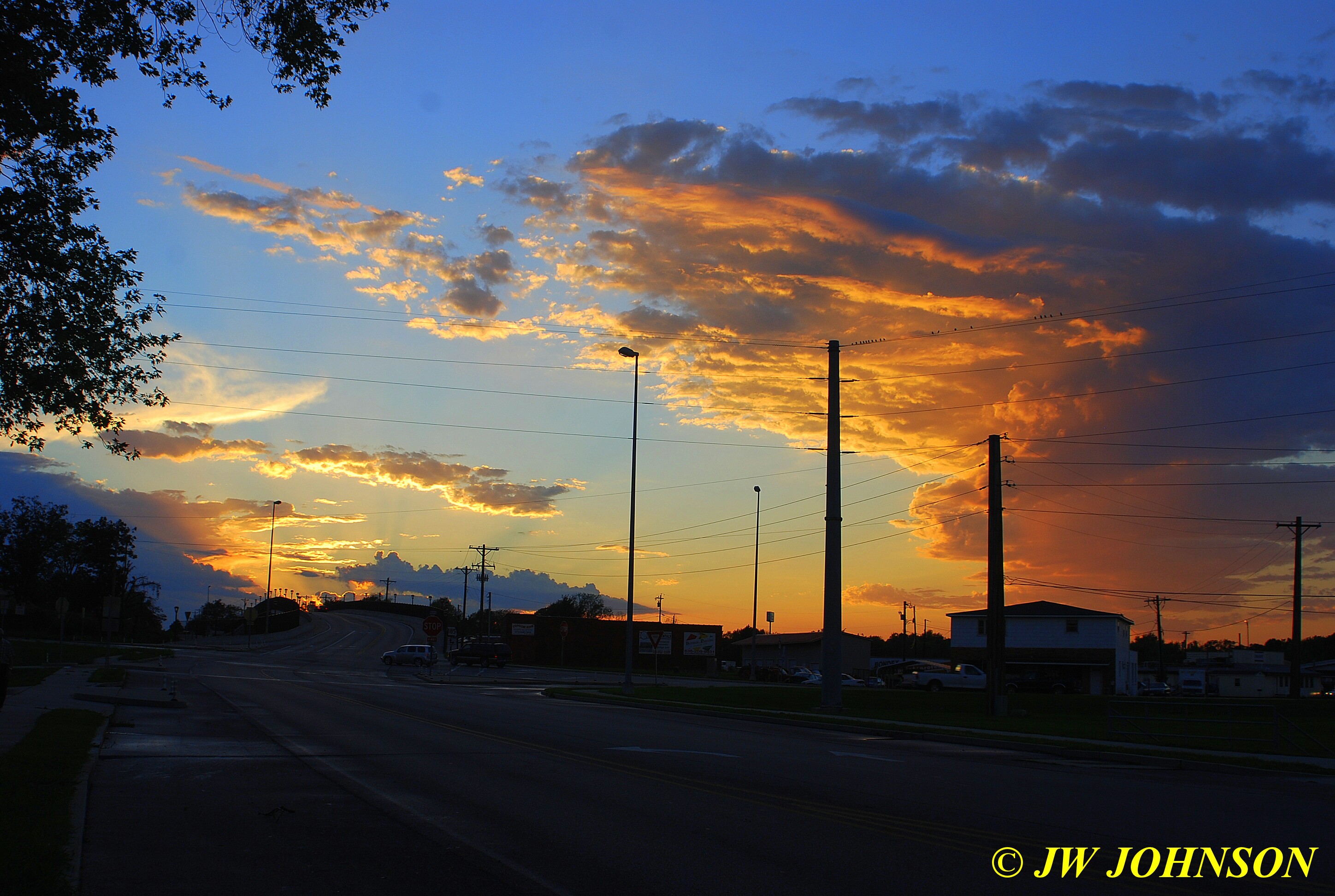
…and when those colors start fading, they go fast….
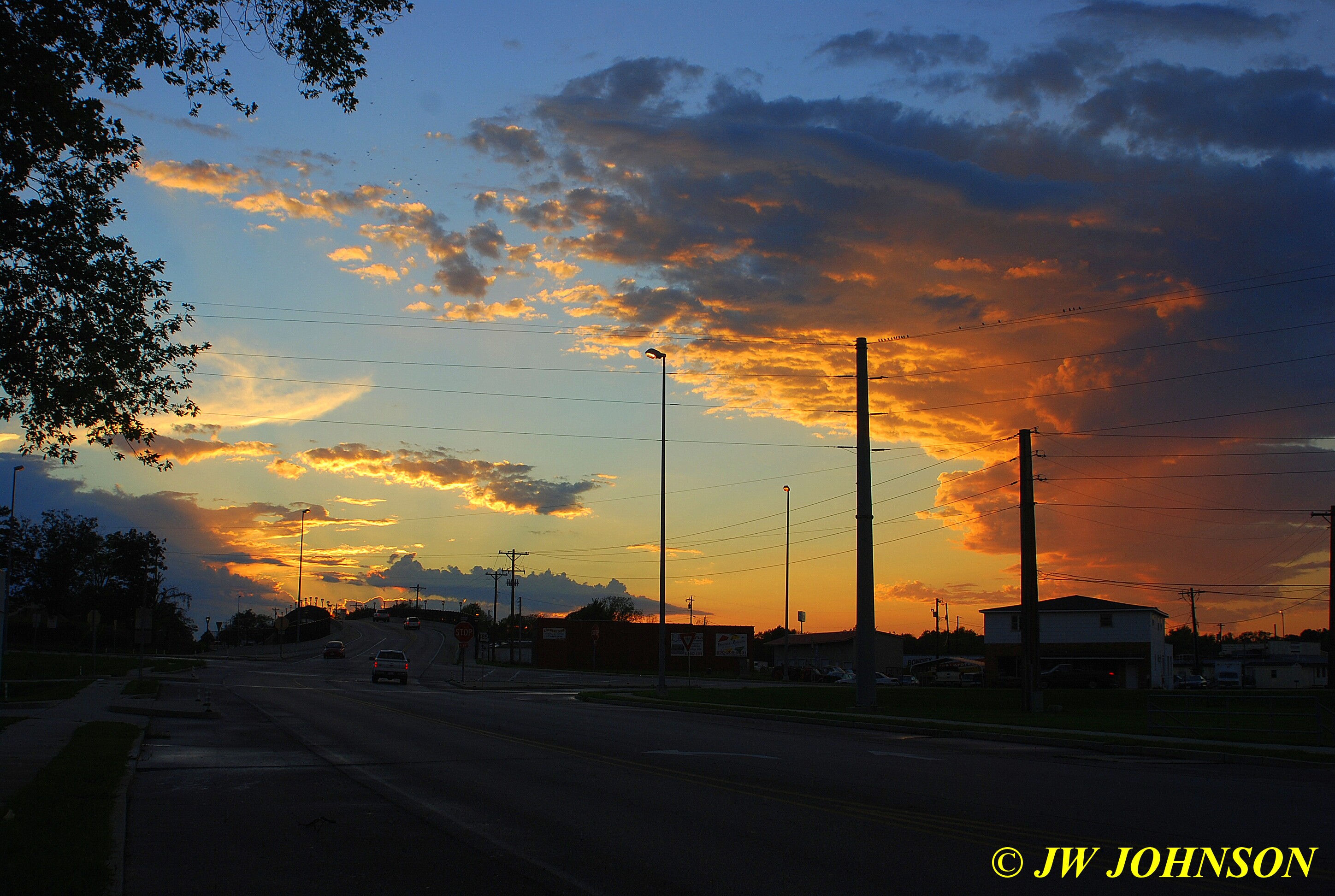
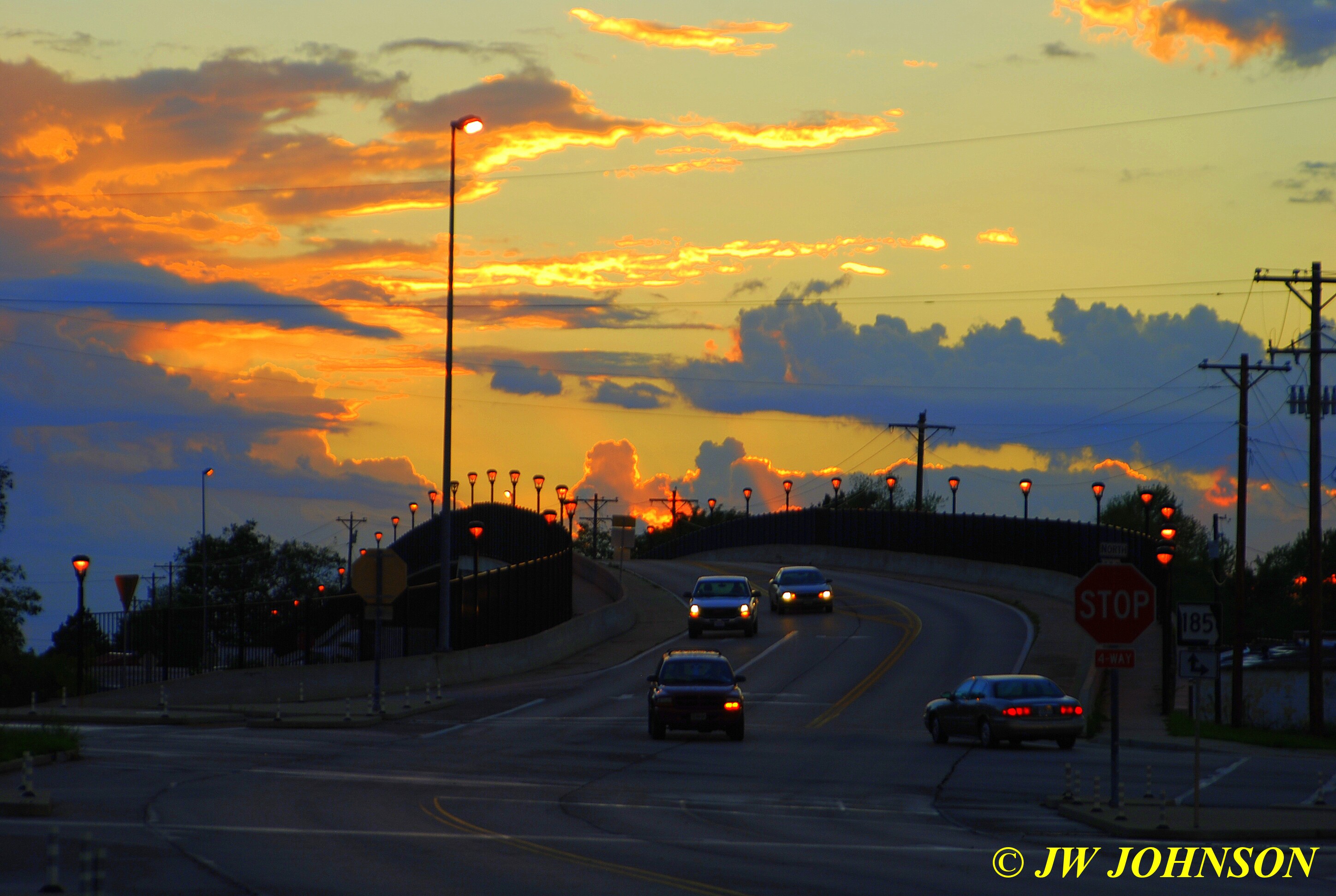
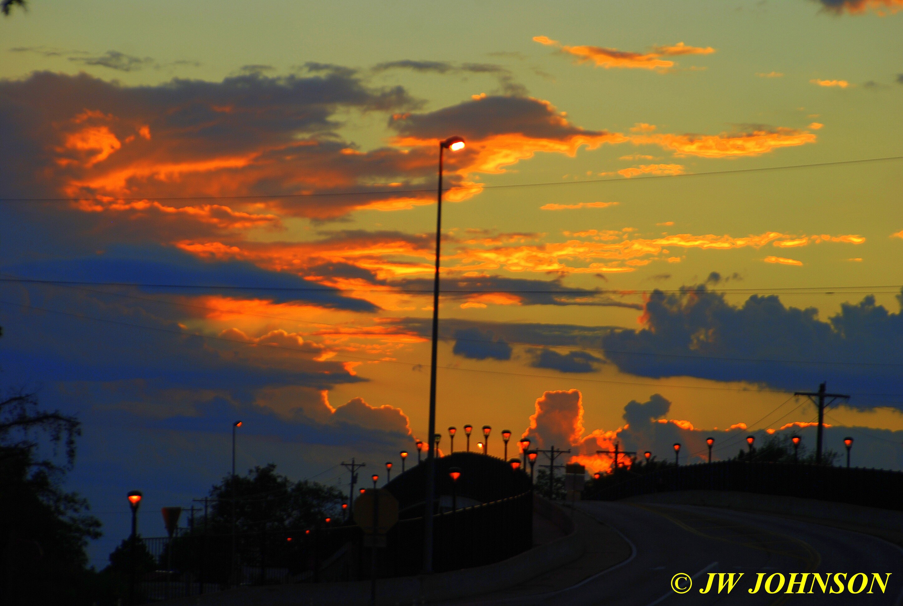
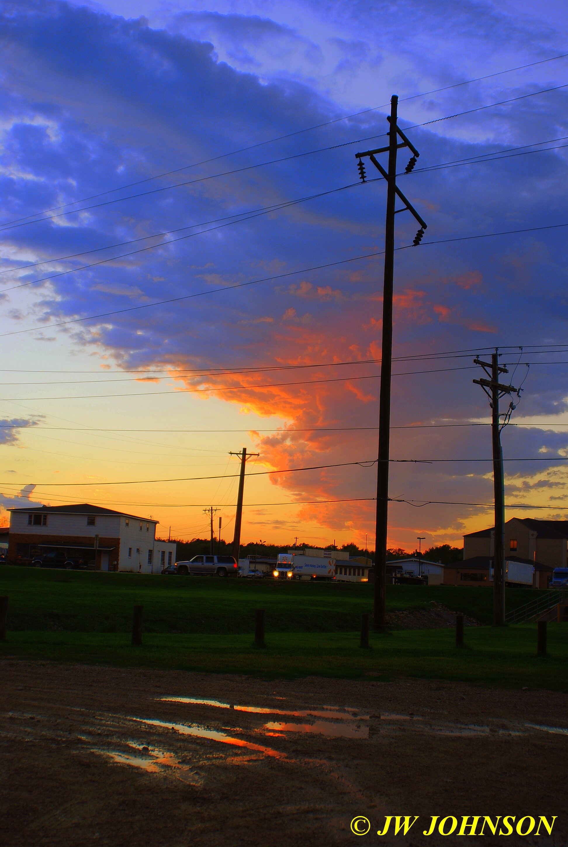
..I spotted some water puddles across the street and shot the one above there, to get a little water reflection….
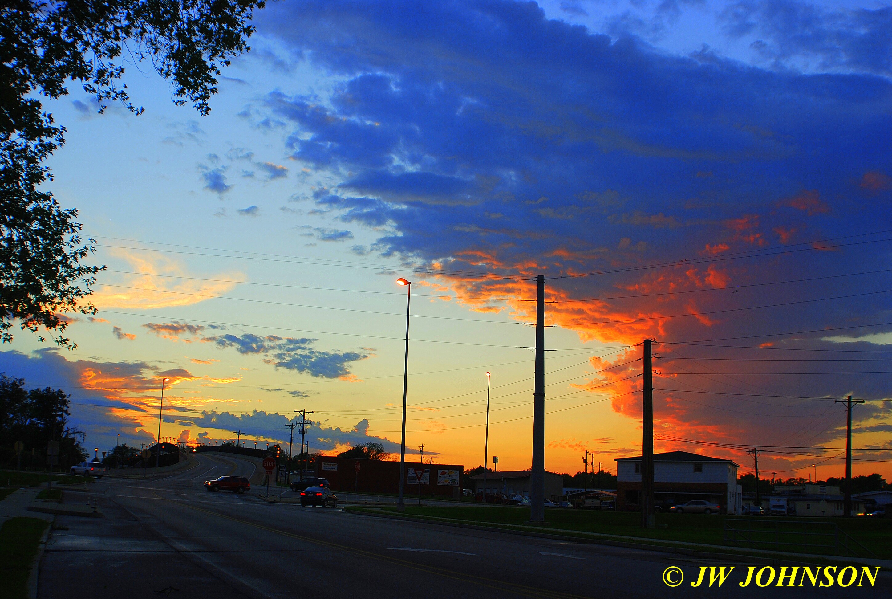
A nice ending to the day….
I dont always get to shoot the sunbeams that I see and some can be a challenge to photograph and capture as well, due to the contrast involved. But I still try !!
I was on my way to work the other evening and spotted this one forming up and so I returned home after shooting two photos of it with my phone camera and shot these two from the ballpark by the City Pool….the sky was an amazing blue and I tweaked it just a bit with my editing program to really bring it out and show the sunbeams better….
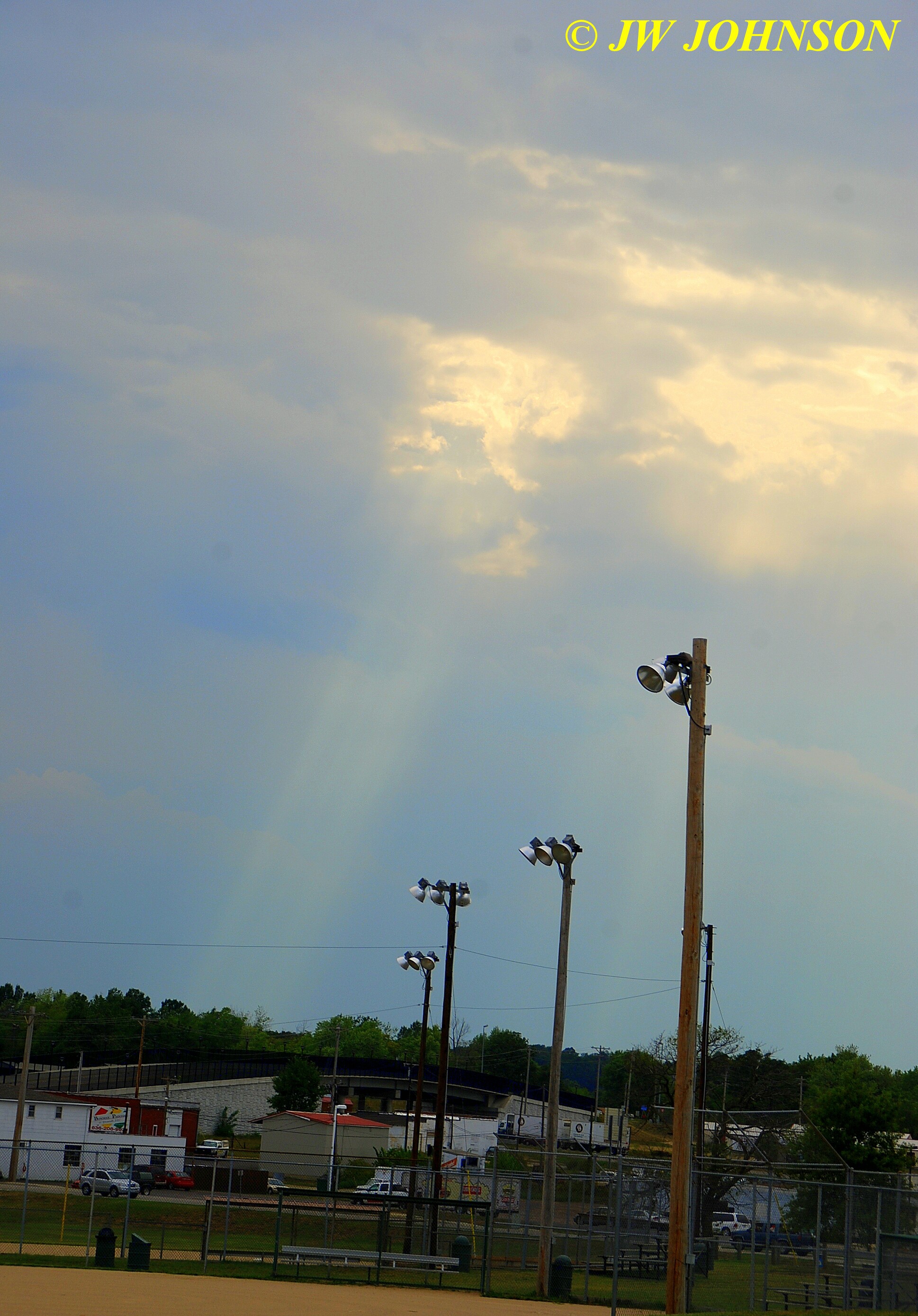
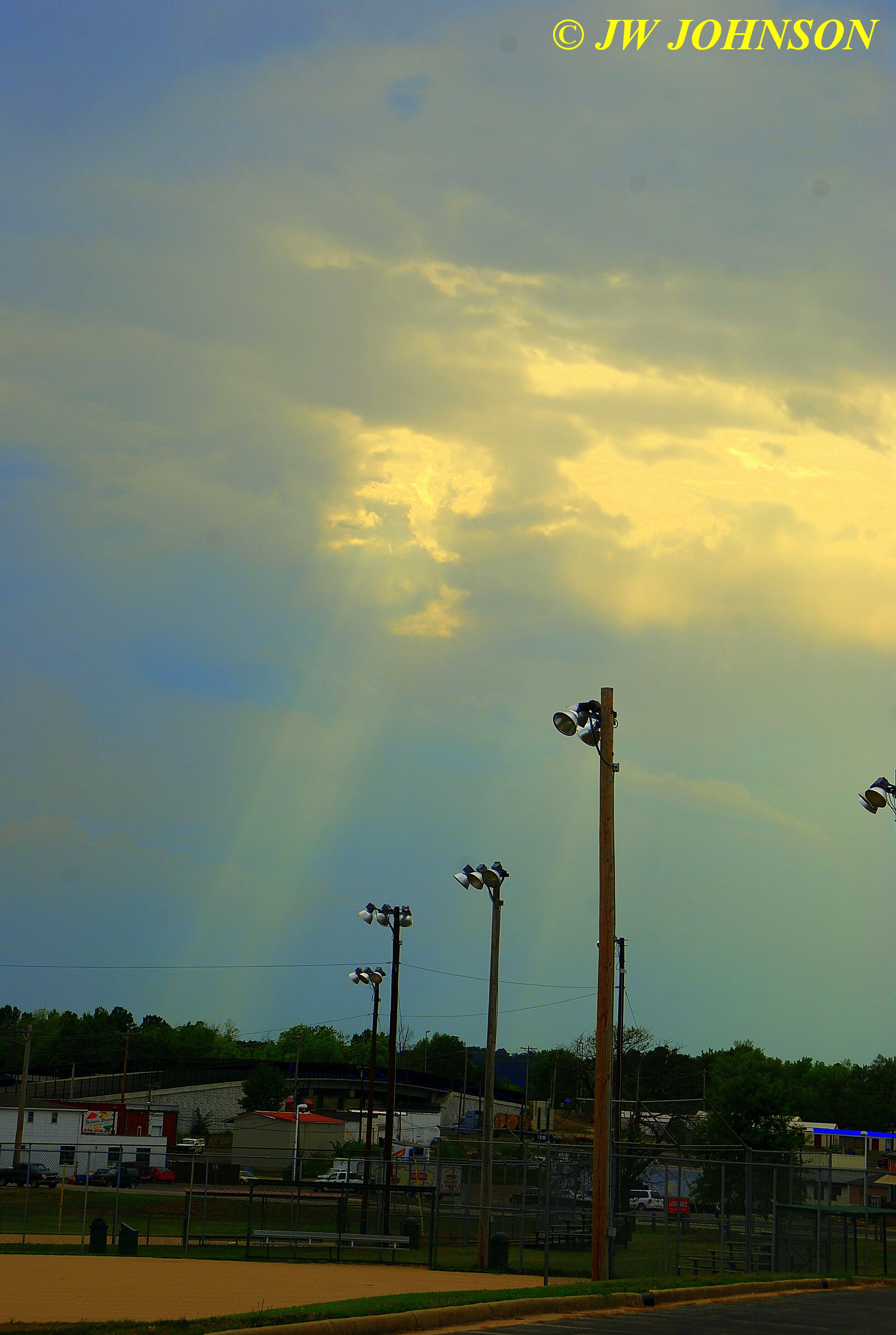
…and here is one I shot in Maplewood on my way to work a few weeks ago as well….

and some of the sunsets I have photographed since the middle of July have been awesome….this one at work….
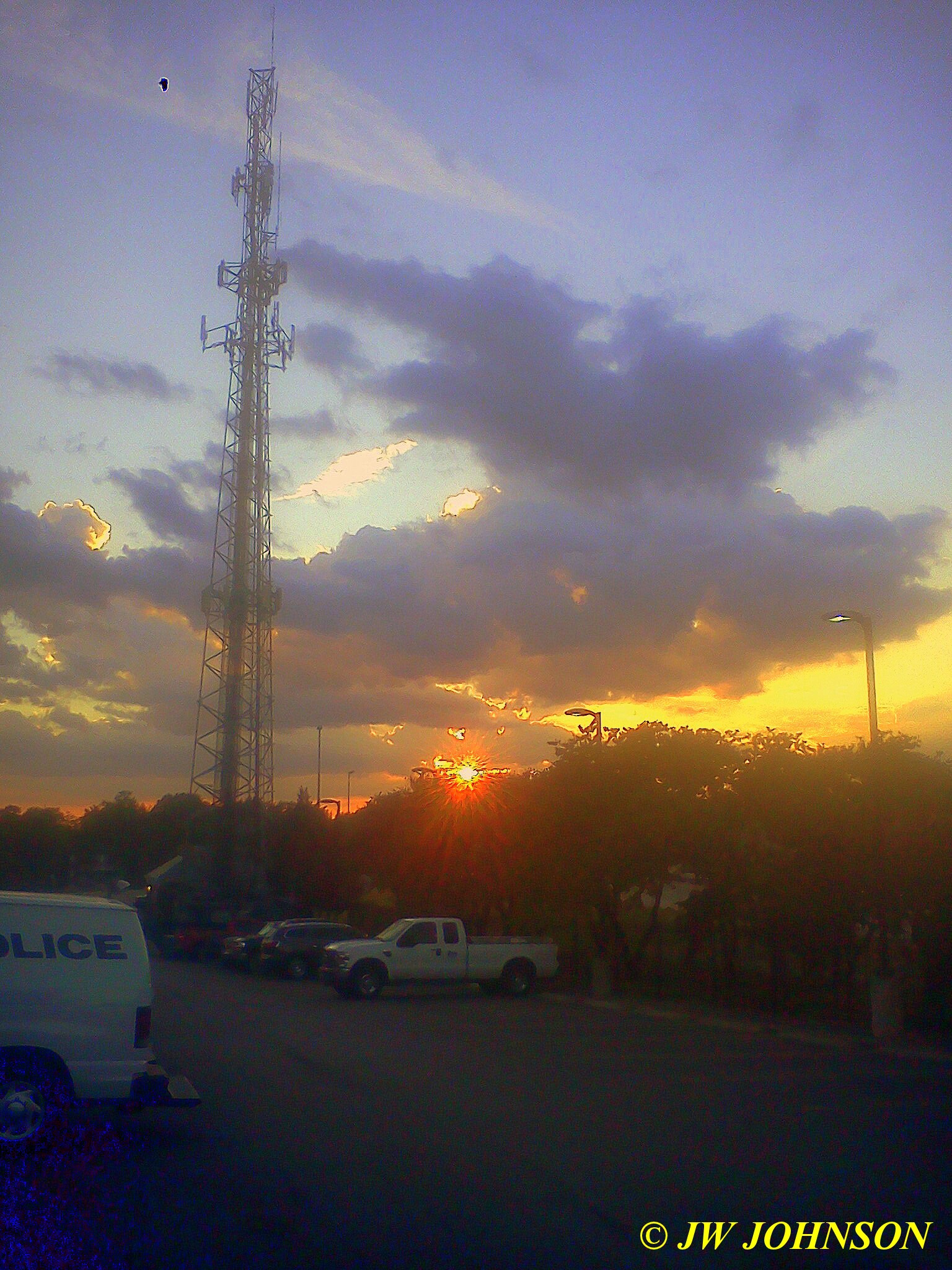
…a few nights later at the ballpark in Sullivan….
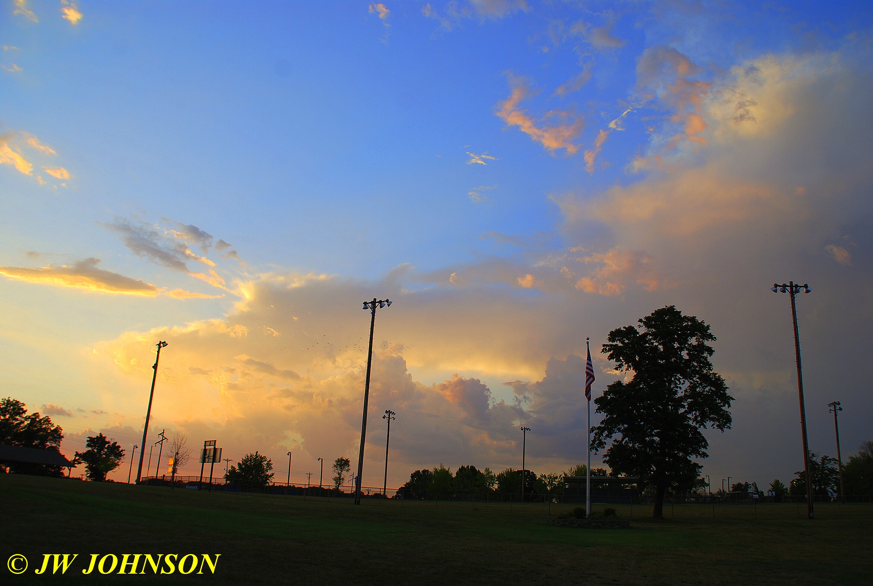
same evening, little later down on Main Street by our Main Fire Station, with the flag at half mast….
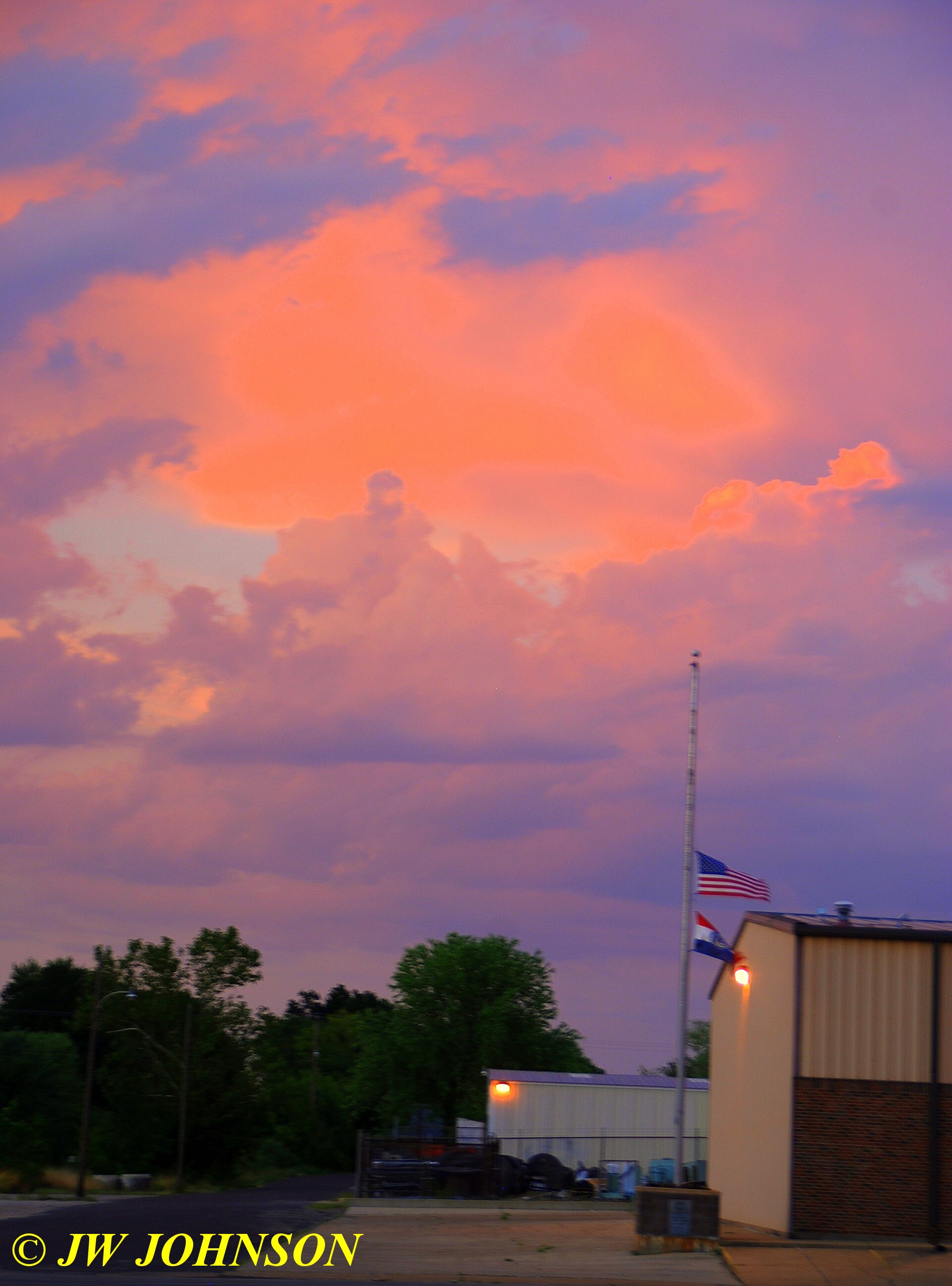
the next one at the main FSCB Bank same evening….

…and the fire station once again….
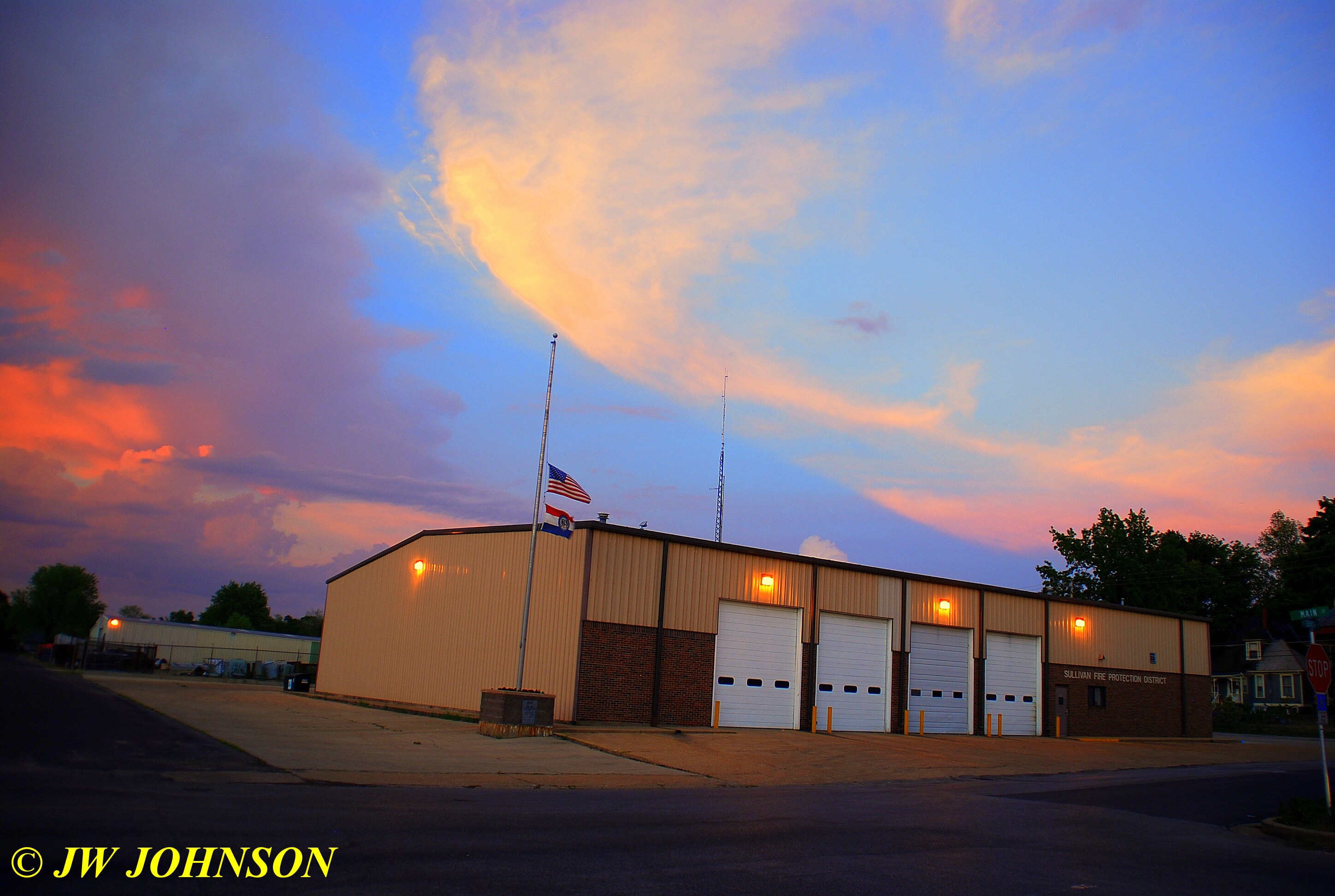
..and this is a set of pretty pine trees not far from my home where the sun sets right down next to them….

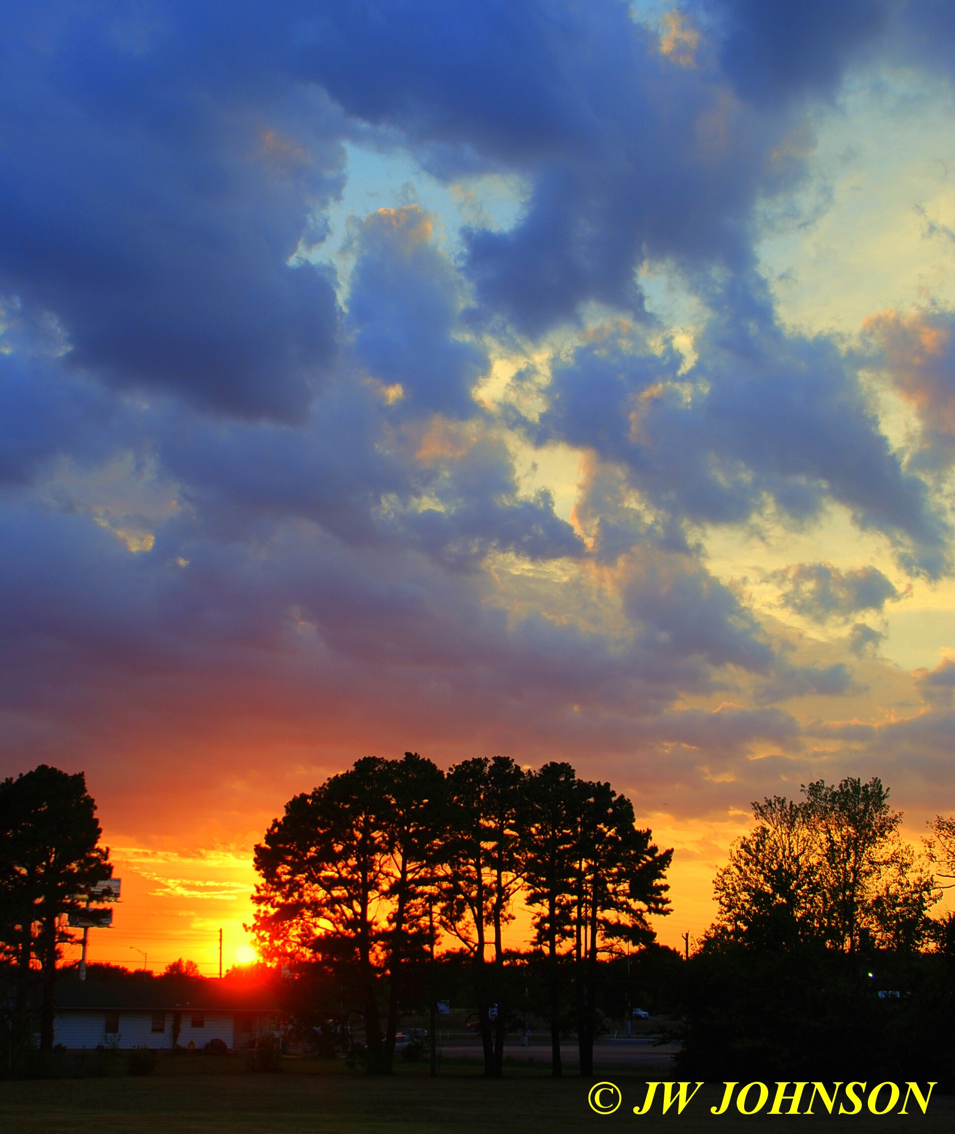


Missy and I loaded up the truck two weeks ago and headed south to Arkansas for a week`s stay on beautiful Lake Ouachita west of Hot Springs and east of Mount Ida….I was asked to photograph the scenery down there four times a year and this was our spring trip down there.
I stopped off in Waldron, on the way down, where my parents are both from and my Mom was raised there on the family farm. I have many fond memories of the family farm and my grandparents and many cousins and relatives in that area from several trips down there at various times of the years, and we still travel there for family reunions at the farm in November each year. My grandparents are buried nearby and my parents usually travel down there for Decoration Day at the cemetery, but were unable to do so this year, so I offered to take care of it for them. It was a beautiful drive out to Sehorn Cemetery, which sits up on a hillside overlooking a creek valley near Winfield, just west of Waldron.
Mom takes hanging baskets down each year and changes them out, I set the new ones on the grass and removed the older ones from the Shepherd`s hook and changed them out…
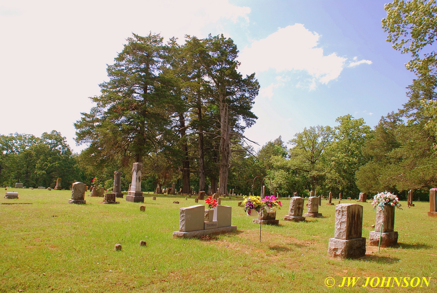
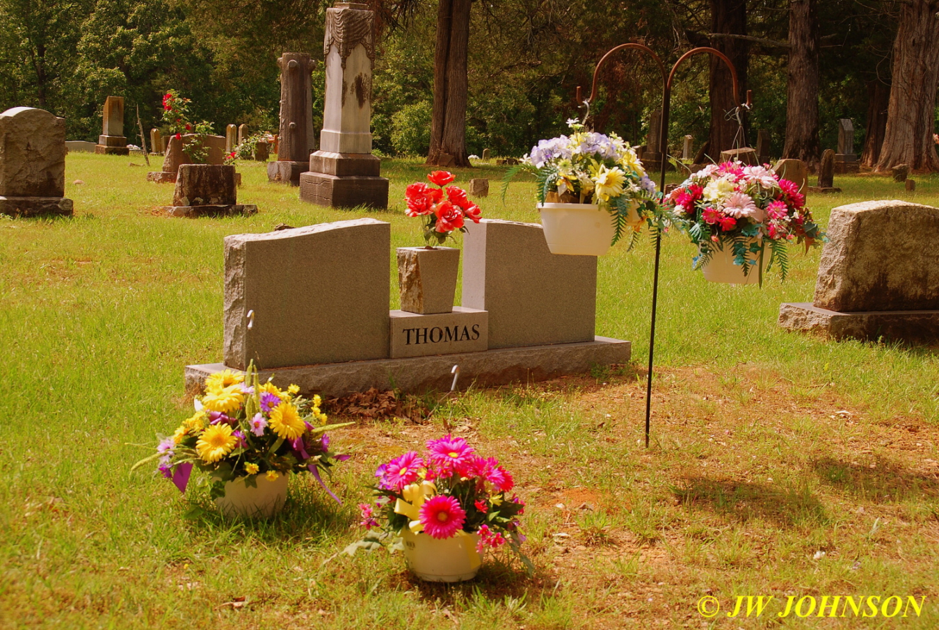
From there, we drove on south to Mount Ida and east on 270 to our turnoff, Mountain Harbor Road, at a wide spot in the road called Joplin. We were staying in a beautifully furnished condo in Harbor East, which was within sight of the lake waters…I photographed the condo and several others when there in November last fall and would mainly be concentrating on scenery around the lake and boating activities on this trip. I had intended to drive on down to Hot Springs and get a good steak dinner at Colton`s, and visit with one of my good friends Scott Effird, who works there, but found myself a little too tired after the long drive down today. We had alot of headwinds on the way down, and I was wore out, so we went over to the Harbor Dining Lodge instead and had a good dinner there. I really enjoy the atmosphere in the Harbor Lodge, very friendly people that work there and there is a great view of the lake there while eating. After dinner, we went down and looked at the big fireboat again, its a retired Coast Guard Cutter retrofitted to use as a fireboat….
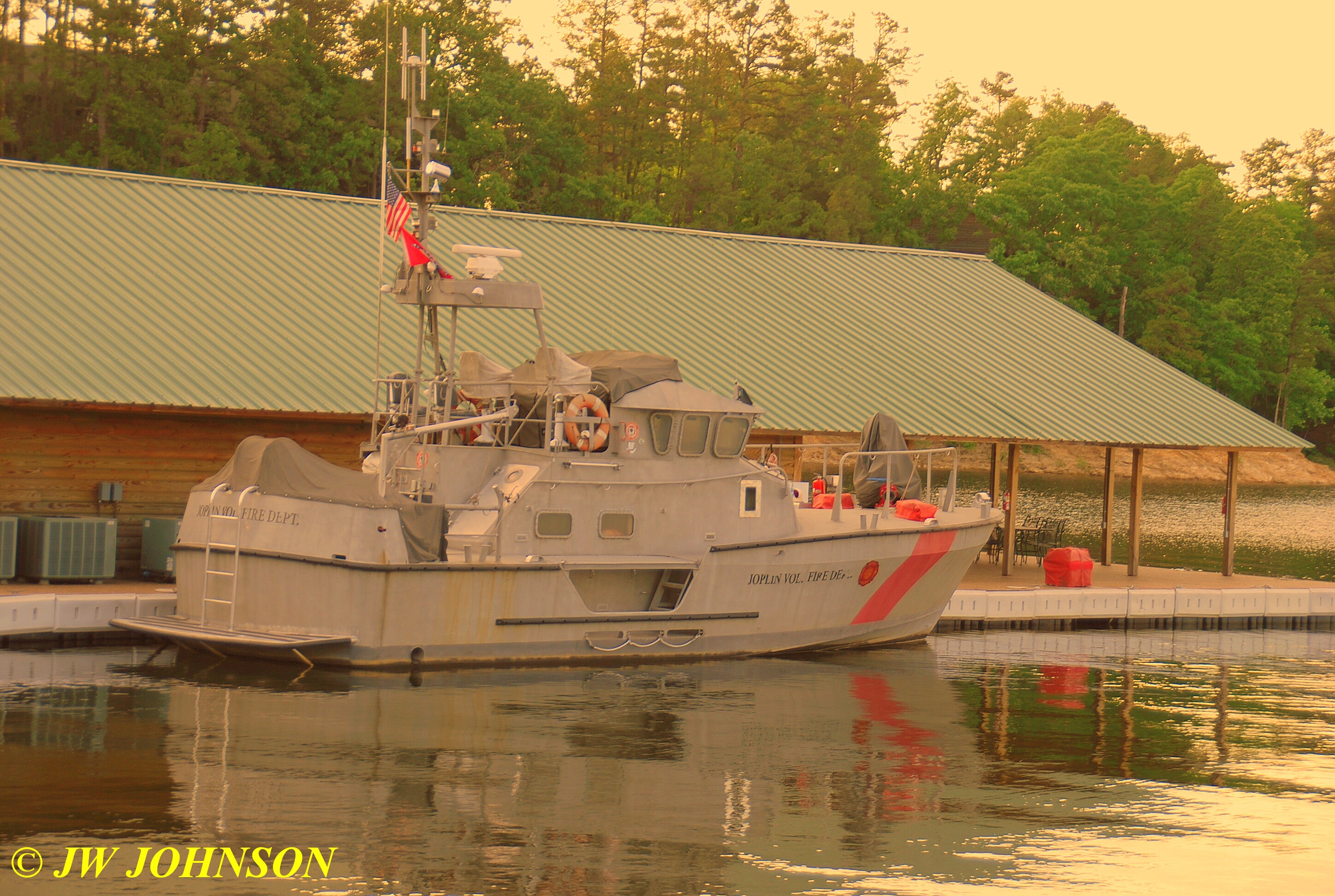
…it was purchased by a resident of Mountain Harbor for the Harbor to use as a fireboat….it almost went to Alaska and would have if it hadnt been purchased, from what I understand. It sure is impressive looking and I was treated to a tour of it while there as well.
Missy and I wandered over to Micah`s Pointe after that and photographed some speedboats racing across the west side of the lake as the sun began to set….

…and a sailboat tied up in one of the many docks at Mountain Harbor….

…and then I spotted a couple of fishermen trying their luck from the waters near a beautiful wooden bridge near the Pointe….
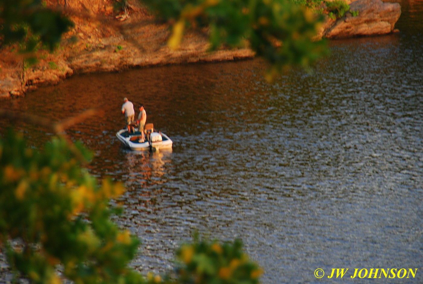
..pretty soon after that, the sun began setting and I photographed it….

…this is a great place to shoot sunsets from, the Pointe sits atop a beautiful high bluff overlooking Lake Ouachita with a great expanse of water to the west right in front of you…there is a nice wooden platform built up on top of the bluff and nicely framed with beautiful pines and cedars…I know I`m using the word beautiful here quite a bit, but thats what this place consists of….alot of beauty….and as we stood there and watched, the sunset just kept getting better and better….

…and while we were there, a buzzard swooped down in front of me a few times so I photographed him as well…
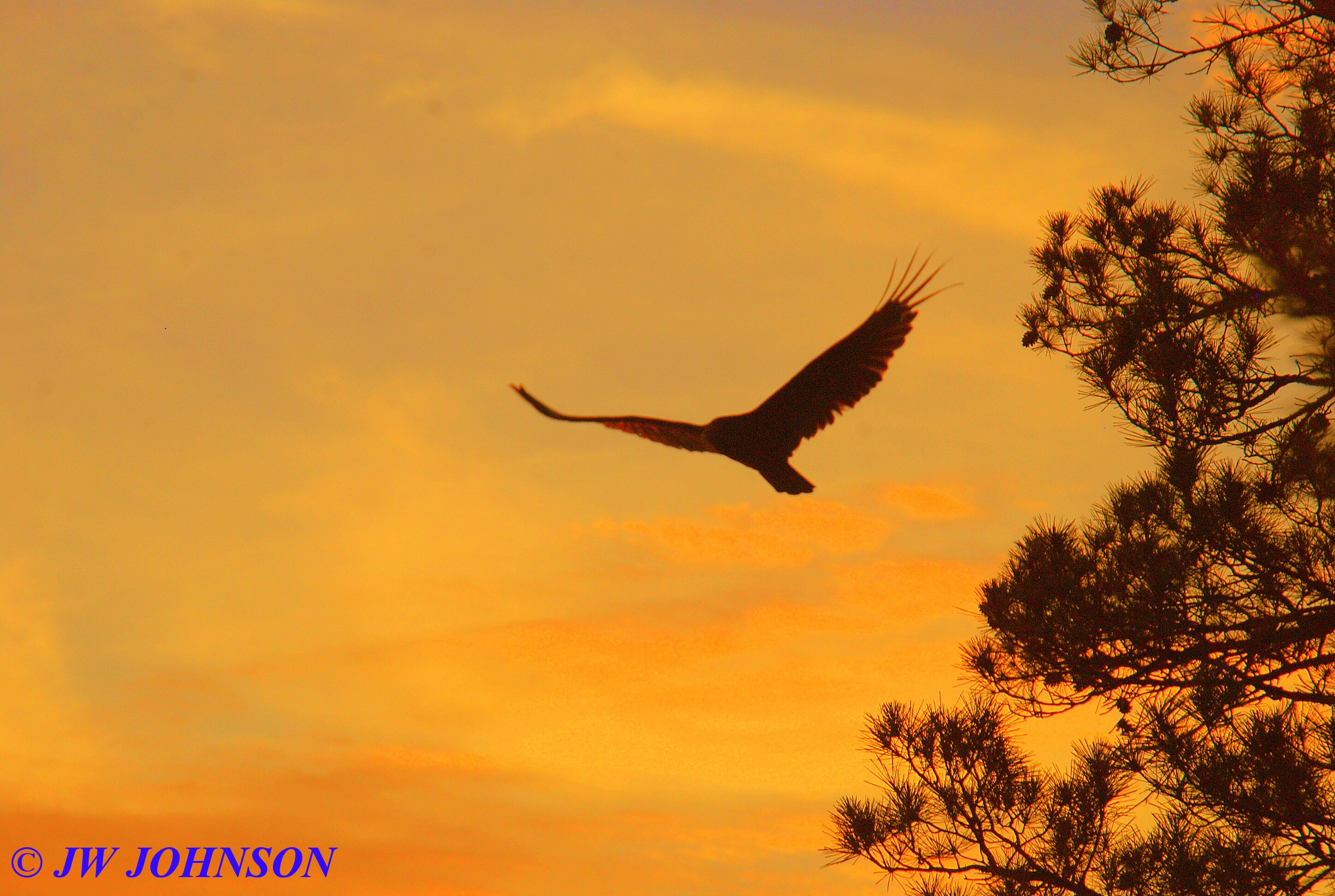
…I then repositioned at the wooden bridge to get more water reflections in my images….…and while this sunset didnt fill the entire sky, the narrow cloudline in the middle sure did turn some nice colors as the sun finally dropped….
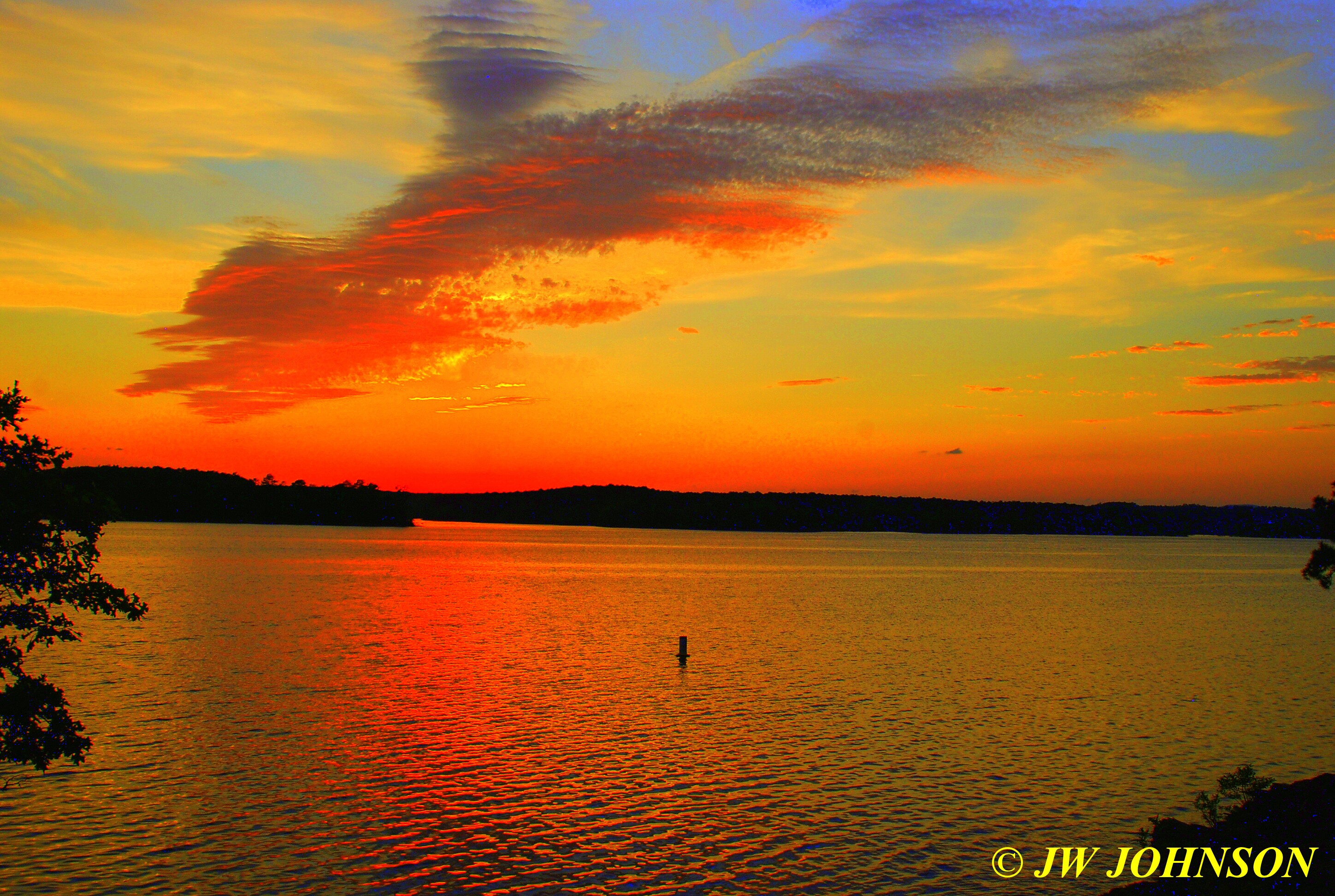
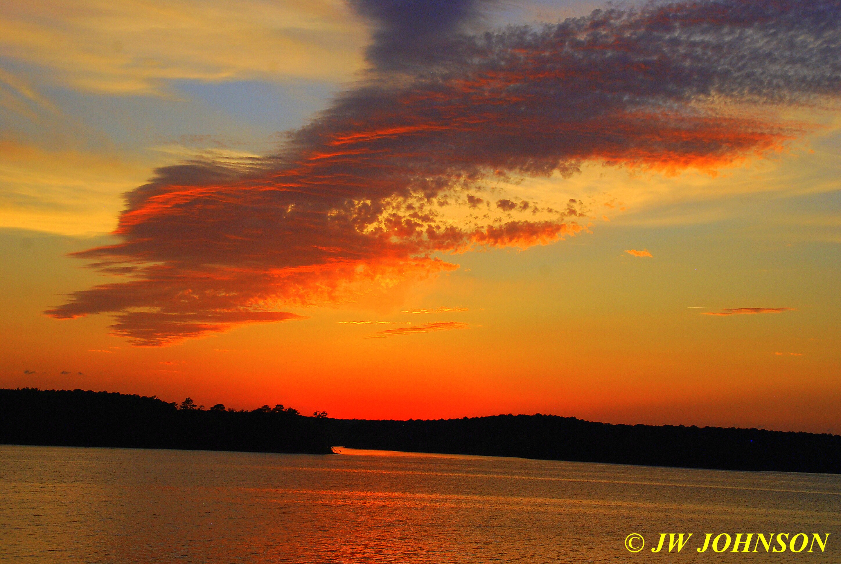
…and that blossomed into this….
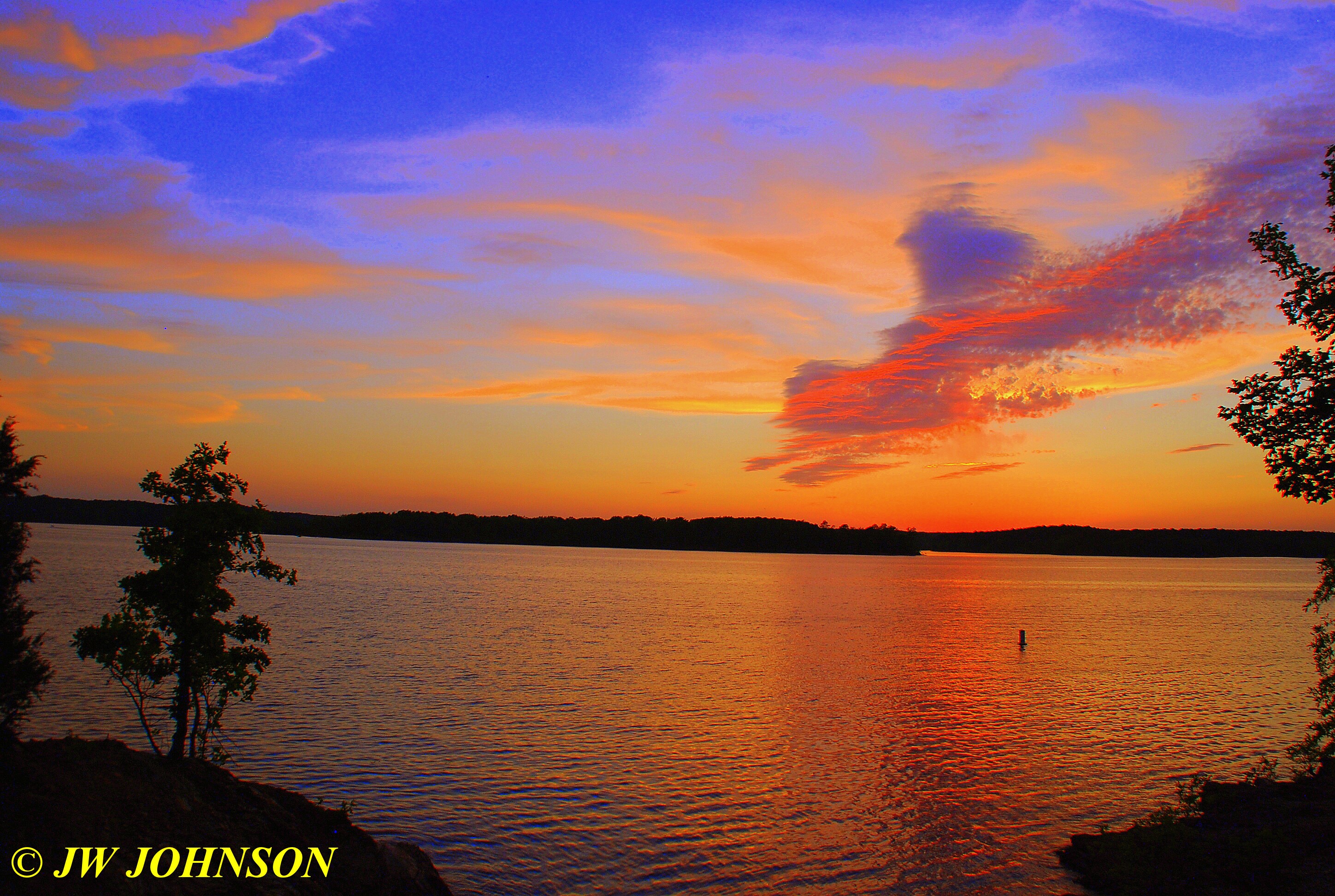
and then this….
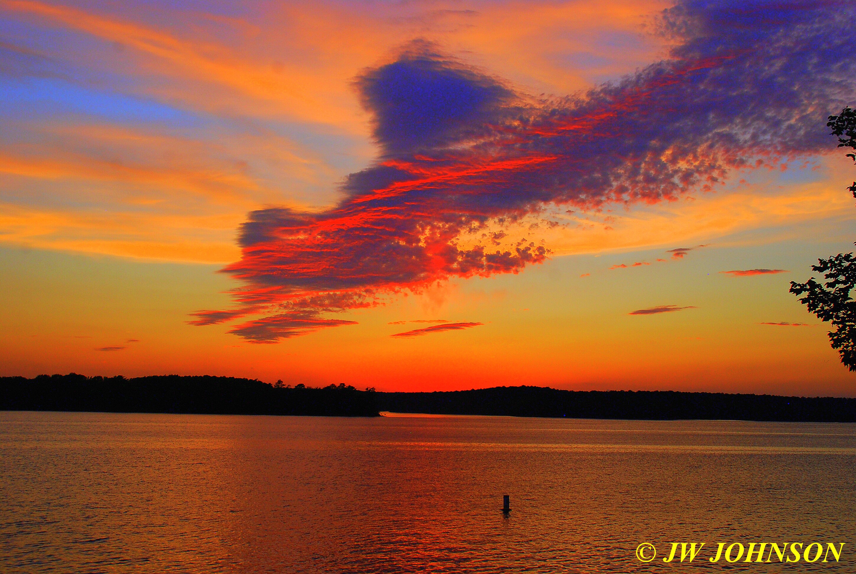
Well the next morning, I started photographing a few things around the condo for Sami….she has a very nice condo that she lets me stay in while there, and she runs a management service for other condo owners there…she goes above and beyond for pet owners like me….provides dog bowls so I dont have to bring Missy`s….

…her cleaning staff do a tremendous job as well, and always leave these cute characters on your bed to find when you arrive…neat greeters…..

…and even though she cant be there to greet everyone herself, on your arrival, Sami still makes you feel welcome as you walk through the door….

Missy walked in past the welcome sign, saw her reflection, and prob though Sami had arranged company for her visit…
…and once we got settled in, opened the fridge to stock my bottled water and Arizona Green Tea and found some treats inside waiting too….
Sami also thinks of your breakfast needs too….and she will also stock the fridge and kitchen for you if you have a shopping list, so its all there when you arrive…

I`m never sure if one can find what the basics I have to have…I drink a certain type of bottled water and Arizona Green Tea isnt found everywhere either…so I just take my own stuff when I travel.…but she was right on the mark with cereal for me. She also provides pet pillows for your pet to sleep on and treats…
…so if you ever want to stay there, give Sami a shout at Lake Ouachita Vacation Realty and she can make it happen.
After that, Missy and I got outside and took a walk around to re-acquaint ourselves with the layout of Harbor East, and get a good walk in as well….we were walking down a hill and I noticed in the ditchline and hillside that there were chunks of massive quartz sticking out of the dirt all over the place….

…I rarely see any crystals in the quartz in this area, found a few small ones, but I have heard that they can be found in the wooded areas surrounding Lake Ouachita and there are a few old abandoned mines along the trails outside this area as well. I talked to one of the maintenance men working that morning outside and he told me that he lives just a few miles west of Mtn Harbor toward Mt Ida and there are quartz crystal clusters that pop up on his property each spring during the spring thaw season…so they can be found in some areas in the woods for sure.
We walked on down and saw that the Harbor East pool was being prepared to open soon for the season….

…there is a nice pavilion on top and restrooms down below…there is a nice tennis court behind me and a basketball court to my left, right there with the pool…and the lake is right below the hill from the basketball court about 100 feet….as we were walking back to the condo, I saw some neat wind catchers in the form of hot air balloons….
…on returning to the condo, I got word that a buddy of mine couldnt make it down to visit, so Missy and I loaded up and headed to Bear Mountain Mine to look for quartz…as we got to the entrance to Harbor East, we saw a doe feeding in the grass…
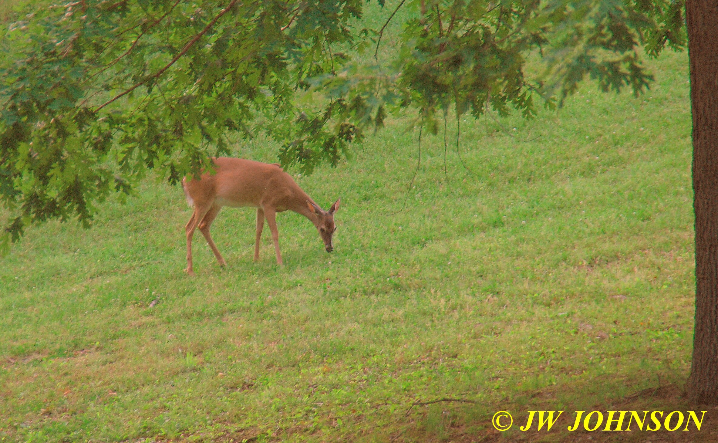
We had a great time over at Bear Mtn Mine, for that story and photos visit my rock collecting site at http://jwjrocks.com
I was driving in a different route than I normally take, and we came across some deer on the very east side of the property along East Basin Road, and I understand they are there every day at various times…this one was standing up at the top of a road cut…its a little fuzzy, mainly because the truck was running and my arm was resting on the windowsill while shooting….
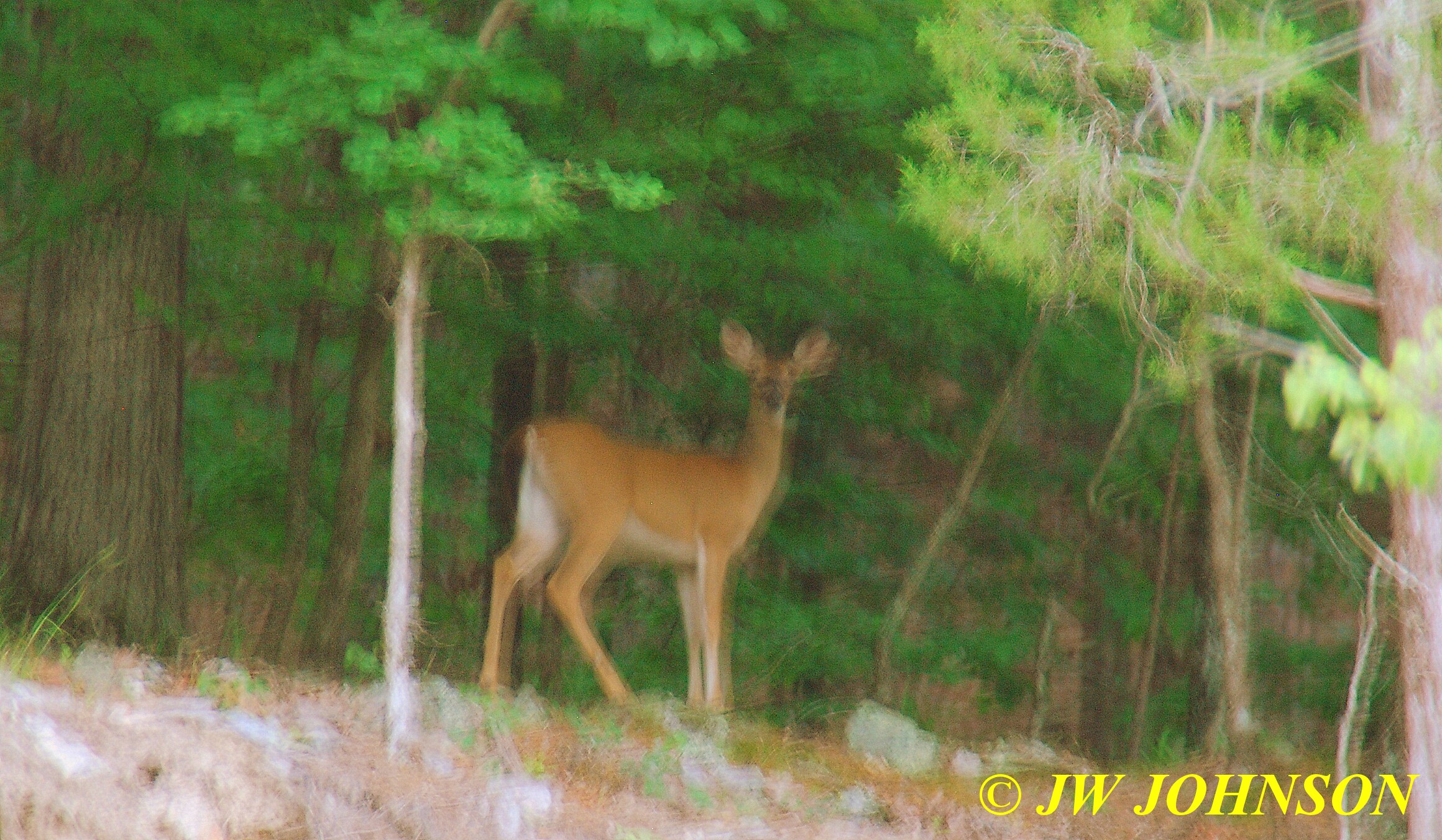
…I drove down to a different section for my sunset photos this time…down to a boat ramp in Harbor East, right below and just east of the pool and pavilion area…we found it during our morning walk and it looked like a great place to shoot some photos…and it was….
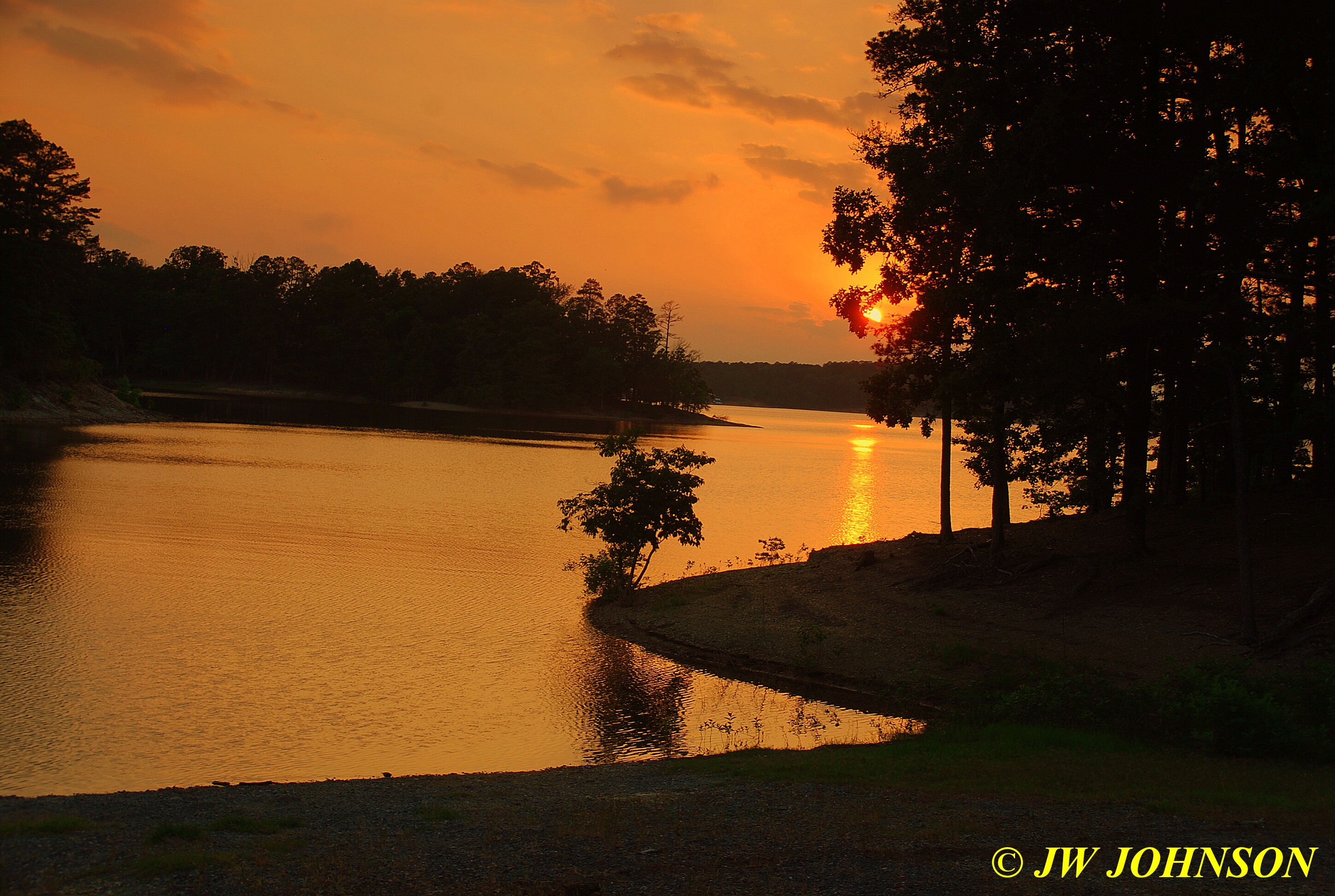
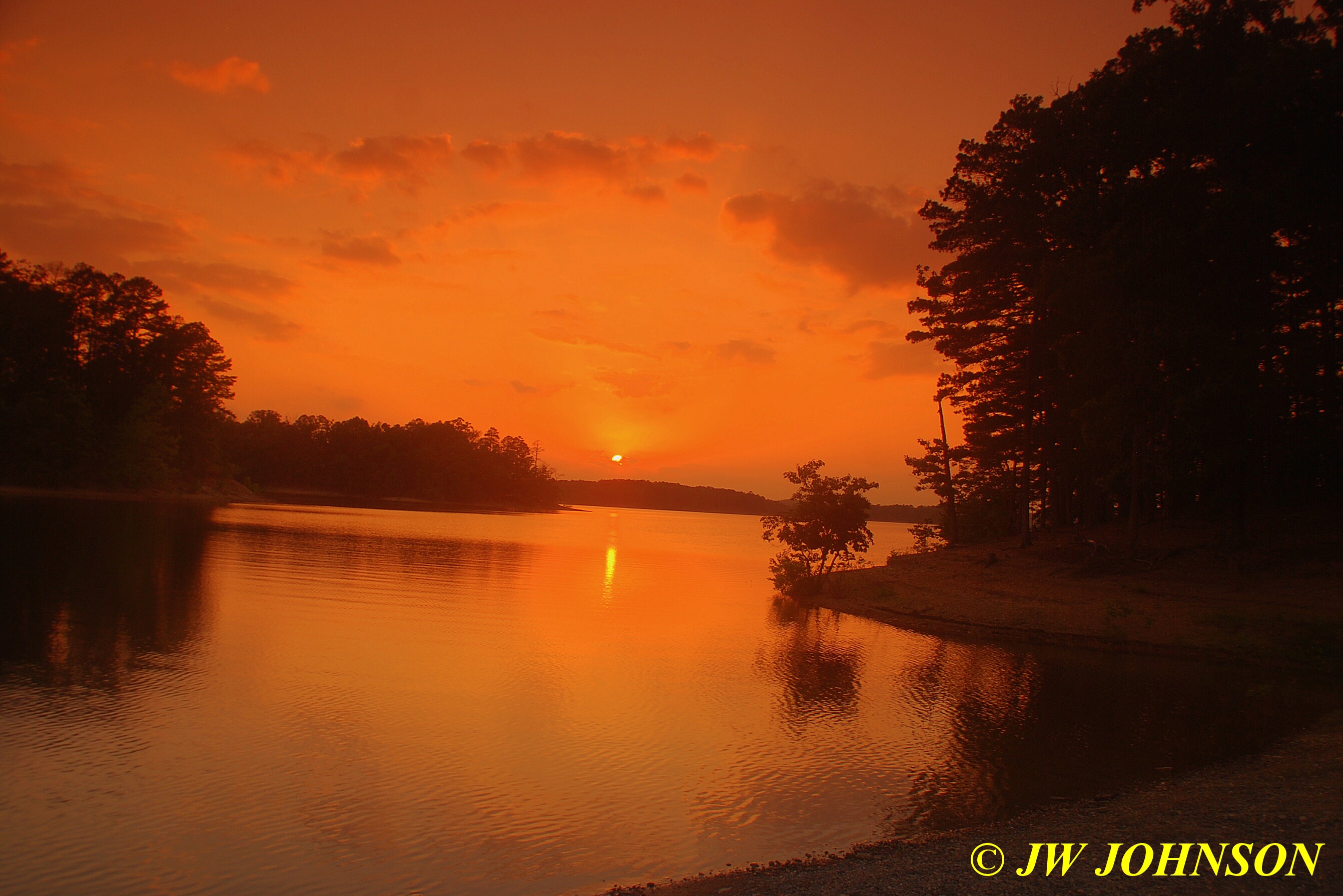


The next morning we got up bright and early and headed over to Miller Mountain Mine, on the northeast corner of Lake Ouachita and about 12 miles west of Jessieville off Hwy 298…another of my favorite quartz mines to go dig at…that story is also in my rock collecting site. I wore out there by 1 pm and then we headed down to Hot Springs to grab a pizza and headed back the condo to rest up the rest of the day. I think the heat must have worn me down two days in a row, it was early May and already hot and muggy down there. I didnt shoot the sunset this evening because there were no clouds in the sky and it was just not very pretty at all, which is highly unusual for Mtn Harbor cause its a very pretty place to shoot sunsets and this time of the year they are normally very nice.
Friday morning I waited for Sami to get back from some errands, and while waiting, I visited with Stu Schmidt, who is a rock collector and buyer, he used to have his own quartz mine near Mount Ida, and a wavellite mine near Avante, on the north side of Lake Ouachita, but recently sold both mines and now he just buys and sells rocks and minerals. I went to see what he had in green wavellite and wound up purchasing a few specimens from him that were covered in bubbles and cats eye. Pretty stuff.
When I returned to Harbor East, I stopped off to photograph a trailhead for Sami, located next to Turtle Spa….


Apparently its a nice trail to get a good cardio workout on…located next to Turtle Spa…
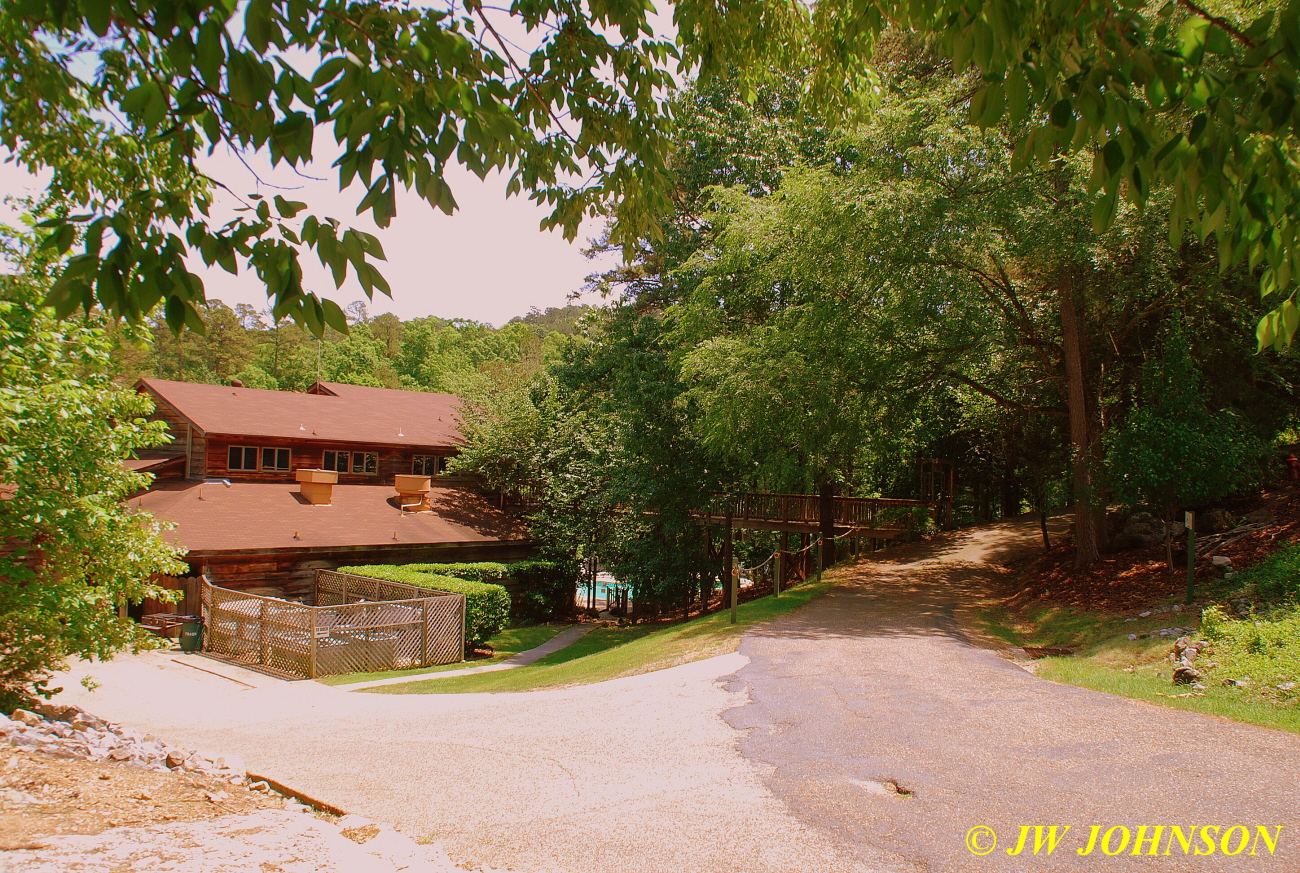
Friday afternoon, Sami picked me up and we went out on Lake Ouachita to shoot some boats and scenery…here are some friends of hers coming into port as we were going out on to the lake….

…we first motored over to the marina to get some gas and I met a few of the marina boys there…Connor is one of the marina boys and he showed me the fire boat up close, gave me a tour of it, and let me tell you, the interior storage room on it was like a sauna…it was quite impressive though. After filling the gas tank, we motored out into the middle of the lake and saw boats all over the place….


We went by the cove where my condo is located…you can see the corner of the roof, right above the lake side condos….
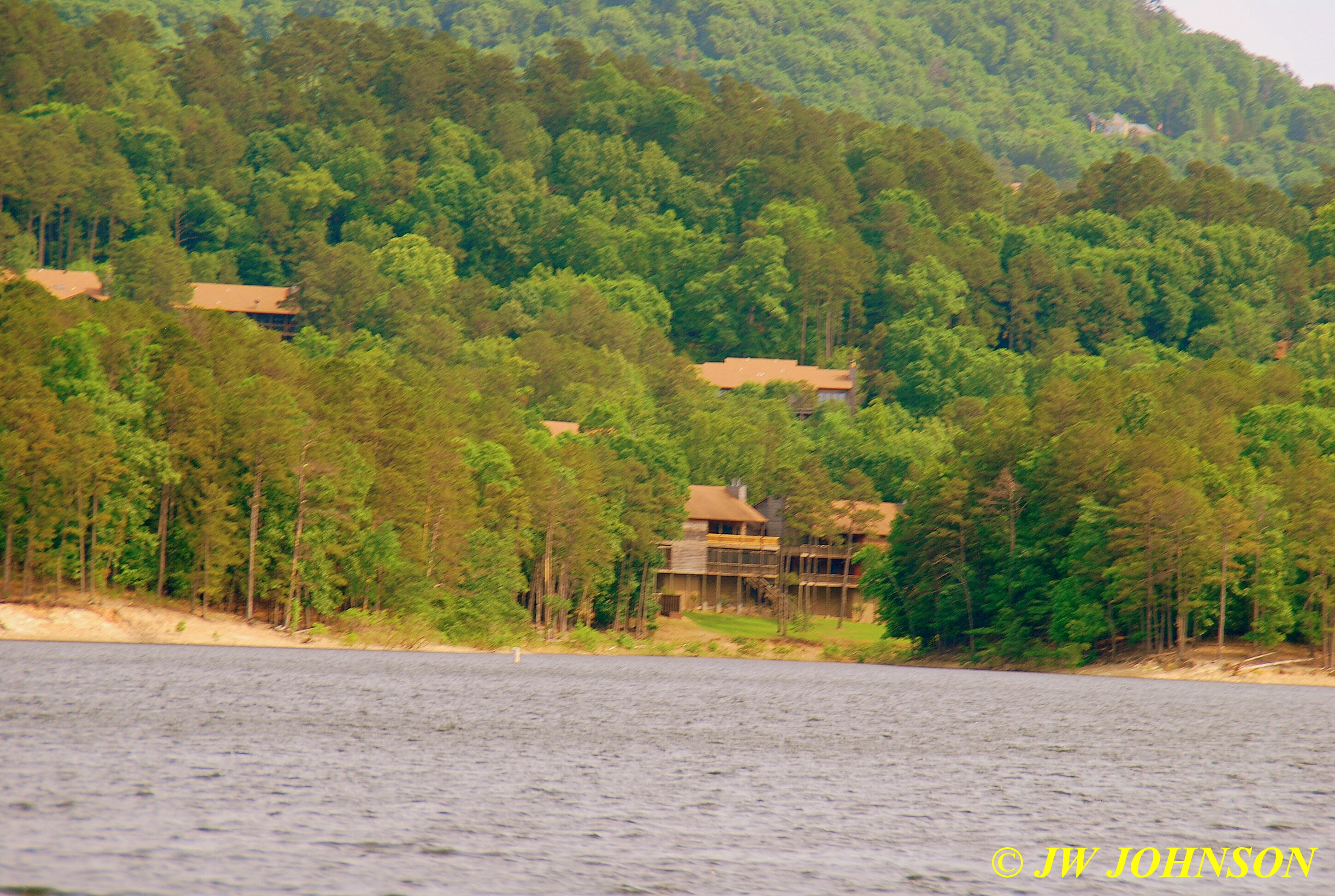
..the next photo shows an island where someone requested their ashes buried at because they loved this lake area so well…

…and here is what the north shoreline looks like in many areas….rugged beauty at its best….


We motored into another cove and found a guy had stretched out a big hammock and was sound asleep in it…

…and on the other side of the cove was an island that has a memorial bench placed up above the waterline…the son of a family well known in the area, an area the son really liked to visit and enjoyed during his time on earth…friends placed a concrete memorial bench here in his honor….
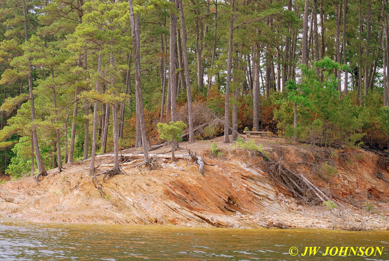
…very pretty place for it and well thought out and designed……and here you see the bench above and closeup below…
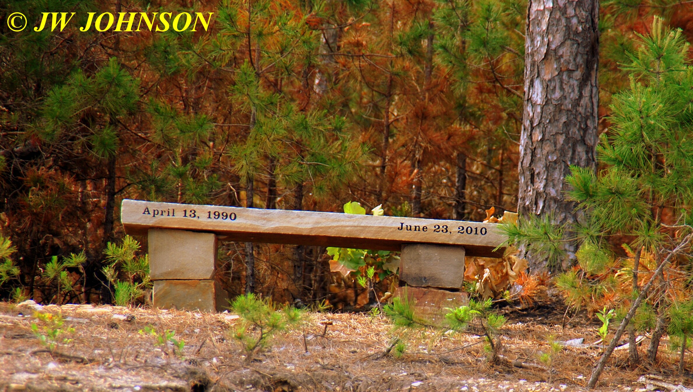
…and then we continued motoring across and east on the lake, seeing boats everywhere…
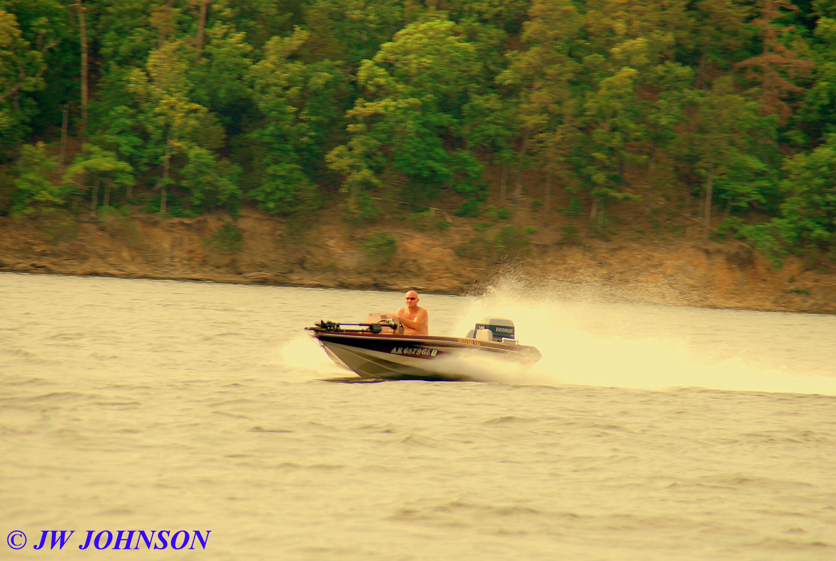
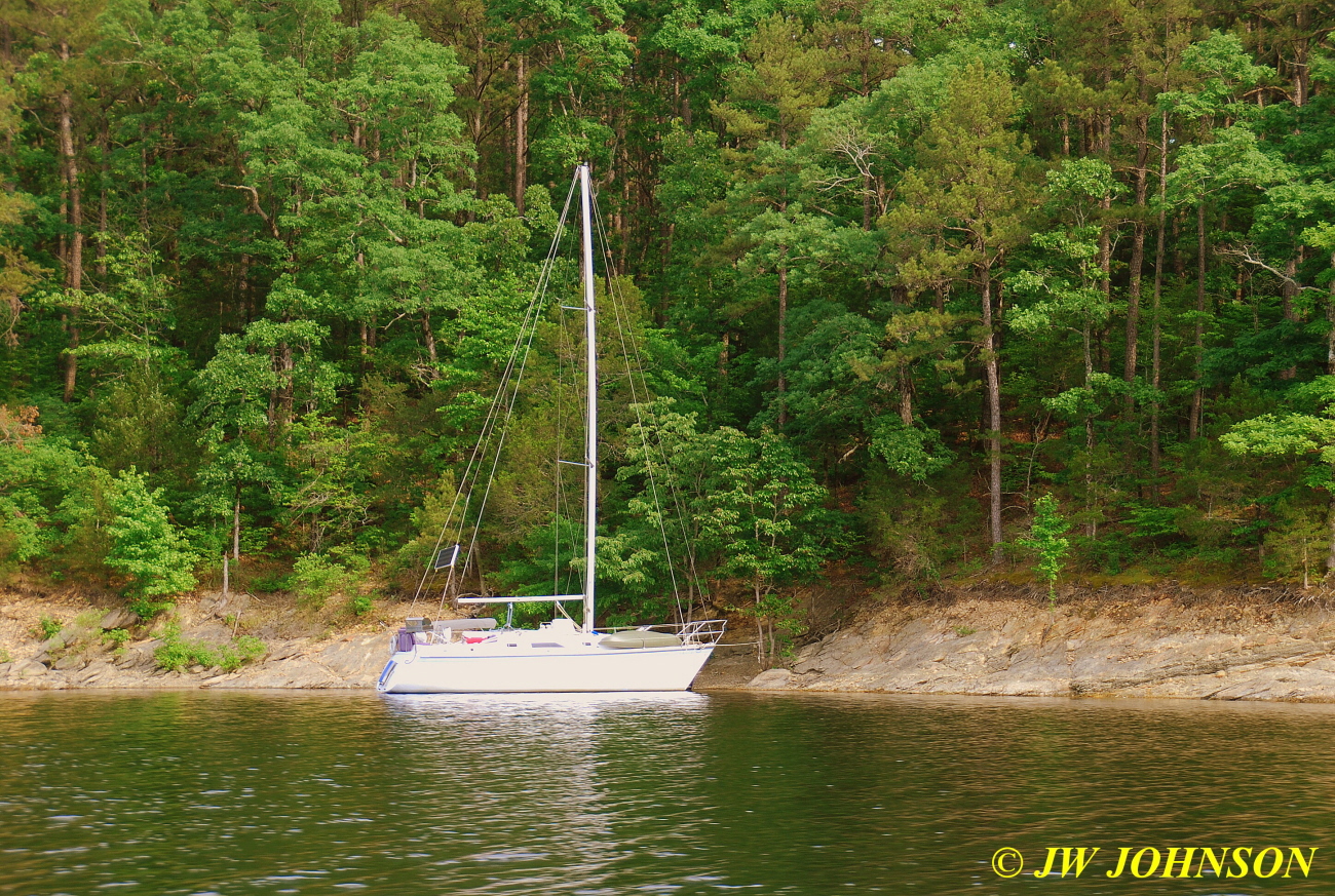
Sami then pointed out Brady Mountain Overlook, sits up above Lake Ouachita on the south side of the lake, we were planning to go up there the next day and get some photos of the lake from there…
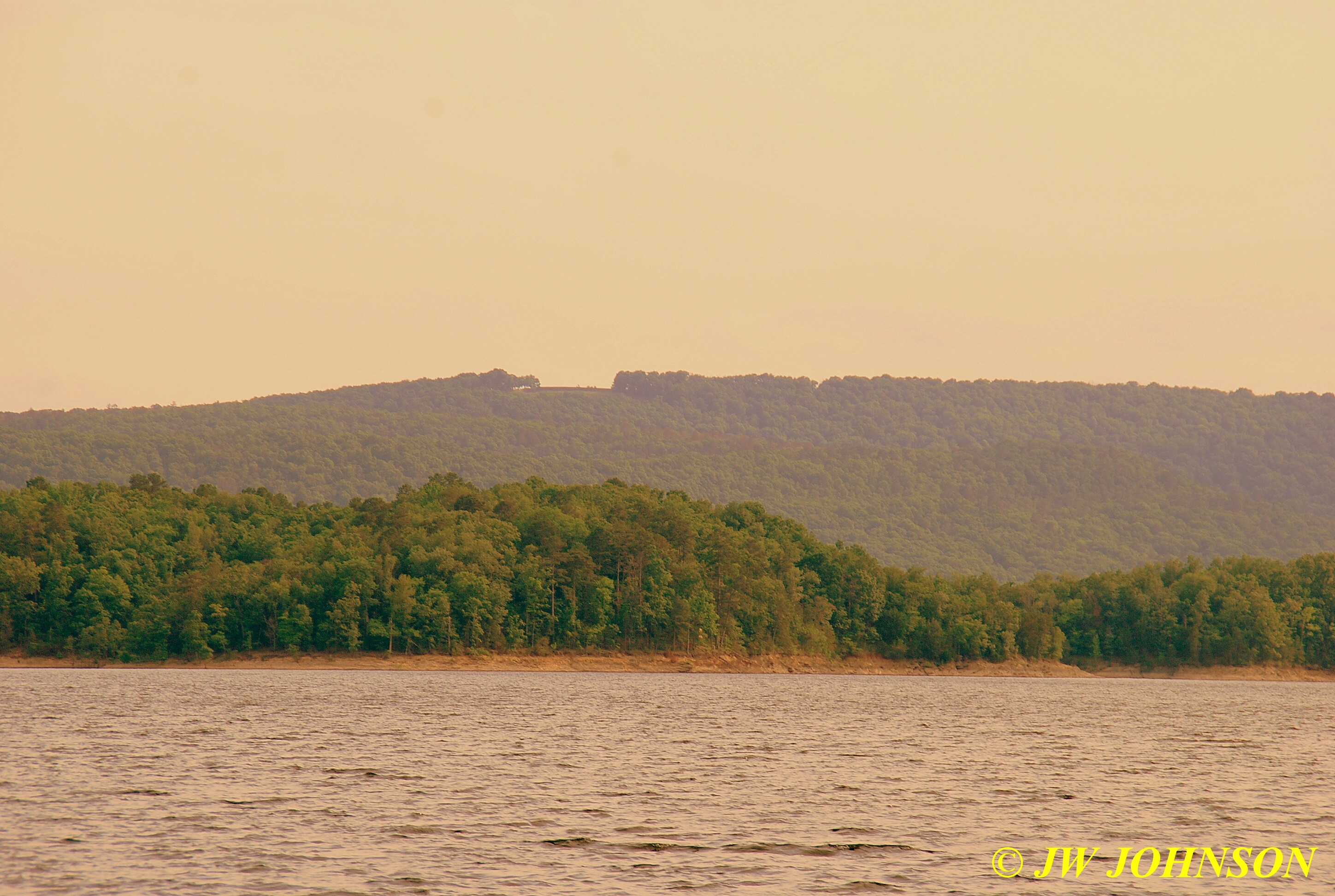
…and here it is with a nice houseboat in the image….

…and another speedboat with flags flying as well….
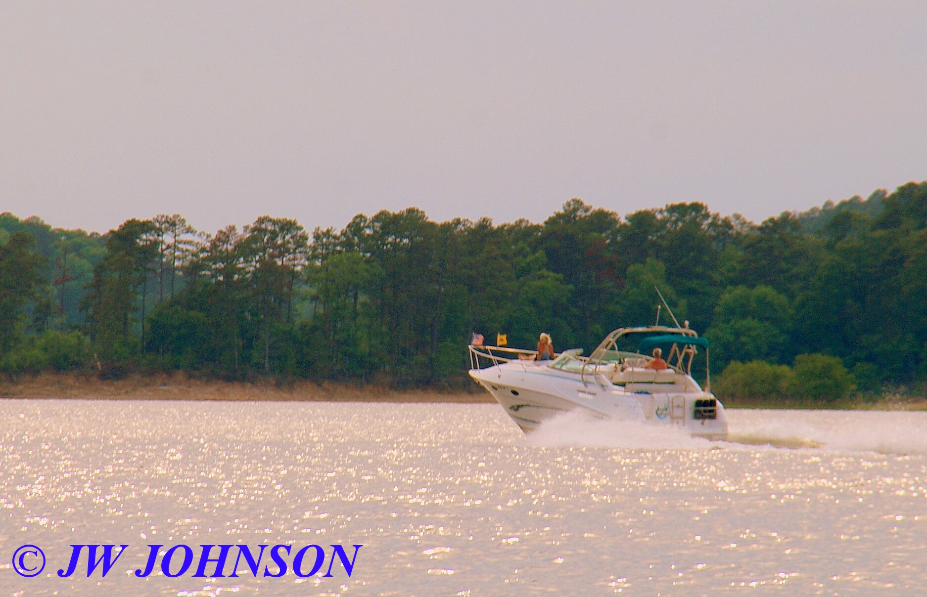
…we then motored over to Micah`s Pointe…here is the pretty wooden bridge where I shot sunsets on Tuesday night….
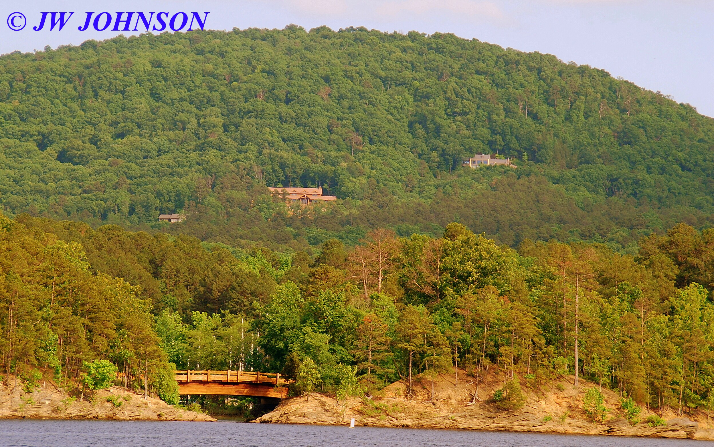
…you can see the glass house at the top of the hill on the right side above the bridge…this house is owned by friends of Sami, and there is a tremendous view from there as well…I met them the next day at the Parking Lot, too…very nice people. The next photo shows Micah`s Pointe….
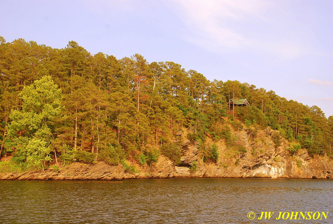
…and here is a close up view of the pretty wooden bridge and the marina behind it…
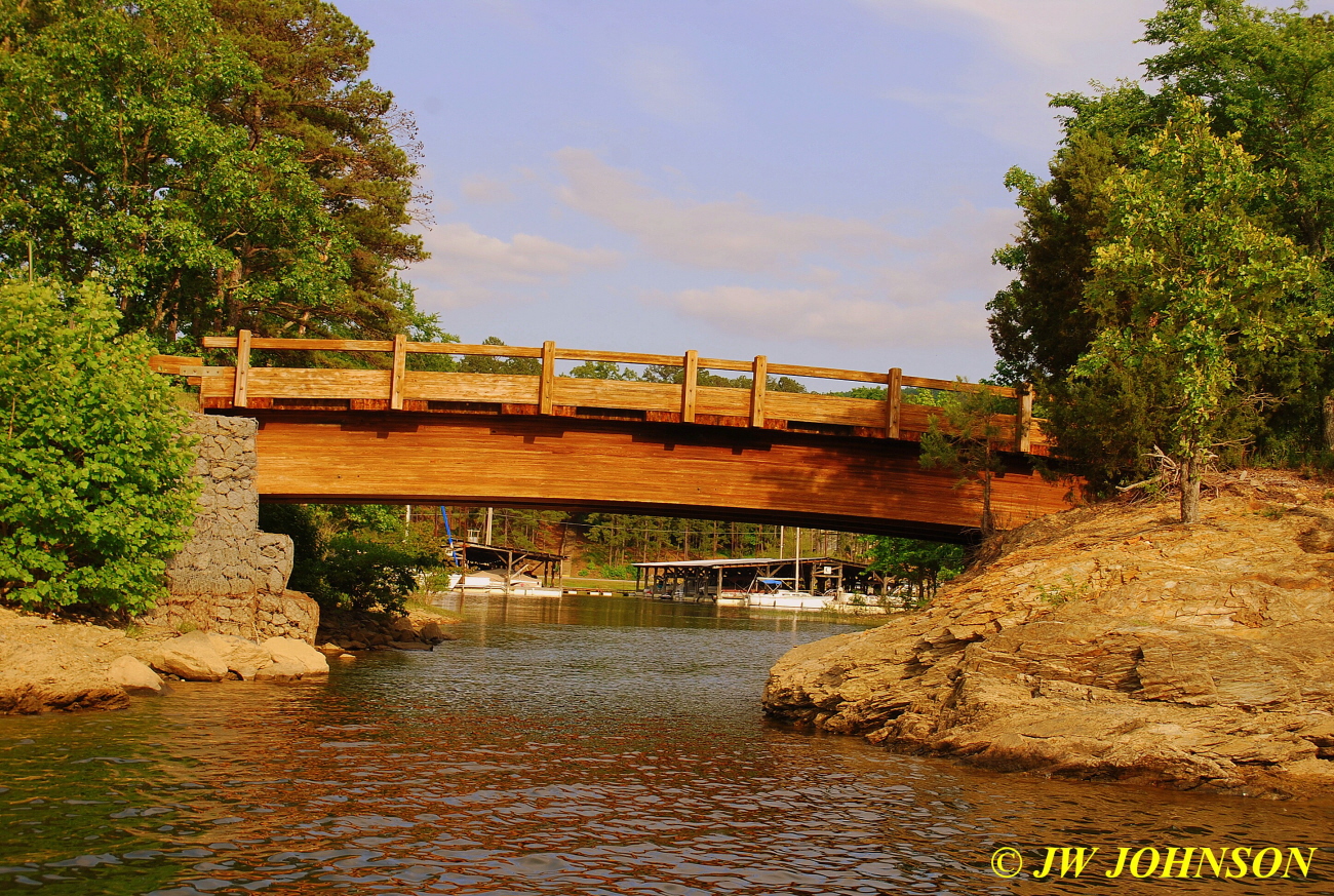
…we motored around a little more and on this island below, found another houseboat tied off…
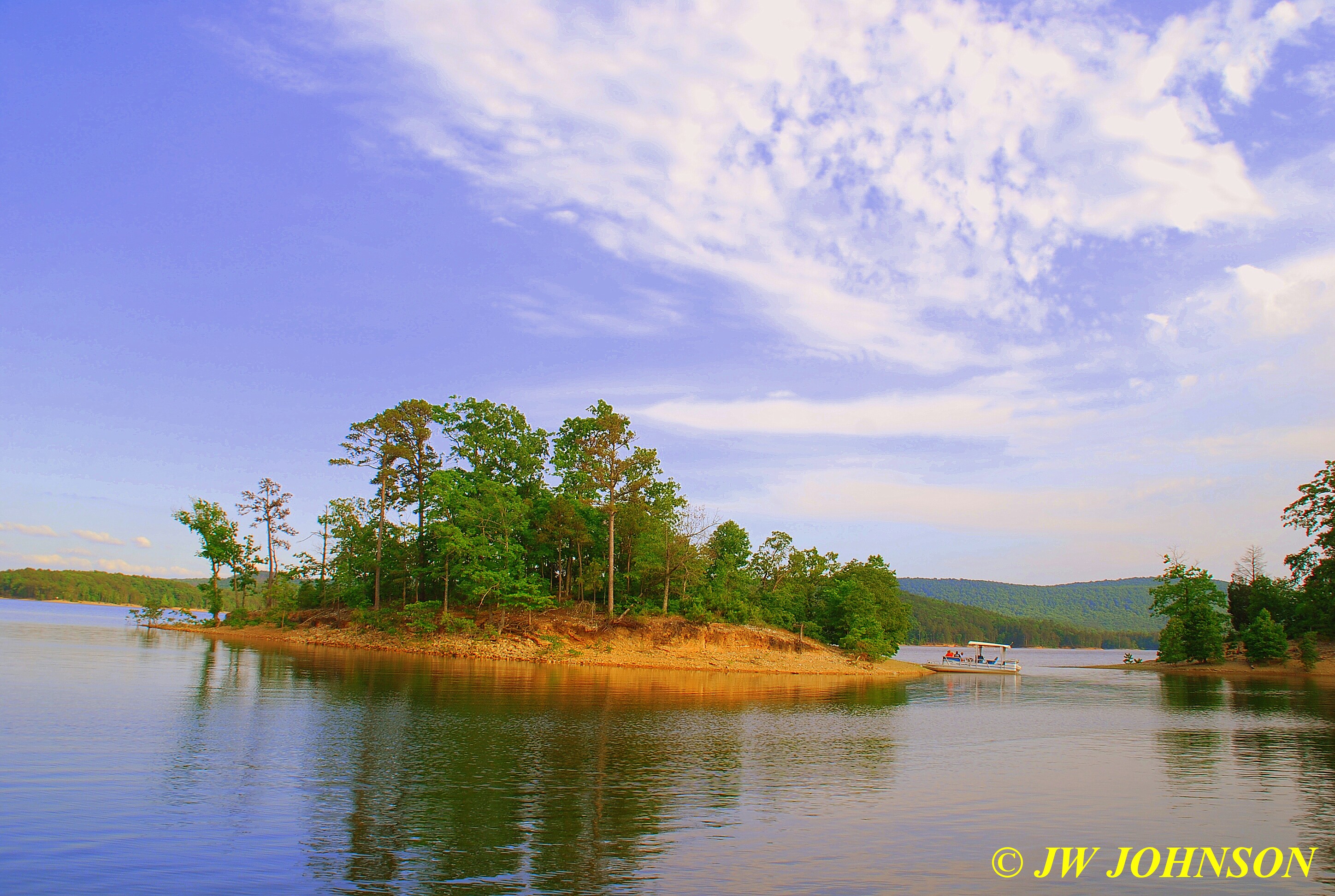
…and saw some nice sunbeams as well….
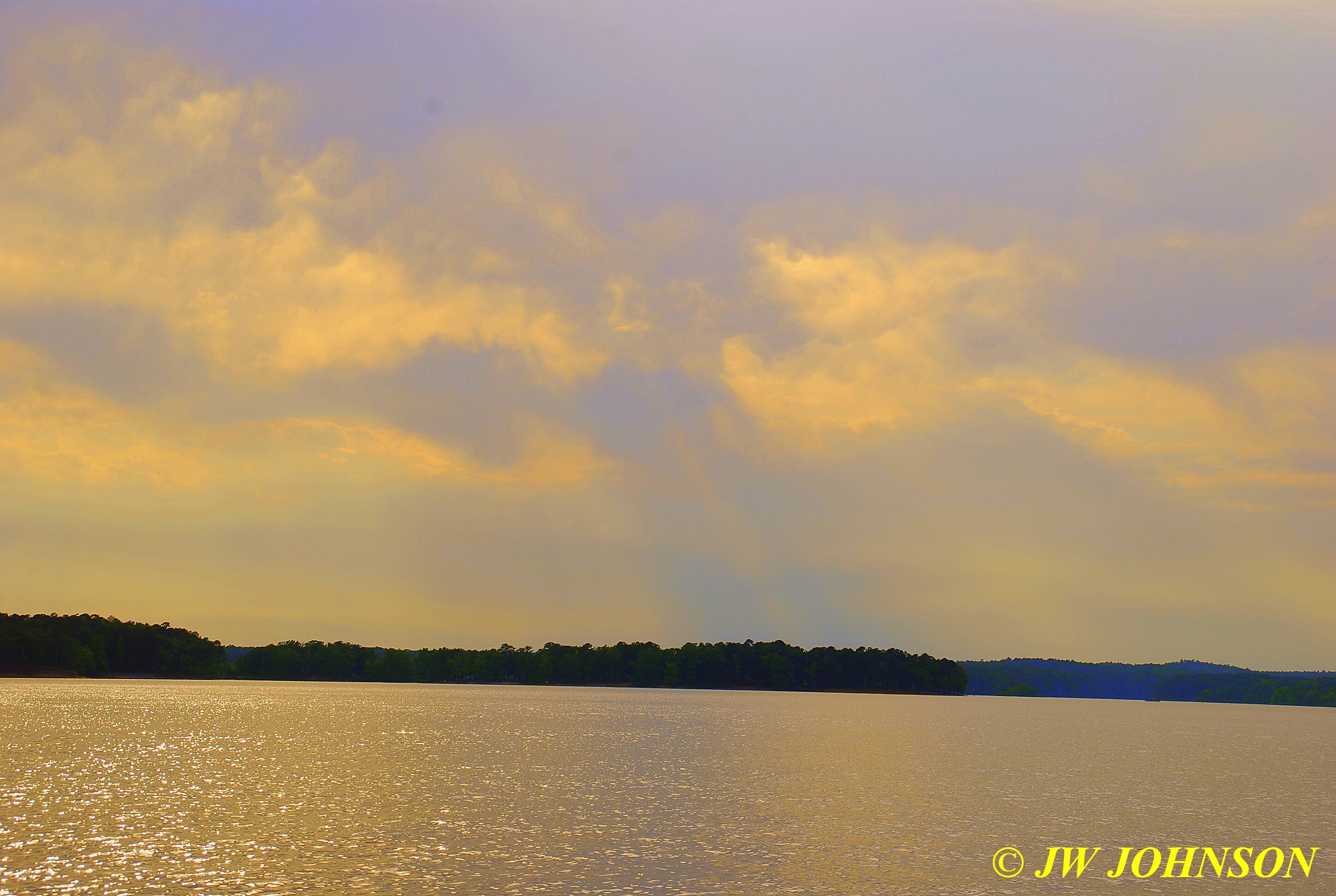

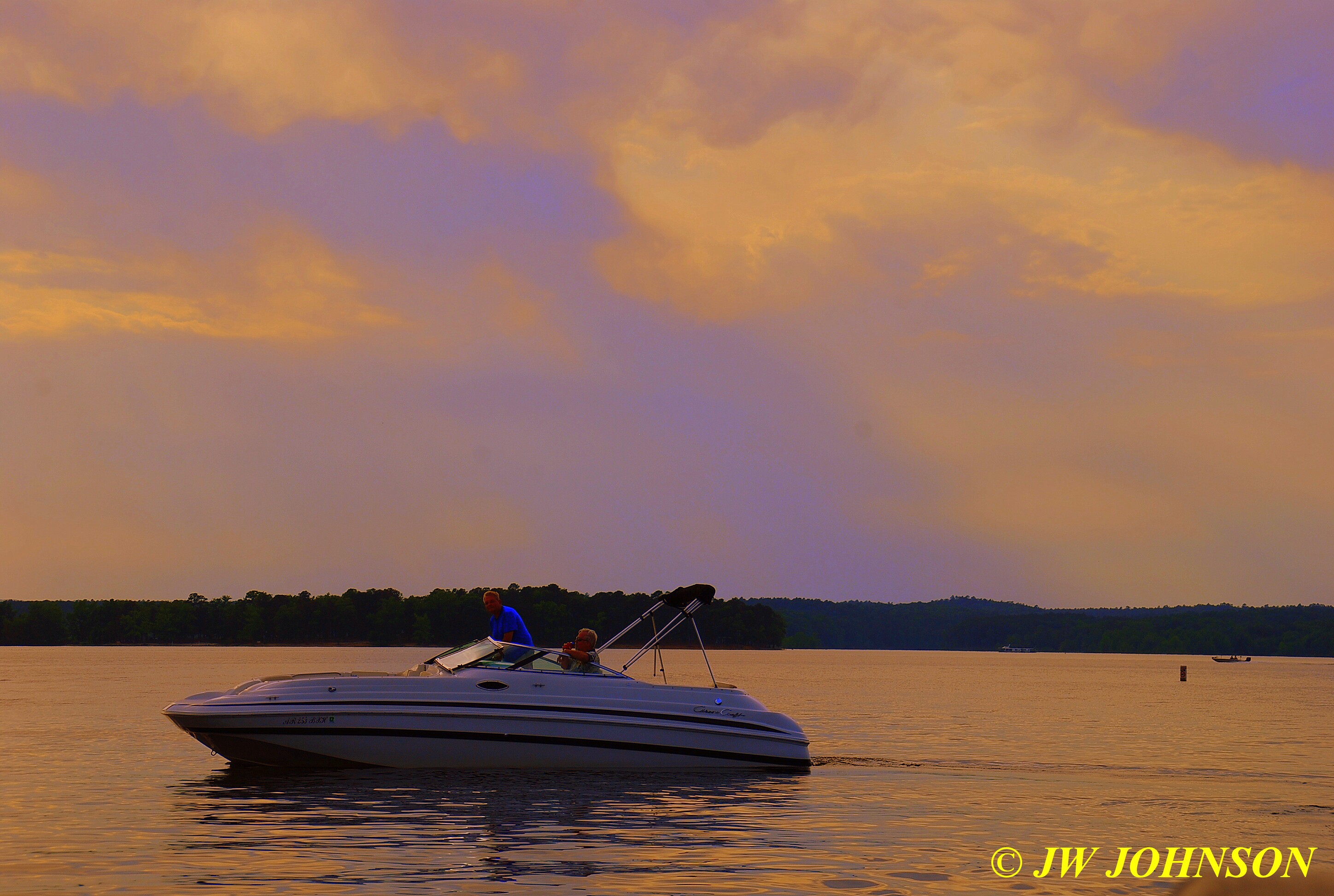
…and then saw some friends of hers coming into port as we were finishing up as well…
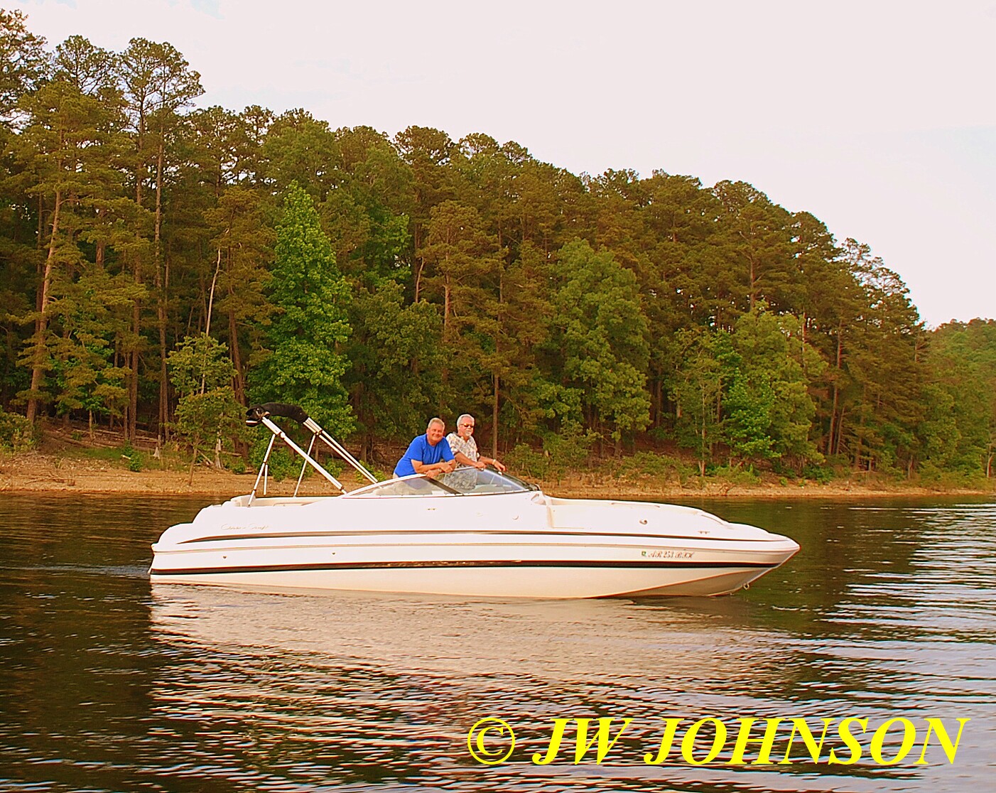
We got back into the marina on the east side and returned the boat to the owner, a super nice guy who is the Subway District Manager for that area and we docked next to his houseboat there at the marina….
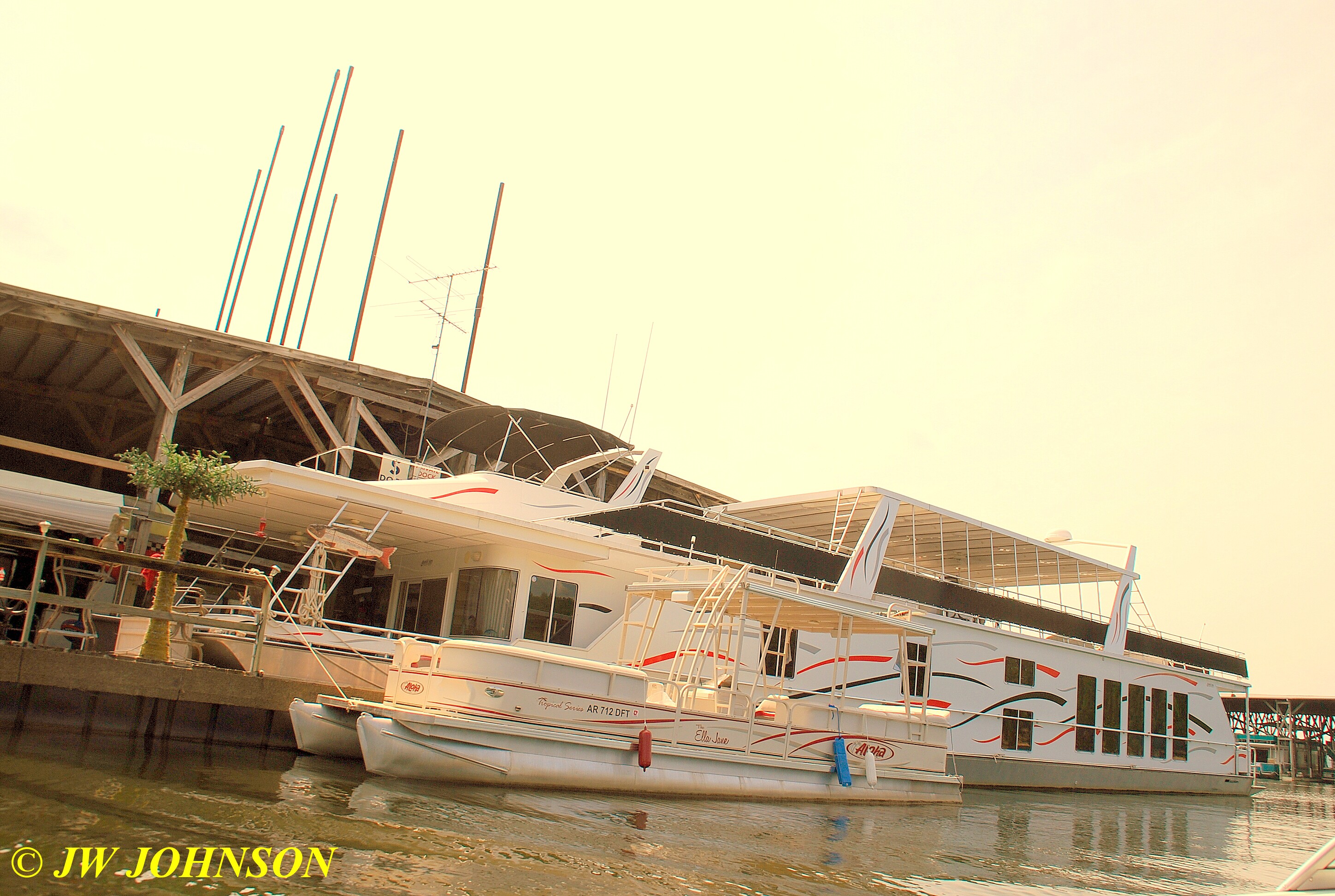

...it`s one hundred feet long folks…I never knew houseboats were that big, never seen one that long, never have seen any that big out on the water, but there were several tied up in the three marina`s there….and he gave me a grand tour of the inside and it was absolutely beautiful, very nicely furnished and just immaculate interior…six or seven bedrooms…we saw so many I lost count after four, each has its own bath, the master bath has a hot tub, there is another hot tub up on the roof, full size kitchen, dining room,and living room, and a full size deck outside the living room.
Sami dropped me off at the condo and after cleaning up, Missy and I headed to the lodge to get some supper…we then headed over to the east basin boat dock to see how well the sunset would look tonight…we were pleasantly surprised this evening….

…it was absolutely gorgeous !!! I walked down to the waters edge on the shoreline and started shooting immediately…there was a couple there taking a boat out of the water and a young lady snapping photos of the setting sun with her Canon camera…I gave her some tips on how to get some better sunset photos while her husband was placing their boat on the trailer…

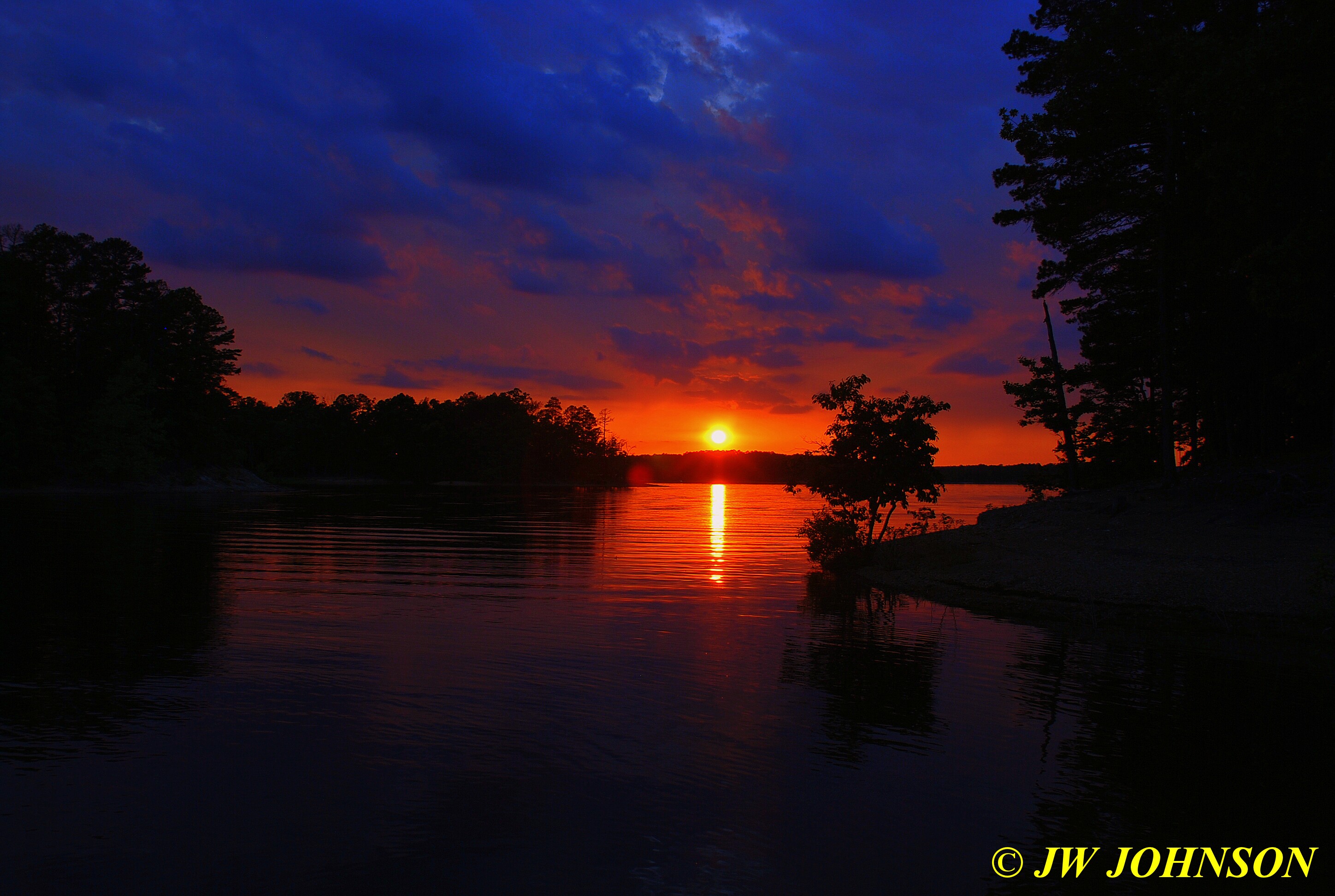
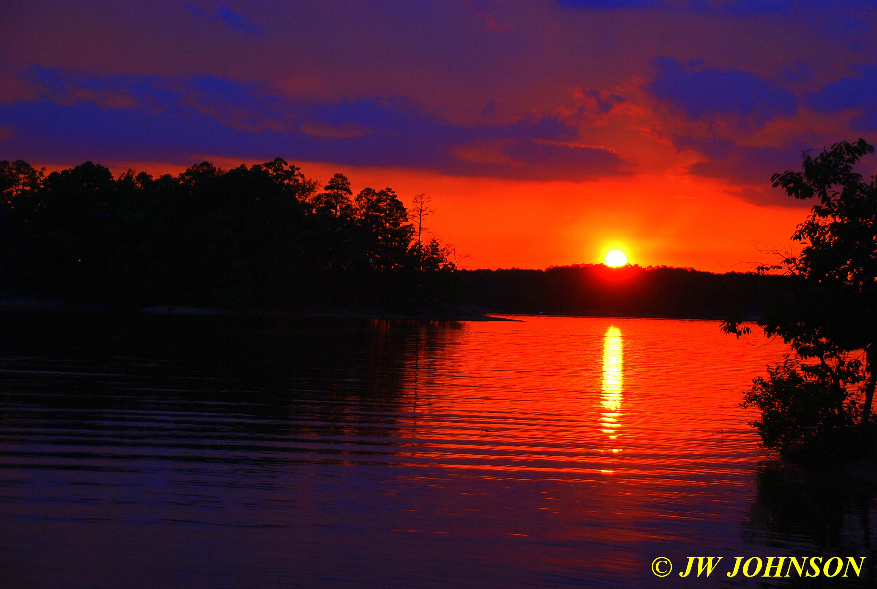
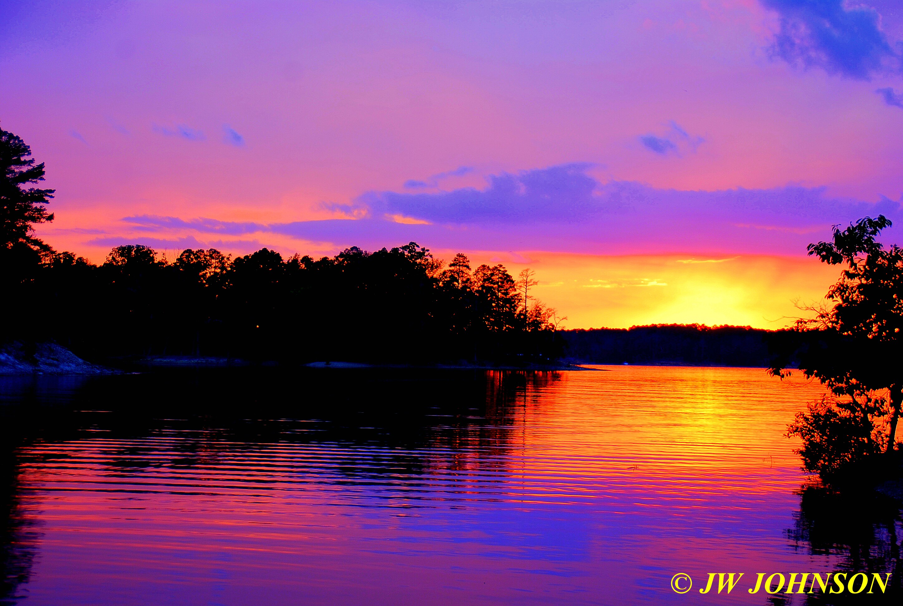

…after snapping many photos of this beautiful setting sun, another truck showed up wanting to launch their boat and so she jumped in her truck and removed her boat and trailer from the ramp…as the new truck backed into the water on the ramp, a beautiful red Dodge pickup, I moved to the other side of the ramp and shot it as the foreground for the sunset…
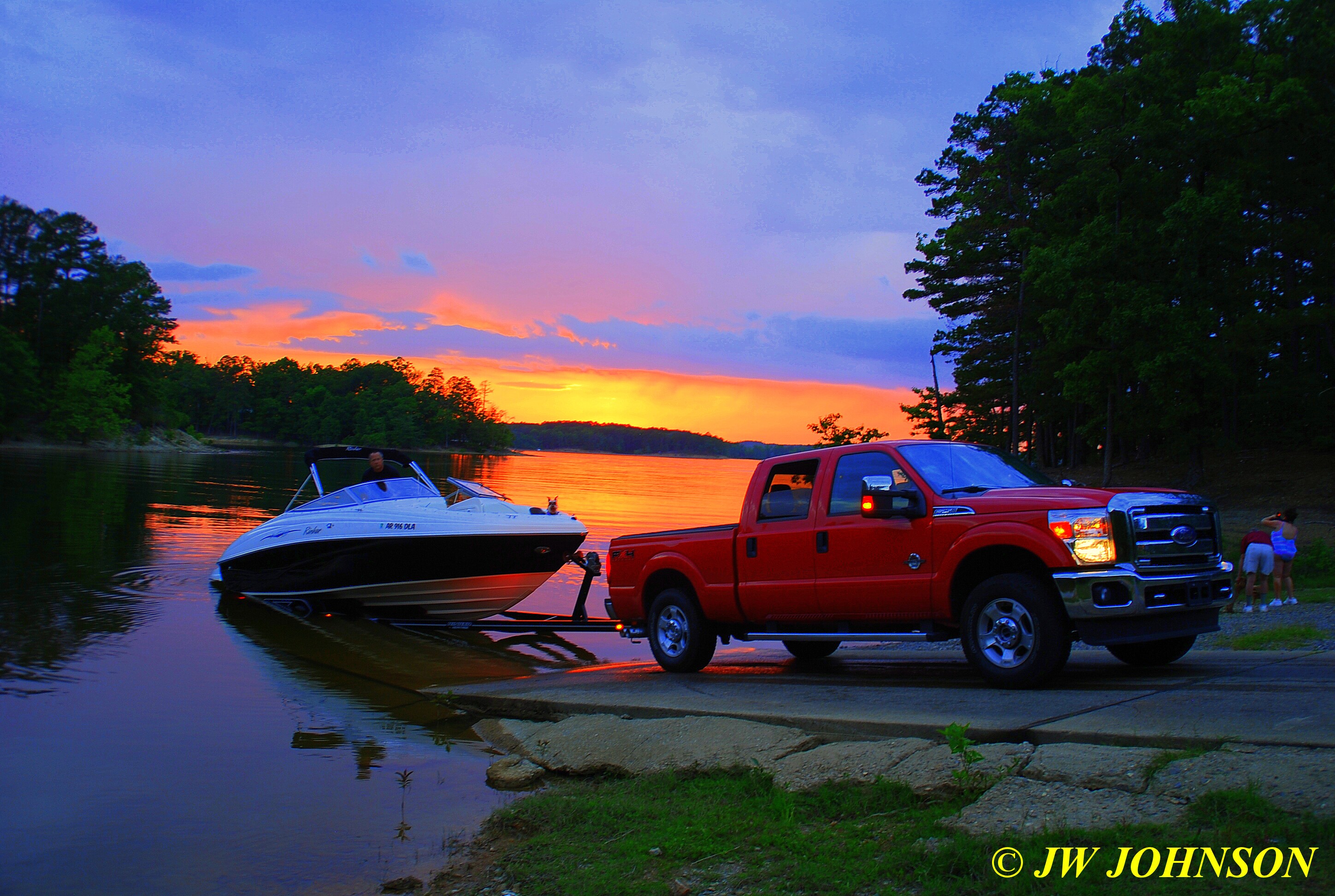
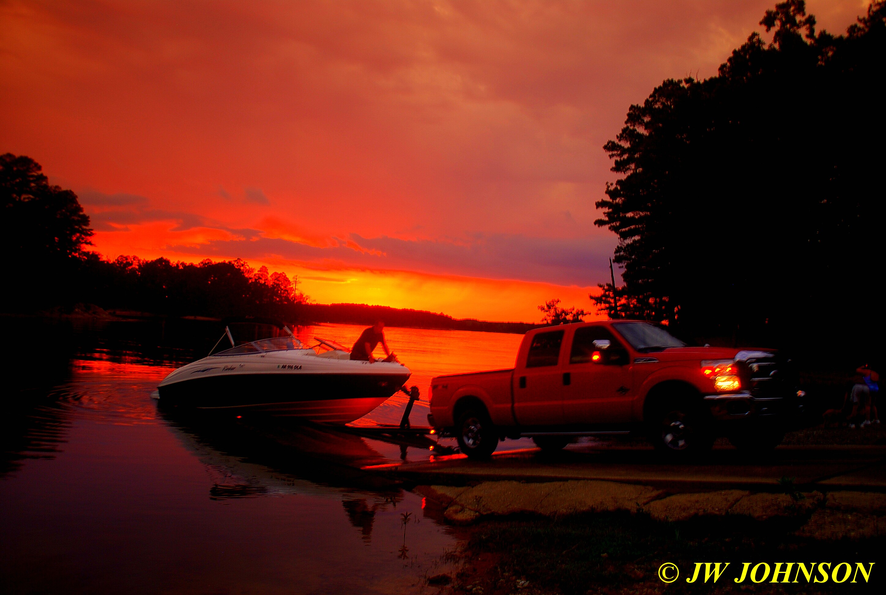
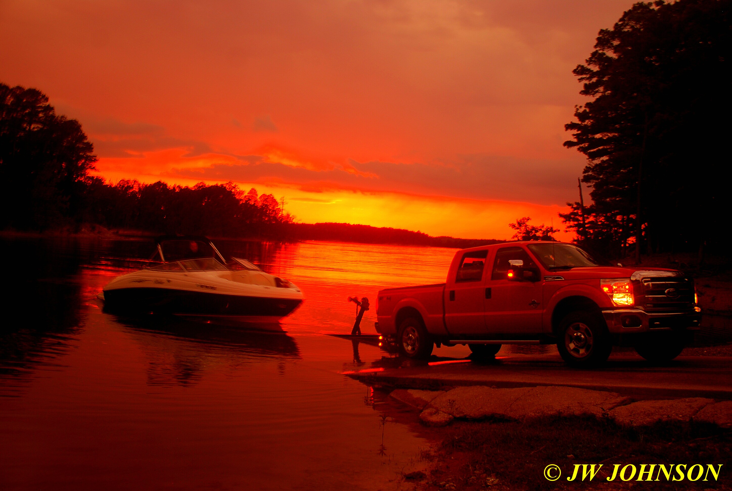
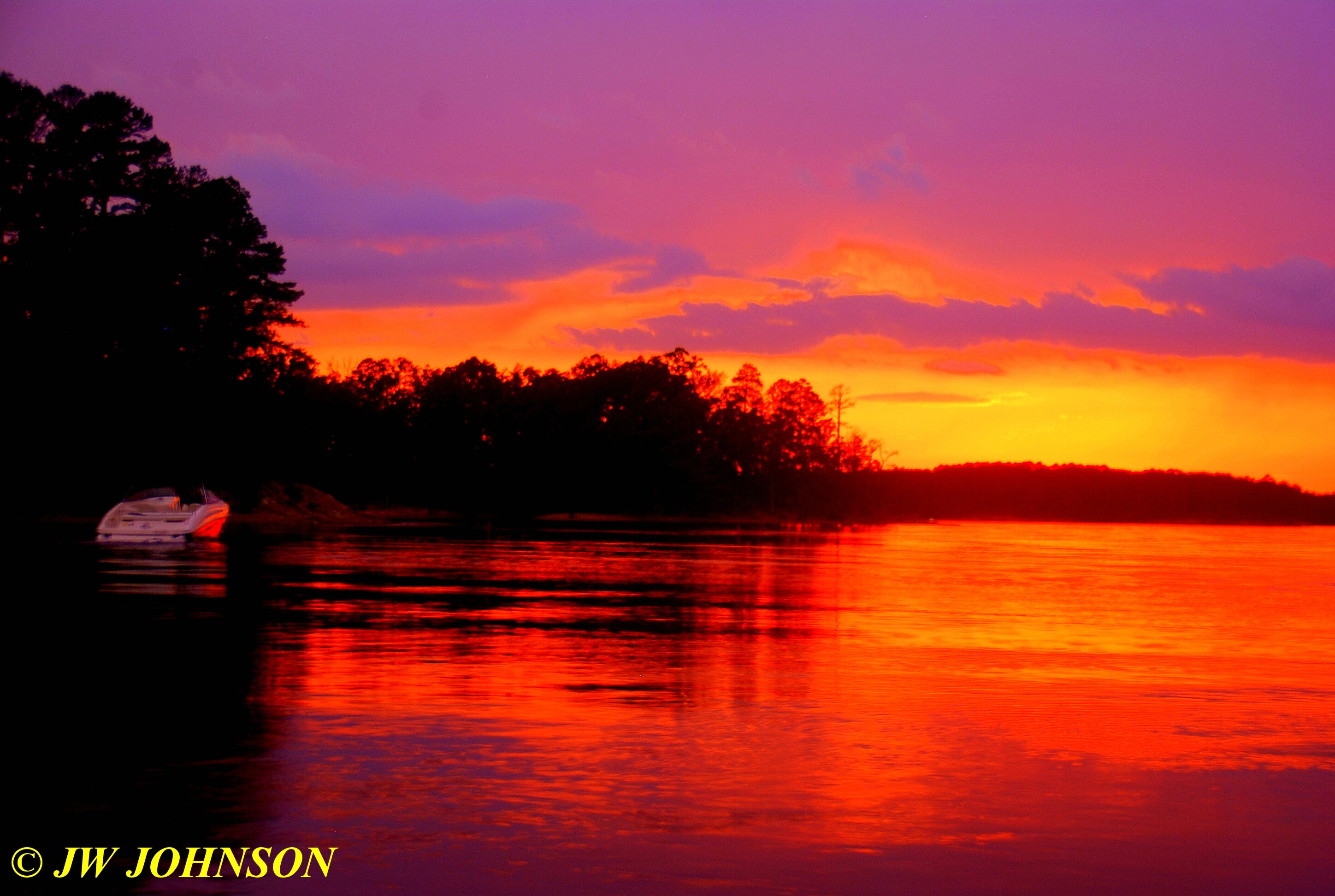
Saturday morning, Sami picked me up and we went for a ride up to the top of Brady Mountain to the Hickory Nut Overlook, where there is a commanding view of the vastness of Lake Ouachita….

I was simply astounded at the view from up there, one could see for many miles and then some…I wished I had taken my haze filter with me as it was fairly thick up there…but here are more of the views…there were a couple of boats zipping around down there as well…
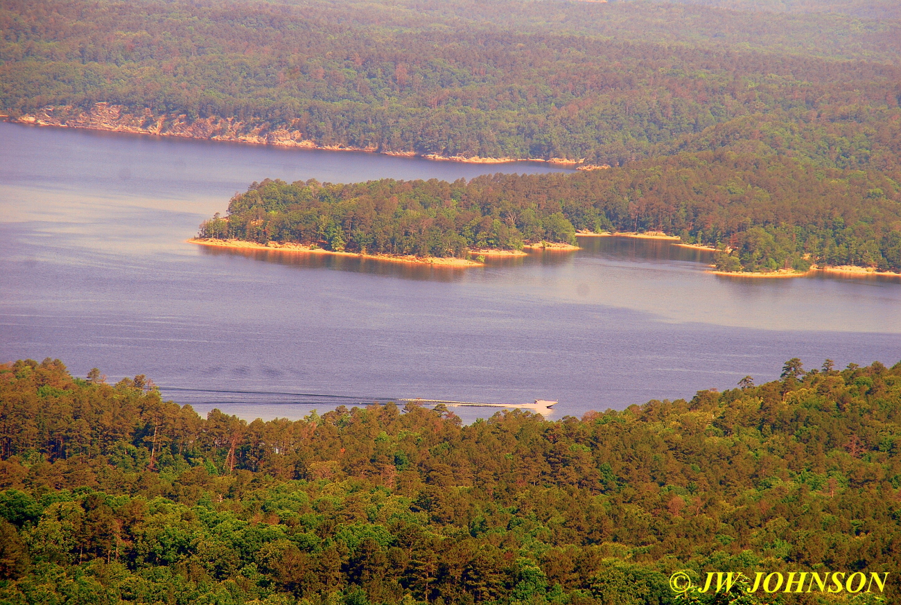

…we then came back down the mountain and as we entered the Harbor area, we came upon a doe feeding in the brush on the side of the road….

…and then as we made our way back to the condo, we came upon a doe and fawn on the east side near some homes……they crossed the road in front of us three times as we slowly made our way through the area, and the last time we saw them they were feasting on some azaleas roadside….

Sami picked me up Saturday afternoon and we went out with a friend of hers in his speedboat, so she could get some water skiing in and I could photograph her water skiing…he had a beautiful boat and we were soon out in the middle of the lake once again and Sami was in the water getting adjusted to the water temperature….

…and soon after that she was up on her waterski on the surface of the water….

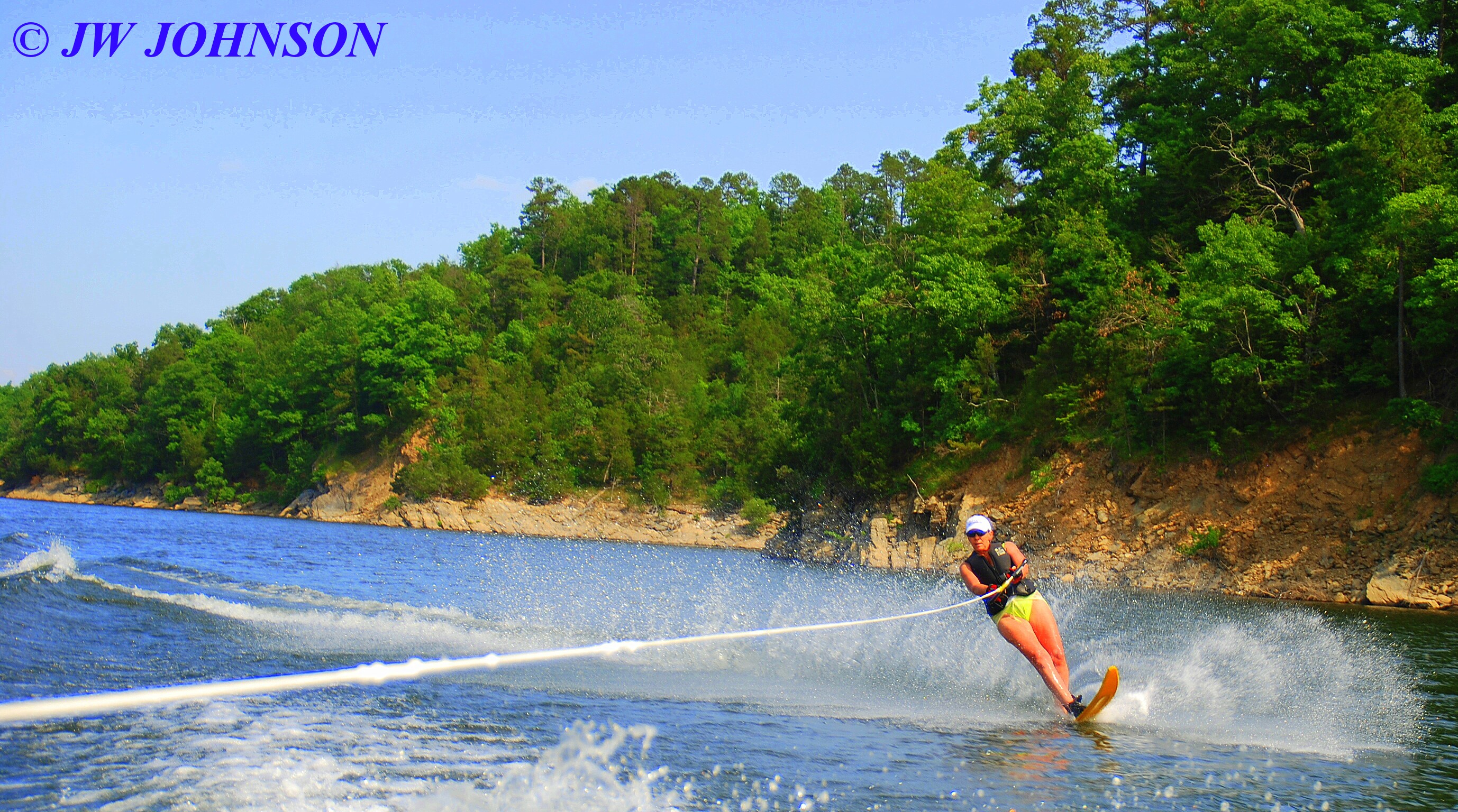

…she did a great job considering she hadnt been out on the water for at least two years. We picked her up and headed over to the Parking Lot to meet up with her friends Julie and Joel, her neighbors across the street from her house in Harbor East…I had met them the day before and found them to be very nice. As we motored over to the island, we saw this guy zipping across the water in a pretty speedboat with a flag….

…we soon arrived at The Parking Lot and found Joel and Julie with Sami`s friends from the Glass House, relaxing in the water at the beach….
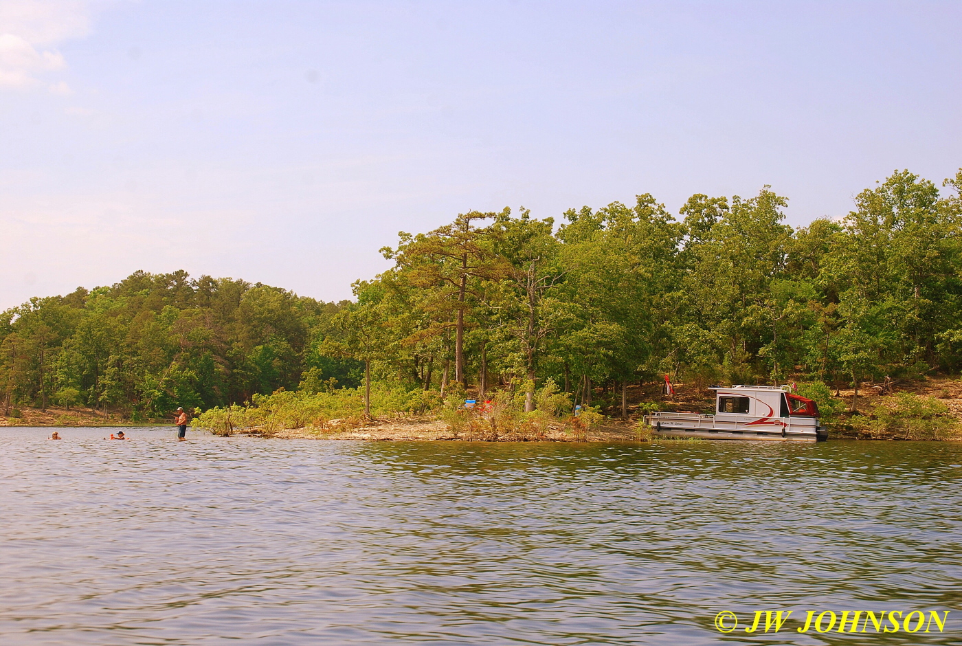
Joel came over and helped Sami and I make a safe transition from the speedboat to his houseboat, since we both had our hands full of stuff, and then after Sami`s speedboat friend took off to join up with some of his buddies on the other side of the lake, we sat down on the comfy boat seats and relaxed, waiting for Joe to arrive in his bass boat with Sami`s dogs….
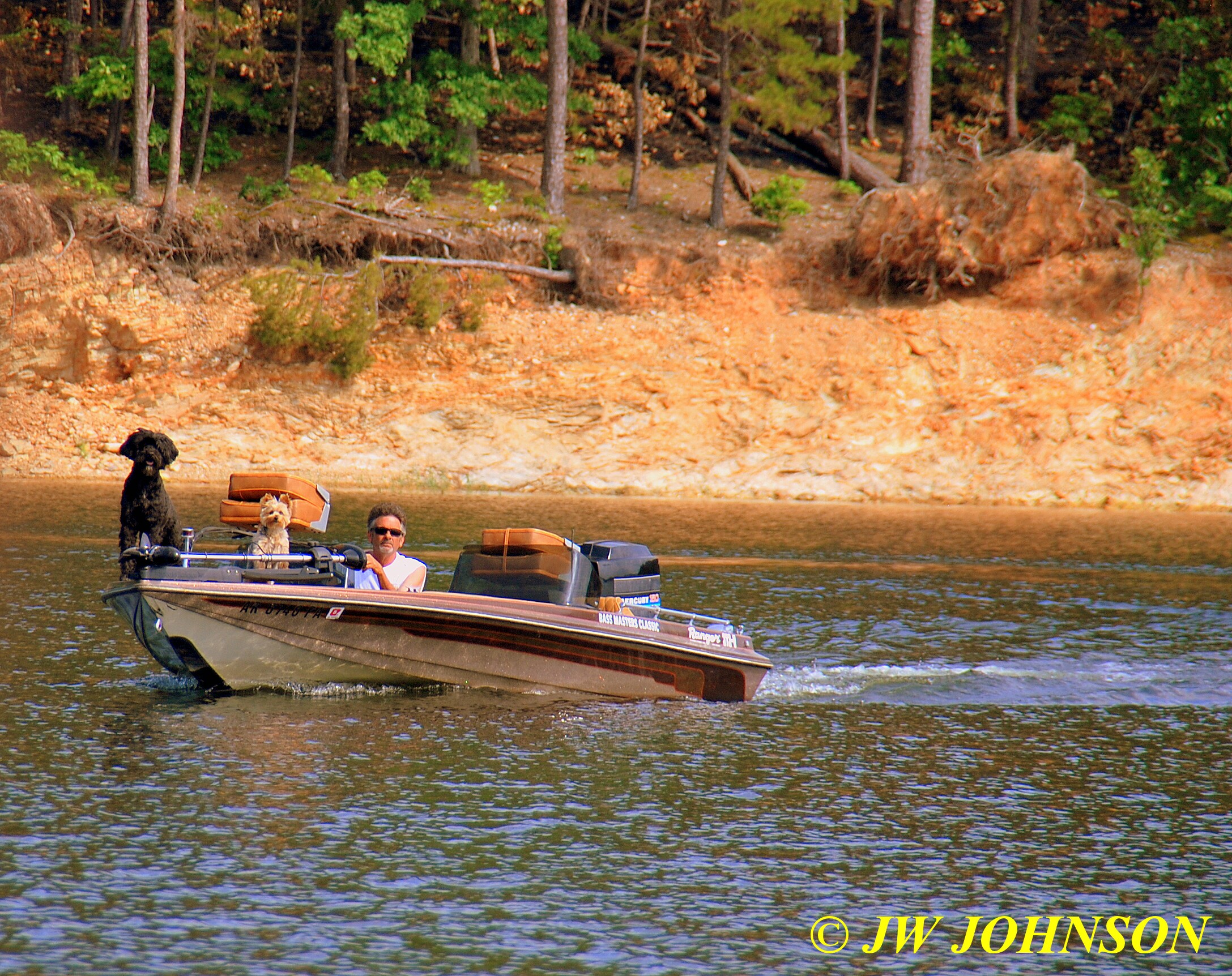
Then after a grilled dinner on the island, DJ and his family headed back to their house in DJ`s beautiful sleek speedboat….
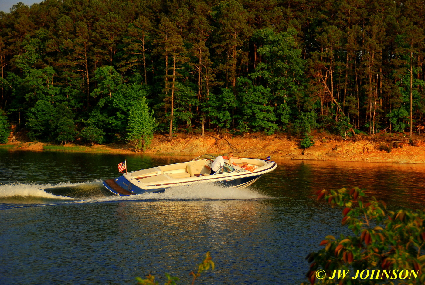
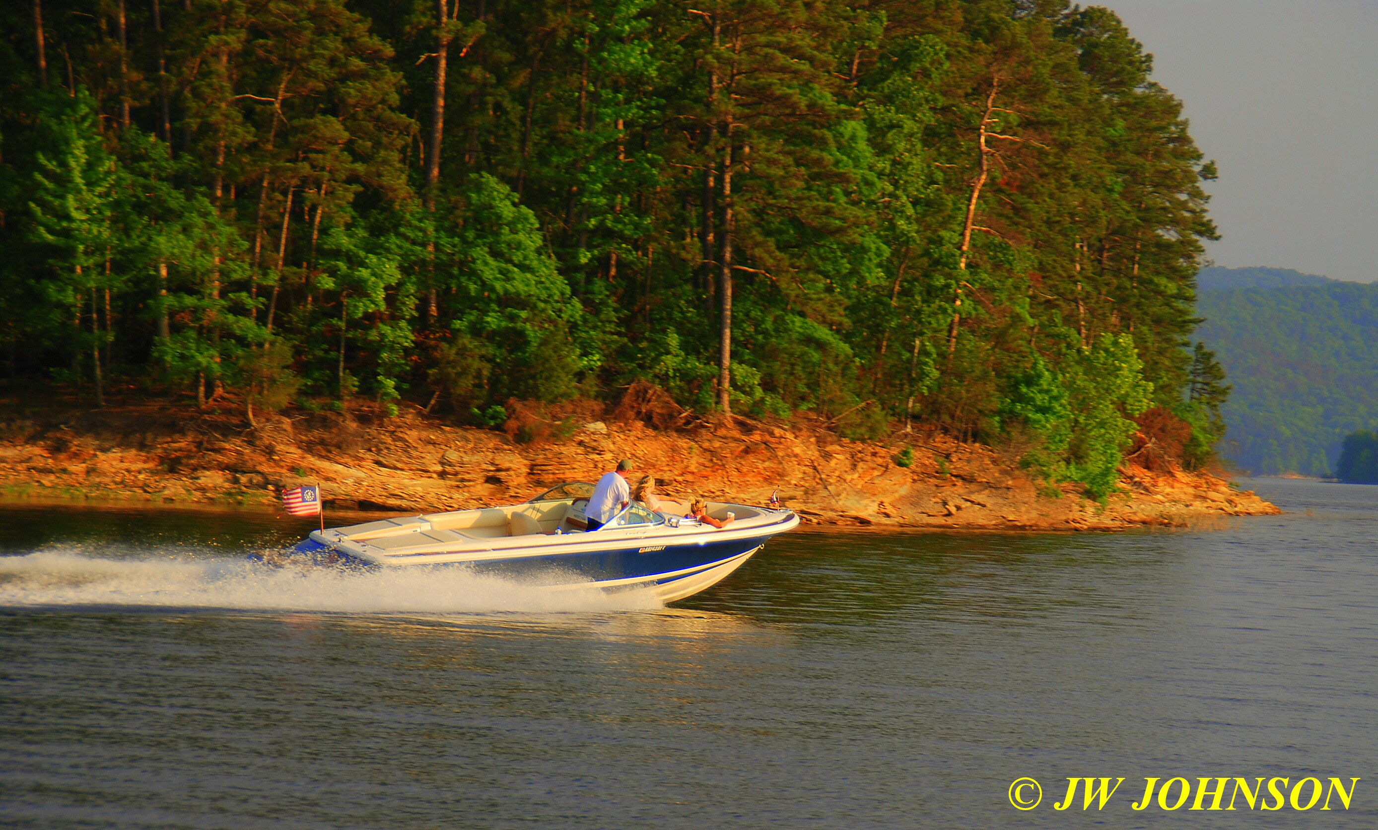

After another hour of relaxing on the beach, we finally loaded up Joe`s bass boat and headed back across the lake to Mountain Harbor…I shot this mid day setting sun across the lake….
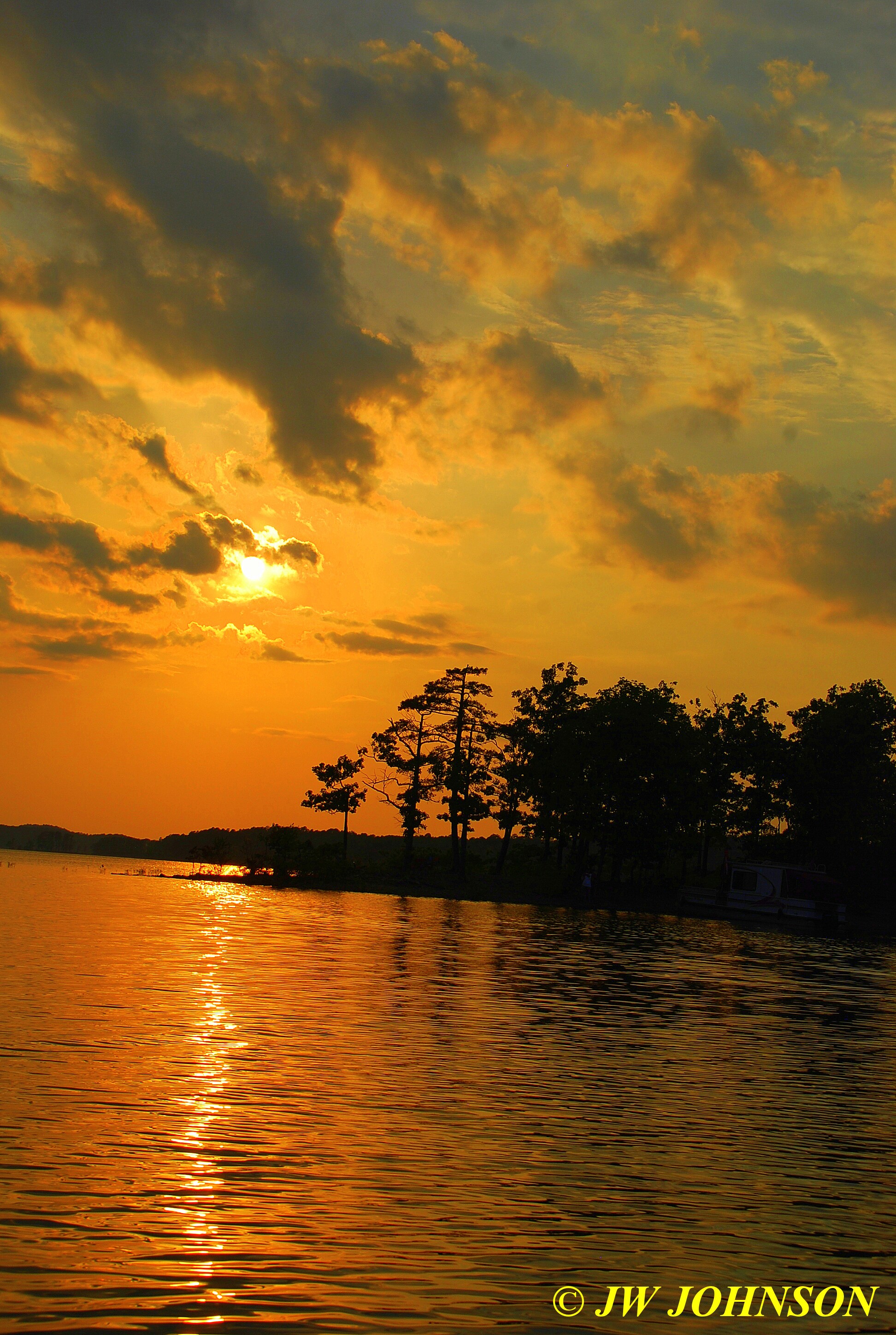
…and then later that evening, I went down to the main marina at the dining lodge and tried to shoot the super moon, but folks, it looked like a normal moon to me….

…maybe just a little brighter, but thats the only difference I saw.
Well that wrapped up a nice six day stay in southern Arkansas in May, Missy and I loaded up the next morning and headed home.
I was driving into work a week ago tonight and noticed the clouds forming up to a potentially good sunset with some nice colors and shapes forming up by the time I drove through the Highway 50 interchange…looking at my clock, I decided I had a few extra minutes since I left a little earlier than normal. I decided to stop off at the Shaws Arboretum in Gray Summit since there is a pretty lake there that would give me great reflections if the clouds indeed did produce a nice sunset….as I exited near Mr Fuel and slowed at the top of the ramp, I looked west and saw this….
…and knew I had just a few minutes to get over to the Arboretum and find a good spot…once there, I found out the gates would shut at dark and knew this one would hang up in the sky for awhile, so I drove down to the lake and crossed the bridge, and looked back to see some nice reflections…